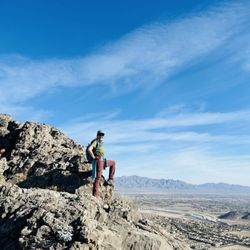
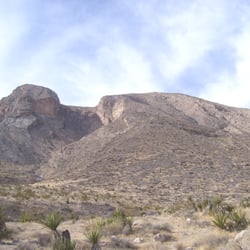
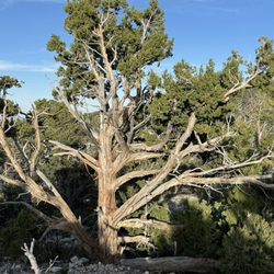
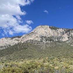
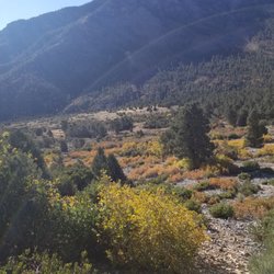
Raintree via North Loop Photos


You might also consider


More like Raintree via North Loop
Recommended Reviews - Raintree via North Loop
Start your review...


Reviews With Photos


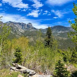
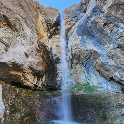
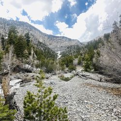
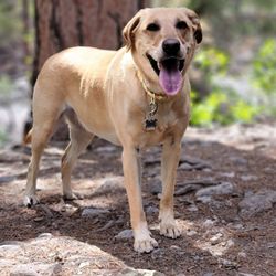
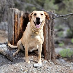
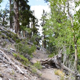
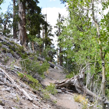
Of the three main trails taking you to the summit of Mt. Charleston, this one is the best. The other two, South Loop and TrailCanyonTrail, are good, but this is best. All three trails have an appreciable midway point for you to turn back at if you don't wish to summit. To be clear, my review for each trail is based on only the first half, which is what most people looking for a day hike will do. Raintree benefits from being off the main drag, meaning not as many people hike it as they do the other two and, of course, MaryJaneFalls. It makes for a quieter hike. More secluded. There is one section of switchbacks, but it has fewer than the other trails. You start in pine and never leave pine--all pine, all the time! Halfway to Raintree, the trail opens to a large picnic knoll. There are no benches, but there are tree for lounging on and under. It's pretty gd delightful, away from sounds of traffic, out of sight of the same, and not too strenuous a 2ish mile hike to get there. Once you arrive at Raintree with Mummy's Toe towering overhead, you can turn left to continue on Northloop to TrailCanyonTrail and Mt. Charleston summit, or you can hang a right to Mummy Falls, a short half'ish mile away. The falls flow pretty well from spring-mid-summer depending on winter snowfall. There are winding lovely trails beyond the falls if you cross over. As you can tell from some of my photos, I and the pup love the hell out of this trail. There are lots of secretive side trails and plenty of peace and quiet. Go! Commune!


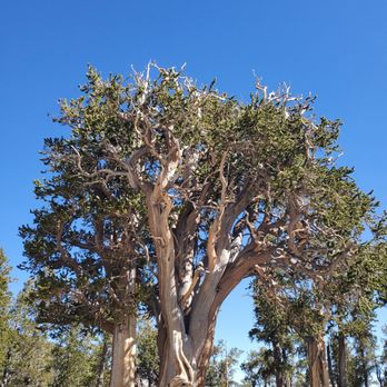
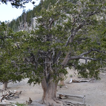
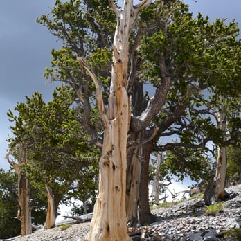
I came to see the oldest living thing in Nevada, Bristlecone pine named Raintree. It's said to be some 3000 yrs old. The hike is around 6 mile round trip and has about 1700 ft. elevation gain and altitudes over 10,000. The trail is located up in the Spring Mountains National Recreation aka Mt. Charleston. Drive out to the Spring Mountains Visitor Center, then continue on Kyle Canyon Road to Deer Creek Road. Then turn right onto Deer Creek Road and continue north to the North Loop Trailhead. The trail is moderately strenuous due to elevation. It took us 4hrs up and back including breaks & photography. It's extremely well marked and easy to follow. We saw several chipmunks and got caught in a thunderstorm for a little bit. There are a lot of steep switchbacks. Your heart will be pumping going uphill and this hike is a quad kicker! As we hiked up the trail, the bristlecone pines were a highlight for me. All around us was quite magical. There were gnarly, twisted, but very colorful. Once you're at Raintree, check out every angle of the tree. When you're ready, go to the right, it's only 1/3 mile to Mummy Springs. Take plenty of water, snacks, wear good walking/hiking shoes and please respect the Bristlecones! Happy Hiking!


Thought I'd leave a review since it's been nearly a year. Hiking here at the end of April, very warm in Vegas yet low 40's here at dawn when I arrived, and t-shirt weather on the way back down. About 6 miles round trip. I've hiked all over Mt. Charleston but the elevation change seemed to make this one a little harder than other hikes nearby. I brought snow-spikes just in case but didn't need to use. There were several areas where the snow covered the trail for a ways but it wasn't slippery. The nearby Mummy Springs were completely frozen with icicles. The Raintree was very nice to see. It is several times bigger than the other bristlecone pine trees in the area. There are far-older bristlecone pine trees in Nevada but are far harder to reach. Arrived a little before dawn, I saw no one on the way up. Coming back down passed about a dozen people.


This is a great hike to test your endurance in higher altitudes. Definitely one of the better hikes to start out with if you are not used to hiking up in Mt. Charleston. It's a well maintained trail with lots of switchbacks (not too steep, but enough to get your heart pumping). You will pass by vegetation throughout the entire hike, desert flowers, pine trees, and TONS of bristlecone trees. The hike leads up to the fabled 3000 year old Raintree, and there is a few dead trees that have been turned into "benches" where you can take a rest and eat your snacks. On the way up, there are great views of Kyle Canyon and the surrounding peaks in Charleston.If you make it to Raintree, make sure you take the short hike to Mummy Spring (it's just 0.3 miles) and check out the spring and the different terrain in that area. Quick stats: 6 miles roundtrip Out and back trail Elevation gain: 1700 feet 3-4 hours total time finish Hiking poles not needed, but they are helpful Be prepared! Bring a jacket (even in the summer) I did this hike Memorial Day 2010 and we got caught in a major snow snowstorm, lost the trail it snowed so hard, thankfully we had GPS .

11 months ago

2 years ago
In A Nutshell: -The North Loop Trailhead is very easy to get to. -Located right off Deer Creek Road, you should be able to find a parking spot, but spots are limited. -Most people only do the 4 mile loop, which is the North Loop Trail to the Wild Horse Canyon trail or vice versa. -It's not a difficult trail, but you will experience some elevation gains. -The trail is mostly sheltered from the sun, I would say about 65% shade. -There are many trees in the 8,000+ elevation range to include ponderosa pine, white fir, limber pines & the longest living trees in the world, the bristlecone pine trees. -Even in mid-August you should spot a small stream of running water along the Wild Horse Canyon trail, which is very cool to see. Overall, this trail system will break off into other trails so you can choose your own adventure in this island in the sky! read more

The hike to Raintree via North Loop Trail is a popular trek that is full of scenic views. Raintree itself is what people say is the oldest living thing in the state of Nevada, a huge bristlecone pine tree thought to be over 3,000 years old. We made another trek up to the tree yesterday to escape the valley heat and soak up some mountain air. There were already a lot of cars at the trailhead at 7:30am. It's just about 2.75 miles one way and it's mostly incline the whole time. My Garmin clocked our hike at 5.51 miles roundtrip, 1,765 ft of elevation gain, and moving time of 3 hours 24 minutes (I hit PAUSE when we were taking a break at the tree). In addition to Raintree itself, I love seeing all the other bristlecone trees along the way. They each have their own twisting personality. This is a great hike for a good calorie burn, escaping into nature, and a bit of Nevada history. read more



Of the three main trails taking you to the summit of Mt. Charleston, this one is the best. The other two, South Loop and TrailCanyonTrail, are good, but this is best. All three trails have an appreciable midway point for you to turn back at if you don't wish to summit. To be clear, my review for each trail is based on only the first half, which is what most people looking for a day hike will do. Raintree benefits from being off the main drag, meaning not as many people hike it as they do the other two and, of course, MaryJaneFalls. It makes for a quieter hike. More secluded. There is one section of switchbacks, but it has fewer than the other trails. You start in pine and never leave pine--all pine, all the time! Halfway to Raintree, the trail opens to a large picnic knoll. There are no benches, but there are tree for lounging on and under. It's pretty gd delightful, away from sounds of traffic, out of sight of the same, and not too strenuous a 2ish mile hike to get there. Once you arrive at Raintree with Mummy's Toe towering overhead, you can turn left to continue on Northloop to TrailCanyonTrail and Mt. Charleston summit, or you can hang a right to Mummy Falls, a short half'ish mile away. The falls flow pretty well from spring-mid-summer depending on winter snowfall. There are winding lovely trails beyond the falls if you cross over. As you can tell from some of my photos, I and the pup love the hell out of this trail. There are lots of secretive side trails and plenty of peace and quiet. Go! Commune! read more


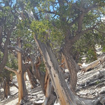
I came to see the oldest living thing in Nevada, Bristlecone pine named Raintree. It's said to be some 3000 yrs old. The hike is around 6 mile round trip and has about 1700 ft. elevation gain and altitudes over 10,000. The trail is located up in the Spring Mountains National Recreation aka Mt. Charleston. Drive out to the Spring Mountains Visitor Center, then continue on Kyle Canyon Road to Deer Creek Road. Then turn right onto Deer Creek Road and continue north to the North Loop Trailhead. The trail is moderately strenuous due to elevation. It took us 4hrs up and back including breaks & photography. It's extremely well marked and easy to follow. We saw several chipmunks and got caught in a thunderstorm for a little bit. There are a lot of steep switchbacks. Your heart will be pumping going uphill and this hike is a quad kicker! As we hiked up the trail, the bristlecone pines were a highlight for me. All around us was quite magical. There were gnarly, twisted, but very colorful. Once you're at Raintree, check out every angle of the tree. When you're ready, go to the right, it's only 1/3 mile to Mummy Springs. Take plenty of water, snacks, wear good walking/hiking shoes and please respect the Bristlecones! Happy Hiking! read more



8 years ago
Thought I'd leave a review since it's been nearly a year. Hiking here at the end of April, very warm in Vegas yet low 40's here at dawn when I arrived, and t-shirt weather on the way back down. About 6 miles round trip. I've hiked all over Mt. Charleston but the elevation change seemed to make this one a little harder than other hikes nearby. I brought snow-spikes just in case but didn't need to use. There were several areas where the snow covered the trail for a ways but it wasn't slippery. The nearby Mummy Springs were completely frozen with icicles. The Raintree was very nice to see. It is several times bigger than the other bristlecone pine trees in the area. There are far-older bristlecone pine trees in Nevada but are far harder to reach. Arrived a little before dawn, I saw no one on the way up. Coming back down passed about a dozen people. read more
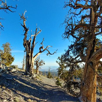

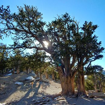


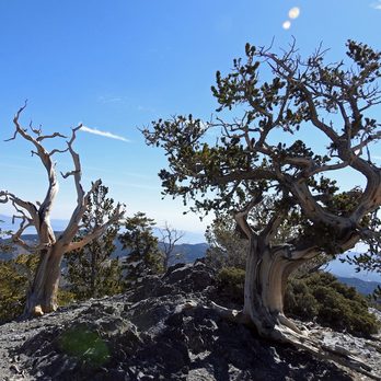

This is a great hike to test your endurance in higher altitudes. Definitely one of the better hikes to start out with if you are not used to hiking up in Mt. Charleston. It's a well maintained trail with lots of switchbacks (not too steep, but enough to get your heart pumping). You will pass by vegetation throughout the entire hike, desert flowers, pine trees, and TONS of bristlecone trees. The hike leads up to the fabled 3000 year old Raintree, and there is a few dead trees that have been turned into "benches" where you can take a rest and eat your snacks. On the way up, there are great views of Kyle Canyon and the surrounding peaks in Charleston.If you make it to Raintree, make sure you take the short hike to Mummy Spring (it's just 0.3 miles) and check out the spring and the different terrain in that area. Quick stats: 6 miles roundtrip Out and back trail Elevation gain: 1700 feet 3-4 hours total time finish Hiking poles not needed, but they are helpful Be prepared! Bring a jacket (even in the summer) I did this hike Memorial Day 2010 and we got caught in a major snow snowstorm, lost the trail it snowed so hard, thankfully we had GPS . read more




12 years ago
I hiked this in July in the afternoon when the strip was 105F, but Mt Charleston was about 80F so it was a comforting escape from the heat and noise of the city. I did the hike to the Rain Tree and then to Mummy Spring. I was with my dog and stopped every once in a while for water and pictures and it took me about two hours to get to the Rain Tree (kiosk says 3 hours). The trail has activity which is always good to see, but by no means crowded. It was maintained well and was very clean. It is one of the best hikes I have done in the Las Vegas Area. If you are going to the Rain Tree, you might as well tack on the extra 2/3 mile round trip to see Mummy Spring. When you get to the 3,000 year old tree, take the trail to the right at the junction. It felt like the terrain and ecology was very different from the rest of the hike on the way to Mummy Spring, and the payoff at the spring is amazing. I looked up into a canyon of lush green life. I even saw some new flowers and spiky plants that I haven't seen before. The trail continues on to some switchbacks but fades into random rock scrambling, so you can just head back once you see the spring. Overall, the hike was great and I am a little sore today, it was pretty much all moderate+ uphill the whole way to the rain tree. I brought 8L of water for me and the pup, and I drank about 3L and the pup 1.5L. Going to Mummy spring and back was about 4.5 hours total with pictures and water breaks. read more



16 years ago

11 years ago
More info about Raintree via North Loop
Toiyabe National Forest
Mt. Charleston, NV 89124
Directions
Hours
Outdoor Amenities
Ask the Community - Raintree via North Loop
Does anyone know the status of Rain Tree with the fire? The actual tree, not the trail. Oldest living organism in the state.
This trail is currently closed at this time due to the Mahogany Fire.