Sacred Places Photos


You might also consider
More like Sacred Places
Recommended Reviews - Sacred Places
Start your review...

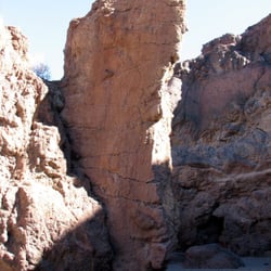
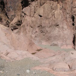
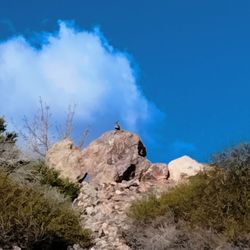
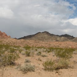
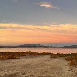
Located within a 5 minute drive from Laughlin Nevada is a spot where a very short hike takes you back thousands of years. The Sacred area is well worth the short trip and shorter walk. There are literally hundreds of petroglyphs and other stunning views of the rocky mountainous and desert terrain. If the the Laughlin area - Just Do It. read more


More info about Sacred Places
601 Nevada Way
Boulder, NV 89005
Directions
(702) 293-8990
Call Now
Hours
Outdoor Amenities


Sacred Places - hiking - Updated July 2026
Best of Boulder
People found Sacred Places by searching for…
Things to Do in Boulder, Nevada
Abandoned Places in Boulder, Nevada
Scenic Views in Boulder, Nevada
Hiking Trails in Boulder, Nevada
Walking Trails in Boulder, Nevada
Beautiful Views in Boulder, Nevada
Walking Groups in Boulder, Nevada
Running Routes in Boulder, Nevada
Running Trails in Boulder, Nevada
Lookout Points in Boulder, Nevada
Fall Foliage in Boulder, Nevada
Free Things to Do With Kids in Boulder, Nevada
Romantic Views in Boulder, Nevada
Jogging Trails in Boulder, Nevada
Nature Walks in Boulder, Nevada
Stuff to Do in Boulder, Nevada
Off Road Trails in Boulder, Nevada
Browse Nearby
BEST of Boulder, Nevada Things to Do near Sacred Places
BEST of Boulder, Nevada Coffee near Sacred Places
BEST of Boulder, Nevada Restaurants near Sacred Places
BEST of Boulder, Nevada Breakfast near Sacred Places
BEST of Boulder, Nevada Walking Trails near Sacred Places
BEST of Boulder, Nevada Parks near Sacred Places
BEST of Boulder, Nevada Campgrounds near Sacred Places
Browse Brands
Browse Articles
People who viewed Sacred Places also viewed
Sloan Canyon National Conservation Area
44 reviews
Petroglyph Trail
4 reviews
Clark County Wetlands Pabco Trailhead
12 reviews
Railroad Pass Loop
4 reviews
Clark County Wetlands Wells Trailhead
2 reviews
Lake Las Vegas Overlook
2 reviews
Shoreline Trail
4 reviews
Wetlands Trail
8 reviews
Bootleg Canyon Park
10 reviews
Lake Mead Overlook
22 reviews