Fortification Hill Photos


You might also consider
More like Fortification Hill
Recommended Reviews - Fortification Hill
Start your review...

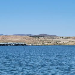
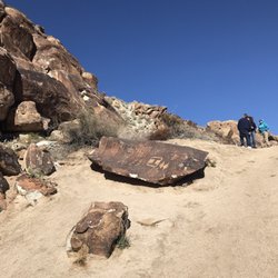
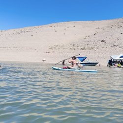
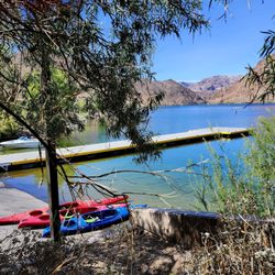
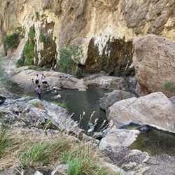
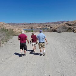
This review is for Fortification Hill which was a ~3.5 miles round trip that took ~3 hours to complete. Fortification Hill was one of most challenging hikes I have ever done; located a hour from Vegas. Plenty of steep inclines and declines on loose gravel. Highly recommend using hiking poles! One particular area requires a little bit of rock scrambling. No shade; completely exposed to the sun. Stunning view of Lake Mead and the surroundings with a distant view of Hoover Dam. Required to drive on ~5.8 miles of dirt road. Recommend a high clearance vehicle. Short video of the hike for those interested! https://youtu.be/iIylDeCLBuE read more


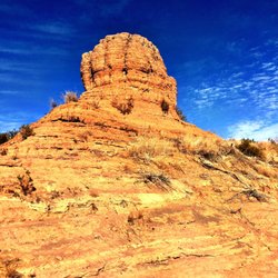
Fortification Hill is an extinct volcano located in the Lake Mead National Recreation Area on the Arizona side of Hoover Dam. This is a moderately strenuous hike of about 5 miles and about 1,200 feet of elevation gain. This is primarily a class 1 trail hike but portions are steep and loose, and there is a short section of class 2 scrambling with very minor exposure. It is not a hike for children or anyone who can't do some short but difficult rock scrambling or handle a steep scree slope. The hike is fully exposed to the sun the entire way. Make sure to wear a hat, sunscreen and bring plenty of water. Just returned from the hike today. As we were heading down the hill, we saw a baby horned lizard. To drive to the trailhead, they recommend a four-by-four high-clearance vehicle with good off-road tires for the last 2.5 miles of driving. I would not recommend to drive the road if it is raining or there is a threat of rain, as flash flooding occurs here. The view from the top is one of the very best in the whole valley and has a great view of the dam. read more


10 years ago
More info about Fortification Hill
Temple Bar Marina, AZ 86443
Directions
(702) 293-8990
Call Now
Hours
Outdoor Amenities
You might also consider


Fortification Hill - hiking - Updated July 2026
Best of Temple Bar Marina
People found Fortification Hill by searching for…
Lakes in Temple Bar Marina, AZ
Things to Do in Temple Bar Marina, AZ
Dinosaur Park in Temple Bar Marina, AZ
Hiking Trails With Waterfalls in Temple Bar Marina, AZ
Off Road Trails in Temple Bar Marina, AZ
Cliff Diving in Temple Bar Marina, AZ
View Points in Temple Bar Marina, AZ
Easy Hikes in Temple Bar Marina, AZ
Scenic Views in Temple Bar Marina, AZ
Skyline View in Temple Bar Marina, AZ
Fishing Spots in Temple Bar Marina, AZ
State Park in Temple Bar Marina, AZ
Canyoneering in Temple Bar Marina, AZ
Dog Friendly Trails in Temple Bar Marina, AZ
Walking Trails in Temple Bar Marina, AZ
Trails in Temple Bar Marina, AZ
Restaurant With a View in Temple Bar Marina, AZ
Browse Nearby
BEST of Temple Bar Marina, Arizona Things to Do near Fortification Hill
BEST of Temple Bar Marina, Arizona Lakes near Fortification Hill
BEST of Temple Bar Marina, Arizona Restaurants near Fortification Hill
BEST of Temple Bar Marina, Arizona Beaches near Fortification Hill
BEST of Temple Bar Marina, Arizona Cabins near Fortification Hill


