SYCAMORE CANYON WILDERNESS PARK · YELP ASSISTANT
Ask Yelp Assistant
Sycamore Canyon Wilderness Park Photos


You might also consider


More like Sycamore Canyon Wilderness Park
Recommended Reviews - Sycamore Canyon Wilderness Park
Start your review...


Reviews With Photos


Beautiful location to get in a good hike, walk or hit it spinning on your mountain bike. Easy to get to, good sized parking, small visiting center and located in a great area. Family friendly of course and the trails vary from easy to hard. The hills offer different sized inclines and declines. All depends on how heavy you feel like breathing. Very nice trails and word of advice the hikes are much easier with the proper hiking shoes.


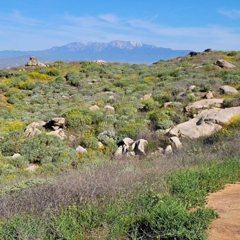
First time going on this hike and I give it a 5/5, albeit, I probably went at the perfect time. It's late April so beginning of spring when this hike is full of green, lush, plants and wildlife and I hiked at 5pm, two hours before sunset so it wasn't too hot and the air was clean and crisp. I believe there are a couple of entrances to this hike but we parked in a small public parking lot on Central Ave. the trail is moderate in difficulty as there are a lot of hills and is unpaved and allows for leashed dogs and bike riding. Lots of friendly hikers and open fields and great views. Can't tell you an exact mileage for this hike because there are so many spinoff trials, but we did 3.5 miles on our hike. Will def be back!


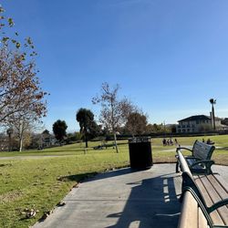
We did this trail after finishing Mt. Rubidoux trail today. The two trails couldn't be more opposites. We parked at Sycamore Highlands Park and began the trail at the rear of the park. There were many different paths to take along the trail. You can pretty much design your own workout. Anywhere from 1 mile to at least 10 miles. Although we didn't see any bikes along the trail today, I would consider the trail for for mountain biking than for a hike. Seems to have nice terrain with plenty of twists, turns, dips and inclines that would be heaven for a mountain biker. In fact, to hike this trail, there are parts where you have to gain some momentum to ensure you made it up the little hills. At the beginning of the trail, you are pretty close to homes (with impressively large 1-acre lots!) but gradually the hike moves you further and further away. I find this trail lacks the scenery, interest points, or a destination point...things that you would typically find in a 5 star hike. I also think this hike would be pretty brutal in the summer months as there are no canopies along this trail. I probably won't return here since it is almost an hour from our house. There are way to many better options within the same radius from home. Thanks for the experience...if I ever come back, it will be with a mountain bike!


I did this hike for the first time yesterday. It was ok...nothing special. Parking- parked for free by the park and accessed the trail from the back of the park Trail - many options with some parts being wide and some very narrow parts; no shade; we didn't cross anyone on the trail (we did about 3.5 miles) Wildlife- saw lots of lizards (snake food), a few rabbits, but no snakes Views- some cool rocky areas that look out down below *seems like this cool be a brutal hike at the wrong season or time of the day *could be better on a bike


The "field" the "playground" mountain bikers have a few nicknames for this awesome trail system located on the outskirts of Riverside. Whatever they call it. It's definitely a ton of fun. The mountains can be too cold and unpredictable to ride in during winter and this is a great city option. Summers can get a little hot so extra early morning starts are advisable. If strictly mt biking I would be weary of starting on the central side of the park as its heavy on hikers. Starting off by Jenson's is more ideal and if you happen to need anything the warehouse is great place to get discounted cycling products. It also looks like the single track trails are expanding. There has been some freshly plowed dirt that the trail gurus are waiting to carve out for us over by the Farmer Brothers. A little something for everyone here and mountain bikers of all skill levels will enjoy the trail system There are even crazy jumps set up for extreme downhillers to fly over and do table tops on. I wouldn't recommend taking xc bikes over to attempt any of those jumps, you'll need the proper forks and travel to be able to handle that more advanced area.

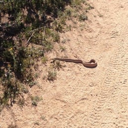

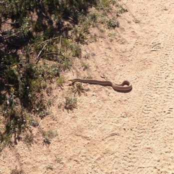
I've been here a few times with the family and its a great spot. I just walk/hike because every time I have the kids with me, but there are plenty of runners and mountain bikers. I think the bikers outnumber everyone else but they are all courteous and not trail hogs by any means. Speaking of the trails, they vary in width from fire roads to single file cuts between rocks/bushes and vary in grade from flat land to pretty steep sections. Trail maps are posted at the three main entrances. It gets hot in the summer (duh) with hardly any shade, and watch for snakes and coyote dung. Along the north east border there is a nice housing track with a nice roomy park and playground. There's a trail that leads right to it. Good to give the little ones a break in the hike. I sit in the shady grass and let them play on the playground.


This wilderness area is a sanctuary for all varieties of lical desert flora and fauna including Coyotes, Rattlesnakes, Rabbits, Hawks and Falcons, Beetles and Bugs, Creosote, Sage, Oak, grasses, flowers, shrubs, and of course Sycamores. It's only a couple square miles of area but there are parts where you can't see civilization and would swear you're all alone. Scenic viewpoints are EVERYWHERE and rugged trails take to all areas. It's impossibile to get lost as it's surrounded by community--just pick a trail and start walking, or ask one of the many trail bike riders!


This is a beautiful get away in the middle of the city. It's almost possible to believe you are away from civilization when you are here. There are trails shared by bikers and hikers alike. It's not too strenuous and it's dog-friendly. There isn't much shade so make sure to bring plenty of water. There is a surprising amount of wildlife inhabiting the park. We've seen rabbits, lizards, a coyote, and snakes. A really cool thing about the area is that there is the Ameal Moore Nature Center. It's at the main entrance to the park. You can go on guided walks through the park and see exhibits of the local flora and fauna. Also, if you see a plant or animal you are unfamiliar with, you can snap a picture and send it to the Nature Center. They will get back to you and let you know what it is and add it to their online archives.


Our favorite hiking spot. Trail is always clear and clean....safe and easy enough for my 7 and 10yo kids but still challenging. Great views of the city!


This is an absolutely beautiful nature preserve. There are owls, coyotes, K rats. There are various types of terrain if you want a really healthy hike or just a really nice walk. This is an absolute asset to this area and to Riverside. Especially now with all the rain, there are actually waterfalls and streams. Don't miss this!!


A true hidden gem in Southeast Riverside. Not far from UCR, I'm surprised this trail is as rarely crowded as it is. I've hiked this trail at least 10 times. It's challenging enough for a quick workout, and it has enough routes to allow for short, medium and very long hikes. I start at the nature center and hike up to the park, then head back. I find the scenery just incredible. You get pretty good immersion in the hiking experience, despite being located right off a roadway (the entrance is, anyway). read more


By foot or astride a mountain bike, this is the little-big getaway I needed that's not too far from home but feels like getting away from society at the same time. Sure, housing encroached on the east and west flanks but the steep hills, ravines and canyon itself ensures you are immersed in nature with the façade only occasionally broken by a plane lifting off from the nearby air force base. Top reason to go? No crowds or kids. Seriously, I've seen people turn back after ascending the first hill, which comes almost immediately. Unfortunately, this didn't prevent graffiti schmucks from tagging rocks inside of 100 yards, something that happened between my third and fourth visits. You'll need a lot of water and a good wide brimmed hat because there's virtually no shade. Plus, a decent set of hiking boots is important. It's also possible to get lost so I recommend using the AllTrails app for the satellite views and topographical maps to see where the trails are. While fitness apps such as Strava are useful, you won't see the map as easily so running both makes sense. Sun block too, definitely need to reapply after 45 minutes to an hour. "Do what thou wilt": there are so many trails and possible loops just do what you want and have fun. The rattlesnakes are awake now so keep off the rocks on the hilltops, you'll likely see their trails in the dirt. There are tons of lizards too, all sizes and colors, plus hummingbirds, hawks, and ravens. We saw a raven pluck a small ground squirrel from some rocks by its tail and could hear its squeaks. Sad, but that's nature. You won't go as far as you think for the same output of energy as, say, Mt. Rubidoux. This is more rugged and rustic, hence fewer people and dogs. It's taken me four visits to exceed three miles that felt like six or seven. Nevertheless, it's a challenge and so picturesque. Next time I'm hoping ascend Rattlesnake Peak at 1608 feet, tucked dab smack in the middle of the wilderness. I typically use the Central entrance but there are others available, just use the app to locate them. I don't recommend being out there after noon on days over 80 degrees, either go early or after 5pm. If you go later bring a headlamp just in case you take longer getting back than expected. Not for the faint of heart, which is why it's becoming my top training ground for more difficult and longer hikes in the mountains. read more


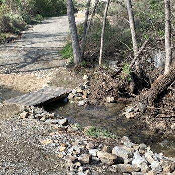


Beautiful location to get in a good hike, walk or hit it spinning on your mountain bike. Easy to get to, good sized parking, small visiting center and located in a great area. Family friendly of course and the trails vary from easy to hard. The hills offer different sized inclines and declines. All depends on how heavy you feel like breathing. Very nice trails and word of advice the hikes are much easier with the proper hiking shoes. read more




7 years ago
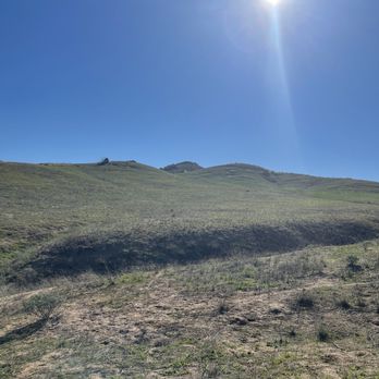
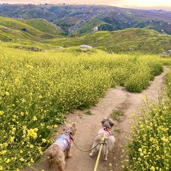
First time going on this hike and I give it a 5/5, albeit, I probably went at the perfect time. It's late April so beginning of spring when this hike is full of green, lush, plants and wildlife and I hiked at 5pm, two hours before sunset so it wasn't too hot and the air was clean and crisp. I believe there are a couple of entrances to this hike but we parked in a small public parking lot on Central Ave. the trail is moderate in difficulty as there are a lot of hills and is unpaved and allows for leashed dogs and bike riding. Lots of friendly hikers and open fields and great views. Can't tell you an exact mileage for this hike because there are so many spinoff trials, but we did 3.5 miles on our hike. Will def be back! read more




3 years ago

We did this trail after finishing Mt. Rubidoux trail today. The two trails couldn't be more opposites. We parked at Sycamore Highlands Park and began the trail at the rear of the park. There were many different paths to take along the trail. You can pretty much design your own workout. Anywhere from 1 mile to at least 10 miles. Although we didn't see any bikes along the trail today, I would consider the trail for for mountain biking than for a hike. Seems to have nice terrain with plenty of twists, turns, dips and inclines that would be heaven for a mountain biker. In fact, to hike this trail, there are parts where you have to gain some momentum to ensure you made it up the little hills. At the beginning of the trail, you are pretty close to homes (with impressively large 1-acre lots!) but gradually the hike moves you further and further away. I find this trail lacks the scenery, interest points, or a destination point...things that you would typically find in a 5 star hike. I also think this hike would be pretty brutal in the summer months as there are no canopies along this trail. I probably won't return here since it is almost an hour from our house. There are way to many better options within the same radius from home. Thanks for the experience...if I ever come back, it will be with a mountain bike! read more


I did this hike for the first time yesterday. It was ok...nothing special. Parking- parked for free by the park and accessed the trail from the back of the park Trail - many options with some parts being wide and some very narrow parts; no shade; we didn't cross anyone on the trail (we did about 3.5 miles) Wildlife- saw lots of lizards (snake food), a few rabbits, but no snakes Views- some cool rocky areas that look out down below *seems like this cool be a brutal hike at the wrong season or time of the day *could be better on a bike read more


3 years ago

The "field" the "playground" mountain bikers have a few nicknames for this awesome trail system located on the outskirts of Riverside. Whatever they call it. It's definitely a ton of fun. The mountains can be too cold and unpredictable to ride in during winter and this is a great city option. Summers can get a little hot so extra early morning starts are advisable. If strictly mt biking I would be weary of starting on the central side of the park as its heavy on hikers. Starting off by Jenson's is more ideal and if you happen to need anything the warehouse is great place to get discounted cycling products. It also looks like the single track trails are expanding. There has been some freshly plowed dirt that the trail gurus are waiting to carve out for us over by the Farmer Brothers. A little something for everyone here and mountain bikers of all skill levels will enjoy the trail system There are even crazy jumps set up for extreme downhillers to fly over and do table tops on. I wouldn't recommend taking xc bikes over to attempt any of those jumps, you'll need the proper forks and travel to be able to handle that more advanced area. read more


5 years ago
Great place for an easy hike, trail run, or mountain biking. I went during the week and it was not busy at all. Parking lot for easy access and water fountains at start of trail. Many different route possibilities. read more


13 years ago
I've been here a few times with the family and its a great spot. I just walk/hike because every time I have the kids with me, but there are plenty of runners and mountain bikers. I think the bikers outnumber everyone else but they are all courteous and not trail hogs by any means. Speaking of the trails, they vary in width from fire roads to single file cuts between rocks/bushes and vary in grade from flat land to pretty steep sections. Trail maps are posted at the three main entrances. It gets hot in the summer (duh) with hardly any shade, and watch for snakes and coyote dung. Along the north east border there is a nice housing track with a nice roomy park and playground. There's a trail that leads right to it. Good to give the little ones a break in the hike. I sit in the shady grass and let them play on the playground. read more


3 years ago

13 years ago
This wilderness area is a sanctuary for all varieties of lical desert flora and fauna including Coyotes, Rattlesnakes, Rabbits, Hawks and Falcons, Beetles and Bugs, Creosote, Sage, Oak, grasses, flowers, shrubs, and of course Sycamores. It's only a couple square miles of area but there are parts where you can't see civilization and would swear you're all alone. Scenic viewpoints are EVERYWHERE and rugged trails take to all areas. It's impossibile to get lost as it's surrounded by community--just pick a trail and start walking, or ask one of the many trail bike riders! read more


12 years ago
This is a beautiful get away in the middle of the city. It's almost possible to believe you are away from civilization when you are here. There are trails shared by bikers and hikers alike. It's not too strenuous and it's dog-friendly. There isn't much shade so make sure to bring plenty of water. There is a surprising amount of wildlife inhabiting the park. We've seen rabbits, lizards, a coyote, and snakes. A really cool thing about the area is that there is the Ameal Moore Nature Center. It's at the main entrance to the park. You can go on guided walks through the park and see exhibits of the local flora and fauna. Also, if you see a plant or animal you are unfamiliar with, you can snap a picture and send it to the Nature Center. They will get back to you and let you know what it is and add it to their online archives. read more


10 years ago
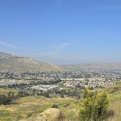
Our favorite hiking spot. Trail is always clear and clean....safe and easy enough for my 7 and 10yo kids but still challenging. Great views of the city! read more


This is an absolutely beautiful nature preserve. There are owls, coyotes, K rats. There are various types of terrain if you want a really healthy hike or just a really nice walk. This is an absolute asset to this area and to Riverside. Especially now with all the rain, there are actually waterfalls and streams. Don't miss this!! read more


11 years ago
The park itself is very spacious with plenty of grass, tables, and area for picnic. My friend and I took the hiking trail with his scottish terrier dog. There were a few people on the trail. There are many trails that lead to different areas, but they all kind of looked the same. There are not many shady spots, but lots of dirt pathways and rocks. It was still a nice hike to get a beautiful view of Riverside. read more


7 years ago


7 years ago

6 years ago

12 years ago
Great hiking place! Lots of trails to take, you will definitely get a work out. There's a sign at the entrance that warns you about snakes... Take it serious! We saw at least 3 snakes in the one hour we where there! read more


10 years ago
I love exploring this place. Miles and miles of trails. Small creeks and lots of wildlife. Great for biking as well, but I hike it. Not a lot of people which is what I like being alone in nature. read more


11 years ago
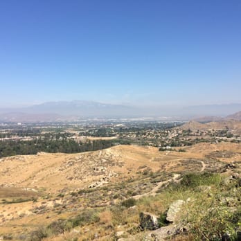
Hiked here for the first time and it was actually pretty awesome! When you get up high enough you see sweeping views all around you. I highly suggest taking a friend or a group with you! I didn't see any snakes but I went early in the morning. I did get up close with a coyote, but he seemed more startled by me than I was by him. He gave me a quick look and took off in the opposite direction. Just watch out for the bugs, beetles, giant fire ants, and grasshoppers! I saw a ton of lizards too. There really is no shade, and it's definitely no mt rubidoux but it's still a great workout. Oh and be careful by those rocks that are near the homes next to the park. There is a giant beehive inside the crevasses of the rocks (I almost walked right into it). read more




14 years ago
l love to come trail running here. This place is great for trail running and mountain biking. I have been coming here for years and it's the best place around Riverside/MoVal. It's a little more flat and chill than Box Springs Mountain. read more


9 years ago
No shade but lots of ups and downs to travel on. It seems like a really great path to bike on! Saw a couple of bunnies there and the great part is it's not overwhelming full of people. It's a great workout! Chose a mountain to climb and you'll be sweating in time! read more


I went here today not expecting too much because I just wanted to walk around, but this place is amazing! The trails are fairly easy to walk on, but you need to be aware about the people around you because there are bikers that come here at fast speeds. The best thing about the sycamore canyon is the vegetation. I haven't seen a lot of mountains around riverside area that has as much vegetation as this place. There are a lot of shrubs and flowering plants here that grow. I would definitely go back here during spring when flowers bloom. read more


11 years ago
Great place to hike or ride your bike. This place is worth a visit. The senery is beautiful with lots of different trails. During spring there are abundance of wild flowers. There is a small stream that runs the lengths the park. read more


12 years ago
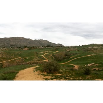
Great hike! I was surprised that there was such beautiful greenery in Riverside. Definitely going back and such a good workout. Loved how there were several trails read more


8 years ago

11 years ago
This was a great beginning place to take the kiddos for a hike , the trails were clearly marked and as long as the kids stayed on the trails I they were safe . My only complaints is that there is no restroom mon-wed and with kids drinking a lot of water on the hike it's not a good mix lol . (Luckily I carry a portable potty ) overall very happy with the scenery , will be back for a longer hike , great views of downtown riverside ! read more


11 years ago
I grew up across the street from the canyon crest entrance. This trail offered me solace and peace, when I couldn't find it elsewhere. I get very nostalgic thinking about this awesome park. It offers awesome views of riverside. You can see "The C" and the cross on rubidoux if you know where to look. Best to go after a few days of rain when it starts to get green. Green or not, I love it here. read more


10 years ago
This park is great with many trails and routes. Hiking or biking it's great. I've tried many routes and some are better for walking vs biking. I suggest you walk it before biking to determine which route fits your skill level on your mountain bike. Multiple entrances as well. The regulars are courteous and everyone is polite whether you're biking or hiking. Bring your water with you. Plenty of different types of terrain to keep you from getting bored as well. read more


12 years ago
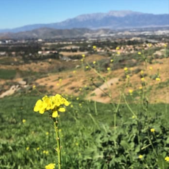
First time coming here, it was a very good hike trails were smooth didn't see any snakes only one coyote and a rabbit. had a very good time with the family. Well recommended to other's. read more



13 years ago
Pretty easy trails that can break-off into steeper more challenging trails. Had fun hiking here with the dogs, might try going when its not 97 degrees out. Minimal shady areas for rest, great scenic view of Riverside, do-able trails for not-so-hardcore-hikers like myself. Will def do it again. read more


7 years ago

9 years ago

15 years ago
Page 1 of 2
More info about Sycamore Canyon Wilderness Park
Sycamore Canyon Park
Riverside, CA 92507
Directions
Hours
Outdoor Amenities
Ask the Community - Sycamore Canyon Wilderness Park
Is there free parking? Also, is any type of pass required to enter the trails?
No charge for parking and no pass required.
What would be the best place to start the trail? I'm a runner and new to Riverside and was looking for a good place to start at.
I like to start off of East Alessandro at the Barton Street entrance. You can either go left or right and make a big loop.