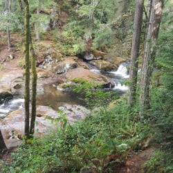
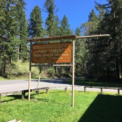
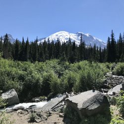
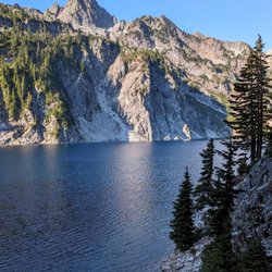
Sumner Link Trail Photos


You might also consider
More like Sumner Link Trail
Recommended Reviews - Sumner Link Trail
Start your review...

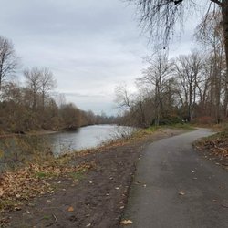
I actually liked this trail a lot as it goes on the Sumner side of the Puyallup River and on the other side is the Puyallup River Walk Trail. There are lots of creepy kind of people that walk or maybe even live along that trail but I noticed so much less of that on this trail. You still get great views of the river as well as farmland which is refreshing to see. Lots of your "typical " sort of folk on this trail just enjoying the outdoors and a somewhat rural setting (on some parts of the trail). read more


Well that was disappointing. I would have to say the shorter side of this trail is not pretty or relaxing at all. You walk past a sludge waste treatment facility and next to industrial areas. It is however good for dog walking and small children if you want to get them started on mild outdoor trail walking. They might not know any different. The trail is paved, so on dry days you can ride a bike, push a stroller, or walk your dog. The city provides those doggy doo baggies, so please please pick up after your mutt. I'm sure when its dry you can play out on the grass..toss Frisbees and do a picnic but honestly...the link trail side isn't where I'd want a picnic. On this day it was rainy and gloomy, full of puddles..some I had to tippy toe through, so it can't get much worse. Oh did I say this side was a short distance? lol Next time I'll hit up the trail on the other side. It's supposedly much much longer actually following the river almost into Tacoma. Moving on! read more


More info about Sumner Link Trail
Inter Ave E & Washington 410 & E Main Ave
Sumner, WA 98390
Directions
Hours
Outdoor Amenities
You might also consider


Sumner Link Trail - hiking - Updated July 2026
Best of Sumner
People found Sumner Link Trail by searching for…
Trending Searches in Sumner, WA
Blueberry Picking near Sumner Link Trail
Boat Tours near Sumner Link Trail
Cliff Jumping near Sumner Link Trail
Day Trips near Sumner Link Trail
Dog Friendly Beaches near Sumner Link Trail
Dog Friendly Trails near Sumner Link Trail
Free Picnic Areas near Sumner Link Trail
Jet Ski Rental near Sumner Link Trail
Kayak Rental near Sumner Link Trail
Off Road Trails near Sumner Link Trail
Outdoor Activities near Sumner Link Trail
Peach Picking near Sumner Link Trail
Places To Swim near Sumner Link Trail
Places To Walk Around near Sumner Link Trail
Public Shower near Sumner Link Trail
River Swimming near Sumner Link Trail
River Tubing near Sumner Link Trail
Rock Quarry near Sumner Link Trail
Scenic Night View near Sumner Link Trail
Scenic Overlook near Sumner Link Trail
Secluded Spots near Sumner Link Trail
Soccer Store near Sumner Link Trail
Sunrise View near Sumner Link Trail
Swimming Holes near Sumner Link Trail
Swimming Lakes near Sumner Link Trail
U Pick Farms near Sumner Link Trail
Browse Articles
Browse Nearby
BEST of Sumner, Washington Coffee near Sumner Link Trail
BEST of Sumner, Washington Things to Do near Sumner Link Trail
BEST of Sumner, Washington Restaurants near Sumner Link Trail
BEST of Sumner, Washington Walking Trails near Sumner Link Trail
BEST of Sumner, Washington Breakfast near Sumner Link Trail
BEST of Sumner, Washington Parks near Sumner Link Trail
BEST of Sumner, Washington Campgrounds near Sumner Link Trail
Browse Brands
Related Searches in Sumner, WA
Affordable Kayak Rental Services in Sumner, Washington
Best Dog Hiking Trails Around Sumner, Washington
Best Fishing Locations and Guides in Sumner, Washington
Best Nature Trails for Hiking in Sumner, Washington
Best Places for Horseback Riding in Sumner, Washington
Best Sightseeing Experiences Available in Sumner, Washington
Check Out Off Road Trails in Sumner, Washington
Discover Dog Friendly Trails to Explore in Sumner, Washington
Discover Easy Hiking Trails Near Sumner, Washington
Discover Kid Friendly Hiking Trails in Sumner, Washington
Discover Popular Bike Trails in Sumner, Washington
Discover Scenic Mountain Bike Trails Near Sumner, Washington
Discover Walking Parks in Sumner, Washington Near You
Discover a Hiking Trail in Sumner, Washington
Discover the Best Night Hike Trails in Sumner, Washington
Dog-Friendly Hikes With Dogs in Sumner, Washington
Enjoy Camping Adventures Around Sumner, Washington
Enjoy Kayaking Adventures in Sumner, Washington
Enjoy Off Leash Dog Hikes in Sumner, Washington
Enjoy Scenic Places to Walk in Sumner, Washington
Enjoy a Beautiful Waterfall Hike in Sumner, Washington
Enjoy the Best Walking Path in Sumner, Washington
Enjoy the Best Walking Trails in Sumner, Washington
Explore Beautiful Parks and Green Spaces in Sumner, Washington
Explore Easy Hikes Perfect for All in Sumner, Washington
Explore Fun Activities to Do in Sumner, Washington
Explore Popular Campgrounds Near Sumner, Washington
Explore Popular Dog Walking Trails in Sumner, Washington
Explore Top Dog Parks in Sumner, Washington Near You
Explore Top Water Parks in Sumner, Washington Today
Explore the Best Beach Spots in Sumner, Washington
Family Friendly Hiking With Kids in Sumner, Washington
Find Popular Ziplining Spots Around Sumner, Washington
Find Top-Rated Waterfalls in Sumner, Washington Now
Find the Best Parks for Picnics in Sumner, Washington
Hiking Trails With Waterfalls in Sumner, Washington
Off Leash Dog Hiking Trails in Sumner, Washington
Popular Outdoor Activities to Try in Sumner, Washington
Popular Picnic Spots to Visit in Sumner, Washington
Popular Waterfall Hiking Trails in Sumner, Washington
Safe River Swimming Areas in Sumner, Washington
Safe and Fun Parks for Kids in Sumner, Washington
Top Hiking Trails to Explore in Sumner, Washington
Top Playgrounds for Kids to Enjoy in Sumner, Washington
Top Running Trails to Explore in Sumner, Washington
Top Swimming Lakes to Enjoy in Sumner, Washington
Top Swimming Spots and Pools in Sumner, Washington
Top-Rated Camping Sites in Sumner, Washington