Spicewood Valley Trail Photos



You might also consider


More like Spicewood Valley Trail
Recommended Reviews - Spicewood Valley Trail
Start your review...


Reviews With Photos


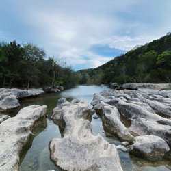
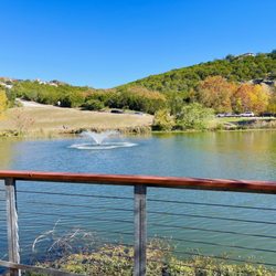
Excellent trail to go on a hike. Loved the mountain lake view. Would love to again to explore more paths.


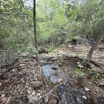
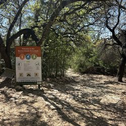
This place has some negative reviews for reasons I don't find valid. This trail is absolutely amazing and I had no issues either time I went. There was a giant sign in front of the entrance to the trail which let me know exactly where it started and the parking wasn't an issues at all. There are three different entrances to this trail and I parked in a lovely neighborhood with tons of parking on two separate occasions. I went during the week which may have helped with the parking situation. My two boys age 5 and 6 had a blast. We found a creek which lead to a waterfall and fishing hole. We sat at the water and were able to take a long break playing in the water, searching for rocks and creatures before heading back up the trail. Personally, I don't think a one star review, because someone couldn't find the trail, is a valid review. Who knows, maybe they took a wrong turn and it was nothing to do with the visibility of the trail itself. And if you can't find parking that's because it's probably a lovely day and weekend at which everyone wants to use the trail. Again, there are three entrances. Anyway, this is an amazing trail and worth the experience. It is magical.


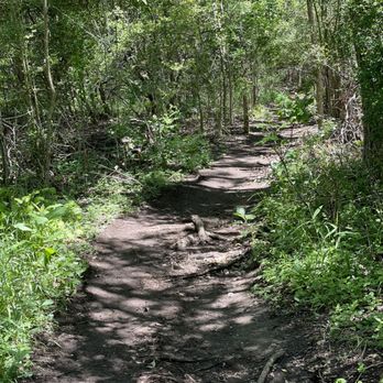
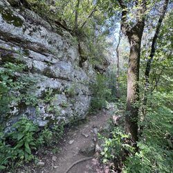
Thank god for Cotton's review or I would have walked around what looks like an average paved neighborhood park forever. I walked and lurked creepily near the houses until I found the entrance off the road. It's totally unmarked so look for a little break in the trees and what looks like the beginning of a trail. This trail was surprising. I had no idea that it existed nor that it was so long. I ran into just two other people while I was hiking around and it's pretty picturesque. Big trees and a windy trail into sunny pastures back into darker denser spots. I'm just beginning to explore these north Austin treasures and this one is definitely a new fave.


A couple of weeks ago after we had some storms and still had stormy Skies I had a surreal experience here. It was around 6 PM and I ventured out with my Pup for an evening hike.... The sun was trying to peek out and it had a hard time to challenge the mood of the day... We did the entire trail about 3 miles and it was filled with Fire Flies on the way back! I highly recommend this place for an evening hike..


Easy and short trail in between houses in northwest Austin. Nothing spectacular and the water quality also isn't the best; there's a sulfur smell from the creek. Nice shaded trails and parking is available on the street or in very small parking lot. read more


2 years ago
One of my favorite traits that I have seen jet.. It has two beautiful waterfalls and a big lake at the end that is clean enough to swim in ... Love my time here Thank you read more





5 years ago
Excellent trail to go on a hike. Loved the mountain lake view. Would love to again to explore more paths. read more



5 years ago
This place has some negative reviews for reasons I don't find valid. This trail is absolutely amazing and I had no issues either time I went. There was a giant sign in front of the entrance to the trail which let me know exactly where it started and the parking wasn't an issues at all. There are three different entrances to this trail and I parked in a lovely neighborhood with tons of parking on two separate occasions. I went during the week which may have helped with the parking situation. My two boys age 5 and 6 had a blast. We found a creek which lead to a waterfall and fishing hole. We sat at the water and were able to take a long break playing in the water, searching for rocks and creatures before heading back up the trail. Personally, I don't think a one star review, because someone couldn't find the trail, is a valid review. Who knows, maybe they took a wrong turn and it was nothing to do with the visibility of the trail itself. And if you can't find parking that's because it's probably a lovely day and weekend at which everyone wants to use the trail. Again, there are three entrances. Anyway, this is an amazing trail and worth the experience. It is magical. read more


Thank god for Cotton's review or I would have walked around what looks like an average paved neighborhood park forever. I walked and lurked creepily near the houses until I found the entrance off the road. It's totally unmarked so look for a little break in the trees and what looks like the beginning of a trail. This trail was surprising. I had no idea that it existed nor that it was so long. I ran into just two other people while I was hiking around and it's pretty picturesque. Big trees and a windy trail into sunny pastures back into darker denser spots. I'm just beginning to explore these north Austin treasures and this one is definitely a new fave. read more


A couple of weeks ago after we had some storms and still had stormy Skies I had a surreal experience here. It was around 6 PM and I ventured out with my Pup for an evening hike.... The sun was trying to peek out and it had a hard time to challenge the mood of the day... We did the entire trail about 3 miles and it was filled with Fire Flies on the way back! I highly recommend this place for an evening hike.. read more


6 years ago
Lovely trail near Mountain View park. The entrance I went through is on the corner of Scotland Well Dr and Old Lampasas Trail. It's not marked, near the paved area with a few parking spots starting at fire hydrant. Thank you to Troop 513 for your contribution, the sign was very helpful read more


6 years ago
4 years ago
3 years ago

18 years ago
5 years ago

7 years ago

9 years ago

16 years ago

11 years ago
More info about Spicewood Valley Trail
10978 Callanish Park Dr
Austin, TX 78750
Directions
Hours
Outdoor Amenities
Ask the Community - Spicewood Valley Trail
Review Highlights - Spicewood Valley Trail
You might also consider


















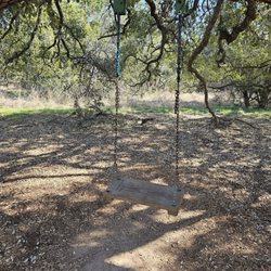
Spicewood Valley Trail - hiking - Updated October 2026
Best of Austin
People found Spicewood Valley Trail by searching for…
Trending Searches in Austin, TX
Apple Orchards near Spicewood Valley Trail
Apple Picking near Spicewood Valley Trail
Archery near Spicewood Valley Trail
Beautiful Views near Spicewood Valley Trail
Bird Sanctuary near Spicewood Valley Trail
Blow Dry Bar near Spicewood Valley Trail
Corn Maze near Spicewood Valley Trail
Dog Friendly Trails near Spicewood Valley Trail
Halloween Events near Spicewood Valley Trail
Haunted Houses near Spicewood Valley Trail
Hiking near Spicewood Valley Trail
Hiking Trails near Spicewood Valley Trail
Kids Birthday Party near Spicewood Valley Trail
Lookout Points near Spicewood Valley Trail
Makeup Artists near Spicewood Valley Trail
Off Road Trails near Spicewood Valley Trail
Photo Spots near Spicewood Valley Trail
Pick Your Own Farms near Spicewood Valley Trail
Places To Take Pictures near Spicewood Valley Trail
Places To Walk Around near Spicewood Valley Trail
Public Shower near Spicewood Valley Trail
Pumpkin Patches near Spicewood Valley Trail
Quilt Shop near Spicewood Valley Trail
Rock Quarry near Spicewood Valley Trail
Scenic Night View near Spicewood Valley Trail
Scenic Overlook near Spicewood Valley Trail
Browse Articles
Browse Nearby
BEST of Austin, Texas Coffee near Spicewood Valley Trail
BEST of Austin, Texas Walking Trails near Spicewood Valley Trail
BEST of Austin, Texas Things to Do near Spicewood Valley Trail
BEST of Austin, Texas Restaurants near Spicewood Valley Trail
BEST of Austin, Texas Breakfast near Spicewood Valley Trail
Browse Brands
Related Searches in Austin, TX
Affordable Kayak Rental Services in Austin, Texas
Best Dog Hiking Trails Around Austin, Texas
Best Fishing Locations and Guides in Austin, Texas
Best Nature Trails for Hiking in Austin, Texas
Best Places for Horseback Riding in Austin, Texas
Best Sightseeing Experiences Available in Austin, Texas
Best Waterfalls and Swimming Holes in Austin, Texas
Check Out Off Road Trails in Austin, Texas
Discover Dog Friendly Trails to Explore in Austin, Texas
Discover Kid Friendly Hiking Trails in Austin, Texas
Discover Popular Bike Trails in Austin, Texas
Discover Walking Parks in Austin, Texas Near You
Discover a Hiking Trail in Austin, Texas
Discover the Best Night Hike Trails in Austin, Texas
Dog-Friendly Hikes With Dogs in Austin, Texas
Enjoy Camping Adventures Around Austin, Texas
Enjoy Kayaking Adventures in Austin, Texas
Enjoy Off Leash Dog Hikes in Austin, Texas
Enjoy Scenic Places to Walk in Austin, Texas
Enjoy Tent Camping Spots Around Austin, Texas
Enjoy a Beautiful Waterfall Hike in Austin, Texas
Enjoy the Best Walking Path in Austin, Texas
Enjoy the Best Walking Trails in Austin, Texas
Explore Beautiful Parks and Green Spaces in Austin, Texas
Explore Easy Hikes Perfect for All in Austin, Texas
Explore Fun Activities to Do in Austin, Texas
Explore Popular Campgrounds Near Austin, Texas
Explore Popular Dog Walking Trails in Austin, Texas
Explore Top Dog Parks in Austin, Texas Near You
Explore the Best Beach Spots in Austin, Texas
Explore the Best Swimming Holes Around Austin, Texas
Family Friendly Hiking With Kids in Austin, Texas
Find Beautiful Views in Austin, Texas
Find Popular Ziplining Spots Around Austin, Texas
Find Top-Rated Waterfalls in Austin, Texas Now
Find the Best Parks for Picnics in Austin, Texas
Hiking Trails With Waterfalls in Austin, Texas
Off Leash Dog Hiking Trails in Austin, Texas
Popular Outdoor Activities to Try in Austin, Texas
Popular Picnic Spots to Visit in Austin, Texas
Safe River Swimming Areas in Austin, Texas
Safe and Fun Parks for Kids in Austin, Texas
Top Hiking Trails to Explore in Austin, Texas
Top Running Trails to Explore in Austin, Texas
Top Swimming Lakes to Enjoy in Austin, Texas
Top Swimming Spots and Pools in Austin, Texas
Top-Rated Camping Sites in Austin, Texas


