Mueller Tunnel Photos


You might also consider
More like Mueller Tunnel
Recommended Reviews - Mueller Tunnel
Start your review...

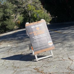
Sunday I hike with a friend through red box parking lot to do San Gabriel 5 peaks Circular a total of 13 miles. The wind was wild but we did all 5 peaks. The Mueller Tunnel was cool to see at the start of the trail I passed by walking and running after finishing all the peaks. Recommended to do Mt Markham, Mt Disappointment, Mt Deception, San Gabriel Peak and Mt Lowe since all are close by and you can do a loop. Look in All trails San Gabriel 5 Peaks Circular and you can download the map. Enjoy the trails and please leave no trace. read more


8 years ago
We hiked eaton saddle trail for the first time this past weekend. Make sure you display your adventure pass. We started at 6:30am as we knew it was hot due to weather temps rising in southern cal lately. So plan accordingly and pack enough for any type of season. The hike itself was nice. The biggest negative was the mosquitoes all over the place the moment i got out of the car. I got bit a few times but come prepare with long sleeves and pants or bug spray. Otherwise, i think winter time they will be gone. The hike to mueller tunnel is not far. Nice gradual incline and the trail is wide enough with out any dangerous drop offs. After passing the tunnel, the trail continue on and can go to many points of interest. When you arrive to the water tank fork, there are many trails to go on. Far right will take you to san gabriel peak, mount disappointment and mount deception. Left of that trail looks like a service road, that will take you to inspiration point, which most people hike to inspiration from the sam merrill trail to echo mountain. The trail left of the service road, there is a sign but can be difficult to spot if not paying attention. That leads to mount lowe. The trail left of mount lowe or farthest left. I'm not 100% sure, but think it's to mount markham. If anyone hikes it, let me know. But for this day, we proceeded to inspiration point. The posted signs here are not great, i would recommend printing out a trail map of the area as there is a lot of trails to explore. So pace yourself and have fun. We explored tom sloane saddle also. We roughly hiked about 8 mile round trip. read more


10 years ago
TRADITIONS MATTER!!! Picture this...Los Angeles, Sunday morning, January 1, 2006, Sierra and I were bored out of our gourd and needed to get our hike on. We have spent many weekends in the Angeles Crest area and since it had recently snowed, I thought it would be fun to play in the snow with her, again. The drive up the Angeles Crest Highway is not only long and windy, but at times a bit scary, especially knowing that at least one person dies on the road every weekend. Tricked out cars use this road to test out their, idk, whatever they test out. And crotch rockets, usually become road kill, as they cross over the double yellow, speed around tight corners and boom!! Anywhoo, Sierra and I headed up the Angeles Crest Highway in search of snow. First site of any amount of snow worthy of Sierra wasn't until the Mt. Wilson turnoff. Mueller Tunnel trailhead was the first safe turnoff with trail in site, so we unloaded and followed the well-traveled trail. The trail is a gentle uphill grade, simple enough for novice hikers. Built by the US Forest Service in 1942, Mueller Tunnel serves as a gateway to the top of Mt. Lowe. Our first time up the trail, I wasn't sure where it would lead, nor what was ahead, so we just kept going. At last, not too far from the tunnel, we came across four points, meaning four separate trails going in four separate directions. One leading to Mt. Disappointment, another to, well, I don't really know, and A third met the Sam Merrill trail, which leads to the top of Mt. Lowe. Sierra was leading and she led us straight, which offered stunning views of snow covered mountains. Yep, that was it, Sierra loved to catch snowballs and enjoyed eating snow out of my hands. Sunday morning, January 1, 2006 was the first day of what would become an annual tradition for Sierra and I. Although she passed away in 2013, I have kept this tradition alive and have continued to hike this area every year on this day, January 1, every year, for as long as I am able. LIGHT AT THE END OF THE TUNNEL: Although parking can be a challenge in this area, both because of the windiness of road, race cars and crotch rockets speeding around the bends, pulling off the road to park requires much care. However, once parked and unloaded, this simple to follow trail offers many striking views of tree filled or snowy mountains, depending on what time of year you decide to...start your own tradition. During warm months, watch out for rattlers. All year, watch out for Poodle Dog Brush. Even though Poodle Dog is only supposed to grow and live the first 10 years after a fire, and the fires that hit this area was well over 10, Poodle Dog is still around. DISCLAIMER: Hiking is not something that can be taken lightly. It can be life-threatening as you see and hear on the news, people die or get lost all time. Please, if you are going to hike, never go alone and prepare for the worst, hope for the best. Remember when going for a hike, no matter how short you think it may be, always be prepared. Carry at least two liters of water for every five miles (more if the weather is warm), protein bar, nuts, and electrolytes. Wear sturdy lug sole shoes and protective clothing. Some areas the weather can change quicker than a fireman can put on his gear. It is also very important, always always always let a family member or friend know where you are going and when you expect to be back. Lastly, have fun when you hike it up. read more


More info about Mueller Tunnel
Mount Wilson, CA 91107
Directions
Hours
Outdoor Amenities
You might also consider


Mueller Tunnel - hiking - Updated May 2026
Best of Mount Wilson
People found Mueller Tunnel by searching for…
Snow Play in Mount Wilson, California
Hiking Trails in Mount Wilson, California
Snow in Mount Wilson, California
Waterfall in Mount Wilson, California
Forest in Mount Wilson, California
Off Road Trails in Mount Wilson, California
Beautiful Views in Mount Wilson, California
Adventure in Mount Wilson, California
Places to Walk in Mount Wilson, California
Walking Trails in Mount Wilson, California
Tourist Attractions in Mount Wilson, California
Trail in Mount Wilson, California
Shaded Hike in Mount Wilson, California
Hiking Groups in Mount Wilson, California
Things to Do in Mount Wilson, California
Sunrise Hike in Mount Wilson, California
Easy Hikes in Mount Wilson, California
Views in Mount Wilson, California
Park in Mount Wilson, California
Scenic View in Mount Wilson, California
Places to Walk at Night in Mount Wilson, California
Fun Things to Do at Night in Mount Wilson, California
Browse Nearby
BEST of Mount Wilson, California Coffee near Mueller Tunnel
BEST of Mount Wilson, California Restaurants near Mueller Tunnel
BEST of Mount Wilson, California Things to Do near Mueller Tunnel
BEST of Mount Wilson, California Scenic View near Mueller Tunnel
BEST of Mount Wilson, California Breakfast near Mueller Tunnel
BEST of Mount Wilson, California Playgrounds near Mueller Tunnel
BEST of Mount Wilson, California Campgrounds near Mueller Tunnel
BEST of Mount Wilson, California Hotels near Mueller Tunnel
BEST of Mount Wilson, California Sledding near Mueller Tunnel