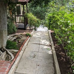
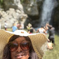
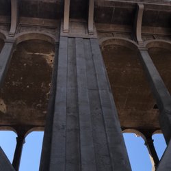
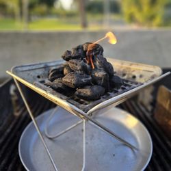
El Prieto Trail Photos


You might also consider
More like El Prieto Trail
Recommended Reviews - El Prieto Trail
Start your review...

Reviews With Photos

Parking- we arrived before 7 am but found the small lot full so we parked on a side street(Sterling Pl.) near Ventura St. and Windsor Ave. Trailhead- we accessed the trail where Windsor Ave becomes Ventura St.; your walk on a private paved road with a yellow metal barricade to block vehicle traffic...you walk on this road for about half a mile until you connect to the dirt trail...for this paved part the back of the Jet Propulsion Lab is to your left Trail- you will be on the dirt trail for about .8 miles when you reach a spot where the trail splits in two and you will complete a 5.2 mile loop...we decided to stay to the right and we did the loop counter clockwise; after 2.6 miles from the split we reached the Brown Mountain Saddle where some other trails connect here and there was a nice bench there for us to take a little break, take in the views, and eat a little something; after about a 10 min. break we continued with the rest of the the loop which was also 2.6 miles back to the area where the loop ends and connects back to the trail that leads you back to the road Distance- 8 miles...the loop portion made up about 5.2 miles of the hike Elevation Gain- 1,350 ft (peak elevation was 2,380 ft) Duration- took us about 3 hrs Trail Conditions- this is a very narrow trail for the most part and is sun exposed for the majority of it *for the first 2 hrs we saw very few people but it started to get busy after 9 am and the majority of the people on the trail were mountain bikers and with this trail being so narrow it is important to not hike using a bluetooth speaker or wearing earphones *hiking poles are not needed on this one but make sure to wear shoes with good grip and bring enough water for the conditions...I only used 1L but it was early and not very hot

My hiking partner and Yelper Kris A. and I started off on the Gabrielino Trail over by JPL to hike on 9/23/13. We decided we better kick up the work out a bit after consuming extra calories over the weekend. El Prieto Trail is a perfect trail to get a work out whether you are hiking or riding a Mountain Bike. We parked near the Gabrielino trailhead by Windsor and JPL and walked about 1.33 miles until the we saw the turnoff for the El Prieto Trail. This is the second fork in the trail past JPL. We met a guy who hikes there quite a bit named Ivan R. and he told us there was a better place to park if you go all the way to the top of Lincoln Avenue and then head west on Canyon Crest Rd. Ivan also told us to look for El Prieto Road on our GPS. He said the fire road that connects to the trail starts at a double wide driveway in this residential area of Altadena abd you can walk down to access the main trail. I am sure you can use "Maps" on your smartphone to help you while trying to find it too. When we got to the El Prieto Trailhead there is a sign that indicates that it is 2 Miles to Lower Brown Mountain Road. We hiked quite a bit farther than 2 miles and decided to turn around because there were so many forks in the trail and we didn't want to get lost. On our way back to our car we met Ivan again who told us that we were really close to the fire road and he explained which way to go at the last fork. Next time we'll turn left at that last fork above the picnic tables to access the fire road. The elevation gains in that 5.65 mile round trip hike were about 2,200 feet so it felt like a good work out. Next time ,we'll park near the beginning of the trail and make our way to the Brown Mountain Fire Road. Tips: - There are quite a few stream crossings, so if it rains you may end up getting your feet wet because there are no logs to help you get across. - I didn't need poles, but if you have bad knees then poles would help you a lot on your way back down. - Don't hike alone. I am sure there are Mountain Lions and Black Bears up there. Rattlesnakes were the least of my worries. Miscellaneous: Here are some interesting historical facts about the San Gabriel Mountains and the early settlers. http://www.kcet.org/updaily/socal_focus/history/la-as-subject/from-sierra-madre-to-the-san-gabriels-a-brief-history-of-socals-crooked-mountain-range.html
")
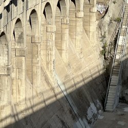
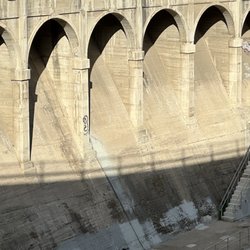
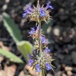
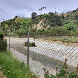
My friend and I decided to go for a hike at 8.30am Wednesday morning in mid April 2022, the first of the year. This trail is very green at this time of the year, has great tree cover over the trail so allows for shade on sunny days and the ground cover was really lush green. The parking lot at the bottom is very spacious and allows for many vehicles to be parked there. It is right next to a NASA lab. The trail started on a tar road at a level of 1-2 in hardness at the bottom, but it brogressed to a 5-7 towards the middle and lop in steepness as well as the trait went from tar to dirt. There were numerous dam walls built in the rivers path, we passed by over a dozen of them. There were 3 bridges we crossed. We encountered squirels, beetles, various birds and quail on our hike, but no rattle snakes(there was a sign warning us of rattle snakes). The river was running in places and dry in others. We had to cross 2-3 puddles along the hike, nothing major and were easy to pass through. There were numerous flowers of all colors. The dirt path ranged from 1.5 - 7 ft in width. Some places were very steep and the path very narrow with an almost vertical drop, so be careful. We did encounter some cyclists coming down the hill, some slow, others fast, so be careful. At the top we got a view of the canyon and right at the top of the hill were residential houses. It's private property so you can't go look at the view. We started our descent along a tar road and weren't sure how to get back to the car so cut between 2 houses we found a path going down. It said restricted access with permit only, so be careful. In conclusion I enjoyed the hike, its level of difficulty was a 5-6, it's scenery a 7-8, but I did encounter dog poop on the ground 4 times which I was very surprised by. This is a very high end area of LA(Pasadena) so I expect people to pick up after their animals, but it wasn't the case. Also I must say for being in LA county, it was quiet, not that many hikers and there was hardly any graffiti(which was nice) All and all the hike was like 2hrs 45min(1hr 30min up, 1hr 15min down) PS. I did stop to take a few photos

We started hiking on Fern Truck/Arroyo trail and merged into El Prieto trail. We hiked a full loop and ended up to the Windsor parking. This trail was beautiful and serene. The plants and flowers looked gorgeous. A very green scenic view. The Fern Truck/Arroyo trail was a very moderate hike. You are pretty much going up hill. El Prieto was easy to walk down. It took us 8.3 miles to complete the loop. A beautiful trail to bring your friends and family.

The El Prieto Trail is more known to bikers than hikers. I've hiked this trail about a dozen times, and have came across maybe 5 hikers versus 50 bikers! Anyway, this trail is perfectly fine for both bikers and hikers. I'd say its a moderate trail and definitely not one for beginners. You'll have to go uphill-a-plenty, and have to hop/jump on rocks to cross rivers. Its easy to get lost getting to the start of this trail. You'll have to walk through part of the Gabrielino Trail, and at the second road split (its a grassy hill), you head uphill (I'll take a pic next time as Point of Interest). Once you head uphill, keep following the road and you get to a small water fall with this sign http://www.yelp.com/biz_photos/el-prieto-trail-pasadena?select=y9n2sy0gsmnAE-yiemhbtg#f7AFR--cW33IpBSYdYKxaA You can either head left or right, its basically a loop around Brown Mountain so it doesn't matter which way you go. But the way most people start is from the left, since coming down on the right side is much more fun. Starting from the left side of the mountain, the first half of the trail is basically a fire road uphill. The incline gets pretty steep and there is zero shade here. The good is that you get a great view of the city and a nice work out. Once you get to the middle part of the trail, there's a flat area where hikers and bikers usually rest, and the large road is split into 3. I'm not sure where the other road leads, but if you keep to the left road, you'll get to the second part of this trail. Going downhill is much different than the first half going uphill. You'll see a lot more trees and greenery, and will have to cross some rivers. There are many paths that break off, but just remember to keep left (heading down) and you'll get back to the base of the trail. This is a pretty fun trail and you'll get a great workout. The best part is that you get two different rides/hikes in one since the terrain changes mid-way. Just watch out for rattlesnakes! I've come across them a few times already.

Great area for hiking, not a lot of people know about this place. There is a lot of mountain bike traffic so don't be a moron and wear earbuds. You'll hear them coming and can announce yourself. All the bikers I came across were really courteous. The one warning I will give, is DO NOT park at the top of Rising Hill Rd. Back in the day this was OK, but today the woman at 4950 Rising Hill flipped out when she saw me pass by. Rising Hill Road connects with 2N68 which is a public road so residents are not allowed to impede public traffic. However she started taking photos of me and told me she was calling the Sheriff. I tried asking her a question, and she kept yelling that this was private land and had been for 200 years. Instead I parked on El Prieto Rd and the neighbors waved and said hello.

Whew!!! You have to huff your bike 4 miles up a fire road before you get to the first set of single tracks to wind you in and out of diverse flora back down the mountain. There is dry brown brush and then lush jungly greens that appear out of nowhere. There are some fast flowy sections and many tight hairpin turns. Some of the trail crumbles alongside steep hillside so if you were off your line a bit and took a tumble recovering from a fall wouldn't be pretty. Be Careful!! You will encounter a lot of people on this trail. Hikers with dogs and some bikers run the lower portion of the trail backwards so be aware of that as well. On the weekends there are two shuttle services available. For $15 you can avoid climbing completely. As arduous as it is I think it's more rewarding to do the climb on your bike. Shuttle feels like cheating!!!

This trail is not for the faint of heart. If you are a beginner or an intermediate rider like me you have to consider this trail at least once and see for yourself the technical terrains that I have encountered during my first run down this mountain. Of course, just like what I did, you can always walk the trail if you're hesitant to tackle hairpin switchbacks, small drops, and narrow trails. Otherwise, just go for it and enjoy! The climb, depending on your endurance and again level of expertise, is not as bad as I thought it would be. Just pace yourself and enjoy the scenery as you head up the mountain. Once you reach the top, put on your knee pads or whatever choice of protective gear you have just in case and get your camera rolling because you are in for a nice treat of adrenaline rush on your way down the hill. Overall, this trail is worth trying out and it won't disappoint thrill seekers and adrenaline junkies alike.

We used the beginning of Gabrielino trail to head up Brown Mountain. About a mile or so into the hike, you will see a sign (for El Prieto, Brown Mountain trails) and an option to take the trail to the right. The hike is mostly uphill but not a severe incline. It's also not shaded. However, it's a nice dirt path without many loose rocks hindering your way. You will arrive at a flat landing area with options for different trails and another sign to your left. Facing the sign, take the Ken Burton trail to the right of the sign and go 2.6 miles more. This part of the hike is easier but more rocky. At the end of the hike, you will be atop the mountain and there are very nice views. All in all, I figure it's about 6+ miles each way. tip - go early to avoid the heat since most of the hike is not shaded and wear sunscreen.


3.5 stars because I love nature. There is a very small parking lot if you can get there early if not there is nearby residential parking. The view was lovely because there wasn't much elevation, the view wasn't spectacular. The trail is is very narrow in most place so only one biker or biker at a time. And rocky. There were so many bikers speeding up and down the trails it made it difficult to truly enjoy it. It has made the hike longer because of all the necessary stops and starts. Dogs are welcome. This hike is mostly shaded. Bring plenty of water and a snack. Moderate intensity. Wear good hiking shoes, tends to be a little slippery. There's a picnic area at the end of this trail. I do recommend this hike but would not do it again.

Parking can suck depending on where you decide to start from, but overall, just consider this embedded walk as part of your hike. The well-maintained trail system can take you many various places and you can do a nominal effort hike or you can bust your butt and head for the summits that continue on via other various trails and fire roads read more


My friend picked this trail randomly off of Google maps cause we were up for a little exploring. It was a November afternoon on a Sunday, and the three of us along with two dogs made our way over to the parking area which kinda felt like a construction site. There was enough free parking to go around, so thumbs up to that. Since this was our first time here, we took the low road which lead to what seemed to be a river that had dried up. A fair amount of this part of the trail had sticks and branches all over, implying it might not be as maintained these days. With that said, you'll have the opportunity to pass under small, old bridges and an array of tall, thin trees that don't see as much foot traffic. I personally preferred this bit more. The good thing about this trail is that if you get tired of the lower areas, you can reach for higher ground in many spots by just walking up and out onto the main trail. By contrast, there were more hikers along with cyclists to share the road with. The dirt on this road can be pretty loose too, so having face masks as well as sunglasses helps. All in all, a fun time was had. One of the doggos was thirsty and getting tired from the heat and incline, so we had to leave earlier. The main road is definitely wide, though we still had to watch out for rocks and ditches on the ground, potentially scary for wheeled folks. Would come back to finish this and reassess in the future. read more


Parking- we arrived before 7 am but found the small lot full so we parked on a side street(Sterling Pl.) near Ventura St. and Windsor Ave. Trailhead- we accessed the trail where Windsor Ave becomes Ventura St.; your walk on a private paved road with a yellow metal barricade to block vehicle traffic...you walk on this road for about half a mile until you connect to the dirt trail...for this paved part the back of the Jet Propulsion Lab is to your left Trail- you will be on the dirt trail for about .8 miles when you reach a spot where the trail splits in two and you will complete a 5.2 mile loop...we decided to stay to the right and we did the loop counter clockwise; after 2.6 miles from the split we reached the Brown Mountain Saddle where some other trails connect here and there was a nice bench there for us to take a little break, take in the views, and eat a little something; after about a 10 min. break we continued with the rest of the the loop which was also 2.6 miles back to the area where the loop ends and connects back to the trail that leads you back to the road Distance- 8 miles...the loop portion made up about 5.2 miles of the hike Elevation Gain- 1,350 ft (peak elevation was 2,380 ft) Duration- took us about 3 hrs Trail Conditions- this is a very narrow trail for the most part and is sun exposed for the majority of it *for the first 2 hrs we saw very few people but it started to get busy after 9 am and the majority of the people on the trail were mountain bikers and with this trail being so narrow it is important to not hike using a bluetooth speaker or wearing earphones *hiking poles are not needed on this one but make sure to wear shoes with good grip and bring enough water for the conditions...I only used 1L but it was early and not very hot read more


4 years ago
My hiking partner and Yelper Kris A. and I started off on the Gabrielino Trail over by JPL to hike on 9/23/13. We decided we better kick up the work out a bit after consuming extra calories over the weekend. El Prieto Trail is a perfect trail to get a work out whether you are hiking or riding a Mountain Bike. We parked near the Gabrielino trailhead by Windsor and JPL and walked about 1.33 miles until the we saw the turnoff for the El Prieto Trail. This is the second fork in the trail past JPL. We met a guy who hikes there quite a bit named Ivan R. and he told us there was a better place to park if you go all the way to the top of Lincoln Avenue and then head west on Canyon Crest Rd. Ivan also told us to look for El Prieto Road on our GPS. He said the fire road that connects to the trail starts at a double wide driveway in this residential area of Altadena abd you can walk down to access the main trail. I am sure you can use "Maps" on your smartphone to help you while trying to find it too. When we got to the El Prieto Trailhead there is a sign that indicates that it is 2 Miles to Lower Brown Mountain Road. We hiked quite a bit farther than 2 miles and decided to turn around because there were so many forks in the trail and we didn't want to get lost. On our way back to our car we met Ivan again who told us that we were really close to the fire road and he explained which way to go at the last fork. Next time we'll turn left at that last fork above the picnic tables to access the fire road. The elevation gains in that 5.65 mile round trip hike were about 2,200 feet so it felt like a good work out. Next time ,we'll park near the beginning of the trail and make our way to the Brown Mountain Fire Road. Tips: - There are quite a few stream crossings, so if it rains you may end up getting your feet wet because there are no logs to help you get across. - I didn't need poles, but if you have bad knees then poles would help you a lot on your way back down. - Don't hike alone. I am sure there are Mountain Lions and Black Bears up there. Rattlesnakes were the least of my worries. Miscellaneous: Here are some interesting historical facts about the San Gabriel Mountains and the early settlers. http://www.kcet.org/updaily/socal_focus/history/la-as-subject/from-sierra-madre-to-the-san-gabriels-a-brief-history-of-socals-crooked-mountain-range.html read more


4 years ago
My friend and I decided to go for a hike at 8.30am Wednesday morning in mid April 2022, the first of the year. This trail is very green at this time of the year, has great tree cover over the trail so allows for shade on sunny days and the ground cover was really lush green. The parking lot at the bottom is very spacious and allows for many vehicles to be parked there. It is right next to a NASA lab. The trail started on a tar road at a level of 1-2 in hardness at the bottom, but it brogressed to a 5-7 towards the middle and lop in steepness as well as the trait went from tar to dirt. There were numerous dam walls built in the rivers path, we passed by over a dozen of them. There were 3 bridges we crossed. We encountered squirels, beetles, various birds and quail on our hike, but no rattle snakes(there was a sign warning us of rattle snakes). The river was running in places and dry in others. We had to cross 2-3 puddles along the hike, nothing major and were easy to pass through. There were numerous flowers of all colors. The dirt path ranged from 1.5 - 7 ft in width. Some places were very steep and the path very narrow with an almost vertical drop, so be careful. We did encounter some cyclists coming down the hill, some slow, others fast, so be careful. At the top we got a view of the canyon and right at the top of the hill were residential houses. It's private property so you can't go look at the view. We started our descent along a tar road and weren't sure how to get back to the car so cut between 2 houses we found a path going down. It said restricted access with permit only, so be careful. In conclusion I enjoyed the hike, its level of difficulty was a 5-6, it's scenery a 7-8, but I did encounter dog poop on the ground 4 times which I was very surprised by. This is a very high end area of LA(Pasadena) so I expect people to pick up after their animals, but it wasn't the case. Also I must say for being in LA county, it was quiet, not that many hikers and there was hardly any graffiti(which was nice) All and all the hike was like 2hrs 45min(1hr 30min up, 1hr 15min down) PS. I did stop to take a few photos read more
 - Hiking Near Me - Pasadena, California")


5 years ago
We started hiking on Fern Truck/Arroyo trail and merged into El Prieto trail. We hiked a full loop and ended up to the Windsor parking. This trail was beautiful and serene. The plants and flowers looked gorgeous. A very green scenic view. The Fern Truck/Arroyo trail was a very moderate hike. You are pretty much going up hill. El Prieto was easy to walk down. It took us 8.3 miles to complete the loop. A beautiful trail to bring your friends and family. read more

The El Prieto Trail is more known to bikers than hikers. I've hiked this trail about a dozen times, and have came across maybe 5 hikers versus 50 bikers! Anyway, this trail is perfectly fine for both bikers and hikers. I'd say its a moderate trail and definitely not one for beginners. You'll have to go uphill-a-plenty, and have to hop/jump on rocks to cross rivers. Its easy to get lost getting to the start of this trail. You'll have to walk through part of the Gabrielino Trail, and at the second road split (its a grassy hill), you head uphill (I'll take a pic next time as Point of Interest). Once you head uphill, keep following the road and you get to a small water fall with this sign http://www.yelp.com/biz_photos/el-prieto-trail-pasadena?select=y9n2sy0gsmnAE-yiemhbtg#f7AFR--cW33IpBSYdYKxaA You can either head left or right, its basically a loop around Brown Mountain so it doesn't matter which way you go. But the way most people start is from the left, since coming down on the right side is much more fun. Starting from the left side of the mountain, the first half of the trail is basically a fire road uphill. The incline gets pretty steep and there is zero shade here. The good is that you get a great view of the city and a nice work out. Once you get to the middle part of the trail, there's a flat area where hikers and bikers usually rest, and the large road is split into 3. I'm not sure where the other road leads, but if you keep to the left road, you'll get to the second part of this trail. Going downhill is much different than the first half going uphill. You'll see a lot more trees and greenery, and will have to cross some rivers. There are many paths that break off, but just remember to keep left (heading down) and you'll get back to the base of the trail. This is a pretty fun trail and you'll get a great workout. The best part is that you get two different rides/hikes in one since the terrain changes mid-way. Just watch out for rattlesnakes! I've come across them a few times already. read more


11 years ago
Great area for hiking, not a lot of people know about this place. There is a lot of mountain bike traffic so don't be a moron and wear earbuds. You'll hear them coming and can announce yourself. All the bikers I came across were really courteous. The one warning I will give, is DO NOT park at the top of Rising Hill Rd. Back in the day this was OK, but today the woman at 4950 Rising Hill flipped out when she saw me pass by. Rising Hill Road connects with 2N68 which is a public road so residents are not allowed to impede public traffic. However she started taking photos of me and told me she was calling the Sheriff. I tried asking her a question, and she kept yelling that this was private land and had been for 200 years. Instead I parked on El Prieto Rd and the neighbors waved and said hello. read more


Whew!!! You have to huff your bike 4 miles up a fire road before you get to the first set of single tracks to wind you in and out of diverse flora back down the mountain. There is dry brown brush and then lush jungly greens that appear out of nowhere. There are some fast flowy sections and many tight hairpin turns. Some of the trail crumbles alongside steep hillside so if you were off your line a bit and took a tumble recovering from a fall wouldn't be pretty. Be Careful!! You will encounter a lot of people on this trail. Hikers with dogs and some bikers run the lower portion of the trail backwards so be aware of that as well. On the weekends there are two shuttle services available. For $15 you can avoid climbing completely. As arduous as it is I think it's more rewarding to do the climb on your bike. Shuttle feels like cheating!!! read more


15 years ago
This trail is not for the faint of heart. If you are a beginner or an intermediate rider like me you have to consider this trail at least once and see for yourself the technical terrains that I have encountered during my first run down this mountain. Of course, just like what I did, you can always walk the trail if you're hesitant to tackle hairpin switchbacks, small drops, and narrow trails. Otherwise, just go for it and enjoy! The climb, depending on your endurance and again level of expertise, is not as bad as I thought it would be. Just pace yourself and enjoy the scenery as you head up the mountain. Once you reach the top, put on your knee pads or whatever choice of protective gear you have just in case and get your camera rolling because you are in for a nice treat of adrenaline rush on your way down the hill. Overall, this trail is worth trying out and it won't disappoint thrill seekers and adrenaline junkies alike. read more

12 years ago
We used the beginning of Gabrielino trail to head up Brown Mountain. About a mile or so into the hike, you will see a sign (for El Prieto, Brown Mountain trails) and an option to take the trail to the right. The hike is mostly uphill but not a severe incline. It's also not shaded. However, it's a nice dirt path without many loose rocks hindering your way. You will arrive at a flat landing area with options for different trails and another sign to your left. Facing the sign, take the Ken Burton trail to the right of the sign and go 2.6 miles more. This part of the hike is easier but more rocky. At the end of the hike, you will be atop the mountain and there are very nice views. All in all, I figure it's about 6+ miles each way. tip - go early to avoid the heat since most of the hike is not shaded and wear sunscreen. read more


14 years ago
Nice trail. Mixed use, horses, hikers and mountain bikers. Nice mix of high exposed segments with great views and shaded stream side walks. Watch out for bikes. Remember that horses, then hikers and finally bikers have right of way. read more


8 years ago
3.5 stars because I love nature. There is a very small parking lot if you can get there early if not there is nearby residential parking. The view was lovely because there wasn't much elevation, the view wasn't spectacular. The trail is is very narrow in most place so only one biker or biker at a time. And rocky. There were so many bikers speeding up and down the trails it made it difficult to truly enjoy it. It has made the hike longer because of all the necessary stops and starts. Dogs are welcome. This hike is mostly shaded. Bring plenty of water and a snack. Moderate intensity. Wear good hiking shoes, tends to be a little slippery. There's a picnic area at the end of this trail. I do recommend this hike but would not do it again. read more


13 years ago
One of the most popular single tracks in Los Angeles. Popular, for good reason. It's beautiful, mystic, challenging and 20 mins from downtown. Hike it or ride your bike, doesn't matter. Just be safe and courteous to other trail users. read more


13 years ago
11 years ago
16 years ago
14 years ago
13 years ago
10 years ago
14 years ago
10 years ago
10 years ago
It is a good trail, I been hiking a lot in Orange County, it is nothing like that. This hiking have a lot of tree and lot of shade. It is amazing. read more


17 years ago
17 years ago
More info about El Prieto Trail
Ask the Community - El Prieto Trail
Review Highlights - El Prieto Trail
You might also consider


Why does Yelp recommend reviews?
El Prieto Trail - hiking - Updated June 2026
Best of Pasadena
People found El Prieto Trail by searching for…
Hiking Trails in Pasadena, California
Waterfall Hike in Pasadena, California
Lookout Points in Pasadena, California
Bike Path in Pasadena, California
Hiking Trails Kid Friendly in Pasadena, California
Walking Trails in Pasadena, California
Running Trails in Pasadena, California
Mountain Biking in Pasadena, California
Easy Hikes in Pasadena, California
Trails in Pasadena, California
Fall Colors in Pasadena, California
Shaded Hike in Pasadena, California
Places to Walk at Night in Pasadena, California
Scenic Night View in Pasadena, California
Off Road Trails in Pasadena, California
Scenic Overlook in Pasadena, California
Beautiful Views in Pasadena, California
Places to Take Pictures in Pasadena, California
Waterfall in Pasadena, California
Places to Watch Sunset in Pasadena, California
Trending Searches in Pasadena, CA
Bait And Tackle Shop near El Prieto Trail
Black Owned Nail Salons near El Prieto Trail
Boat Rental near El Prieto Trail
Cliff Jumping near El Prieto Trail
Day Trips near El Prieto Trail
Dog Friendly Trails near El Prieto Trail
Fishing Spots near El Prieto Trail
Jet Ski Rental near El Prieto Trail
Kayak Rental near El Prieto Trail
Lakes & Ponds near El Prieto Trail
Outdoor Activities near El Prieto Trail
Pick Your Own Farms near El Prieto Trail
Places To Walk Around near El Prieto Trail
Public Shower near El Prieto Trail
River Swimming near El Prieto Trail
Rock Quarry near El Prieto Trail
Scenic Night View near El Prieto Trail
Scenic Overlook near El Prieto Trail
Secluded Spots near El Prieto Trail
Soccer Store near El Prieto Trail
Splash Pad near El Prieto Trail
Strawberry Picking near El Prieto Trail
Sunrise View near El Prieto Trail
Swimming Holes near El Prieto Trail
Swimming Lakes near El Prieto Trail
Swimming Pools near El Prieto Trail
Watch Sunset near El Prieto Trail
Browse Articles
Browse Nearby
BEST of Pasadena, California Coffee near El Prieto Trail
BEST of Pasadena, California Things to Do near El Prieto Trail
BEST of Pasadena, California Restaurants near El Prieto Trail
BEST of Pasadena, California Walking Trails near El Prieto Trail
BEST of Pasadena, California Parks near El Prieto Trail
BEST of Pasadena, California Breakfast near El Prieto Trail
BEST of Pasadena, California Caves near El Prieto Trail
BEST of Pasadena, California Hot Springs near El Prieto Trail
BEST of Pasadena, California Campgrounds near El Prieto Trail
Browse Brands
Related Searches in Pasadena, CA
Affordable Kayak Rental Services in Pasadena, California
Best Fishing Locations and Guides in Pasadena, California
Best Nature Trails for Hiking in Pasadena, California
Best Places for Horseback Riding in Pasadena, California
Check Out Off Road Trails in Pasadena, California
Discover Dog Friendly Trails to Explore in Pasadena, California
Discover Kid Friendly Hiking Trails in Pasadena, California
Discover Scenic Hiking Trails in Pasadena, California
Discover Scenic Mountain Bike Trails Near Pasadena, California
Discover Scenic Waterfall Spots in Pasadena, California
Discover Walking Parks in Pasadena, California Near You
Discover a Hiking Trail in Pasadena, California
Discover the Best Night Hike Trails in Pasadena, California
Discover the Best Running Track in Pasadena, California
Dog-Friendly Hikes With Dogs in Pasadena, California
Enjoy Camping Adventures Around Pasadena, California
Enjoy Exciting Mountain Biking Adventures in Pasadena, California
Enjoy Kayaking Adventures in Pasadena, California
Enjoy Tent Camping Spots Around Pasadena, California
Enjoy a Beautiful Waterfall Hike in Pasadena, California
Enjoy a Peaceful Nature Walk in Pasadena, California
Enjoy the Best Walking Path in Pasadena, California
Enjoy the Best Walking Trails in Pasadena, California
Exciting Cliff Jumping Spots in Pasadena, California
Explore Beautiful Parks and Green Spaces in Pasadena, California
Explore Easy Hikes Perfect for All in Pasadena, California
Explore Fun Activities to Do in Pasadena, California
Explore Popular Campgrounds Near Pasadena, California
Explore the Best Beach Spots in Pasadena, California
Explore the Best Trail Options in Pasadena, California
Family Friendly Hiking With Kids in Pasadena, California
Find Beautiful Views in Pasadena, California
Find the Best Parks for Picnics in Pasadena, California
Find the Best Scenic View Locations in Pasadena, California
Great Places to Walk in Pasadena, California
Hike the Popular Waterfall Trail in Pasadena, California
Hiking Trails With Waterfalls in Pasadena, California
Off Leash Dog Hiking Trails in Pasadena, California
Plan a Scenic Drive Route Near Pasadena, California
Popular Outdoor Activities to Try in Pasadena, California
Popular Picnic Spots to Visit in Pasadena, California
Safe River Swimming Areas in Pasadena, California
Safe and Fun Parks for Kids in Pasadena, California
Top Climbing Spots and Gyms in Pasadena, California
Top Paddleboarding Activities in Pasadena, California
Top Running Trails to Explore in Pasadena, California
Top Swimming Lakes to Enjoy in Pasadena, California
Top Swimming Spots and Pools in Pasadena, California
People who viewed El Prieto Trail also viewed
Gabrielino Trail
81 reviews
Dawn Mine Hike
69 reviews
Inspiration Point via Castle Canyon
191 reviews
Millard Canyon
141 reviews
Strawberry Peak via Colby Canyon
6 reviews
Catalina Verdugo Trail
16 reviews
Echo Mountain via the Sam Merrill Trail
458 reviews
Mt Lowe Railway Trail
4 reviews
Henninger Flats Campground
98 reviews
San Gabriel Peak
10 reviews