Cancel

    Open app

    Search

    Minam River Lodge

    4.8 (12 reviews)

    Minam River Lodge Photos

    You might also consider

    Recommended Reviews - Minam River Lodge

    Your trust is our priority, so businesses can't pay to alter or remove their reviews. Learn more about reviews.
    Yelp app icon
    Browse more easily on the app
    Review Feed Illustration

    1 year ago

    Helpful 0
    Thanks 0
    Love this 0
    Oh no 0

    4 years ago

    Helpful 1
    Thanks 0
    Love this 1
    Oh no 0
    Photo of Art D.
    2
    22
    5

    3 years ago

    Helpful 0
    Thanks 0
    Love this 1
    Oh no 0

    5 years ago

    Helpful 0
    Thanks 0
    Love this 0
    Oh no 0

    5 years ago

    Helpful 0
    Thanks 0
    Love this 0
    Oh no 0

    7 years ago

    Helpful 0
    Thanks 0
    Love this 1
    Oh no 0

    7 years ago

    Helpful 0
    Thanks 0
    Love this 0
    Oh no 0

    9 years ago

    Helpful 1
    Thanks 0
    Love this 1
    Oh no 0

    7 years ago

    Helpful 0
    Thanks 0
    Love this 0
    Oh no 0
    Photo of C B.
    0
    8
    0

    7 years ago

    Helpful 1
    Thanks 0
    Love this 0
    Oh no 0

    9 years ago

    Helpful 0
    Thanks 0
    Love this 0
    Oh no 0

    9 years ago

    Helpful 0
    Thanks 0
    Love this 0
    Oh no 0

    Ask the Community - Minam River Lodge

    Review Highlights - Minam River Lodge

    From Nicole, the gardener, giving us a tour on her day off to the deliciously talented Chef Carl.

    Mentioned in 3 reviews

    Read more highlights

    Verify this business for free

    Get access to customer & competitor insights.

    Verify this business

    Eagle Cap Wilderness - Big Sheep Creek trail, first creek crossing

    Eagle Cap Wilderness

    4.2(5 reviews)
    8.9 mi

    This review is for one of the Big Sheep Creek trails accessed by the NF-100 road off Wallowa…read moreMountain Road (Loop). First off, Eagle Cap is a fabulous wilderness area. I love it and after this first time experience, we'll be back. That said, our hiking adventure was shorter than we'd planned because the creeks were still too high to allow all the several crossings necessary to do the several miles in that we wanted. We were too early in the season (late May). But we did get 2.6 miles of hiking in and enjoyed every bit of it. Fantastic scenery. The access road wasn't too bad even in a Toyota Corolla, although we were stopped by snow a few hundred yards short of the trailhead, Not that many critters, though. Highly recommended.

    Nestled in the far northeast corner of Oregon lies a magical land of awe-inspiring mountain peaks,…read morealpine lakes filled with jumping trout, beautifully vibrant meadows, and miles upon miles of trails. This place doesn't get the love & press of it's northern neighbor, The Enchantments (Washington's Cascadian alpine wonderland), but I would argue this outdoor area is just as good....or dare I say: better? [[[[bracing myself for tomatoes and trash to be thrown at me]]]] OK, I'm only saying it's "better" because it's in more of a remote area (so less traffic), and you don't need to worry about measuring your luck with a permit lottery (it's probably not needed due to less traffic). So this place is definitely more approachable. The Eagle Cap Wilderness is a huge area (almost 600 square miles). It's still new to me, but in 2015, I had the pleasure of spending two trips up here, one in July & the other in Sept. It is an expansive area, but I would say, obviously enough, that Eagle Cap peak is the hub of the area. From Eagle Cap, you have spokes of mountain ranges and river valleys. There are several approaches to get you from lower elevations to the alpine region around Eagle Cap. For my first experience, we went for a less-traveled approach from the south: Eagle Creek Valley. The solitude here is surely something I daydream about, but I would have to say the 4th of July weekend has some brutally hot weather--especially when hiking uphill. We camped one night in this valley and made it over Horton Pass to a camp up in the alpine area for a couple of nights. While at Horton Pass, I took a side trip up to summit Eagle Cap. The views here were life-changing. MOSQUITO HEAVEN: July in Eagle Cap Wilderness was hot and there were mosquitoes up the ying yang! It as pretty unbearable. I slept in a bivy sack, and I cooked in it as the mosquitoes tried stealing my blood as they peered in at me through the face screen. Sleep was tough. But during the day, it was great to have day hikes around the area, jump in clear & cold lakes and to also wet a fly while pursuing trout. Fall is my preference though. In September we did an approach from the north and hiked up the East Lostine River Valley. Once you get above 5000, there is a long glacial valley which is just about the most beautiful place I've ever seen. Hiking this valley was surreal. The peaceful stream, the beautiful color of the vegetation, and Eagle Cap looking over us the whole time: perfect hiking! There's no mosquitoes at all, but the days are short. The weather is a little chilly, so no chance of taking a dip in the Lostine River. But it was pretty nice. The Lostine River approach is also an easier hike, too. You don't have to hike over a mountain pass. And you can pretty much get up to the alpine area after a few hours of hiking.

    Photos
    Eagle Cap Wilderness - Big Sheep Creek trail

    Big Sheep Creek trail

    Eagle Cap Wilderness - Big Sheep Creek trailhead parking area

    Big Sheep Creek trailhead parking area

    Eagle Cap Wilderness - Big Sheep Creek trail

    See all

    Big Sheep Creek trail

    Hells Canyon National Recreation Area - High Trail.

    Hells Canyon National Recreation Area

    5.0(1 review)
    28.7 mi

    Hells Canyon is what you make of it. If you imagine it to be a gateway to hell, then that is…read moreexactly what it will be: grueling trails through rugged country, hostile heat and cold, intrusive plants and animals (poison ivy, ticks, rattlesnakes), and endlessly long and steep days followed by eternally long nights. If you approach it differently, with an open mind and an expansive heart, then Hells Canyon will be like the Iceland of the American West: beauty instead of brutality; green fields, verdant wildflowers, snow-topped ridges, and cascading mountain streams. Birds will sing and winds will blow; stars will shine brightly at night and you will stare in perpetual awe at one of America's most pristine wilderness areas. But the greater truth is that BOTH of these places exist - the Hells Canyon of nightmares, and the Hells Canyon of dreams. You simply have to find a way during your visit here to reconcile these opposing visions into an integrated whole. If you can do that - the beauty and and the beast coexisting happily together - then you will emerge from Hells Canyon a transformed person with a deeper sense of self and an enhanced appreciation for the diversity of the wider world in an appropriately sized package (750,000 acres, for starters). And if you can survive the ordeal, you will exit the canyon happier, heartier, and healthier than when you left - like Orpheus in the Underworld, except that in this particular case, you won't feel the need to look back. That, in essence, is what Hells Canyon means to me. And to you, if you are ready for the experience. May is the best of all possible months for visiting the canyon by foot or mule: you'll likely enter using Freezeout Trailhead (30 miles on asphalt and gravel roads from Joseph, OR), or Dug Bar, a long high-clearance road to the North (downstream). Bear in mind that the Idaho side of the canyon - the Seven Devils Wilderness - is still deep in melting snow, and is not accessible until the summer, so you'll need to enter from the Oregon side if you want to see the wildflowers and the impossibly green meadows that carpet the canyon in springtime. Plan for 3-5 days, choose the High Trail (#1751) as your main route, and don't descend to the Snake River unless you are prepared for thorns, poison ivy, and brush. Sluice Creek and Saddle Creek make good access points if you choose this path (Temperance Creek does not). If you are a first-time visitor, I'd recommend staying on the High Trail the whole time. Head up, down, and then North until you are tired, find a campsite, then return back over Freezeout Saddle when you have had your fill of what the canyon has to offer. The climb over Freezeout Saddle is epic: steep, switchbacked, with expansive views of the Seven Devils and of the distant Eagle Cap wilderness to the West. On a clear day, with lupines, Indian paintbrush, and arrowleaf balsamroot blooming, this is the most beautiful place you ever will see - as untouched and unvarnished a natural landscape as you are likely to find in the continental U.S. This is hard country. You need to be prepared. That "hell" part isn't a joke. But it's also America's grandest and most incredible canyon, end of story. If you are able to come, and it takes time, effort, and luck, then just do it! You'll emerge a different person than when you started, and that's something to treasure for years and decades to come.

    Photos
    Hells Canyon National Recreation Area - Seven Devils.

    Seven Devils.

    Hells Canyon National Recreation Area - Saddle Creek campsite.

    Saddle Creek campsite.

    Hells Canyon National Recreation Area - Lupines and ponderosa pines along the High Trail.

    See all

    Lupines and ponderosa pines along the High Trail.

    Hells Canyon Dam - Looking north from the dam. A dam fine view, if I say so myself.

    Hells Canyon Dam

    4.7(3 reviews)
    30.3 mi

    Took the beautiful drive up to the dam from Baker City...about 85 miles each way via State Route…read more86. The road gets pretty windy once you hit Copperfield, but the views of Hells Canyon and Snake River are worth it! There are quite a few pull-outs to stop and take pics. We also passed numerous campground and picnic options. We enjoyed driving over the dam and taking pictures from both sides. Such beautiful views! If you follow the road to the end, passed the dam about 0.5 mile, you come across the visitors center. It was closed when we arrived, but we did enjoy watching the rafters and kayakers from the back deck. Would highly recommend a visit!

    Hells Canyon Dam sits at the end of the road. Literally. It's the last of a series of dams that pen…read moreup the Snake River as it rolls along a steep, deep crevasse that separates Oregon and Idaho. To access the dam, you pick up Hells Canyon Road at Copperfield (if coming from the Oregon side) and snake your way up along the Hells Canyon Reservoir for about half an hour. It's a scenic drive that offers plenty of places to pull off and swim, and quite a few trailheads for hikes up into the Idaho side of the canyon. The route takes you along the base of some very steep cliffs and overhangs, and you can tell by the dents in the blacktop that there are often rockfalls along here. My wife was white-knuckling it during most of the ride out. The dam itself is nothing too spectacular, but it does sit in a very scenic spot on the river. Once you cross the dam, the road ends in a boat launch, and this is where the adventure begins. Here you can put in for kayaking, rafting and drift-boat floats down the canyon. Fishing abounds. The dam itself has a little visitor's center with historical photographs and a couple of Idaho Power employees who can answer questions. We were able to get some good info on road quality for our forthcoming drive up the forest service roads into the Wallowas. Super helpful! If you're not floating or fishing or otherwise using the recreation side of the river, there's not a whole lot to do here other than learn about the dam and take in some pretty scenic views from the canyon floor. It's almost more about the views on the drive in. And you'll be seeing them again on the drive out, as there's nowhere to go from here but back the way you came.

    Photos
    Hells Canyon Dam - Looking up from the dam parking lot.

    Looking up from the dam parking lot.

    Hells Canyon Dam
    Hells Canyon Dam - Gateway to Hells Canyon

    See all

    Gateway to Hells Canyon

    Blue Mountains Trails

    Blue Mountains Trails

    5.0(1 review)
    53.6 mi

    These trails aren't just for winter sports. I've made it here during the summer to take my…read moremountain bike for a ride. I parked at the Sno-Park Parking lot where one would go during the winter months. Here you have a couple of dirt roads to choose from for off-road options. I decided to do some climbing and went for NFD Rd 64--to get to this road from the parking lot, ride your bike further up the valley a few hundred yards (their's a trail), and then take right. This road is fairly nice. There are lots of rock on it, but no potholes. It is a fairly uphill jaunt from the get-go. As I was approaching the top of the valley, I eyed a side road. The sign on it said (6400 500), so I don't know which is the name of the road, but I decided to take it, because it looked tiny and way less traveled (in fact it was closed to motorized vehicles). Nice. Yeah, this trail ended up being the high-point of the day. It wasn't single track, but it was close. I must admit I had the willies when I saw a half-eaten deer leg within the first minute of climbing (the rest of the ride I kept thinking of the cougar, bear, or zombie which was eyeing me from the bushes as I rode by). I love to climb. I love burning my quads like Hades. It felt good to be riding. Unfortunately, this side road only lasted a little bit before I made it up to the top of the ridge/mountain. Here this trail ties back up with one of the major dirt roads again. There are some decent views here. I then took the little road downhill. Man, I'm must be a total old fogie, because wow---I think I rode the breaks the entire way down! The road was steep, and I hit some high speeds within seconds. There were also rocks to watch out for as well. In other words, I rode it like an old person (which I am I suppose). But it was fun. It's the kind of fun, where you just have to yell with abandon (I think I did a few times--with a smile). These trails are definitely good for snow activities, and I'd say they are decent for bike riding. I don't know if I'd come here to do some straight-up hiking though. I'd save the Cascades for that. NOTE: Be careful on this road in the winter. This is the infamous scene of where my truck and my crew rolled down a mountain just over a year ago!
    Photos
    Blue Mountains Trails - Our Trip Along NFD Rd 64

    Our Trip Along NFD Rd 64

    Blue Mountains Trails - My Gloves...I like orange

    My Gloves...I like orange

    Blue Mountains Trails - Along NFD Rd 700

    See all

    Along NFD Rd 700

    South Fork Walla Walla River Trailhead - Walla Walla River

    South Fork Walla Walla River Trailhead

    4.5(2 reviews)
    51.8 mi

    This hike happened by happenstance…read more A friend and I were supposed to go up to Horseshoe Prairie (http://www.yelp.com/biz/horseshoe-prairie-nordic-ski-area-pendleton) for snowshoeing, but unfortunately, I let my friend drive and he was a little too confident about his car's snowy-road-handling ability. After spinning tires a time or two, we canned our fun-in-the-snow plans, turned around, and slid down the hill to civilization. While picking up chocolates at Petite Noirs (http://www.yelp.com/biz/petits-noirs-milton-freewater), the owner mentioned a nearby hike. To not make the day a total loss, we were all ears, and went for it. Just off of main street in Milton Freewater, you take the turn off for Harris Park (as you're driving south out of town, it'll be the left BEFORE you take the hill up and out of town). You then drive about 10 miles up a canyon carved by the South Fork of the Walla Walla River. This canyon is part of the Blue Mountains, and it's amazing to see how quickly the landscape changes from the drabby flatness of Milton-Freewater to the alpine-y beauty of the Blues & Walla Walla river. Once you're in the area of the park, keep going until you approach the trailhead for the South Fork Walla Walla River trail. Here there are quite a few parking spots, a couple of restrooms and river bubbles within earshot. You are clearly outside of civilization and within an honest to goodness country landscape. The deep valley is beautiful and the trail looks inviting. For the most part the trail parallels the river. Sometimes it sidetracks and goes up the side of the valley wall, but the river is always within view. The trail is well-kept and nice (other than a few boggy/muddy spots). We went for about 2.5 miles on the trail before calling it a day. We enjoyed sightings of elk at one spot (we later saw herds of deer, turkey, and even a scooting coyote during our dusk drive out). I'm so glad I made it here. I can definitely see myself coming back to dip myself within the magic waters (à la Field of Dreams) and fly fishing the stream (à la A River Runs Through It). I've also heard that you can ride your mountain bike here too---I'd also be down for that! South Fork of the Walla Walla Trail. I will see you again---very, very soon.

    This was a great hike with my dog. Very turn their was a beautiful view of the Walla walla River…read more Trail was in decent condition. Plenty of parking at the trailhead.

    Photos
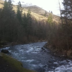
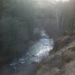
    South Fork Walla Walla River Trailhead - South Fork Walla Walla River

    South Fork Walla Walla River

    South Fork Walla Walla River Trailhead - South Fork Walla Walla River

    South Fork Walla Walla River

    South Fork Walla Walla River Trailhead - Trailhead

    See all

    Trailhead

    Minam River Lodge - hiking - Updated August 2026

    Loading...
    Loading...
    Loading...