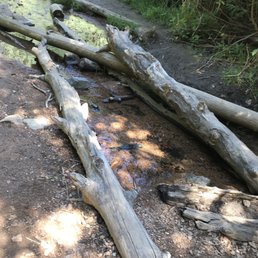
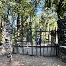
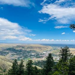
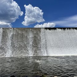
Lower Maxwell Falls Trail Head Photos


You might also consider
More like Lower Maxwell Falls Trail Head
Recommended Reviews - Lower Maxwell Falls Trail Head
Start your review...

Reviews With Photos
")
It seems the general consensus is shared: a nice hike close to Denver, the trail just gets too crowded. After doing my own research of Maxwell Falls and having it on my hiking list for some time, I knew when the temps warmed up last Friday I had to jet over to Evergreen. Major plus not coming on a weekend. I snagged the last spot in the parking lot, that only has around 15 spots. When I left cars were starting to line the roads. Now let's talk hike! Though shorts weather, the trails were still snowy and icy. This was the trade I settled for instead of coming on a Saturday. Still worth it in my opinion. I only slipped once! It's a fairly easy hike, though at one time in particular, extremely hard to navigate with all the snow. Myself and a few solo hikers got turned around here, eventually we veered back in the right direction. I doubt you'd have these issues in the summer. It's a very beautiful hike. Tall trees with that Evergreen glow, large boulders with the sun glistening off them just right. The Falls themselves were frozen, but still a sight for sore eyes. Other than the many icy spots, I really can't complain sneaking in a hike on the last day of April! Its close proximity to Denver makes it one of the more highly trafficked hikes, which shouldn't come as a surprise. Took me 40 minutes from my place in Sloan's. Cliff notes: avoid weekends, arrive before 10am, bring lots of water, the trail is dog friendly, there are many spots to relax and have a snack.

I thoroughly enjoyed this trail. The majority of the trail is lined with towering trees. The gentle sound of the nearby river can be heard for the majority of the hike. I came out at the beginning of August on a 90 degrees summer day, yet the shade, refreshing river, and light breeze kept me cool for the entire hike. Other reviews complained about the number of hikers on the weekend, which almost made me avoid this trail. But I came here in a Sunday morning before 9am, it was well traveled by others, but nothing too uncomfortable. I plan to come back in the spring when there's more wild flowers and and more runoff to fill the river.

Don't follow the address that's attached to this it will led you to a residential are. Look up on google "Lower Maxwell Falls Trail" or "Upper Maxwell Falls Trail". I went on the Upper maxwell falls trail and it's was a really beautiful hike but it's really close to a residential area if you get off the trail you will run into houses. Oh and It's not a waterfall it's a really small creek.

Come early to beat the foot traffic! We came here on Mother's Day, arrived around 9.30am and got a parking spot in the little overflow parking just up from the trailhead parking lot. When we got back to the car around 12 noon there were cars all up the sides of the road and the trail was super busy!! I can see why it's popular, it's a beautiful spot and close to Denver. We were slow carrying out 15 month old, 30 lb baby. We were overtaken by a lot of people. But made it to the falls just fine, getting down to the falls when we got there was a little challenging because I had the carrier on the front and I had to climb down the rocks but I got there. The waterfall was still frozen on the top but you could see a little water coming through. The trail started to get slippery and muddy on the way back because of all the people and the little bit of snow remaining on the ground. We only saw one bad of dog poop left on the side of the trail near the start.

Great hike in about 2.3mi (steep) to a waterfall. Terrain is decent enough to wear a good pair of trail running shoes instead of boots. Like adventurers lol we veered off the trail. Thank God we did because we found a dog!!! She was lost for 6 days in the forest and miraculously we were able to hike her out of here and reunite her with her family... Best birthday weekend ever!!!

Yeah for hiking close to denver! As mentioned, shaded for most of it. IF you start from the lower trail head it's a good up and down hike. It can be tricky to see the falls - pay attention when the mileage gets close! Lots of people and dogs. Lots of small children that just end up whining that it is too far! Tiny parking lot, tiny over flow parking, and parking on the side of the road leave you on a blind corner. So be careful! It was a fun hike, but go early, stay hydrated. FYI - there are no trashcans at the trail head, so pack it in, and pack it back out to your car - including dog poop! :)

We did the UPPER Maxwell Falls Trail, which is about 2.4 miles. It was a lot of climbing on rocks, and ups & downs, but beautiful. The biggest issue is just that there are a lot of people there. We brought our 3 kids and 2 small dogs, and it was challenging but fun! The waterfall at the end makes it all worth it.

If it's a sunny, hot day, the shaded hike is perfect... Over 2 miles of up and half a mile down and then up again, 3.4 miles total to climb down into the falls... Ya really need to climb down in to get to the falls, and cuz of the Monsoon the week before, the water is flowing immensely... If coming from upper trail, much shorter but many more ppl even for a weekday like this, lower trail had all of 2 ppl besides us... After hitting the top of the falls which includes 1/2 of the Upper Trailhead, we grabbed the loop that starts with a C and wrapped it back down to the bridge where you'll see it connect at the Lower Trailhead... All in all, 9.7 miles, and the pups loved every bit of it... BTW those with kids, the yelling at the falls DOES disturb the peace, the bristling of the leaves and the tranquility of the mountainside with rushing waters...

Hosted an awesome all women's hike at this trail yesterday. The scenery is beautiful, gorgeous vistas if you combine your hike with the cliff loop trail. Even though the river is currently frozen we could still hear a gentle stream of water running. If you plan to hike on a weekend I would definitely recommend arriving early as the parking area is fairly small. I can't wait to return to this trail and have a totally different experience in the summer.

Great hike! Beautiful scenery! My dog loved it too~~ its not an easy trail, so people passing called her a trooper since she is a miniature pinscher and was trotting along the whole thing. Only downside is there are no bathrooms, not even anything near. So make sure to go before you get thhere. And no trashcans, so take your trash with you. When we were done with our hike, cars were parked in the lot, overflow lot, and up and down the highway! It gets crowded

This hike was incredibly rewarding; I brought my sister here and my good friend who came back from the Navy as a hero. We hiked a total of 2.3 miles and saw lots of wonder and beauty. Along the trails, we managed to meet the light drops of drizzling level rain. There was even a deer spotted towards the end of our hike and we even wet our toes in the small stream nearby. The first trail is a little challenging, simply because of the steeper hills, the big rocks, the height of the edges and much carefulness is needed. I prefer to go hiking mainly in the late afternoon/early evening, much because of the harshness of the sun is gone. I tend to get a little dehydrated, but there is nothing more to fix that problem than gulps of water. Another cool thing was the fact that I have hiked here before back in 2013 and was disappointed that I couldn't finish the trail. It's almost like God wanted me to revisit an unfinished goal and to show me, "Look how far you've gone, look how much you've grown!" The trails were about 1 hour and a half. We managed to get out of here around 7:30 ish. It's always easier to hike back than hike for the first time in exploring the trail. There are lots of people that may pass you nearby to say hello and they often bring their little, furry friends and sometimes children too. My sister, she loved the hike. I'm incredibly thankful to have brought her here, simply because she wanted to go on a different kind of an adventure and she managed to see it young. I didn't hike much at all, and I want to open those doors to my little sister. 1 star less because unfortunately, we did not find that waterfall. Only a small stream and although we washed our feet, we were looking forward to finding that waterfall, and it just wasn't found. Someone even told us that we were on the wrong park-- but I knew that wasn't right either. We were much too tired to finish it, so we just went back and hoped to come back and try again. Some of the hikers told us to take a left on the trail sign that I took a photo of. We must go left on the crest and then go left. We did that, but it wasn't found. We'll try a different path for the future. Overall, it wasn't much of a waste of time. Still a glorious experience. I'm glad I'm alive.

On a hot sunny day Lower Maxwell Falls is the perfect hike in the shade. When your feet get hot and tired remove the shoes and soak in the cold creeks and enjoy a moment to relax! Postcard views are what you can expect when you aim your camera! It is a challenging course so make sure you are prepared. The trails are clearly marked so no worries about getting lost! read more


6 months ago
2 years ago
I love checking out the trails when I'm not in KC. I was recently in the Denver area and found this trail via the All Trails app. I'm not an experienced hiker but this one was perfect. It's a little under 4 miles from start to finish. The trail did have some other hikers but I didn't find it overly congested. It definitely wasn't deserted but it wasn't overrun either. The trail is moderate. There's some rocky areas and parts of the trail are very sandy so watch your step. There was a little bit of wildlife, mainly deer, chipmunks, and various birds. I wasn't prepared to come across anything larger so that suited me just fine. The waterfalls weren't overly impressive but that's due to the time of year. I'd definitely hike this again if I come through the area when there's a bit more water. read more


It seems the general consensus is shared: a nice hike close to Denver, the trail just gets too crowded. After doing my own research of Maxwell Falls and having it on my hiking list for some time, I knew when the temps warmed up last Friday I had to jet over to Evergreen. Major plus not coming on a weekend. I snagged the last spot in the parking lot, that only has around 15 spots. When I left cars were starting to line the roads. Now let's talk hike! Though shorts weather, the trails were still snowy and icy. This was the trade I settled for instead of coming on a Saturday. Still worth it in my opinion. I only slipped once! It's a fairly easy hike, though at one time in particular, extremely hard to navigate with all the snow. Myself and a few solo hikers got turned around here, eventually we veered back in the right direction. I doubt you'd have these issues in the summer. It's a very beautiful hike. Tall trees with that Evergreen glow, large boulders with the sun glistening off them just right. The Falls themselves were frozen, but still a sight for sore eyes. Other than the many icy spots, I really can't complain sneaking in a hike on the last day of April! Its close proximity to Denver makes it one of the more highly trafficked hikes, which shouldn't come as a surprise. Took me 40 minutes from my place in Sloan's. Cliff notes: avoid weekends, arrive before 10am, bring lots of water, the trail is dog friendly, there are many spots to relax and have a snack. read more
 - Hiking Near Me - Evergreen, Colorado")

 - Hiking Near Me - Evergreen, Colorado")
 - Hiking Near Me - Evergreen, Colorado")
 - Hiking Near Me - Evergreen, Colorado")
 - Hiking Near Me - Evergreen, Colorado")
 - Hiking Near Me - Evergreen, Colorado")
 - Hiking Near Me - Evergreen, Colorado")
 - Hiking Near Me - Evergreen, Colorado")

11 months ago
4 years ago
I thoroughly enjoyed this trail. The majority of the trail is lined with towering trees. The gentle sound of the nearby river can be heard for the majority of the hike. I came out at the beginning of August on a 90 degrees summer day, yet the shade, refreshing river, and light breeze kept me cool for the entire hike. Other reviews complained about the number of hikers on the weekend, which almost made me avoid this trail. But I came here in a Sunday morning before 9am, it was well traveled by others, but nothing too uncomfortable. I plan to come back in the spring when there's more wild flowers and and more runoff to fill the river. read more


7 years ago
Don't follow the address that's attached to this it will led you to a residential are. Look up on google "Lower Maxwell Falls Trail" or "Upper Maxwell Falls Trail". I went on the Upper maxwell falls trail and it's was a really beautiful hike but it's really close to a residential area if you get off the trail you will run into houses. Oh and It's not a waterfall it's a really small creek. read more


Come early to beat the foot traffic! We came here on Mother's Day, arrived around 9.30am and got a parking spot in the little overflow parking just up from the trailhead parking lot. When we got back to the car around 12 noon there were cars all up the sides of the road and the trail was super busy!! I can see why it's popular, it's a beautiful spot and close to Denver. We were slow carrying out 15 month old, 30 lb baby. We were overtaken by a lot of people. But made it to the falls just fine, getting down to the falls when we got there was a little challenging because I had the carrier on the front and I had to climb down the rocks but I got there. The waterfall was still frozen on the top but you could see a little water coming through. The trail started to get slippery and muddy on the way back because of all the people and the little bit of snow remaining on the ground. We only saw one bad of dog poop left on the side of the trail near the start. read more


3 years ago
Great hike in about 2.3mi (steep) to a waterfall. Terrain is decent enough to wear a good pair of trail running shoes instead of boots. Like adventurers lol we veered off the trail. Thank God we did because we found a dog!!! She was lost for 6 days in the forest and miraculously we were able to hike her out of here and reunite her with her family... Best birthday weekend ever!!! read more

Yeah for hiking close to denver! As mentioned, shaded for most of it. IF you start from the lower trail head it's a good up and down hike. It can be tricky to see the falls - pay attention when the mileage gets close! Lots of people and dogs. Lots of small children that just end up whining that it is too far! Tiny parking lot, tiny over flow parking, and parking on the side of the road leave you on a blind corner. So be careful! It was a fun hike, but go early, stay hydrated. FYI - there are no trashcans at the trail head, so pack it in, and pack it back out to your car - including dog poop! :) read more


7 years ago
We did the UPPER Maxwell Falls Trail, which is about 2.4 miles. It was a lot of climbing on rocks, and ups & downs, but beautiful. The biggest issue is just that there are a lot of people there. We brought our 3 kids and 2 small dogs, and it was challenging but fun! The waterfall at the end makes it all worth it. read more


12 years ago
If it's a sunny, hot day, the shaded hike is perfect... Over 2 miles of up and half a mile down and then up again, 3.4 miles total to climb down into the falls... Ya really need to climb down in to get to the falls, and cuz of the Monsoon the week before, the water is flowing immensely... If coming from upper trail, much shorter but many more ppl even for a weekday like this, lower trail had all of 2 ppl besides us... After hitting the top of the falls which includes 1/2 of the Upper Trailhead, we grabbed the loop that starts with a C and wrapped it back down to the bridge where you'll see it connect at the Lower Trailhead... All in all, 9.7 miles, and the pups loved every bit of it... BTW those with kids, the yelling at the falls DOES disturb the peace, the bristling of the leaves and the tranquility of the mountainside with rushing waters... read more


Hosted an awesome all women's hike at this trail yesterday. The scenery is beautiful, gorgeous vistas if you combine your hike with the cliff loop trail. Even though the river is currently frozen we could still hear a gentle stream of water running. If you plan to hike on a weekend I would definitely recommend arriving early as the parking area is fairly small. I can't wait to return to this trail and have a totally different experience in the summer. read more


11 years ago
Great hike! Beautiful scenery! My dog loved it too~~ its not an easy trail, so people passing called her a trooper since she is a miniature pinscher and was trotting along the whole thing. Only downside is there are no bathrooms, not even anything near. So make sure to go before you get thhere. And no trashcans, so take your trash with you. When we were done with our hike, cars were parked in the lot, overflow lot, and up and down the highway! It gets crowded read more


This hike was incredibly rewarding; I brought my sister here and my good friend who came back from the Navy as a hero. We hiked a total of 2.3 miles and saw lots of wonder and beauty. Along the trails, we managed to meet the light drops of drizzling level rain. There was even a deer spotted towards the end of our hike and we even wet our toes in the small stream nearby. The first trail is a little challenging, simply because of the steeper hills, the big rocks, the height of the edges and much carefulness is needed. I prefer to go hiking mainly in the late afternoon/early evening, much because of the harshness of the sun is gone. I tend to get a little dehydrated, but there is nothing more to fix that problem than gulps of water. Another cool thing was the fact that I have hiked here before back in 2013 and was disappointed that I couldn't finish the trail. It's almost like God wanted me to revisit an unfinished goal and to show me, "Look how far you've gone, look how much you've grown!" The trails were about 1 hour and a half. We managed to get out of here around 7:30 ish. It's always easier to hike back than hike for the first time in exploring the trail. There are lots of people that may pass you nearby to say hello and they often bring their little, furry friends and sometimes children too. My sister, she loved the hike. I'm incredibly thankful to have brought her here, simply because she wanted to go on a different kind of an adventure and she managed to see it young. I didn't hike much at all, and I want to open those doors to my little sister. 1 star less because unfortunately, we did not find that waterfall. Only a small stream and although we washed our feet, we were looking forward to finding that waterfall, and it just wasn't found. Someone even told us that we were on the wrong park-- but I knew that wasn't right either. We were much too tired to finish it, so we just went back and hoped to come back and try again. Some of the hikers told us to take a left on the trail sign that I took a photo of. We must go left on the crest and then go left. We did that, but it wasn't found. We'll try a different path for the future. Overall, it wasn't much of a waste of time. Still a glorious experience. I'm glad I'm alive. read more


Decent hike for a few hour. The hardest thing was that it was lots of ups and down, so it felt like it was uphill both ways! Haha. We climbed down to the falls, which wasn't necessarily easy to get to for someone who may not be comfortable with bouldering or crossing a creek. The trail was very crowded for a Saturday even. The trail was mostly shaded, so great for a summer day. read more


6 years ago
10 years ago
11 years ago
Great hike close to Denver. It's a beautiful shaded trail and a fairly easy hike, which makes it popular. A nice loop with water most of the way, except the cliff loop. The cliff loop had lots of wild flowers to make up for it though. It would have been a 5 star hike for me, if not for all the dog poop bags. We picked up lots of trash along our way, but there were bags of dog poop everywhere. Gross people - pack it out!! If you can't respect our trails, DON'T USE THEM! read more

10 years ago
Went for the first time today, loved it! Beautiful in all ways. Was not busy at all today (Thursday), seen 4 people and 1 dog in 2.5 hours! Sooooo peaceful! read more


11 years ago
6 years ago
6 years ago
9 years ago
9 years ago
10 years ago
9 years ago
10 years ago
10 years ago
10 years ago
9 years ago
Really nice hike, although like previous reviews there was a lot of doggy waste bags that people left on the ground. Disappointed in those people, you should pick up after your pets and that includes taking those bags with you. Other then that it was great! read more

Page 1 of 2
More info about Lower Maxwell Falls Trail Head
S Brook Forest Rd
Evergreen, CO 80439
Directions
Hours
Outdoor Amenities
Ask the Community - Lower Maxwell Falls Trail Head
Review Highlights - Lower Maxwell Falls Trail Head


Why does Yelp recommend reviews?
Lower Maxwell Falls Trail Head - hiking - Updated June 2026
Best of Evergreen
People found Lower Maxwell Falls Trail Head by searching for…
Hiking Trails With Waterfalls in Evergreen, CO
Off Leash Dog Hikes in Evergreen, CO
Hiking Groups in Evergreen, CO
Scenic Overlook in Evergreen, CO
Dog Friendly Hiking Trails in Evergreen, CO
Natural Hot Springs in Evergreen, CO
Hiking With Kids in Evergreen, CO
Lookout Points in Evergreen, CO
Scenic Places to Walk in Evergreen, CO
Off Road Trails in Evergreen, CO
Trending Searches in Evergreen, CO
Amusement Parks near Lower Maxwell Falls Trail Head
Beaches near Lower Maxwell Falls Trail Head
Black Owned Nail Salons near Lower Maxwell Falls Trail Head
Boat Rental near Lower Maxwell Falls Trail Head
Cliff Jumping near Lower Maxwell Falls Trail Head
Creeks near Lower Maxwell Falls Trail Head
Dog Friendly Trails near Lower Maxwell Falls Trail Head
Fishing Spots near Lower Maxwell Falls Trail Head
Free Kids Activities near Lower Maxwell Falls Trail Head
Jet Ski Rental near Lower Maxwell Falls Trail Head
Lakes near Lower Maxwell Falls Trail Head
Outdoor Activities near Lower Maxwell Falls Trail Head
Pick Your Own Farms near Lower Maxwell Falls Trail Head
Public Shower near Lower Maxwell Falls Trail Head
Rock Quarry near Lower Maxwell Falls Trail Head
Running Trails near Lower Maxwell Falls Trail Head
Scenic Drive near Lower Maxwell Falls Trail Head
Secluded Spots near Lower Maxwell Falls Trail Head
Soccer Store near Lower Maxwell Falls Trail Head
Splash Pad near Lower Maxwell Falls Trail Head
Strawberry Picking near Lower Maxwell Falls Trail Head
Sunrise View near Lower Maxwell Falls Trail Head
Swimming Holes near Lower Maxwell Falls Trail Head
Swimming Lakes near Lower Maxwell Falls Trail Head
Swimming Pools near Lower Maxwell Falls Trail Head
Watch Sunset near Lower Maxwell Falls Trail Head
Browse Articles
Browse Nearby
BEST of Evergreen, Colorado Restaurants near Lower Maxwell Falls Trail Head
BEST of Evergreen, Colorado Coffee near Lower Maxwell Falls Trail Head
BEST of Evergreen, Colorado Things to Do near Lower Maxwell Falls Trail Head
BEST of Evergreen, Colorado Breakfast near Lower Maxwell Falls Trail Head
BEST of Evergreen, Colorado Shopping near Lower Maxwell Falls Trail Head
Browse Brands
Related Searches in Evergreen, CO
Affordable Kayak Rental Services in Evergreen, Colorado
Best Fishing Locations and Guides in Evergreen, Colorado
Best Places for Horseback Riding in Evergreen, Colorado
Check Out Off Road Trails in Evergreen, Colorado
Discover Dog Friendly Trails to Explore in Evergreen, Colorado
Discover Scenic Mountain Bike Trails Near Evergreen, Colorado
Discover Scenic Waterfall Spots in Evergreen, Colorado
Discover Top Scenic Spots to Visit in Evergreen, Colorado
Discover a Hiking Trail in Evergreen, Colorado
Discover the Best Night Hike Trails in Evergreen, Colorado
Dog-Friendly Hikes With Dogs in Evergreen, Colorado
Enjoy Camping Adventures Around Evergreen, Colorado
Enjoy Exciting Mountain Biking Adventures in Evergreen, Colorado
Enjoy Kayaking Adventures in Evergreen, Colorado
Enjoy River Tubing Adventures in Evergreen, Colorado
Enjoy Tent Camping Spots Around Evergreen, Colorado
Enjoy Water Activities and Fun in Evergreen, Colorado
Enjoy a Beautiful Waterfall Hike in Evergreen, Colorado
Enjoy the Best Picnic Spots and Ideas in Evergreen, Colorado
Enjoy the Best Tubing Experiences in Evergreen, Colorado
Enjoy the Best Walking Path in Evergreen, Colorado
Enjoy the Best Walking Trails in Evergreen, Colorado
Exciting Cliff Jumping Spots in Evergreen, Colorado
Experience Thrilling White Water Rafting in Evergreen, Colorado
Explore Beautiful Parks and Green Spaces in Evergreen, Colorado
Explore Easy Hikes Perfect for All in Evergreen, Colorado
Explore Fun Activities to Do in Evergreen, Colorado
Explore Popular Campgrounds Near Evergreen, Colorado
Explore Scenic Lakes to Visit in Evergreen, Colorado
Explore Top Dog Parks in Evergreen, Colorado Near You
Explore the Best Boating Spots in Evergreen, Colorado
Explore the Best Swimming Holes Around Evergreen, Colorado
Family Friendly Hiking With Kids in Evergreen, Colorado
Find Beautiful Views in Evergreen, Colorado
Find Popular Ziplining Spots Around Evergreen, Colorado
Find the Best Playgrounds to Visit in Evergreen, Colorado
Find the Best Scenic View Locations in Evergreen, Colorado
Hiking Trails With Waterfalls in Evergreen, Colorado
Off Leash Dog Hiking Trails in Evergreen, Colorado
Plan a Scenic Drive Route Near Evergreen, Colorado
Popular Outdoor Activities to Try in Evergreen, Colorado
Popular Picnic Spots to Visit in Evergreen, Colorado
Safe River Swimming Areas in Evergreen, Colorado
Safe and Fun Parks for Kids in Evergreen, Colorado
Top Climbing Spots and Gyms in Evergreen, Colorado
Top Running Trails to Explore in Evergreen, Colorado
Top Swimming Lakes to Enjoy in Evergreen, Colorado
Top Swimming Spots and Pools in Evergreen, Colorado