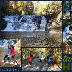
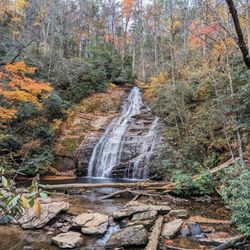
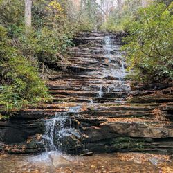
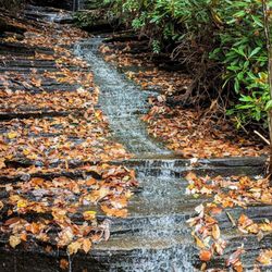
Lookout Rock Photos

More like Lookout Rock
Recommended Reviews - Lookout Rock
Start your review...

12 years ago
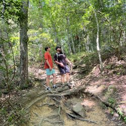
Beautiful resting spot partway up Mt Yonah. Great views! This is the first good place to get an unobstructed view, and a good spot to take a rest before continuing on to the summit. It is also a worthy destination if you don't have time or energy to do the full hike. read more


More info about Lookout Rock
Chambers Rd
Cleveland, GA 30528
Directions
Hours
Outdoor Amenities


Lookout Rock - hiking - Updated May 2026
Best of Cleveland
People found Lookout Rock by searching for…
Beautiful Views in Cleveland, GA
Scenic Overlook in Cleveland, GA
Hiking Trails in Cleveland, GA
Places to Take Pictures in Cleveland, GA
Lookout Points in Cleveland, GA
Walking Trails in Cleveland, GA
Running Trails in Cleveland, GA
Off Road Trails in Cleveland, GA
Restaurants With a View in Cleveland, GA
Fun Things to Do at Night in Cleveland, GA
Off Leash Dog Hikes in Cleveland, GA
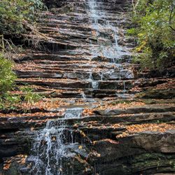
Waterfalls and Swimming Holes in Cleveland, GA
Romantic Views in Cleveland, GA
Trending Searches in Cleveland, GA
Botanical Gardens near Lookout Rock
Bounce House Rentals near Lookout Rock
Cheap Plants near Lookout Rock
Cliff Jumping near Lookout Rock
Floral Designers near Lookout Rock
Flower Fields near Lookout Rock
Garage Sales near Lookout Rock
Garden Center near Lookout Rock
Lakes & Ponds near Lookout Rock
Nurseries & Gardening near Lookout Rock
Outdoor Activities near Lookout Rock
Outdoor Furniture Stores near Lookout Rock
Party Equipment Rentals near Lookout Rock
Picnic Areas near Lookout Rock
Places To Take Pictures near Lookout Rock
Running Trails near Lookout Rock
Spray Tanning near Lookout Rock
Swimming Holes near Lookout Rock
Table And Chair Rentals near Lookout Rock
Browse Articles
Browse Nearby
BEST of Cleveland, Georgia Restaurants near Lookout Rock
BEST of Cleveland, Georgia Coffee near Lookout Rock
BEST of Cleveland, Georgia Things to Do near Lookout Rock
BEST of Cleveland, Georgia Parks near Lookout Rock
BEST of Cleveland, Georgia Scenic View near Lookout Rock
BEST of Cleveland, Georgia Breakfast near Lookout Rock
BEST of Cleveland, Georgia Campgrounds near Lookout Rock
Browse Brands
Related Searches in Cleveland, GA
Affordable Kayak Rental Services in Cleveland, Georgia
Best Fishing Locations and Guides in Cleveland, Georgia
Best Nature Trails for Hiking in Cleveland, Georgia
Best Places for Horseback Riding in Cleveland, Georgia
Best Waterfalls and Swimming Holes in Cleveland, Georgia
Check Out Off Road Trails in Cleveland, Georgia
Discover Dog Friendly Trails to Explore in Cleveland, Georgia
Discover Kid Friendly Hiking Trails in Cleveland, Georgia
Discover Lakes & Ponds to Explore in Cleveland, Georgia
Discover Scenic Mountain Bike Trails Near Cleveland, Georgia
Discover Top State Parks to Visit in Cleveland, Georgia
Discover a Hiking Trail in Cleveland, Georgia
Discover the Best Night Hike Trails in Cleveland, Georgia
Dog-Friendly Hikes With Dogs in Cleveland, Georgia
Enjoy Camping Adventures Around Cleveland, Georgia
Enjoy Exciting Mountain Biking Adventures in Cleveland, Georgia
Enjoy River Tubing Adventures in Cleveland, Georgia
Enjoy Tent Camping Spots Around Cleveland, Georgia
Enjoy a Beautiful Waterfall Hike in Cleveland, Georgia
Enjoy the Best Family Activities in Cleveland, Georgia
Enjoy the Best Picnic Spots and Ideas in Cleveland, Georgia
Enjoy the Best Tubing Experiences in Cleveland, Georgia
Enjoy the Best Walking Trails in Cleveland, Georgia
Exciting Cliff Jumping Spots in Cleveland, Georgia
Experience Thrilling White Water Rafting in Cleveland, Georgia
Explore Beautiful Parks and Green Spaces in Cleveland, Georgia
Explore Easy Hikes Perfect for All in Cleveland, Georgia
Explore Fun Activities to Do in Cleveland, Georgia
Explore Popular Campgrounds Near Cleveland, Georgia
Explore Popular Scenic Overlook Points in Cleveland, Georgia
Explore Top Dog Parks in Cleveland, Georgia Near You
Explore Top Water Parks in Cleveland, Georgia Today
Explore the Best Boating Spots in Cleveland, Georgia
Explore the Best Swimming Holes Around Cleveland, Georgia
Explore the Best Trail Options in Cleveland, Georgia
Find Beautiful Views in Cleveland, Georgia
Find Cozy Camping Cabins in Cleveland, Georgia
Find Popular Ziplining Spots Around Cleveland, Georgia
Find the Best Playgrounds to Visit in Cleveland, Georgia
Find the Best Scenic View Locations in Cleveland, Georgia
Hiking Trails With Waterfalls in Cleveland, Georgia
Plan a Scenic Drive Route Near Cleveland, Georgia
Popular Picnic Spots to Visit in Cleveland, Georgia
Popular Things to Do in Cleveland, Georgia
Safe River Swimming Areas in Cleveland, Georgia
Top Paddleboarding Activities in Cleveland, Georgia
Top Running Trails to Explore in Cleveland, Georgia
Top Swimming Lakes to Enjoy in Cleveland, Georgia
People who viewed Lookout Rock also viewed
Mount Yonah Trailhead
37 reviews
Hemlock Falls Trail
12 reviews
Lake Zwerner
3 reviews
Martin Creek Falls
3 reviews
DeSoto Falls
20 reviews
Stonewall Creek Falls
2 reviews
Blood Mountain Wilderness Area
25 reviews
Angel Falls & Panther Falls
11 reviews
Currahee Mountain
4 reviews
Panther Creek Recreation Area
37 reviews