
Jones Peak Loop Trail Photos


You might also consider
More like Jones Peak Loop Trail
Recommended Reviews - Jones Peak Loop Trail
Start your review...

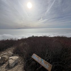
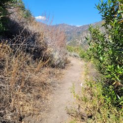
I did the trail counterclockwise. And that was by accident. Usually I like to do the steepest part on the outbound leg. In the end, I think I made the right decision. As one of the other reviewers mentioned, the only way to ascend going clockwise is to do so on your hands and knees. Coming down that stretch was pretty death-defying, although my hiking boots definitely proved their worth. Once you get off the main trail, most of the ascent and descent is grown over. Wearing shorts, that meant getting some pretty serious bushwhacking. Although somehow I escaped without any cuts or bruises. Weather could not have been more perfect. High clouds, no direct sunlight, and a decent breeze. Parking is on the street in a residential neighborhood, but it seems pretty safe. That said, there isn't much curbside parking. I am not one who enjoys an early morning hike. On a May afternoon I started around 1400 and finished around 1800. Perfect timing. read more


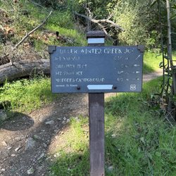
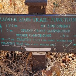
This trail was brutal especially for my older badminton friend who had to stop several times on the incline. Parking is on the street with limited space on Saturday morning! Looked like there were a few trails that branch off as you hike further in. Many people on this trail until you hit the last 1 mile to Jones Peak. The trail was very narrow; some areas can only fit 1-2 people so watch your steps! This was supposed to be a 5.3 mile loop, however we missed a turn and it ended up being 6.83 miles. We ended up at Bailey Canyon Park which was 0.75 miles away from where we parked. My friend was dead tired to walk that 0.75 miles so he called his wife to pick us up. Haha read more


3 years ago
4 years ago
More info about Jones Peak Loop Trail
400 Mt Wilson Trl
Sierra Madre, CA 91024
Directions
Hours
Outdoor Amenities
You might also consider


Jones Peak Loop Trail - hiking - Updated July 2026
Best of Sierra Madre
People found Jones Peak Loop Trail by searching for…
Hiking Trails in Sierra Madre, CA
Waterfall Hike in Sierra Madre, CA
Fun Things to Do in Sierra Madre, CA
Walking Trails in Sierra Madre, CA
Fishing Spots in Sierra Madre, CA
Running Trails in Sierra Madre, CA
Scenic View in Sierra Madre, CA
Easy Hikes in Sierra Madre, CA
Sunrise Hike in Sierra Madre, CA
Beautiful Views in Sierra Madre, CA
Places to Walk at Night in Sierra Madre, CA
Places to Walk in Sierra Madre, CA
Nature Walks in Sierra Madre, CA
Shaded Hike in Sierra Madre, CA
Stairs Workout in Sierra Madre, CA
View Points in Sierra Madre, CA
Canyoneering in Sierra Madre, CA
Trending Searches in Sierra Madre, CA
Blueberry Picking near Jones Peak Loop Trail
Boat Tours near Jones Peak Loop Trail
Cliff Jumping near Jones Peak Loop Trail
Day Trips near Jones Peak Loop Trail
Jet Ski Rental near Jones Peak Loop Trail
Kayak Rental near Jones Peak Loop Trail
Kids Activities Indoor near Jones Peak Loop Trail
Lakes near Jones Peak Loop Trail
Off Road Trails near Jones Peak Loop Trail
Outdoor Activities near Jones Peak Loop Trail
Peach Picking near Jones Peak Loop Trail
Picnic Spots near Jones Peak Loop Trail
Places To Walk Around near Jones Peak Loop Trail
Public Shower near Jones Peak Loop Trail
Rainy Day Activities near Jones Peak Loop Trail
River Swimming near Jones Peak Loop Trail
Rock Quarry near Jones Peak Loop Trail
Scenic Night View near Jones Peak Loop Trail
Scenic Overlook near Jones Peak Loop Trail
State Parks near Jones Peak Loop Trail
Swimming Holes near Jones Peak Loop Trail
Swimming Lakes near Jones Peak Loop Trail
Things To Do On A Rainy Day near Jones Peak Loop Trail
Things To Do With Teenagers near Jones Peak Loop Trail
Tubing near Jones Peak Loop Trail
View Points near Jones Peak Loop Trail
Watch Sunset near Jones Peak Loop Trail
Browse Articles
Browse Nearby
BEST of Sierra Madre, California Coffee near Jones Peak Loop Trail
BEST of Sierra Madre, California Things to Do near Jones Peak Loop Trail
BEST of Sierra Madre, California Restaurants near Jones Peak Loop Trail
BEST of Sierra Madre, California Walking Trails near Jones Peak Loop Trail
BEST of Sierra Madre, California Parks near Jones Peak Loop Trail
BEST of Sierra Madre, California Breakfast near Jones Peak Loop Trail
BEST of Sierra Madre, California Campgrounds near Jones Peak Loop Trail
BEST of Sierra Madre, California Day Trips near Jones Peak Loop Trail
BEST of Sierra Madre, California Sledding near Jones Peak Loop Trail
Browse Brands
Related Searches in Sierra Madre, CA
Best Dog Hiking Trails Around Sierra Madre, California
Best Fishing Locations and Guides in Sierra Madre, California
Best Nature Trails for Hiking in Sierra Madre, California
Best Places for Horseback Riding in Sierra Madre, California
Check Out Off Road Trails in Sierra Madre, California
Discover Dog Friendly Trails to Explore in Sierra Madre, California
Discover Easy Hiking Trails Near Sierra Madre, California
Discover Kid Friendly Hiking Trails in Sierra Madre, California
Discover Popular Bike Trails in Sierra Madre, California
Discover Scenic Mountain Bike Trails Near Sierra Madre, California
Discover Walking Parks in Sierra Madre, California Near You
Discover a Hiking Trail in Sierra Madre, California
Discover the Best Night Hike Trails in Sierra Madre, California
Dog-Friendly Hikes With Dogs in Sierra Madre, California
Enjoy Camping Adventures Around Sierra Madre, California
Enjoy Kayaking Adventures in Sierra Madre, California
Enjoy Off Leash Dog Hikes in Sierra Madre, California
Enjoy Scenic Places to Walk in Sierra Madre, California
Enjoy a Beautiful Waterfall Hike in Sierra Madre, California
Enjoy the Best Walking Path in Sierra Madre, California
Enjoy the Best Walking Trails in Sierra Madre, California
Explore Beautiful Parks and Green Spaces in Sierra Madre, California
Explore Easy Hikes Perfect for All in Sierra Madre, California
Explore Fun Activities to Do in Sierra Madre, California
Explore Popular Campgrounds Near Sierra Madre, California
Explore Popular Dog Walking Trails in Sierra Madre, California
Explore Top Dog Parks in Sierra Madre, California Near You
Explore the Best Beach Spots in Sierra Madre, California
Family Friendly Hiking With Kids in Sierra Madre, California
Find Beautiful Views in Sierra Madre, California
Find Parks and Recreation Activities in Sierra Madre, California
Find Top Dog Friendly Parks to Visit in Sierra Madre, California
Find Top-Rated Waterfalls in Sierra Madre, California Now
Find the Best Parks for Picnics in Sierra Madre, California
Hiking Trails With Waterfalls in Sierra Madre, California
Off Leash Dog Hiking Trails in Sierra Madre, California
Popular Outdoor Activities to Try in Sierra Madre, California
Popular Picnic Spots to Visit in Sierra Madre, California
Popular Waterfall Hiking Trails in Sierra Madre, California
Safe River Swimming Areas in Sierra Madre, California
Safe and Fun Parks for Kids in Sierra Madre, California
Top Hiking Trails to Explore in Sierra Madre, California
Top Playgrounds for Kids to Enjoy in Sierra Madre, California
Top Running Trails to Explore in Sierra Madre, California
Top Swimming Lakes to Enjoy in Sierra Madre, California
Top Swimming Spots and Pools in Sierra Madre, California
Top-Rated Camping Sites in Sierra Madre, California
Walk Dog Friendly Hiking Trails in Sierra Madre, California
Walk the Best Paved Walking Trails in Sierra Madre, California
People who viewed Jones Peak Loop Trail also viewed
El Prieto Trail
29 reviews
San Gabriel Peak
10 reviews
Mount Zion Trail
24 reviews
Ben Overturff Trail
24 reviews
Sunset Ridge Trail
4 reviews
Monrovia Hillside Preserve
7 reviews
Hillside Wilderness Preserve Trail
5 reviews
Inspiration Point via Eaton Canyon
28 reviews
Mt. Lukens Fire Road
14 reviews
Manzanita Ridge
10 reviews