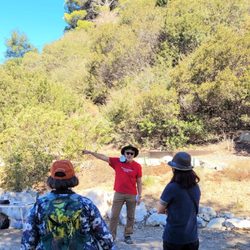
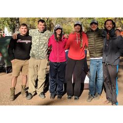
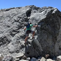
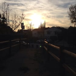
Mt. Lukens Fire Road Hiking Photos


You might also consider
More like Mt. Lukens Fire Road
Recommended Reviews - Mt. Lukens Fire Road
Start your review...

Reviews With Photos


Its clean its wide its smooth for a fire road. There is not much to see there. The views are decent. Lukens holds one distinction though. Its the highest point in los angeles county. If you want to enjoy yourself a little more don't go up Mt Lukens from the ranger station. Go up from grizzly flats entrance off highway 2 which joins Mt Lukens fire road halfway up. The view and walking terrain will be much more enjoyable while still giving you the "I climbed the highest point in LA" award. You will also be walking under shade a bit more via grizzly flats. Bring water. The Sun beats you down after a while. You can catch the grizzly flats entrance 2 miles north of the ranger station.

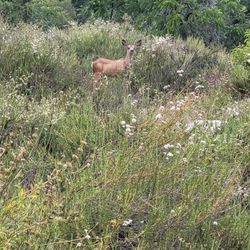
This is a pretty tough hike/trail running trail! The highest point in the LA County area at about 5500 elevation. Mt Lukens is a pretty desolate hike. I think I ran into 10 people max, but most of the time I was by myself. Aside from the occasional wild life run-ins of course. I parked at Deukmejian Wilderness Park and took the "Crescent Trail" which broke off into Mt Luken's trail I believe -- it was well marked. If you're not comfortable with insects, lizards, occasional snakes; then I suggest staying in the city where you're for the most part far and safe away from nature. Bugs a buzzing, lizards scrambling, birds chirping, and snakes slithering away; this was an interesting run up and down. I would have to say I was most uncomfortable when I hit the brushes and I couldn't see anything except trees and bushes, while hearing small critters scrambling away from me. I didn't want to step on a snake haha! This is a tough one to run up since its pure uphill battle and my legs tired almost every turn. I would say pick and choose your battle. Coming down was a quick sprint, but be sure to slow down for the turns; don't want you to fall off the mountain! I consider this a great training run. So if you're thinking of getting into the sport then start here. Overall, it took me 2 1/2 hours up and down. Literally 2 hours up, but 30 mins down. I'm an experience hiker and trail runner. For you beginners, plan for a 5-6 hours hike and bring tons of water! I also live in PHX so a hot day for me is 100 degrees and up; anything below is winter season haha! - Enjoy!


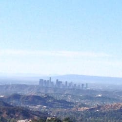
Don't ever go on this trail. You'll absolutely hate it. You'll be miserable and the grueling hours you spend hiking it will be time you'll never get back. Just don't even consider it - move on to other trails. No seriously don't keep reading bc it's a waste of time. Ok, now that I've weeded out the people who don't really read on haha...Actually this "trail" is truly a whimsical hidden gem! I hesitate to review it bc it's still largely quiet and lightly trafficked! A real local secret treasure! We LOVED our hike here! It's along a "fire road" but don't let that fool you - it's not paved. It's rocky and bumpy and definitely still feels like a nature trail (but the incline is very gradual and we didn't need any poles). Seems like only service vehicles use it and not very often. It's wide and easy to hike on. The incline is a good butt-kicker - a great workout but very manageable if you're at all used to any incline. I found it to be pretty easy, even though AllTrails calls it moderate (and I'm not "in shape" by any stretch of the imagination lol). We did 6 miles total with a gain of just under 1100 feet. Incline all the way in, downhill all the way out - just how I like it! I love trails that have a little "reward" to work towards and this one does not disappoint!! If you make it all the way, you're rewarded with a really cool tee pee (although it's bare right now with no canvas), a cool bee farm next to a lavender field, amazing views, and a small rock maze with a treat inside! We sat up on a high rocky vantage point to really soak it all in and refuel before heading back down. But really you're rewarded all along the way bc the views are just breathtaking! There's a nice bench about halfway where you can see all of the SGV, the LA basin, DTLA, and even Marina del Rey!! It was a tad smoggy but you can see the ocean and Channel Islands too when it's more clear. I bet sunsets are just incredible here! The other name for this trail is the "Tee Pee trail" and that's how you find it on AllTrails. It's right off the Angeles Crest Hwy. We just plugged "Mt Lukens Fire Road" into our gps and it took us right to the parking area. Parking is a dirt/gravel pull out on the side of the highway. It's narrow and backs right up to a steep mountain drop off so be very careful when parking or you'll go over the side of the mountain!! Kinda scary! You'll know you're there bc you'll see a ranger station across the hwy from the parking and that's where the trailhead is...even though it says "not open to the public" - it's ok to hike it - they just don't want anyone driving inside. Crossing the road from the parking is also a little scary though bc it's hard to see cars coming around the bends so be careful and RUN! Lol To get to the tee pee and bee farm, you'll eventually come to a cute mailbox marked "Bee Flat" with a chain across the road at the top of a hill. You'll see a nice, grassy area with a well worn trail. Go to the left of the mailbox and head towards the beehives. The tee pee is all the way at the end. It's private property but the owners allow hikers unless otherwise stated. It's not residential at all so it's not like it's someone's house or yard or anything. It's just a small little bee/lavender farm area. I think an adventure pass is required to park. And it's limited and seems to fill fast - it was almost full when we arrived at 745am on a Friday! But it was virtually empty when we left around lunch time. And there aren't any bathrooms so come prepared. This trail does go far on beyond the tee pee area - my understanding is it takes you all the way to the Mt Lukens peak which is the highest point within the LA city limits! #hikinggoals!! read more


6 years ago
Awesome and butt kicking trail. I lost my polaroid camera somewhere along the way. If found please call or text me @ 310-508-0091. Thank you! read more

Its clean its wide its smooth for a fire road. There is not much to see there. The views are decent. Lukens holds one distinction though. Its the highest point in los angeles county. If you want to enjoy yourself a little more don't go up Mt Lukens from the ranger station. Go up from grizzly flats entrance off highway 2 which joins Mt Lukens fire road halfway up. The view and walking terrain will be much more enjoyable while still giving you the "I climbed the highest point in LA" award. You will also be walking under shade a bit more via grizzly flats. Bring water. The Sun beats you down after a while. You can catch the grizzly flats entrance 2 miles north of the ranger station. read more


This is a pretty tough hike/trail running trail! The highest point in the LA County area at about 5500 elevation. Mt Lukens is a pretty desolate hike. I think I ran into 10 people max, but most of the time I was by myself. Aside from the occasional wild life run-ins of course. I parked at Deukmejian Wilderness Park and took the "Crescent Trail" which broke off into Mt Luken's trail I believe -- it was well marked. If you're not comfortable with insects, lizards, occasional snakes; then I suggest staying in the city where you're for the most part far and safe away from nature. Bugs a buzzing, lizards scrambling, birds chirping, and snakes slithering away; this was an interesting run up and down. I would have to say I was most uncomfortable when I hit the brushes and I couldn't see anything except trees and bushes, while hearing small critters scrambling away from me. I didn't want to step on a snake haha! This is a tough one to run up since its pure uphill battle and my legs tired almost every turn. I would say pick and choose your battle. Coming down was a quick sprint, but be sure to slow down for the turns; don't want you to fall off the mountain! I consider this a great training run. So if you're thinking of getting into the sport then start here. Overall, it took me 2 1/2 hours up and down. Literally 2 hours up, but 30 mins down. I'm an experience hiker and trail runner. For you beginners, plan for a 5-6 hours hike and bring tons of water! I also live in PHX so a hot day for me is 100 degrees and up; anything below is winter season haha! - Enjoy! read more


Overall this was a good trail! Parking available at the bottom. It wasn't too steep to walk to the top and on the way down I was able to run. 4.0 miles total. You are able to go further if you wanted! Good view of the mountains as you are walking up! read more


12 years ago
Love the remoteness of Mt. Lukens and the views are second to none! If you go up from the Ranger Station 29 off Angeles Crest Hwy, it's all fire road. About 7 miles of steep loose fire road. It can also be accessed from La Canada via Earl Canyon or Haynes Canyon in Tujunga. read more


12 years ago
9 years ago
10 years ago
10 years ago
10 years ago
More info about Mt. Lukens Fire Road
Ask the Community - Mt. Lukens Fire Road
Review Highlights - Mt. Lukens Fire Road
You might also consider


Why does Yelp recommend reviews?
1 review that is not currently recommended
The reviews below are not factored into the business's overall star rating.
13 years ago
Mt. Lukens Fire Road - hiking - Updated May 2026
Best of La Canada Flintridge
People found Mt. Lukens Fire Road by searching for…
Snow Play in La Canada Flintridge, CA
Parks in La Canada Flintridge, CA
Secret Spots in La Canada Flintridge, CA
Sunrise Hike in La Canada Flintridge, CA
Hiking Trails in La Canada Flintridge, CA
Sunrise View in La Canada Flintridge, CA
Waterfall Hike in La Canada Flintridge, CA
Views in La Canada Flintridge, CA
Beaches in La Canada Flintridge, CA
Off Road Trails in La Canada Flintridge, CA
Beautiful Views in La Canada Flintridge, CA
Hiking Club in La Canada Flintridge, CA
Playgrounds in La Canada Flintridge, CA
Lookout Points in La Canada Flintridge, CA
Hiking With Kids in La Canada Flintridge, CA
Mountain Biking in La Canada Flintridge, CA
Running Trails in La Canada Flintridge, CA
Easy Hikes in La Canada Flintridge, CA
Hikes With Dogs in La Canada Flintridge, CA
Dog Friendly Hiking Trails in La Canada Flintridge, CA
Walking Trails in La Canada Flintridge, CA
Creeks in La Canada Flintridge, CA
Browse Nearby
BEST of La Canada Flintridge, California Restaurants near Mt. Lukens Fire Road
BEST of La Canada Flintridge, California Coffee near Mt. Lukens Fire Road
BEST of La Canada Flintridge, California Things to Do near Mt. Lukens Fire Road
BEST of La Canada Flintridge, California Breakfast near Mt. Lukens Fire Road
BEST of La Canada Flintridge, California Campgrounds near Mt. Lukens Fire Road
BEST of La Canada Flintridge, California Gyms near Mt. Lukens Fire Road
BEST of La Canada Flintridge, California Hotels near Mt. Lukens Fire Road
Browse Brands
Browse Articles
People who viewed Mt. Lukens Fire Road also viewed
San Gabriel Peak
10 reviews
Strawberry Peak via Colby Canyon
6 reviews
Verdugo Mountains
30 reviews
Flint Canyon Trail
8 reviews
Manzanita Ridge
10 reviews
Waterman Mt & Twin Peaks Hike
8 reviews
Tad Williams Trail
7 reviews
Pasadena Hiking Pacers
35 reviews
Mt. Pacifico Campground
3 reviews
Las Flores Motorway Trail
10 reviews