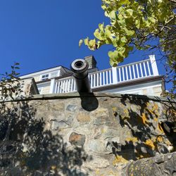
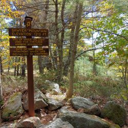
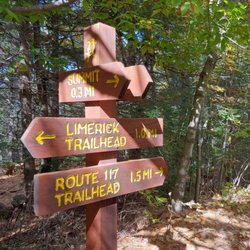
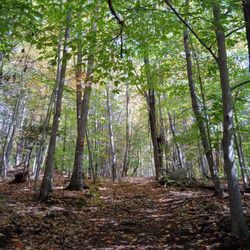
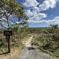
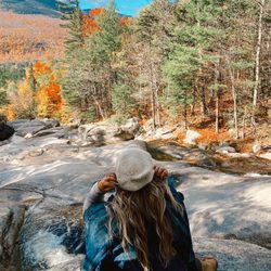
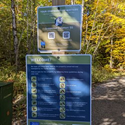
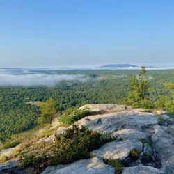
Jagolinzer Preserve Photos


You might also consider
More like Jagolinzer Preserve
Recommended Reviews - Jagolinzer Preserve
Start your review...

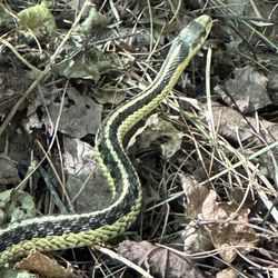
Holy green guacamole, folks -- what an adorable hike for some recreational activity. Eight thumbs up from me. (SAYS THE OCTOPUS!!!) If you must know, Eugene: this loop's difficulty was easy-to-moderate. Moderate; only because there are a few steep inclines/declines & lots of exposed roots throughout. Otherwise, super charming trail -- at time of this post (8.24.25), there was a story book; 'The Wicked Big Toddlah' displayed along the trail 4 people 2 read. That was a fun touch that must have been added by someone who likes fun things. Saco River = the midway point -- and guess what?! -- there's a rope swing there!!! Splish-splash -- take a swing, miss thing! Cool lil' waterfall to observe, as well. FYI: it's in the distance & it comes up towards the end of the loop. You can access it, however, by moving your bod down a fairly steep woodland surface. (Be careful, Uncle Todd!) Lots of pine needles around, too -- but also, hello, it's the woods! Call me Ranger Rick -- but I really enjoyed this hiking loop. Fam said 'bravo ' too! read more


2 years ago
Great time walking the preserve with my husband and dog. Don't be scared off by the "no trespassing" sign at the end of the road, like us. We saw that sign, despite Google maps telling us we arrived, and continued driving. We pulled off and decided to try again and sure enough, the parking lot and trail is JUST down the road slightly. Just past the no trespassing sign. The trail is extremely steep in 2 spots so I can't imagine visiting after it's freezing/icy/snow covered, unless you use snowshoes. Pretty view of the Saco River. Lots of parking. read more


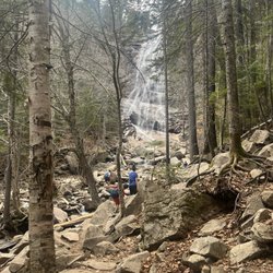
I am pretty sure that this is the very enchanted forest referenced in every fairy tale ever told. As you're driving down Ossipee Trail (Route 25) in Limington, you'll eventually see a REALLY small sign for Olive's Way. Google Maps will tell you the trail is a bit further down, but ignore it, and turn down this road. Park along the left hand side BEFORE the trail sign (because I believe this actually turns into someone's driveway beyond that). After walking into the woods along the path, you'll come to a directional sign. Turn left for the falls, turn right for the trail. My advice? Turn right. The trail itself essentially ends up being a loop and is maybe a little shorter than a mile - and it's a beautiful walk through the woods, along the Saco River, up Pease brook, then to the falls themselves (with a backdrop of both an old dam made from enormous boulders and a steep hillside [that you'll eventually have to climb to leave the preserve]). Since the last time I visited, unfortunately there are now about fifty big black and orange PRIVATE PROPERTY signs posted along *many* of the trees. Because of this, it's unclear when you get to the falls where you can and can't explore. The falls are gorgeous too: multiple tiers of enormous mossy covered rocks with pools of water. And when the sun streams through the canopy of trees, and with the birds singing, it really does feel magical... just a little less so now with the aggressively marked, territorial boundary in place. Still a lovely walk for an autumn's day though! read more


4 years ago
More info about Jagolinzer Preserve


Jagolinzer Preserve - hiking - Updated July 2026
Best of Limington
People found Jagolinzer Preserve by searching for…
Things to Do in Limington, Maine
Tide Pools in Limington, Maine
Hiking Trails With Waterfalls in Limington, Maine
Walking Trails in Limington, Maine
Playgrounds in Limington, Maine
Off Road Trails in Limington, Maine
Scenic Overlook in Limington, Maine
Secret Spots in Limington, Maine
Waterfalls and Swimming Holes in Limington, Maine
Scenic Views in Limington, Maine
Easy Hikes in Limington, Maine
Stroller Walk in Limington, Maine
Beautiful Views in Limington, Maine
Dog Friendly Trails in Limington, Maine
Lookout Points in Limington, Maine
Dog Hiking Trails in Limington, Maine
Attractions in Limington, Maine
Photo Spots in Limington, Maine
View Points in Limington, Maine
Waterfalls in Limington, Maine