Step Falls Preserve Photos


You might also consider
More like Step Falls Preserve
Recommended Reviews - Step Falls Preserve
Start your review...

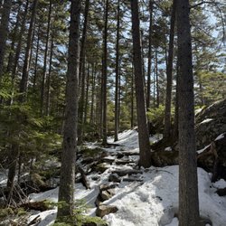
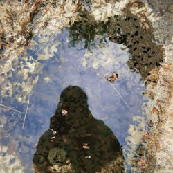
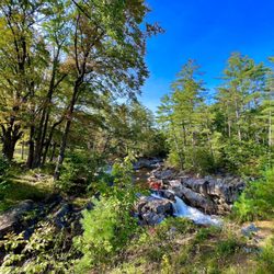
Maine beauty at it's finest! Really wish we had gotten here about a month sooner, temp would have been a little warmer (it was in the 30's thankfully) and we would have had a ton more color than what was left on the trees. But, none the less, this is still an amazing place to visit. Easy hike up the side of the mountain (it really never is overly steep)... I'd say the difficulty rating would be moderate (at best). Nice views of the stream as you hike your way up. You can even get off the path easily to take shots up stream of the Step Falls. As you hike closer and closer you can hear the rush of water passing through the space that was eroded down on the steps. Amazing views looking up and amazing views looking down into the valley area once you reach the top. I would say you can go at your own pace, but it is entirely possible to do this in 90 to 120 min round trip. Maybe 3/4 of a mile all the way in to the top with a pretty groomed trail all the way through. Good place for kids and several people even brought their pups along for some fun. Check this one out! read more


More info about Step Falls Preserve
Newry, ME 04261
Directions
Hours
Outdoor Amenities


Step Falls Preserve - hiking - Updated July 2026
Best of Newry
People found Step Falls Preserve by searching for…
Hiking Trails With Waterfalls in Newry, Maine
Beautiful Views in Newry, Maine
Natural Hot Springs in Newry, Maine
Hikes With Dogs in Newry, Maine
Walking Trails in Newry, Maine
Dog Friendly Hiking Trails in Newry, Maine
Running Trails in Newry, Maine
Off Leash Dog Hikes in Newry, Maine
Tourist Attractions in Newry, Maine
Waterfalls and Swimming Holes in Newry, Maine
Browse Nearby
BEST of Newry, Maine Restaurants near Step Falls Preserve
BEST of Newry, Maine Things to Do near Step Falls Preserve
BEST of Newry, Maine Beaches near Step Falls Preserve
BEST of Newry, Maine Coffee near Step Falls Preserve
BEST of Newry, Maine Campgrounds near Step Falls Preserve
BEST of Newry, Maine Lakes near Step Falls Preserve
BEST of Newry, Maine Breakfast near Step Falls Preserve