Coos Canyon Photos


You might also consider
More like Coos Canyon
Recommended Reviews - Coos Canyon
Start your review...

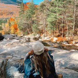
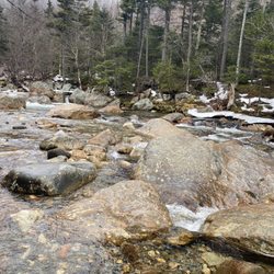
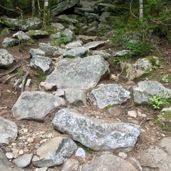
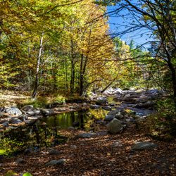
You'll find this fantastic hidden gem of nature as you head north into the Rangeley Lakes region - and it's well worth a stop! The main draw (for me anyway) is the 15-foot waterfall where the Swift River gushes over the smooth carved boulders - it's beautiful! Definitely a lovely visit in the fall colors - they were just starting to show on my visit in late September. But it's my understanding that this is a great place to frolic in natural swimming holes and jump off the rocks and enjoy the water in the warmer months. I had a great time exploring the area! There were butterflies EVERYWHERE!! Many different species - but one species was being particularly cooperative and I had a great time with my camera - and turns out it was a Pink-edged Sulfur which is the State Butterfly of Maine! It's easy to find - right off Swift River Rd and it's free. Theres a picnic area with several tables and a fun giant chair with a story about Paul Bunyan next to it. Everything is well maintained and there's a campground nearby. I didn't see any bathrooms. read more


1 year ago
6 years ago
Looking for that natural swimming hole. You have natural water slides here. You have cliff jumping here. There must be a 4x4 trail close because there was 100+ atv's the day we found this spot. There is a lil country general store here to get lunch also. read more

More info about Coos Canyon


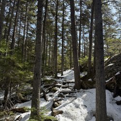


Coos Canyon - hiking - Updated July 2026
Best of Byron
People found Coos Canyon by searching for…
Browse Nearby
Browse Brands
Browse Articles
People who viewed Coos Canyon also viewed
Small Falls Rest Area
7 reviews
Grafton Notch State Park
16 reviews
Mount Blue State Park Campground
7 reviews
Lone Mountain Riverfront Campground
7 reviews
Ellis pond
1 review
J. Eugene Boivin Park
1 review
Rocky Mountain Terrain Park
7 reviews
Rangeley Town of
2 reviews
Maine Huts & Trails
5 reviews
Black Mountain of Maine
8 reviews