Hawk Mountain Trailhead Photos


You might also consider
More like Hawk Mountain Trailhead
Recommended Reviews - Hawk Mountain Trailhead
Start your review...

5 years ago
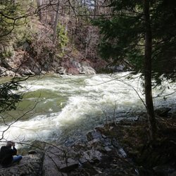
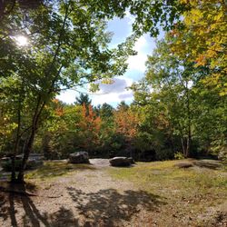
Great hiking area in Oxford County, ME. Visited this hiking spot during a recent camping trip at Papoose Pond in Waterford, ME. Only a 15-20 minute drive from the campgrounds. Super quiet hiking spot early in the morning during the week but weekends may differ. About a 25 minute hike up, 20 down. Definitely recommend!! read more
More info about Hawk Mountain Trailhead
100 Hawk Mountain Rd
Waterford, ME 04088
Directions
Hours
Outdoor Amenities


Hawk Mountain Trailhead - hiking - Updated July 2026
Best of Waterford
People found Hawk Mountain Trailhead by searching for…
Hiking Trails in Waterford, ME
Lakes & Ponds in Waterford, ME
Beautiful Views in Waterford, ME
Secluded Spots in Waterford, ME
Walking Trails in Waterford, ME
Running Trails in Waterford, ME
Swimming Holes in Waterford, ME
Off Road Trails in Waterford, ME
Off Leash Dog Hikes in Waterford, ME
Dog Friendly Beaches in Waterford, ME
Places to Take Pictures in Waterford, ME
Dog Friendly Trails in Waterford, ME
Waterfall Hike in Waterford, ME
Fun Places for Kids in Waterford, ME


