Donnabeth Lippman Park Photos


You might also consider
More like Donnabeth Lippman Park
Recommended Reviews - Donnabeth Lippman Park
Start your review...

6 years ago
This is a great little trail to take your kiddos on. There's a playground, a story walk (that changes monthly), beautiful water views and an easy to follow trail around the pond. If you take a little detour off the story walk, you'll even find a cool teepee shaped bunch of sticks leaning against a tree. Children love to explore this area. It's not so far off the path that you'd ever get lost. In between the first few pages of the story walk, when you have an opportunity to go straight, do so. I promise it's only a few feet down the path. Can't miss it! read more


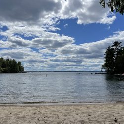
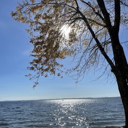
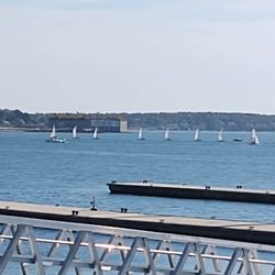
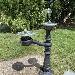
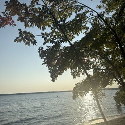
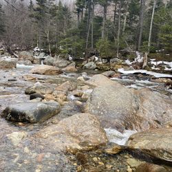
I wasn't expecting so much from this little park right off Route 302 (it's located on a dirt road just after the Westbrook Pool & Spa; there's a large granite sign at the mouth of the road, and you've probably passed it a million times - I know I have - but once you see it, you'll know exactly where this gem is forever)! Donnabeth Lippman Park - formerly known as Chaffin Pond Preserve - is 123 acre mostly wooded area that surrounds a 10 acre pond that's apparently great for fishing. I came here for a walk in the woods and was delighted to find that there was more than meets the eye: there's a family-friendly (you could easily take a stroller here - it's packed earth and not very root-y), totally accessible to all abilities, story book trail with a giant "Once Upon A Time" sign inviting you into the woods (how magical and fantastical is that?). Once you're finished, you can walk back to the parking lot from here via the yellow trail or you can take that same trail and follow it up alongside the pond, through the woods, then back down around the opposite side of the water (side note: I love loop trails - who wants to double back and see the same things?). A red trail deviates off to Mud Pond, and a green trail just adds an extended path through the forest before reconnecting to yellow. All of it is perfectly marked! It's a wonderful walking trail and if I lived nearby I could see this also being a solid spot for a good run! Admittedly, after heavy rain or during spring you should expect it to be quite muddy. No hunting allowed here, so it's a good spot for year round enjoyment (for those of you who are looking for a new snowshoeing spot!); there's an abundance of picnic tables overlooking the pond, a swing set, a big playground area, and plenty of green space to stretch out on. Again - what an unexpectedly great spot hidden in plain sight! read more


More info about Donnabeth Lippman Park


Donnabeth Lippman Park - hiking - Updated July 2026
Best of Windham
People found Donnabeth Lippman Park by searching for…
Things to Do in Windham, Maine
Scenic Overlook in Windham, Maine
Beautiful Views in Windham, Maine
Hiking Trails in Windham, Maine
Fishing Spots in Windham, Maine
Basketball Courts in Windham, Maine
Secret Spots in Windham, Maine
Picnic Areas in Windham, Maine
Running Trails in Windham, Maine
Scenic Views in Windham, Maine
Walking Trails in Windham, Maine
Sledding Hills in Windham, Maine
Picnic Spots in Windham, Maine
Park & Forests in Windham, Maine
Browse Nearby
BEST of Windham, Maine Restaurants near Donnabeth Lippman Park
BEST of Windham, Maine Coffee near Donnabeth Lippman Park
BEST of Windham, Maine Things to Do near Donnabeth Lippman Park
BEST of Windham, Maine Swimming Holes near Donnabeth Lippman Park
BEST of Windham, Maine Breakfast near Donnabeth Lippman Park
BEST of Windham, Maine Lodging near Donnabeth Lippman Park
BEST of Windham, Maine Lakes near Donnabeth Lippman Park
BEST of Windham, Maine Campgrounds near Donnabeth Lippman Park