Mount Agamenticus Trail Photos


You might also consider
More like Mount Agamenticus Trail
Recommended Reviews - Mount Agamenticus Trail
Start your review...

Reviews With Photos

Long-ago, former "Big A" ski area (some of its structures still visible), has this second life as a easy to moderate hiking area on & around the Mt. Agamenticus, with views of the Atlantic Ocean & beautiful forests. Oh, and a shy, red fox. Trails are either packed dirt, stone, root-covered, all-rockface & packed gravel. Mountain bikers love the challenge. There is a viewing tower on the top & the old ski lodge up there is now the visitor center while, at the bottom, there is a great nature center. There are bathrooms on both the top & the bottom. Parking is pretty good but get there early anyway.

It had been years since we've been up to Mt. A. Like, an eon. We usually stick to the beach on vacations, but decided to have a different kind of Maine vacation this year and stick to trails, historic sites, and just being away from the throngs of sweaty tourists at the shore. So it was the perfect time to revisit the trails at Mt. A! Because I'm mobility-challenged, I wondered if this would just be a bust. Not so! We were delighted by what we found. First, one can drive all the way up to the summit. We remembered at least that from 15+ years ago. There are two spots marked for handicapped parking, but there was ample space in the lot. (A good number of people park at the bottom and take the trails from there.) From there, you can check out the info board and get trail maps. There's a learning center, but we didn't go inside because we're not "doing indoors" at this time. Maybe someday when it's safer for my immunocompromised self. We were utterly delighted with The Big A trail!! It's a wide, even trail that winds around the summit beautifully. The material covering the trail is a crushed stone that provides a stable walking surface. I could have used my cane easily, and I think a good wheelchair might traverse it well. Luckily, I didn't need either at the moment. The trail itself is so interesting! We walked through all sorts of flora, and there are ID flip markers to explain different trees, etc. The views were amazing and varied (look to the ocean, look to NH), and we crossed boardwalks and stopped at overlooks. The Big A trail and other trailheads are well-marked with names and distances. That was so helpful! We took a little side trail that was .1 miles. Just my speed. Lol At the summit there's also a lookout that has nice, wide steps up, and a landing where you could rest your legs a minute if needed (not that there are a ton of steps--I'm taking about those of us with mobility issues...I found the stairs to be quite easy). There are picnic tables scattered about, many in the shade of a tree. We spotted a few different birds, chipmunks, and a fat woodchuck. On the drive up the mountain, I saw a deer in the woods! Another important thing: the potty situation. Miss Tiny Bladder that I am, I'm always assessing the restroom access and quality. There are two portapotties not far from the handicapped parking. They are in open sheds to shield them from the sun, a plus! One side is a typical portapotty with just enough space for one to do one's business without touching anything unnecessarily. The other side is spacious, and would fit a wheelchair in. Both were very clean, with toilet paper and plenty of hand sanitizer in their dispensers. That's the only place you'll find hand sanitizer, so bring your own if you're the type to touch all the things (the flip-up info signs, the overlook handrails, picnic tables). We had such a wonderful day, we came back a couple more times just to eat lunch and take a stroll. A most relaxing place, even in the height of a southern Maine summer!

Mount Agamenticus is one of those places that makes me appreciate where I live and New England in general. There are so many beautiful places to hike and admire the beauty and nature around us. Mt. A is one that definitely does not disappoint. My friend and I recently came to Mt. A for a hike and it was an incredibly beautiful day. It doesn't take too long to get to the peak of the mountain with amazing views from every direction, but there is plenty to see, including an antique ski chair lift. Once you reach the top, there are other trails that you can walk that prolong your hiking experience, if you wish to do that, but if you follow a typical trail up to the peak, it probably takes you about 30 minutes or so. It's a perfect spot for a moderate day hike! I will definitely be back to do more hiking at Mt. A!

Having decided on a weekend trip to Maine near Kittery and York, the choice was made to breathe in some fresh air and get outdoors for a change. Mount Agamenticus and its 10,000 acres of land with over 40 miles of trails seemed an appropriate option to achieve this goal. Driving out to this coastal forestland, my boyfriend and I parked the car in a small lot at the trailhead. Thankful for the port-a-john located here, we took our time scouring over the trail map prior to beginning the trek out. Opting for the "Turtle Loop", we took a leisurely hike partway through the ringed trail before opting for the hairpin turn up to the summit. P.S. there is a road up to the top that is open year round, weather permitting but the exercise is refreshing! The summit is a relatively large open field complete with Learning Lodge, lookout towers, an Algonquin memorial, as well as several picnic tables. The Learning Lodge, though not open on my visit, is accessible from Memorial Day weekend until Columbus Day. It sounds as though it provides a number of displays and activities for young ones to learn and be involved in conserving nature. There are wonderful views all along the trail and the summit itself. Information stations along the trail add an element of education to your trip. From the top you can catch a glimpse of Mount Washington and coastal waters. I imagine the view is quite beautiful in the Fall with the changing trees. If your in the area I recommend this location for a quick.... or extended trek. I wouldn't travel out of your way for a visit but its certainly a nice change of pace on a sunny day.

Quick, easy hike. Ideal for those who want some quick cardio, are out of shape trying to get back into shape, have small children, or have puppies. My friend and I brought our pups (on leash). We took the ring trail and it took us about 1:15 to do the whole hike which included some hanging out at the top. The view from the top is very impressive for such a small climb. You can also drive up to the top. The only reason why I am giving this 4 stars is because it was very crowded when we went. (Friday afternoon in July so no surprise there) I had a hard time getting a parking spot at the trail head. Get there early or go in the off season for some more peace and quiet. I also couldn't find a garbage to throw my dogs bathroom bag in so it was a long drive back to Portland ME with that smell coming from my backpack! Carry in Carry out! Had no bug problems except one tick on a dog.

Love this mountain! A very good friend, who is a local, introduced me to the area 8 years ago. There has been so many improvements since my first visit in 2008. My 81 year old mom could walk the trails on top. There is handicap parking, though the lot is not paved, and the trails on top appear to be wheel chair accessible. The learning center, trail maps, and informational placards are super helpful. The Sunset was ah-mazing. My pictures don't do it justice of its 360 degree views.


To prove I do more than just eat, here is a my first review of a hiking trail. We picked the perfect place for a hike, but the worst possible day for it. Despite the blazing hot sun at the top of Mt. Agmenticus, we managed to explore the summit and marvel at the breathtaking views of the Atlantic coastline and distant White Mountains. This mountain trail has been on my Yelp bookmark list for some time now and glad I got the chance to visit. I was not sure what to expect upon arrival. Some vehicles were parked at the base which I assume belong to the more experienced hikers that begin their hike from the bottom. We cheated on this 90 degree day and drove to the top until reaching the visitor's center and free parking area. The visitor's center is referred to as the learning center and is somewhat geared to children with exhibits offering a lesson on local wildlife. An observation deck within this building offers an amazing view from all sides of the mountain. There are also a couple smaller observation decks located at the summit and plenty of tables to enjoy a picnic. From what I could see there are a few intersecting trails clearly marked which span the mountain. I plan to return soon, perhaps on a crisp fall day to enjoy the full hike to the top. What a hidden gem!

I decided to ride the Ring on my mountain bike. Although I DO NOT recommend doing that, it is quite a lovely trail to hike. You can park right next to the trail. Via bike, it can be done in 30-40 minutes... 40 with falling a few times and walking the bike up the roots, then shooting down. It's great if you like adrenaline and the thought that at any moment you could in fact break or dislocate something.


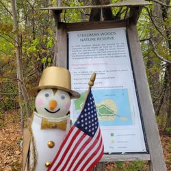
The reason we decided to visit this trail/area, is because one of the news channels always shows the view from the camera at this location. We were always impressed with the view and put this on our list of interesting places. We finally made it this year! The views were beautiful! One of the things we loved about this place, is the fact there are plaques or narrative cards that show what you are looking at with a little history behind it. There are places for you to sit next to the ranger station. A few hikers were enjoying a snack break while we were there. They were commenting on how dusty and dry it was. (the drought of 2025 - for future readers reference) There's not a lot of shade, so prepare accordingly. There was plenty of parking and plenty of trails and views to enjoy! We loved it! read more


11 months ago
Beautiful! Good bathroom facilities (composting toilets and sanitizer, but clean). Maps available. Ample parking, must pay to park. Well-marked trails. Can hike or drive to summit. Educational center at the top (limited hours). Nice lookout points. Easy to low-moderate hike on the trails we took, in my opinion. Not a terrible distance to the summit, mostly shaded hike. Will go back for sure. read more

Came here with friends that are very involved in bird and hawk watching. Located in York Maine. We drove to the top, lots of people were walking or biking it. A lot more windy at the top... be prepared with hats and gloves. Open year round dawn to dusk unless there's some major weather issue. Lots of different trails here, we wondered around the big A, very easy one mile takes you are the field. Lots of birds to see and chipmunks. We also did some of vultures view, very steep and a lot of exposed bedrock. Wear proper hiking shoes. The views are spectacular, mount Washington and the ocean! We saw a few hawks gliding throughout the sky. There is a nature center here but it was closed when we visited. read more


Long-ago, former "Big A" ski area (some of its structures still visible), has this second life as a easy to moderate hiking area on & around the Mt. Agamenticus, with views of the Atlantic Ocean & beautiful forests. Oh, and a shy, red fox. Trails are either packed dirt, stone, root-covered, all-rockface & packed gravel. Mountain bikers love the challenge. There is a viewing tower on the top & the old ski lodge up there is now the visitor center while, at the bottom, there is a great nature center. There are bathrooms on both the top & the bottom. Parking is pretty good but get there early anyway. read more


5 years ago
It had been years since we've been up to Mt. A. Like, an eon. We usually stick to the beach on vacations, but decided to have a different kind of Maine vacation this year and stick to trails, historic sites, and just being away from the throngs of sweaty tourists at the shore. So it was the perfect time to revisit the trails at Mt. A! Because I'm mobility-challenged, I wondered if this would just be a bust. Not so! We were delighted by what we found. First, one can drive all the way up to the summit. We remembered at least that from 15+ years ago. There are two spots marked for handicapped parking, but there was ample space in the lot. (A good number of people park at the bottom and take the trails from there.) From there, you can check out the info board and get trail maps. There's a learning center, but we didn't go inside because we're not "doing indoors" at this time. Maybe someday when it's safer for my immunocompromised self. We were utterly delighted with The Big A trail!! It's a wide, even trail that winds around the summit beautifully. The material covering the trail is a crushed stone that provides a stable walking surface. I could have used my cane easily, and I think a good wheelchair might traverse it well. Luckily, I didn't need either at the moment. The trail itself is so interesting! We walked through all sorts of flora, and there are ID flip markers to explain different trees, etc. The views were amazing and varied (look to the ocean, look to NH), and we crossed boardwalks and stopped at overlooks. The Big A trail and other trailheads are well-marked with names and distances. That was so helpful! We took a little side trail that was .1 miles. Just my speed. Lol At the summit there's also a lookout that has nice, wide steps up, and a landing where you could rest your legs a minute if needed (not that there are a ton of steps--I'm taking about those of us with mobility issues...I found the stairs to be quite easy). There are picnic tables scattered about, many in the shade of a tree. We spotted a few different birds, chipmunks, and a fat woodchuck. On the drive up the mountain, I saw a deer in the woods! Another important thing: the potty situation. Miss Tiny Bladder that I am, I'm always assessing the restroom access and quality. There are two portapotties not far from the handicapped parking. They are in open sheds to shield them from the sun, a plus! One side is a typical portapotty with just enough space for one to do one's business without touching anything unnecessarily. The other side is spacious, and would fit a wheelchair in. Both were very clean, with toilet paper and plenty of hand sanitizer in their dispensers. That's the only place you'll find hand sanitizer, so bring your own if you're the type to touch all the things (the flip-up info signs, the overlook handrails, picnic tables). We had such a wonderful day, we came back a couple more times just to eat lunch and take a stroll. A most relaxing place, even in the height of a southern Maine summer! read more


Mount Agamenticus is one of those places that makes me appreciate where I live and New England in general. There are so many beautiful places to hike and admire the beauty and nature around us. Mt. A is one that definitely does not disappoint. My friend and I recently came to Mt. A for a hike and it was an incredibly beautiful day. It doesn't take too long to get to the peak of the mountain with amazing views from every direction, but there is plenty to see, including an antique ski chair lift. Once you reach the top, there are other trails that you can walk that prolong your hiking experience, if you wish to do that, but if you follow a typical trail up to the peak, it probably takes you about 30 minutes or so. It's a perfect spot for a moderate day hike! I will definitely be back to do more hiking at Mt. A! read more


Having decided on a weekend trip to Maine near Kittery and York, the choice was made to breathe in some fresh air and get outdoors for a change. Mount Agamenticus and its 10,000 acres of land with over 40 miles of trails seemed an appropriate option to achieve this goal. Driving out to this coastal forestland, my boyfriend and I parked the car in a small lot at the trailhead. Thankful for the port-a-john located here, we took our time scouring over the trail map prior to beginning the trek out. Opting for the "Turtle Loop", we took a leisurely hike partway through the ringed trail before opting for the hairpin turn up to the summit. P.S. there is a road up to the top that is open year round, weather permitting but the exercise is refreshing! The summit is a relatively large open field complete with Learning Lodge, lookout towers, an Algonquin memorial, as well as several picnic tables. The Learning Lodge, though not open on my visit, is accessible from Memorial Day weekend until Columbus Day. It sounds as though it provides a number of displays and activities for young ones to learn and be involved in conserving nature. There are wonderful views all along the trail and the summit itself. Information stations along the trail add an element of education to your trip. From the top you can catch a glimpse of Mount Washington and coastal waters. I imagine the view is quite beautiful in the Fall with the changing trees. If your in the area I recommend this location for a quick.... or extended trek. I wouldn't travel out of your way for a visit but its certainly a nice change of pace on a sunny day. read more


Quick, easy hike. Ideal for those who want some quick cardio, are out of shape trying to get back into shape, have small children, or have puppies. My friend and I brought our pups (on leash). We took the ring trail and it took us about 1:15 to do the whole hike which included some hanging out at the top. The view from the top is very impressive for such a small climb. You can also drive up to the top. The only reason why I am giving this 4 stars is because it was very crowded when we went. (Friday afternoon in July so no surprise there) I had a hard time getting a parking spot at the trail head. Get there early or go in the off season for some more peace and quiet. I also couldn't find a garbage to throw my dogs bathroom bag in so it was a long drive back to Portland ME with that smell coming from my backpack! Carry in Carry out! Had no bug problems except one tick on a dog. read more


Love this mountain! A very good friend, who is a local, introduced me to the area 8 years ago. There has been so many improvements since my first visit in 2008. My 81 year old mom could walk the trails on top. There is handicap parking, though the lot is not paved, and the trails on top appear to be wheel chair accessible. The learning center, trail maps, and informational placards are super helpful. The Sunset was ah-mazing. My pictures don't do it justice of its 360 degree views. read more


5 years ago
7 years ago
This was a good moderate hike. I'm not a super hiker but enjoyed the ring trail with the A trail as a side trail to see the summit. read more


To prove I do more than just eat, here is a my first review of a hiking trail. We picked the perfect place for a hike, but the worst possible day for it. Despite the blazing hot sun at the top of Mt. Agmenticus, we managed to explore the summit and marvel at the breathtaking views of the Atlantic coastline and distant White Mountains. This mountain trail has been on my Yelp bookmark list for some time now and glad I got the chance to visit. I was not sure what to expect upon arrival. Some vehicles were parked at the base which I assume belong to the more experienced hikers that begin their hike from the bottom. We cheated on this 90 degree day and drove to the top until reaching the visitor's center and free parking area. The visitor's center is referred to as the learning center and is somewhat geared to children with exhibits offering a lesson on local wildlife. An observation deck within this building offers an amazing view from all sides of the mountain. There are also a couple smaller observation decks located at the summit and plenty of tables to enjoy a picnic. From what I could see there are a few intersecting trails clearly marked which span the mountain. I plan to return soon, perhaps on a crisp fall day to enjoy the full hike to the top. What a hidden gem! read more


I decided to ride the Ring on my mountain bike. Although I DO NOT recommend doing that, it is quite a lovely trail to hike. You can park right next to the trail. Via bike, it can be done in 30-40 minutes... 40 with falling a few times and walking the bike up the roots, then shooting down. It's great if you like adrenaline and the thought that at any moment you could in fact break or dislocate something. read more


10 years ago
Great hike for ages 4-6, my son loved it, and especially the loads of fresh blueberries we found upon our descent on blueberry bluff. Super start for beginners or those wanting the introduce kids to the idea of hiking. read more


9 years ago
18 years ago
I love this place. I love this place. I love this place. Mt. A is an old ski mountain (under 700ft) and some of the chairlift equipment is still there. Every year they do more and more to improve the trails and especially the top where the learning center is. This year I noticed they have done some cutting of trees at the top and they are making crushed rock paths. The parking is free and there is plenty of it. A good trail to hike is The Ring Trail. It skirts around the side of the mountain approximately .2 miles down from the top. You cross the auto road near the bottom at the entrance. The trails are well marked with colored blazes and animals. Each intersecting trail is well marked as well. A lot of trails lead off toward Second Hill which is worth a visit too. These are nature trails with leaves and rocks and even water on them so be prepared with real boots and bring your water. The top can be "breezy" but the views of the White Mountains and nice long stretch of the Atlantic Coastline can't be beat from such a moderate height. I've seen horses here in the summer and some trails you can bike on as well. The trails that are hike only are clearly marked. This is a carry in-carry out park. They have lots of picnic tables for you to enjoy lunch at our you can even just lay or sit in the wide open space at the top in the grass and soak it all in. Plus, you can be on Rt 1 shopping and eating within 4 miles if that is something that rounds out your day. read more


11 years ago
9 years ago
7 years ago

14 years ago
11 years ago
11 years ago
11 years ago
9 years ago
13 years ago
More info about Mount Agamenticus Trail
Ask the Community - Mount Agamenticus Trail
Review Highlights - Mount Agamenticus Trail


Why does Yelp recommend reviews?
1 review that is not currently recommended
The reviews below are not factored into the business's overall star rating.
7 years ago
Mount Agamenticus Trail - hiking - Updated June 2026
Best of York
People found Mount Agamenticus Trail by searching for…
Trending Searches in York, ME
Amusement Parks near Mount Agamenticus Trail
Beaches near Mount Agamenticus Trail
Black Owned Nail Salons near Mount Agamenticus Trail
Boat Rental near Mount Agamenticus Trail
Cliff Jumping near Mount Agamenticus Trail
Dog Friendly Trails near Mount Agamenticus Trail
Fishing Spots near Mount Agamenticus Trail
Free Kids Activities near Mount Agamenticus Trail
Jet Ski Rental near Mount Agamenticus Trail
Lakes near Mount Agamenticus Trail
Outdoor Activities near Mount Agamenticus Trail
Pick Your Own Farms near Mount Agamenticus Trail
Public Pools near Mount Agamenticus Trail
Public Shower near Mount Agamenticus Trail
Running Trails near Mount Agamenticus Trail
Scenic Drive near Mount Agamenticus Trail
Secluded Spots near Mount Agamenticus Trail
Splash Pad near Mount Agamenticus Trail
Strawberry Picking near Mount Agamenticus Trail
Sunrise View near Mount Agamenticus Trail
Swimming Holes near Mount Agamenticus Trail
Swimming Lakes near Mount Agamenticus Trail
Swimming Pools near Mount Agamenticus Trail
Watch Sunset near Mount Agamenticus Trail
Browse Articles
Browse Nearby
Browse Brands
Related Searches in York, ME
Affordable Kayak Rental Services in York, Maine
Best Fishing Locations and Guides in York, Maine
Best Places for Horseback Riding in York, Maine
Check Out Off Road Trails in York, Maine
Discover Dog Friendly Trails to Explore in York, Maine
Discover Scenic Mountain Bike Trails Near York, Maine
Discover Top Boat Tours in York, Maine for All Ages
Discover a Hiking Trail in York, Maine
Discover the Best Night Hike Trails in York, Maine
Dog-Friendly Hikes With Dogs in York, Maine
Enjoy Camping Adventures Around York, Maine
Enjoy Exciting Mountain Biking Adventures in York, Maine
Enjoy Kayaking Adventures in York, Maine
Enjoy Tent Camping Spots Around York, Maine
Enjoy a Beautiful Waterfall Hike in York, Maine
Enjoy the Best Walking Trails in York, Maine
Exciting Cliff Jumping Spots in York, Maine
Explore Beautiful Parks and Green Spaces in York, Maine
Explore Bike Rentals Throughout York, Maine
Explore Easy Hikes Perfect for All in York, Maine
Explore Fun Activities to Do in York, Maine
Explore Popular Campgrounds Near York, Maine
Explore Popular Scenic Overlook Points in York, Maine
Explore Popular View Points Around York, Maine
Explore the Best Beach Spots in York, Maine
Explore the Best Boating Spots in York, Maine
Explore the Best Swimming Holes Around York, Maine
Family Friendly Hiking With Kids in York, Maine
Find Beautiful Views in York, Maine
Find Popular Ziplining Spots Around York, Maine
Find the Best Scenic View Locations in York, Maine
Hiking Trails With Waterfalls in York, Maine
Off Leash Dog Hiking Trails in York, Maine
Perfect Spots to Watch Sunset in York, Maine
Plan a Scenic Drive Route Near York, Maine
Popular Fishing Spots to Explore in York, Maine
Popular Outdoor Activities to Try in York, Maine
Popular Picnic Spots to Visit in York, Maine
Popular Things to Do in York, Maine
Safe River Swimming Areas in York, Maine
Safe and Fun Parks for Kids in York, Maine
Top Climbing Spots and Gyms in York, Maine
Top Paddleboarding Activities in York, Maine
Top Places for Snorkeling in York, Maine
Top Running Trails to Explore in York, Maine
Top Swimming Lakes to Enjoy in York, Maine
Top Swimming Spots and Pools in York, Maine
Top Things to Do With Kids in York, Maine
People who viewed Mount Agamenticus Trail also viewed
Timber Point Trail
7 reviews
Wells Reserve at Laudholm
13 reviews
Northwood Meadows State Park
4 reviews
Great Bay National Wildlife Refuge
5 reviews
Stratham Hill Park
4 reviews
Barters Creek Trail
1 review
Rye Harbor State Park
3 reviews
Bauneg Beg Mountain Conservation Area
2 reviews
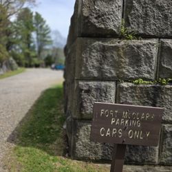
Fort McClary Picnic Area
3 reviews
Nubble Lighthouse
201 reviews