Mt Cutler Photos


You might also consider
More like Mt Cutler
Recommended Reviews - Mt Cutler
Start your review...

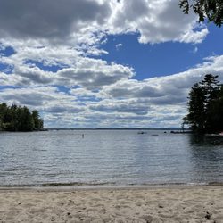
I feel the need to preface all of my nature reviews with this: being 90% forested and having around 3500 miles of coastline, Maine has a tremendous amount of spaces, walkways, paths, and trails of all kinds and of all levels. There's something for everyone. What I'm reviewing is how a spot compares to similar outdoor spots in my personal opinion. Being in nature - and remembering to carry in, carry out - is always five stars! :) Parking? Yes. Loop trail? Kind of. Well marked signs? Kind of. Element of surprise? Yes. Mt Cutler feels like a work in progress. What I read about it online didn't entirely match what we found in real life; and those changes felt recent. Like the town of Hiram realized what a popular place this has become and they're trying to improve it to make it more accessible. That being said, here's what I would do if I were you: from the parking lot on Hiram Hill Rd (please DO NOT park on the road, there's plenty of space in the lot and if there's not... then have a Plan B) enter the woods near the Information Kiosk. Take the blue blazes (North Trail) to white blazes (White Flag Trail) to the yellow blazes (Boulder Trail). This will bring you to the Front Ledges on Mt Cutler, an overlook of a glacial moraine. Parts of this are a steeper climb, but the view is spectacular and an amazing spot to have lunch at. I would then doubleback and go home. AVOID THE RED TRAIL. Apparently this was the original trail and parts of it are basically just rock climbing while other parts are completely eroded (even the information kiosk reminds hikers of this hazard). You can also skip diverging left to the white and yellow blazes, and just keep following the blue trail for a while. It's a pretty steep climb and the views are almost as satisfying as Front Ledge (though there's more tree coverage and less space to enjoy yourself)... so it's A LOT more work for substantially less reward. I'm glad I did this; sitting on the Front Ledges looking at the foliage was special, but I'm not sure this is a trail I would need to repeat. read more


3 years ago
5 years ago
More info about Mt Cutler
Hiram Hill Rd
Hiram, ME 04041
Directions
Hours
Outdoor Amenities


Mt Cutler - hiking - Updated June 2026
Best of Hiram
People found Mt Cutler by searching for…
Browse Nearby
BEST of Hiram, Maine Things to Do near Mt Cutler
BEST of Hiram, Maine Restaurants near Mt Cutler
BEST of Hiram, Maine Shopping near Mt Cutler
BEST of Hiram, Maine Breakfast near Mt Cutler
BEST of Hiram, Maine Fishing near Mt Cutler
BEST of Hiram, Maine Campgrounds near Mt Cutler
BEST of Hiram, Maine Lunch near Mt Cutler