1. Bri-Mar Trail

0

,

Cancel

Open app

Search

Bri-Mar Trail

4.0 (1 review)

Bri-Mar Trail Photos

You might also consider

Recommended Reviews - Bri-Mar Trail

Your trust is our priority, so businesses can't pay to alter or remove their reviews. Learn more about reviews.
Yelp app icon
Browse more easily on the app
Review Feed Illustration

4 years ago

Helpful 22
Thanks 0
Love this 19
Oh no 0

Verify this business for free

People searched for Hiking 265 times last month within 15 miles of this business.

Verify this business

Mount Apatite

Mount Apatite

4.3(3 reviews)
19.5 km

Mount Apatite is unlike many other networks of trails as it offers some really interesting…read moreabandoned quarries. These mining areas used to be rich in apatite and tourmaline, but mostly are abundant in quartz and mica now. You will for sure see families chipping away at boulders and panning in the water for gems and even gold. There was an area where you could crawl into the ground/under the enormous boulders and see a car-sized quartz amidst tree roots. Very, very cool. As was the beach-like/snow-like slag piles and the opportunity to get pretty high on the quarry ledges. I do a lot of hiking/nature walks/trail exploration and my biggest frustration with Mount Apatite is the underwhelming amount of signage. For example, there's no kiosk with a trail map; this wouldn't necessarily be a problem if the trails were properly marked, but they're not and there's only two: blue and red. The blue trail is 99% marked; the red trail is 99% not marked. Despite being seasoned, we still somehow ended up in people's backyards more than once. Just some "Private Property" signs on those dead end trails, or even some wooden signs pointing to the quarries or height of land would be appreciated. Also - the abundance of trash was pretty off-putting. CARRY IN, CARRY OUT. The amount of plastic bottles, Dunkin cups, and food wrappers was astounding. All in all, I probably wouldn't explore this particular spot again, but definitely love that such an expansive, unique spot exists in Auburn.

Need an adventure that not only takes you past military vehicles, hikes you up a small mountain,…read morebut also gives you a mining experience?? This is the place! With a short walk straight up the main trail you will find numerous dig spots that hold numerous types of rocks including Apatite, Tourmaline, and Quartz. Some of the quarries have filled with water and are speckled with frogs and other creatures. This became a fascination to my friend's son who I had with me as the frogs were in their froglet stage. He spent time counting and recounting how many he could see (we got up to 40), skipping rocks, and walking around the edge to explore. We hit up several dig spots, each one of them was cooler than the previous according to my buddy. There was many "Whoa, Miss Mary, check this one out". We brought garden tools to chip away and dig up our treasures. Our last spot we hit also had a nice view of the Auburn area. On the way down we explored one of the many side trails that many mountain bikers use. I guess I see a reason to coming back soon!

Photos
Mount Apatite
Mount Apatite
Mount Apatite

See all

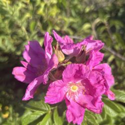
Giant's Stairs Trail - Wild roses on the trail.

Giant's Stairs Trail

4.7(35 reviews)
47.2 km

This is one of my favorite places in Maine. I happened upon here randomly and was so delighted to…read morehave found my way to these islands. I think the word is "quaint", which best describes this whole area. It's not as popular as other places on the coast and even though it's not a secret, I haven't ever seen it get "busy". There's so much about the area that's beautiful but this is the place I take everyone who comes to visit me. It's the same kind of geological formations as you see in the two light area of Cape Elizabeth, but way less people and the rocks are all on their side instead of laying flat. The Giant Stairs are beautiful regardless of the weather, but coming here on a nice day when the sea sparkles is really nothing short of magical. I love the way it's "set up" because you keep the mystery hidden behind the cottages/houses and you park where the designated spots are, you walk backwards towards the main road, turn down to the entrance of the trail, and the whole thing is this dramatic appearance of a beautiful Maine coastline. It's not a crazy hike so you don't need to worry about people's skill, and everyone loves the view. I love the little shop right there as well. It's got all these cute kitschy Maine things and it's not overpriced for a "touristy" place. I hope this review doesn't end up ruining a perfectly wonderful thing, so try not to put this on your "top 10 things to do in Maine" listicles. But do go, the drive alone is worth it.

Very underrated from the information we found online but we were in the area so decided to go. I'm…read moreso glad we did !! Beautiful walkway along the ocean, cliff top area. It's not a very long walk but we had kids with us and very easy for little legs.

Photos
Giant's Stairs Trail - View from the trail

View from the trail

Giant's Stairs Trail - Some of the flowers along the trail. Beautiful roses.

Some of the flowers along the trail. Beautiful roses.

Giant's Stairs Trail

See all

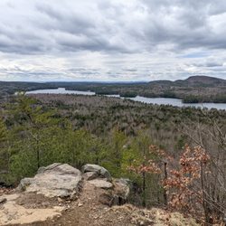
Bald Knob - View of Lake Winni from near the top!

Bald Knob

4.3(4 reviews)
72.0 km

Steep. ?Private. Rocky. Good exercise. Great views of Lake Winnipesaukee. More to come . . .read more

Also known as Bald Peak (and lending it's name to the nearby Bald Peak Colony Club) this little…read moremountain is a decent size to get in a half-day hike, depending on your ability, a picnic lunch, and some incredible views. It's a popular trek. There are also several hiking paths nearby which are maintained by the Castle Preservation Society, as well as Castle in the Clouds itself, and hiking trails at Mt. Shaw (I believe) nearby. I recommend sticking to the path along the eastern side (right-hand side as you approach the base) of the mountain. There are several very interesting places to explore just off the path, however they can get steep. The path travels up around the back of the rocky area. As you approach the outcropping, you will have an impressive view of Lake Winnipesaukee. When I was last there, there was a picnic table and camp fire as well. There are horse trails from the summit that travel west to Castle in the Clouds, but it's a long haul to get over there! (These trails are free and open to the public, but the Castle charges admission.) I believe I read that there are some geocaching spots up there as well. Parking is along the road right at the Tuftonboro/Moultonboro border by the town sign honoring local Olympians Hannah Hardaway and Wolfgang Moser.

Photos
Bald Knob - Cute little Eastern ribbon snake sunning itself.

Cute little Eastern ribbon snake sunning itself.

Bald Knob - Solomon's Plume

Solomon's Plume

Bald Knob - Sign at the trailhead.

See all

Sign at the trailhead.

Bri-Mar Trail - hiking - Updated November 2026

Loading...
Loading...
Loading...