Jackrabbit Mountain Bike Trails Photos


 lake loop - Hiking Near Me - Hayesville, North Carolina")
You might also consider
More like Jackrabbit Mountain Bike Trails
Recommended Reviews - Jackrabbit Mountain Bike Trails
Start your review...

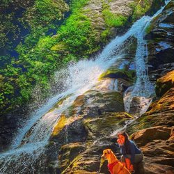
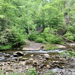
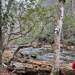
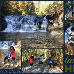
Reviews With Photos

Beautiful trails and nice that they have a tool and air station for the bikes. I'm a Florida flatlander with a desk job so even the climbs here were a bit much for me in the white trail. I'm pretty comfy doing around 13 miles on flat terrains but I turned back on this ride. Hopefully I'll be in better shape for this another time!!? My husband loved it though


Hands down, the best trail ever! The loops all lollipop off a central loop. Good flowy singletrack, with some gentle climbs, fast downhills and cowbells. Yes, cowbells! Sneaking Creek trail has a covered bridge with a chance to ring the bell as you go by and a few more along the way. Check out SABA beach too for nice views of Lake Chatuge. New signage at the trail to guide you, as well as a new sign out front. Port-a-potty, picnic tables & bbq grills make it family friendly. Hikers are also welcome here.
 lake loop")
Superbly maintained, marked and designed mountain biking trails. I was incredibly impressed with the quality of signage and thorough TLC maintenance that must be involved in keeping these trails in shape. The layout is perfect for groups of varying skill levels or riders who want to vary their mileage without being monotonous. The gold trail and the last bit of the central loop trail were by fair my faves but I'm sure personal preferences will differ for everyone. A great location to spend an hour or an entire day.

7 months ago


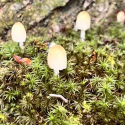
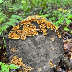
There are 14 miles of trails, "fast and flowing, with rolling dips & berms, and only a few technical areas. They take you along the shores & hills beside Lake Chatuge." The main central loop is considered "easy and nearly level." All lies and I was on foot! After stumbling over tree roots and trudging through dead leaves & mud I soon realized, I don't like hiking. I like nature walks! Pretty, paved, moderate, you get my drift. That being said, Jackrabbit Mountain Trails are lovely! Parking is free. There are pit toilets, maps & information, air pumps & tools. There's a hose to rinse off and a grassy field with picnic tables & grills by the lake. The trail was created for bikers in so I walked alone as they politely zoomed past. The trails are well-worn so you won't get lost and there are colored stickers on the trees every mile or so. There are no benches to stop and rest. But there are educational signs on trees and plants. I met the sassy 'Sassafrass,' the 'Oriental Bittersweet Plant' (which really needs to stop threatening the others), and the beautiful, slow growing, long lived 'White Oak' which can reach 135 feet! Because it was Fall, I couldn't take my eyes off of the trees. I've never seen such brilliant colors! The beautiful golden yellows, bronze and burnt orange leaves were really breathtaking. Then I saw the peaceful, still waters of Lake Chatuge and fell in love! Of course a loud boat sped past and messed up all that tranquility but it was still worth it. I'll return and I'll bring my bike! read more


Camped here this past weekend with family. 7 families total. 34 people total including adults and children. 5/6 hours drive from Goose Creek, SC. While the camp ground is clean and beautifully sits on a hill overlooking the beautiful man made lake with the mountains as a backdrop, it lacks activities and trail options to hike. I believe there was about 4 different trails from easy to moderate hikes but none of those lead to a beautiful waterfall or view of the city/park. The swim area was a nice touch with soft red sand that can easily be mistaken for red clay dirt. The kids enjoyed the swim and it felt great after the 4 mile hike we did together as a group. No electricity, no water -- Restrooms were clean and showers were clean which was a huge plus! It stormed and rained parts of the days during our trip. Saturday's afternoon storm had such strong winds and heavy rain that my tent became a swamp hahah and another family members tent was destroyed. Thank you Mother Nature! All in all we had a fantastic time bonding over the weekend. I would recommend this place if you're wanting to just be lazy, do a little fishing, swimming and sleeping. read more


8 years ago
Beautiful trails and nice that they have a tool and air station for the bikes. I'm a Florida flatlander with a desk job so even the climbs here were a bit much for me in the white trail. I'm pretty comfy doing around 13 miles on flat terrains but I turned back on this ride. Hopefully I'll be in better shape for this another time!!? My husband loved it though read more


5 years ago
7 years ago
16 years ago
Hands down, the best trail ever! The loops all lollipop off a central loop. Good flowy singletrack, with some gentle climbs, fast downhills and cowbells. Yes, cowbells! Sneaking Creek trail has a covered bridge with a chance to ring the bell as you go by and a few more along the way. Check out SABA beach too for nice views of Lake Chatuge. New signage at the trail to guide you, as well as a new sign out front. Port-a-potty, picnic tables & bbq grills make it family friendly. Hikers are also welcome here. read more


4 years ago
11 years ago
Superbly maintained, marked and designed mountain biking trails. I was incredibly impressed with the quality of signage and thorough TLC maintenance that must be involved in keeping these trails in shape. The layout is perfect for groups of varying skill levels or riders who want to vary their mileage without being monotonous. The gold trail and the last bit of the central loop trail were by fair my faves but I'm sure personal preferences will differ for everyone. A great location to spend an hour or an entire day. read more
15 years ago
One of my most favorite places to ride my mountain bike. Purpose made trails following the IMBA guidelines, non-technical, flowy, fun singletrack. The views are awesome, and SABA beach is a great place to take a break and enjoy a snack. read more


12 years ago
14 years ago
More info about Jackrabbit Mountain Bike Trails
Philadelphia Rd
Hayesville, NC 28904
Directions
Hours
Outdoor Amenities
Ask the Community - Jackrabbit Mountain Bike Trails
Review Highlights - Jackrabbit Mountain Bike Trails


Jackrabbit Mountain Bike Trails - hiking - Updated May 2026
Best of Hayesville
People found Jackrabbit Mountain Bike Trails by searching for…
Hiking Trails With Waterfalls in Hayesville, NC
Mountain Biking in Hayesville, NC
Things to Do in Hayesville, NC
Beautiful Views in Hayesville, NC
Lookout Points in Hayesville, NC
Scenic Overlook in Hayesville, NC
Fishing With Kids in Hayesville, NC
Waterfalls and Swimming Holes in Hayesville, NC
Parks for Kids in Hayesville, NC
Picnic Spots in Hayesville, NC
Kids Friendly Beaches in Hayesville, NC
Hiking With Kids in Hayesville, NC
Walking Trails in Hayesville, NC
Trending Searches in Hayesville, NC
Botanical Gardens near Jackrabbit Mountain Bike Trails
Bounce House Rentals near Jackrabbit Mountain Bike Trails
Campgrounds near Jackrabbit Mountain Bike Trails
Cheap Plants near Jackrabbit Mountain Bike Trails
Cliff Jumping near Jackrabbit Mountain Bike Trails
Floral Designers near Jackrabbit Mountain Bike Trails
Flower Shop near Jackrabbit Mountain Bike Trails
Hair near Jackrabbit Mountain Bike Trails
Mountain Bike Trails near Jackrabbit Mountain Bike Trails
Nurseries & Gardening near Jackrabbit Mountain Bike Trails
Outdoor Furniture Stores near Jackrabbit Mountain Bike Trails
Parks near Jackrabbit Mountain Bike Trails
Party Equipment Rentals near Jackrabbit Mountain Bike Trails
Pedicure near Jackrabbit Mountain Bike Trails
Photo Spots near Jackrabbit Mountain Bike Trails
Pick Your Own Farms near Jackrabbit Mountain Bike Trails
Picnic Areas near Jackrabbit Mountain Bike Trails
Places To Take Pictures near Jackrabbit Mountain Bike Trails
Rock Quarry near Jackrabbit Mountain Bike Trails
Running Trails near Jackrabbit Mountain Bike Trails
Rv Rental near Jackrabbit Mountain Bike Trails
Strawberry Picking near Jackrabbit Mountain Bike Trails
Swimming Holes near Jackrabbit Mountain Bike Trails
Table And Chair Rentals near Jackrabbit Mountain Bike Trails
Browse Articles
Browse Nearby
BEST of Hayesville, North Carolina Parks near Jackrabbit Mountain Bike Trails
BEST of Hayesville, North Carolina Scenic View near Jackrabbit Mountain Bike Trails
BEST of Hayesville, North Carolina Restaurants near Jackrabbit Mountain Bike Trails
BEST of Hayesville, North Carolina Things to Do near Jackrabbit Mountain Bike Trails
BEST of Hayesville, North Carolina Coffee near Jackrabbit Mountain Bike Trails
BEST of Hayesville, North Carolina Hotels near Jackrabbit Mountain Bike Trails
BEST of Hayesville, North Carolina Breakfast near Jackrabbit Mountain Bike Trails
BEST of Hayesville, North Carolina Campgrounds near Jackrabbit Mountain Bike Trails
BEST of Hayesville, North Carolina Glamping near Jackrabbit Mountain Bike Trails
Browse Brands
Related Searches in Hayesville, NC
Affordable Kayak Rental Services in Hayesville, North Carolina
Best Fishing Locations and Guides in Hayesville, North Carolina
Best Places for Horseback Riding in Hayesville, North Carolina
Best Spots for Star Gazing in Hayesville, North Carolina
Best Waterfalls and Swimming Holes in Hayesville, North Carolina
Check Out Off Road Trails in Hayesville, North Carolina
Discover Dog Friendly Trails to Explore in Hayesville, North Carolina
Discover Popular Photo Spots in Hayesville, North Carolina
Discover Scenic Mountain Bike Trails Near Hayesville, North Carolina
Discover a Hiking Trail in Hayesville, North Carolina
Discover the Best Night Hike Trails in Hayesville, North Carolina
Discover the Best Running Track in Hayesville, North Carolina
Dog-Friendly Hikes With Dogs in Hayesville, North Carolina
Enjoy Camping Adventures Around Hayesville, North Carolina
Enjoy Exciting Mountain Biking Adventures in Hayesville, North Carolina
Enjoy River Tubing Adventures in Hayesville, North Carolina
Enjoy Tent Camping Spots Around Hayesville, North Carolina
Enjoy the Best Tubing Experiences in Hayesville, North Carolina
Enjoy the Best Walking Trails in Hayesville, North Carolina
Exciting Cliff Jumping Spots in Hayesville, North Carolina
Explore Beautiful Parks and Green Spaces in Hayesville, North Carolina
Explore Bike Rentals Throughout Hayesville, North Carolina
Explore Easy Hikes Perfect for All in Hayesville, North Carolina
Explore Fun Activities to Do in Hayesville, North Carolina
Explore Popular Campgrounds Near Hayesville, North Carolina
Explore Popular Scenic Overlook Points in Hayesville, North Carolina
Explore Scenic Lakes to Visit in Hayesville, North Carolina
Explore Secret Spots Worth Visiting in Hayesville, North Carolina
Explore the Best Boating Spots in Hayesville, North Carolina
Explore the Best Swimming Holes Around Hayesville, North Carolina
Family Friendly Hiking With Kids in Hayesville, North Carolina
Find Beautiful Views in Hayesville, North Carolina
Find Cozy Camping Cabins in Hayesville, North Carolina
Find Fun Kids Activities Outdoor in Hayesville, North Carolina
Find Popular Ziplining Spots Around Hayesville, North Carolina
Find Top Dog Swimming Spots in Hayesville, North Carolina
Find the Best Playgrounds to Visit in Hayesville, North Carolina
Find the Best Scenic View Locations in Hayesville, North Carolina
Hiking Trails With Waterfalls in Hayesville, North Carolina
Off Leash Dog Hiking Trails in Hayesville, North Carolina
Perfect Spots to Watch Sunset in Hayesville, North Carolina
Plan a Scenic Drive Route Near Hayesville, North Carolina
Popular Fishing Spots to Explore in Hayesville, North Carolina
Popular Kids Activities in Hayesville, North Carolina
Popular Picnic Spots to Visit in Hayesville, North Carolina
Top Climbing Spots and Gyms in Hayesville, North Carolina
Top Paddleboarding Activities in Hayesville, North Carolina
Top Running Trails to Explore in Hayesville, North Carolina
Top Swimming Spots and Pools in Hayesville, North Carolina
Top-Rated Boat Rental Services in Hayesville, North Carolina
People who viewed Jackrabbit Mountain Bike Trails also viewed
Black Rock Mountain State Park
57 reviews
Fires Creek Falls
5 reviews
Little Tennesee River Greenway
2 reviews
Lake Chatuge
9 reviews
Upper Moccasin Creek Falls
2 reviews
Morganton Point Recreation Area
11 reviews
Towns County Beach & Playground
6 reviews
Mountain View Campground
9 reviews
Piney Knob Trails
3 reviews
Brasstown Bald Tower
3 reviews