Indian Vista Photos


You might also consider
More like Indian Vista
Recommended Reviews - Indian Vista
Start your review...

29 days ago
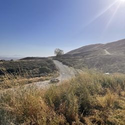
Very Short hike - a matter of feet. The end is a vista view of lake perris. Worth the stop but no restrooms and trail is gravely. read more


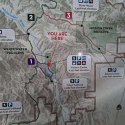
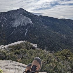
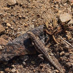
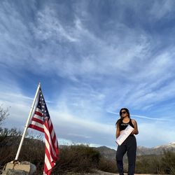
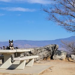
What a beautiful view! After driving on the road for a bit we needed to stop and stretch our legs. We are so glad we stopped here. This roadside stop has a small parking lot and a wheelchair accessible sidewalk. At the end of the sidewalk us a large road and a slightly landscaped viewing area. A great place to grab some fresh mountain air, then get back on the road to Palm Springs. Be warned, there was a rattlesnake alert posted in the parking lot. Stay alert! read more
More info about Indian Vista
33 Banning-Idyllwild Panoramic Hwy
Banning, CA 92220
Directions
Hours
Outdoor Amenities
You might also consider


Indian Vista - hiking - Updated May 2026
Best of Banning
People found Indian Vista by searching for…
Trending Searches in Banning, CA
Botanical Gardens near Indian Vista
Bounce House Rentals near Indian Vista
Cheap Plants near Indian Vista
Cherry Picking near Indian Vista
Cliff Jumping near Indian Vista
Flower Fields near Indian Vista
Garage Sales near Indian Vista
Garden Center near Indian Vista
Lakes & Ponds near Indian Vista
Nurseries & Gardening near Indian Vista
Outdoor Activities near Indian Vista
Outdoor Furniture Stores near Indian Vista
Party Equipment Rentals near Indian Vista
Picnic Areas near Indian Vista
Places To Take Pictures near Indian Vista
Running Trails near Indian Vista
Scenic Drive near Indian Vista
Sunrise View near Indian Vista
Swimming Holes near Indian Vista
Table And Chair Rentals near Indian Vista
Browse Articles
Browse Nearby
Browse Brands
Related Searches in Banning, CA
Best Fishing Locations and Guides in Banning, California
Best Nature Trails for Hiking in Banning, California
Best Places for Horseback Riding in Banning, California
Best Sledding Spots and Fun in Banning, California
Best Waterfalls and Swimming Holes in Banning, California
Check Out Off Road Trails in Banning, California
Discover Dog Friendly Trails to Explore in Banning, California
Discover Kid Friendly Hiking Trails in Banning, California
Discover Scenic Mountain Bike Trails Near Banning, California
Discover Scenic Walking Paths in Banning, California
Discover Scenic Waterfall Spots in Banning, California
Discover Walking Parks in Banning, California Near You
Discover a Hiking Trail in Banning, California
Discover the Best Night Hike Trails in Banning, California
Discover the Breathtaking Waterfall Trail in Banning, California
Dog-Friendly Hikes With Dogs in Banning, California
Enjoy Camping Adventures Around Banning, California
Enjoy Exciting Mountain Biking Adventures in Banning, California
Enjoy Kayaking Adventures in Banning, California
Enjoy Tent Camping Spots Around Banning, California
Enjoy a Beautiful Waterfall Hike in Banning, California
Enjoy a Scenic Walk in Banning, California
Enjoy the Best Picnic Spots and Ideas in Banning, California
Enjoy the Best Walking Trails in Banning, California
Exciting Cliff Jumping Spots in Banning, California
Explore Beautiful Parks and Green Spaces in Banning, California
Explore Easy Hikes Perfect for All in Banning, California
Explore Fun Activities to Do in Banning, California
Explore Popular Campgrounds Near Banning, California
Explore the Best Boating Spots in Banning, California
Explore the Best Swimming Holes Around Banning, California
Explore the Best Trail Options in Banning, California
Family Friendly Hiking With Kids in Banning, California
Find Popular Ziplining Spots Around Banning, California
Find the Best Parks for Picnics in Banning, California
Find the Best Scenic View Locations in Banning, California
Hiking Trails With Waterfalls in Banning, California
Off Leash Dog Hiking Trails in Banning, California
Plan Nature Center Visits in Banning, California
Plan a Scenic Drive Route Near Banning, California
Popular Fishing Spots to Explore in Banning, California
Popular Outdoor Activities to Try in Banning, California
Popular Picnic Spots to Visit in Banning, California
Safe River Swimming Areas in Banning, California
Safe and Fun Parks for Kids in Banning, California
Top Climbing Spots and Gyms in Banning, California
Top Running Trails to Explore in Banning, California
Top Swimming Lakes to Enjoy in Banning, California
People who viewed Indian Vista also viewed
Indian Point Scenic Stop
3 reviews
South Ridge Trail
5 reviews
Deer Springs Trail To Suicide Rock
26 reviews
Ernie Maxwell Scenic Trail
28 reviews
San Jacinto Via Marion Mountain
21 reviews
Tahquitz Peak via Devil's Slide Trail
22 reviews
Simpson Park
29 reviews
Clayton A Record Jr Viewpoint
1 review
Momyer Creek Trail to San Bernardino East Peak
6 reviews
San Gorgonio via Vivian Creek
54 reviews