
Tahquitz Peak via Devil's Slide Trail Photos


You might also consider


More like Tahquitz Peak via Devil's Slide Trail
Recommended Reviews - Tahquitz Peak via Devil's Slide Trail
Start your review...


Reviews With Photos


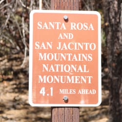
Came up to the junction on a Friday afternoon and it was approximately a 6 mile hike roundtrip. There were patches of ice/snow as we had gone in November. Wear sturdy boots and if you have trekking poles, those would be helpful. There's parking available at the trailhead but note you'll need an adventure pass. It's uphill going there and then downhill all the way down, so prepare for a steady climb. There was a restroom available in the parking lot. There's a fair amount of shade but since it's in the mountains, I would still wear shades and a hat. The junction itself is just a sign and an intersection of trails (not a monument like the sign at the beginning of the trail). Layer up and also wear sunscreen. Overall, it's a really pretty hike at 8,000 ft elevation. I really enjoyed the hike.


This hike is about a 8 mile round trip that took 4.5 hours to complete. A free permit is required at the local ranger station outside the front door (25905 Highway 243, Idyllwild, CA 92549). Steady inclines all the way to the fire lookout tower at the peak along with many nice views! Ton of annoying flies though so make sure you carry a bug spray. I would say this hike was roughly 60-70% shaded. Volunteer at the tower was super friendly as well! Short video of the hike for those interested! https://www.youtube.com/watch?v=VrIkF_0-aRs



Beautiful hike that ends with a rewarding view at the top. Budget 3-4 hours to hike. First 2.5 miles is along the mountainside, nice and shady. Not steep, but not flat either. Next 2 miles after making a hard right at Saddle Junction is along the spine of the mountain. This part is fairly flat, but also more exposed to the sun. The last 0.5 miles up to the peak features a little more steep areas. Make sure you grab a wilderness permit from the ranger's station before heading up!


Came here on 2/28. We were in Idyllwild for a little R&R and really didn't pack for a hike. But a few of us was getting "cabin fever", so we decided to get some fresh air... This was an accidental find. Planned to hike Ernie Maxwell trail, however it was really cold, we were not prepared for a cold hike. We decided to explore the mountain side and ended up at this trail. Glad we did! Yes, you need a permit to hike this trail. Easy to obtain one. Get there early, you'll be in and out before it gets packed. Parking is limited and can be challenging. We parked near Ernie Maxwell (lower level). Oh. My. Goodness. This BEAUTIFUL out & back trail, is approx. 8+ miles. There was snow at the base of the trail head, but it wasn't cold. There was enough sun peaking through the trees, so temp wise, it was a pleasant hike. We were about a half a mile from Saddle Junction and decided to turn back around. Didn't finish due to the lack of gear (enough water, poles, proper shoes/boots, food, meds for altitude sickness), but it's on my "conquer 2021" list . This is a gorgeous hike, with picturesque views all the way around. If you're prone to elevation/altitude sickness, make sure you take medication with you or pace yourself. You'll gain an additional 2+k in elevation. Get up and get out.


Trust the reviews - it's an excellent hike. Depending on your fitness level it might be a bit challenging, but it is absolutely worth it. It does require permit in the summertime on weekends. Get it at the ranger station - get there before opening at 8am just to be safe. They give out only thirty permits a day (up to 12 people per permit). 2018 Cranston fire burned a lot of the mountain (it came up right to the fire lookout), but this trail mostly avoids it.


My 500th review will be for one of the most challenging hikes I've ever done! Challenging but extremely rewarding! According to AllTrails, this hike is considered Moderate. However, I'd say it's moderate bordering strenuous. I am a moderate hiker and yeah, your heart will be pumping. Luckily, 90% of the trail is shaded! And the temperature through the mountain this past weekend was so lovely, it was perfect. It's about a 2.3k foot elevation gain and about 8.1 miles roundtrip. We started the hike around 9:40 AM (a little late), and there was light traffic. We reached the peak in about 2.5 hours, and it took about 1.5 to trek back down. The way up is amazing, such great views all the way and the trail isn't just plain dirt. There's steep areas, rocky steps just to change it up a little from the boring dirt trail. Stopping at Saddle Junction, there's quite a few paths, including to the San Jacinto peak. Everyone is so friendly and helpful! You can take a well-deserved break here, chat with some fellow hikers and eat some lunch. I really enjoyed this hike. The last .2 miles, where you can just FEEL the peak, is the most steep. Once we got to the top, we saw the ranger station (which was closed), took a few photos and settled in for a nice packed lunch! Once we left, the weather was noticeably warmer. And the worst part was how much shade disappeared and seeing people just starting the trail at 1PM. I suggest starting earlier in the morning, having lunch at the top and making your way back down before the day gets too warm for comfort. I definitely recommend this hike! I feel accomplished having done this. Next time I'm in Idyllwild, I would love to tackle San Jacinto! :) Thanks, Nature. Note: don't forget your day-use wilderness permit and Adventure Pass! On the way down, rangers were checking hikers for permits.


Awesome hike. Trail was smooth for the most part. Not too many steep areas or switch backs. Close to town for a nice good beer after. #Clydeafornia


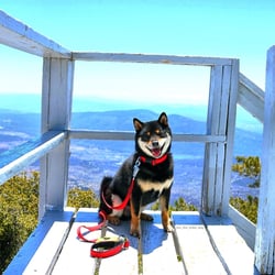
This hike is great. 2.5 miles up to saddle junction. You can continue on to many different trails- I.e. Taquitz Peak is ~2 miles further. It's a pretty ridge trail, with views the whole way up. It is half shade, half sun. 1,600 ft elevation gain up to to saddle junction. Pretty tough, but worth it. You will need an adventure pass to park at Humber park. You can purchase at the ranger station. You also need to get a wilderness permit which is free, can also get at the ranger station. They do max out on passes, so it is recommended to start early in peak season. Park ranger usually checks at saddle junction. Dogs are allowed.


The Idyllwild Mtns are truly a gem and Mecca to day hikers and backpacking. Devils Slide to Tahquitz Peak is an awesome hike for novice hikers, absolutely beautiful climb up Tahquitz Peak Trail. I totally recommend going down South Ridge down the fire road and going back through Ernie Maxwell Trail back to Humbar Park. This makes a novice hike into an advanced hike. Once you master this, take Devils Slide to San Jacinto Peak... 16.3 miles round trip. Get Woodsey!


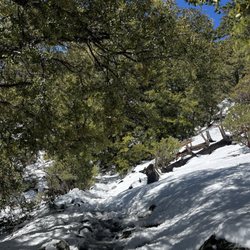
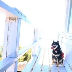
Great hike, Pretty views. Be careful if it's snowing, be prepared. It's called a slide for a reason. We around 8am on a Saturday in March. It began to warm up, but still had a cool wind. There was snow, then ice on one of the switchbacks, it was steep..my dog almost slide down. We turned around as we figured the ice would get worse further up the mountain. :(


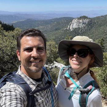
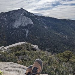
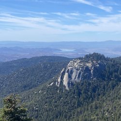
Oh hell yeah, this is a monster day hike! Did the shorter version of this trail yesterday and my Garmin measured 10 miles with 2375' elevation gain. The end of the trail is close to 9000 foot elevation with incredible views of the surrounding mountains and there's an old fire tower at the top. I'd say the first 2 1/2 miles are the most physically challenging. It's a pretty steep grade and it just grinds on you. Once you get past that it's much easier. We got started a little bit later in the day then we initially planned so we did not do the version of this trail that included the Caramba Trail. We've done it before and the Garmin clocked 13 miles. For the first 2 miles there were a lot of bugs. I was wishing I had a little hat. Two of them got up my nose dang it. After that, no more bugs until you got to the top and then there are some bees by the fire tower but not too crazy. You do have to get a permit, you can get it from the Ranger station in town. But if you get it in the most busy summer months before Labor Day, you actually have to fax in a permit request ahead of time and they only allow 30 permits per day. You also have to either have an adventure pass for parking or you can have the America the beautiful pass and put it on your dashboard. There are bathrooms available at the trailhead. No water source along the trail. I drank almost my whole reservoir which is 2.5 L. Perfect way to spend my 7 year Anniversary with my love read more

8 months ago
First of all, nowhere along this hike were there any Takis. Not even a suspiciously rolled tortilla chip. I packed light thinking, "Surely a peak with this name will provide." It did not. Just switchbacks. Endless switchbacks. Furthermore the snack shack at the top was closed. If you're looking for Takis, I would strongly recommend sourcing them elsewhere because this peak will not be assisting. read more


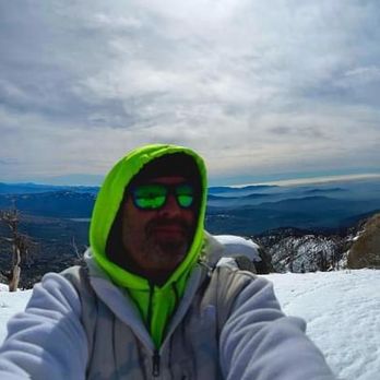
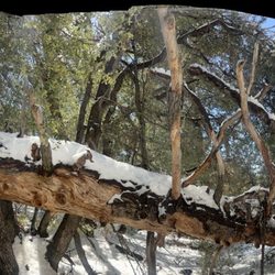
Despite the season, this is a good trail for hiking. This is a review for our snow hike; the weather was perfect for the hike, but it was definitely an exhausting, slower moving hike due to all the post-holing for the entirety of the journey. After some online reviews and some chatter in the lot, we decided we didn't need the snowshoes and boy-o-boy was that an ignorant decision! We managed with the crampons, but there was no hard pack even at the peak, very fresh powder and the snowshoes would've been the correct tool! At the summit, we ended up following a set of feet print that went away from the trail, but we thought maybe since it was winter that it was a better approach, but it just ended up on another beautiful peak, and we were down a very rocky Ridgeline from the actual fire lookout and we'd have to head down and back around to reach it, but we were exhausted and had gotten a late start on the day, so the sun was already going down and we decided to just hump it back down and call it a day. So many people on the lower trail late day without even crampons and looking like they were walking in the city park in spring; be better prepared than they were! read more




1 year ago
Two night trip in February 1971 (up the tram) hiked in snow to base camp, no fires allowed, which was a cold, long night, then climbed to the peak (2.5 hours up) and 30 minutes down to campsite for another miserable night our second day! What an experience, and we repeated it the next year! read more


4 years ago
Came up to the junction on a Friday afternoon and it was approximately a 6 mile hike roundtrip. There were patches of ice/snow as we had gone in November. Wear sturdy boots and if you have trekking poles, those would be helpful. There's parking available at the trailhead but note you'll need an adventure pass. It's uphill going there and then downhill all the way down, so prepare for a steady climb. There was a restroom available in the parking lot. There's a fair amount of shade but since it's in the mountains, I would still wear shades and a hat. The junction itself is just a sign and an intersection of trails (not a monument like the sign at the beginning of the trail). Layer up and also wear sunscreen. Overall, it's a really pretty hike at 8,000 ft elevation. I really enjoyed the hike. read more


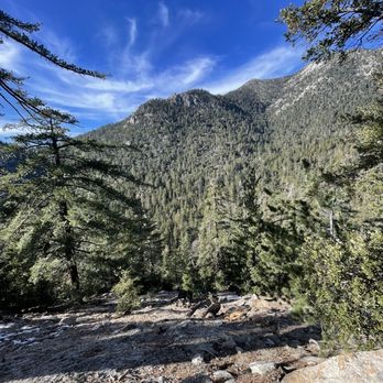
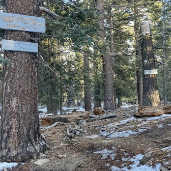


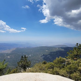
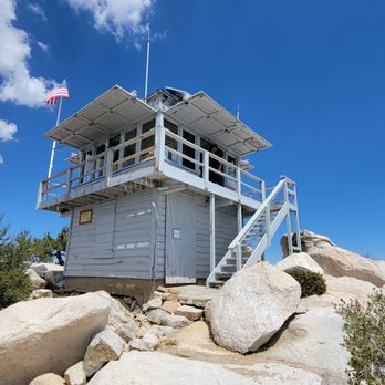
This hike is about a 8 mile round trip that took 4.5 hours to complete. A free permit is required at the local ranger station outside the front door (25905 Highway 243, Idyllwild, CA 92549). Steady inclines all the way to the fire lookout tower at the peak along with many nice views! Ton of annoying flies though so make sure you carry a bug spray. I would say this hike was roughly 60-70% shaded. Volunteer at the tower was super friendly as well! Short video of the hike for those interested! https://www.youtube.com/watch?v=VrIkF_0-aRs read more





1 year ago

3 years ago


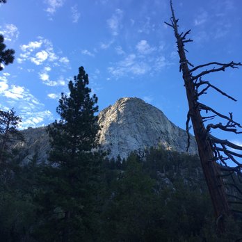
Beautiful hike that ends with a rewarding view at the top. Budget 3-4 hours to hike. First 2.5 miles is along the mountainside, nice and shady. Not steep, but not flat either. Next 2 miles after making a hard right at Saddle Junction is along the spine of the mountain. This part is fairly flat, but also more exposed to the sun. The last 0.5 miles up to the peak features a little more steep areas. Make sure you grab a wilderness permit from the ranger's station before heading up! read more

6 years ago
Came here on 2/28. We were in Idyllwild for a little R&R and really didn't pack for a hike. But a few of us was getting "cabin fever", so we decided to get some fresh air... This was an accidental find. Planned to hike Ernie Maxwell trail, however it was really cold, we were not prepared for a cold hike. We decided to explore the mountain side and ended up at this trail. Glad we did! Yes, you need a permit to hike this trail. Easy to obtain one. Get there early, you'll be in and out before it gets packed. Parking is limited and can be challenging. We parked near Ernie Maxwell (lower level). Oh. My. Goodness. This BEAUTIFUL out & back trail, is approx. 8+ miles. There was snow at the base of the trail head, but it wasn't cold. There was enough sun peaking through the trees, so temp wise, it was a pleasant hike. We were about a half a mile from Saddle Junction and decided to turn back around. Didn't finish due to the lack of gear (enough water, poles, proper shoes/boots, food, meds for altitude sickness), but it's on my "conquer 2021" list . This is a gorgeous hike, with picturesque views all the way around. If you're prone to elevation/altitude sickness, make sure you take medication with you or pace yourself. You'll gain an additional 2+k in elevation. Get up and get out. read more


7 years ago

7 years ago
Trust the reviews - it's an excellent hike. Depending on your fitness level it might be a bit challenging, but it is absolutely worth it. It does require permit in the summertime on weekends. Get it at the ranger station - get there before opening at 8am just to be safe. They give out only thirty permits a day (up to 12 people per permit). 2018 Cranston fire burned a lot of the mountain (it came up right to the fire lookout), but this trail mostly avoids it. read more


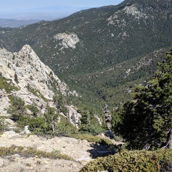

My 500th review will be for one of the most challenging hikes I've ever done! Challenging but extremely rewarding! According to AllTrails, this hike is considered Moderate. However, I'd say it's moderate bordering strenuous. I am a moderate hiker and yeah, your heart will be pumping. Luckily, 90% of the trail is shaded! And the temperature through the mountain this past weekend was so lovely, it was perfect. It's about a 2.3k foot elevation gain and about 8.1 miles roundtrip. We started the hike around 9:40 AM (a little late), and there was light traffic. We reached the peak in about 2.5 hours, and it took about 1.5 to trek back down. The way up is amazing, such great views all the way and the trail isn't just plain dirt. There's steep areas, rocky steps just to change it up a little from the boring dirt trail. Stopping at Saddle Junction, there's quite a few paths, including to the San Jacinto peak. Everyone is so friendly and helpful! You can take a well-deserved break here, chat with some fellow hikers and eat some lunch. I really enjoyed this hike. The last .2 miles, where you can just FEEL the peak, is the most steep. Once we got to the top, we saw the ranger station (which was closed), took a few photos and settled in for a nice packed lunch! Once we left, the weather was noticeably warmer. And the worst part was how much shade disappeared and seeing people just starting the trail at 1PM. I suggest starting earlier in the morning, having lunch at the top and making your way back down before the day gets too warm for comfort. I definitely recommend this hike! I feel accomplished having done this. Next time I'm in Idyllwild, I would love to tackle San Jacinto! :) Thanks, Nature. Note: don't forget your day-use wilderness permit and Adventure Pass! On the way down, rangers were checking hikers for permits. read more




8 years ago
Awesome hike. Trail was smooth for the most part. Not too many steep areas or switch backs. Close to town for a nice good beer after. #Clydeafornia read more

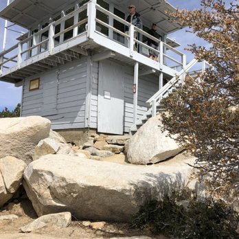


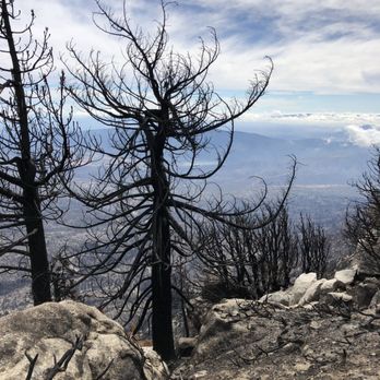


This hike is great. 2.5 miles up to saddle junction. You can continue on to many different trails- I.e. Taquitz Peak is ~2 miles further. It's a pretty ridge trail, with views the whole way up. It is half shade, half sun. 1,600 ft elevation gain up to to saddle junction. Pretty tough, but worth it. You will need an adventure pass to park at Humber park. You can purchase at the ranger station. You also need to get a wilderness permit which is free, can also get at the ranger station. They do max out on passes, so it is recommended to start early in peak season. Park ranger usually checks at saddle junction. Dogs are allowed. read more


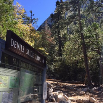


The Idyllwild Mtns are truly a gem and Mecca to day hikers and backpacking. Devils Slide to Tahquitz Peak is an awesome hike for novice hikers, absolutely beautiful climb up Tahquitz Peak Trail. I totally recommend going down South Ridge down the fire road and going back through Ernie Maxwell Trail back to Humbar Park. This makes a novice hike into an advanced hike. Once you master this, take Devils Slide to San Jacinto Peak... 16.3 miles round trip. Get Woodsey! read more


7 years ago

10 years ago
Great hike, Pretty views. Be careful if it's snowing, be prepared. It's called a slide for a reason. We around 8am on a Saturday in March. It began to warm up, but still had a cool wind. There was snow, then ice on one of the switchbacks, it was steep..my dog almost slide down. We turned around as we figured the ice would get worse further up the mountain. :( read more


8 years ago
Excellent hike. An early start is highly recommended even if not terribly warm. The sun will still beat down on you. It's 8.6 miles round trip from the parking at Humber Park to the Fire Tower. It's about 2,400 foot gain and loss. read more
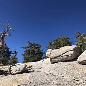
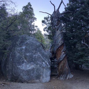
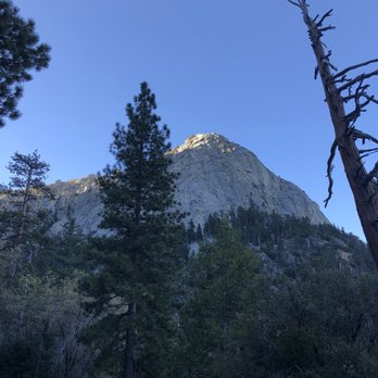


I learned why they call this trail the Devil's Slide. My first time on this trail was in February and it turned into the hike from Hell for me and my dog Sammy. Now, we both love hiking in the snow but on the last 0.7 mile to the Tahquitz Peak it turned into ICE. By the time you realize you should have turned around because you are on a steep icy slope looking down a long slide to the edge of the mountain... it's too late, you're doomed. Luckily, I had time to grab Sammy's collar before we both fell and slid down that icy slope about 12 feet. I was also very lucky that I didn't let go of Sammy's collar and that my micro spikes finally dug an edge into the ice as we stopped about 50 feet short of going over the edge of the mountain at 8,000 feet. It took us about 45 minutes to get off that section of ice, which seemed like an eternity. The whole time I was praying I wouldn't lose my precious Sammy! As we both laid flat on the ice, we slowly inched our way back up to the nearest tree, then to the next tree off to our side. We finally made it back to the manageable crusty snow, stood up, counted our blessings and headed back down the mountain. It was hard, very hard to give up on our summit goal but I had to get Sammy out of harm's way. I hope I never put her in that situation again. My respect for the mountain challenges has grown. NEVER, underestimate how fast the mountain can take your life... or even worse, the one you love! read more


9 years ago
More info about Tahquitz Peak via Devil's Slide Trail
24559 Fern Valley Rd
Idyllwild-Pine Cove, CA 92549
Directions
Hours
Indoor Amenities
Outdoor Amenities
Ask the Community - Tahquitz Peak via Devil's Slide Trail
Review Highlights - Tahquitz Peak via Devil's Slide Trail
You might also consider
















Why does Yelp recommend reviews?
1 review that is not currently recommended
The reviews below are not factored into the business's overall star rating.

10 years ago


