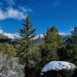
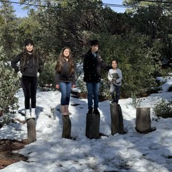
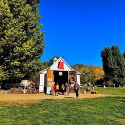
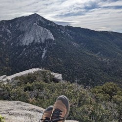
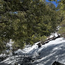
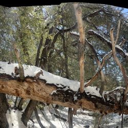
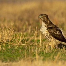
Massacre Canyon Photos


You might also consider
More like Massacre Canyon
Recommended Reviews - Massacre Canyon
Start your review...

Reviews With Photos

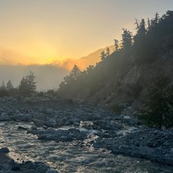
It's better to hike this in the morning if you plan on going the distance. I think it's a lot better than Simpson park. You can go either way with this area. Take the high path which has steep and daunting views of the cliff and the massive view of the canyon. But be cautious where you set foot. This path is not for those that are afraid of heights. Or you can take the low path which requires you to climb up three sectioned cliffs. All easy even to beginners.

6 years ago
Challenging but beautiful! Take the trail along the water, the mountain side one is dangerous. read more


12 years ago
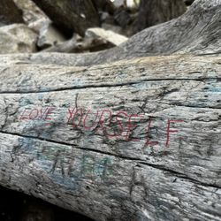
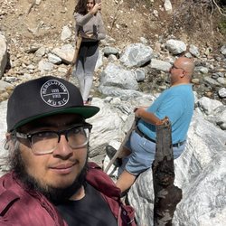
I love this place. Whenever I go to gramma's to do housework for her, I either go here or Idyllwild. I especially love this place on windy and rainy days. The high trail gets pretty sketchy and makes for a good time. For anyone wanting to know where this place gets its name, here goes. The local native tribes had a battle that ended here. One tribe made it to the waterfall and couldn't go anywhere. The other tribe held the high ground and slaughtered them. Google it. Anyway, parking sucks. There are a couple places off the side of the road to park. Other than that, you'll have to take your vehicle down a small hill and park in a dirt lot. Said dirt lot is a place where people like to run OHV's, and their trucks. There are some elevation changes and jumps. This used to be a loop until someone removed the rope from the highest section of the waterfall. The one at the lower half is still there. When the ropes were there, it was about a 5 mile loop.the trail doesn't end at the decent from the ridge to the waterfall. You can take the trail back another 12+ miles. It opens up to some Wild West looking shit, and then a bunch of huge boulders. The high trail is the fun part. It's pretty sketchy without high winds or rain. I prefer to come here with wind, and or rain, for a better time. The width of the high trail is about a foot, to 18 inches. At some spots, it may be unclear If you're not very experienced. At other spots there is no trail, so you'll have to stretch your legs pretty far, or make a short hop. There are plenty of rocks to get a foothold or handhold on, but be careful; some of it fragments quite easily. People also go shooting here, but usually well past the loop, and they don't aim at the trails. This place is not monitored by park rangers, so if you need anything, you'll need to call San Jacinto Sheriffs. Since it's not regulated, you can camp without permits. Have fun, be safe, watch for snakes, weird locals, keep an eye out for falling rocks, and yell down below if you happen to dislodge some rocks from the high trail. This is a good local playground; enjoy it and keep it clean. read more


9 years ago
I've hiked here on and off since the mid nineties, it wasn't lovely then and it's only gotten more decrepit since. There is trash everywhere ( including lots of toilet paper), graffiti, and shotgun shells. The last time I hiked here I slipped down the mountain from the upper trail. The upper trail is quite small and unstable. On our way back we ran into a couple shooting their gun under the bridge, lovely. This place isn't safe, especially for children and pets. There are better and beautiful local places to spend time in nature, go to Simpson Park, hike the trails up to Diamond Valley lake, MountainCenter or Pone Cove. This place is disgusting. read more


13 years ago
It's better to hike this in the morning if you plan on going the distance. I think it's a lot better than Simpson park. You can go either way with this area. Take the high path which has steep and daunting views of the cliff and the massive view of the canyon. But be cautious where you set foot. This path is not for those that are afraid of heights. Or you can take the low path which requires you to climb up three sectioned cliffs. All easy even to beginners. read more


10 years ago
This used to be a really nice and quiet place to hike and enjoy nature. Lately it has been covered in graffiti, trash, broken glass bottles, and bullet shells everywhere. When we were here today some idiots were shooting guns and weren't even using a target - just random shooting and not even far into the canyon... they were completely visible to others and near us as other hikers. We definitely didn't feel safe and cut our hike short. So unfortunate that this once terrific climb is now overloaded with trash and guns. It's a don't go on our list. read more

9 years ago
10 years ago
More info about Massacre Canyon
19070-19562 Gilman Springs Rd
San Jacinto, CA 92583
Directions
Hours
Outdoor Amenities
Ask the Community - Massacre Canyon


Why does Yelp recommend reviews?
1 review that is not currently recommended
The reviews below are not factored into the business's overall star rating.
11 years ago
Massacre Canyon - hiking - Updated August 2026
Best of San Jacinto
People found Massacre Canyon by searching for…
Things to Do in San Jacinto, CA
Hiking Trails With Waterfalls in San Jacinto, CA
Natural Hot Springs in San Jacinto, CA
Off Road Trails in San Jacinto, CA
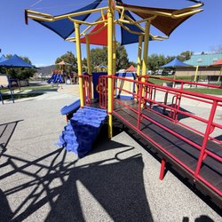
Playgrounds in San Jacinto, CA
Running Trails in San Jacinto, CA
Parks for Kids in San Jacinto, CA
Walking Trails in San Jacinto, CA
Scenic View in San Jacinto, CA
Waterfalls and Swimming Holes in San Jacinto, CA
Lakes & Ponds in San Jacinto, CA
Fun Things to Do With Kids in San Jacinto, CA
Secluded Spots in San Jacinto, CA
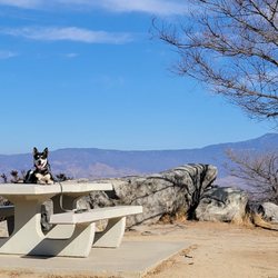
Dog Friendly Hiking Trails in San Jacinto, CA
Hiking With Kids in San Jacinto, CA
Things to Do at Night in San Jacinto, CA
Trending Searches in San Jacinto, CA
Blueberry Picking near Massacre Canyon
Cliff Jumping near Massacre Canyon
Cruising Spots near Massacre Canyon
Day Trips near Massacre Canyon
Dog Friendly Things To Do near Massacre Canyon
Flower Fields near Massacre Canyon
Free Picnic Areas near Massacre Canyon
Kayak Rental near Massacre Canyon
Kids Activities Indoor near Massacre Canyon
Lookout Points near Massacre Canyon
Outdoor Activities near Massacre Canyon
Peach Picking near Massacre Canyon
River Swimming near Massacre Canyon
Rock Quarry near Massacre Canyon
Scenic Drive near Massacre Canyon
Sunrise View near Massacre Canyon
Surf Shop near Massacre Canyon
Swimming Holes near Massacre Canyon
Things To Do On A Rainy Day near Massacre Canyon
Watch Sunset near Massacre Canyon
Browse Articles
Browse Nearby
BEST of San Jacinto, California Restaurants near Massacre Canyon
BEST of San Jacinto, California Coffee near Massacre Canyon
BEST of San Jacinto, California Things to Do near Massacre Canyon
BEST of San Jacinto, California Breakfast near Massacre Canyon
BEST of San Jacinto, California Wineries near Massacre Canyon
Browse Brands
Related Searches in San Jacinto, CA
Best Dog Hiking Trails Around San Jacinto, California
Best Fishing Locations and Guides in San Jacinto, California
Best Nature Trails for Hiking in San Jacinto, California
Best Places for Horseback Riding in San Jacinto, California
Best Sightseeing Experiences Available in San Jacinto, California
Check Out Off Road Trails in San Jacinto, California
Discover Dog Friendly Trails to Explore in San Jacinto, California
Discover Easy Hiking Trails Near San Jacinto, California
Discover Kid Friendly Hiking Trails in San Jacinto, California
Discover Popular Bike Trails in San Jacinto, California
Discover Walking Parks in San Jacinto, California Near You
Discover a Hiking Trail in San Jacinto, California
Discover the Best Night Hike Trails in San Jacinto, California
Dog-Friendly Hikes With Dogs in San Jacinto, California
Enjoy Camping Adventures Around San Jacinto, California
Enjoy Kayaking Adventures in San Jacinto, California
Enjoy Off Leash Dog Hikes in San Jacinto, California
Enjoy Scenic Places to Walk in San Jacinto, California
Enjoy Tent Camping Spots Around San Jacinto, California
Enjoy a Beautiful Waterfall Hike in San Jacinto, California
Enjoy the Best Picnic Spots and Ideas in San Jacinto, California
Enjoy the Best Walking Path in San Jacinto, California
Enjoy the Best Walking Trails in San Jacinto, California
Explore Beautiful Parks and Green Spaces in San Jacinto, California
Explore Easy Hikes Perfect for All in San Jacinto, California
Explore Fun Activities to Do in San Jacinto, California
Explore Popular Campgrounds Near San Jacinto, California
Explore Top Dog Parks in San Jacinto, California Near You
Explore the Best Swimming Holes Around San Jacinto, California
Family Friendly Hiking With Kids in San Jacinto, California
Find Top Dog Friendly Parks to Visit in San Jacinto, California
Find Top-Rated Waterfalls in San Jacinto, California Now
Find the Best Parks for Picnics in San Jacinto, California
Find the Best Playgrounds to Visit in San Jacinto, California
Hiking Trails With Waterfalls in San Jacinto, California
Off Leash Dog Hiking Trails in San Jacinto, California
Popular Outdoor Activities to Try in San Jacinto, California
Popular Picnic Spots to Visit in San Jacinto, California
Popular Waterfall Hiking Trails in San Jacinto, California
Safe River Swimming Areas in San Jacinto, California
Safe and Fun Parks for Kids in San Jacinto, California
Top Hiking Trails to Explore in San Jacinto, California
Top Playgrounds for Kids to Enjoy in San Jacinto, California
Top Running Trails to Explore in San Jacinto, California
Top Swimming Lakes to Enjoy in San Jacinto, California
Top Swimming Spots and Pools in San Jacinto, California
Top-Rated Camping Sites in San Jacinto, California
Walk Dog Friendly Hiking Trails in San Jacinto, California
Walk the Best Paved Walking Trails in San Jacinto, California
People who viewed Massacre Canyon also viewed
Black Mountain Trail
5 reviews
San Gorgonio South Fork Trail
3 reviews
Lake Fulmor
43 reviews
Ernie Maxwell Scenic Trail
30 reviews
Mount San Jacinto State Park
109 reviews
Diamond Valley Lake Marina
66 reviews
Idyllwild Nature Center
72 reviews
Humber Park
51 reviews
San Gorgonio 9 Peaks Challenge
2 reviews
Big Rock
6 reviews