Ice House Canyon Trail Photos


You might also consider


More like Ice House Canyon Trail
Recommended Reviews - Ice House Canyon Trail
Start your review...


Reviews With Photos


One of my favorite hikes ever, lots of shade and water. Tons to look at. Trees a stream old ruins of rock cabins it's a great place to hike for an hour or so the whole thing all day. Parking can get full on busy days. They will ticket if you don't have a pass. Bring lots of water and bring your trash out with you. The hike was very clean last time I went.


Ice House canyon trail is the main trail people start at when hiking up to Ontario or Cucamonga peak. The trail is just off the Baldy round & is pretty close to Mt. Baldy. The parking lot fills up pretty fast so try arriving before 7am, and don't forget your adventure pass for parking. A lot of this trail is shaded by the trees on the mountain, and depending on the time of year some of the creeks will have a good amount of water flowing throughout the trail. The trail does have a decent amount of elevation gain but it's not terrible hard for beginners to get through. You can get a good challenging hike here if you decided to go the 6 plus miles to some of the peaks, or you can wander around and just soak up the nature sites around you.


Rocks everywhere; this probably describes the majority of the trail to Icehouse Saddle. This was also one of the harder trails because it was mostly an uphill climb. We started at 8am and got back at 1pm; it was about a 7 mile round trip. Plenty of parking spots when we arrived. There were a few hikers that passed us on the way up but there were quite a lot of people on the way down. Expect to make multiple stops to the side to let others pass. Trail starts off next to a river that's flowing with water. Eventually, it'll become a gruesome uphill climb up the mountain for miles and the trails become narrow. A lot of experienced hikers seem to be using hiking poles but it's not necessary. There's also an ice patch along the way so pay attention and walk around it. You also want to make sure you have proper clothing. Once you hit the Icehouse Saddle... there was a huge temperature drop and it gets really cold and windy up there.


We usually come to Mt. Baldy for the snow, but this year, we decided to come for fall leaves and hiking. First off, we stopped at the visitor center for the parking pass. ($5 one day parking) Then, about 5 mins drive, you can reach to the parking lot! Limited parking space, we waited around 10 mins to get a spot! About hiking: 2.5 miles round trip to Ice house canyon, there's a beautiful stream there along the hiking trail, perfect for beginners and kids. Advanced hiking: additional 4 miles to Ice horse saddle, comfortable hiking shoes are strongly recommended, it's a bit steep and get prepared to walk over lots of rocks. Scenery is incredible! Some Tips: 1. They have a actual bathroom in the visitor center. It's clean! Or else, there is a public toilet next to the parking lot, close to the entrance of hiking trials. (You can't wash your hands there) 2. There is no WiFi in the mountains, so get yourself prepared for the route first! 3. Bottled water, snacks and a cap are needed! (We had a picnic there on the rock, it was so beautiful!) + Enough water and some food for advanced hiking, the hiking is real! 4. Time your hiking! Give yourself at least one hour beforehand to head back, it gets dark quickly. Mt Baldy is a place worth exploring! Spoil your eyes and enjoy the beauty of the nature, hikers!


Great trail all the way up Mt Baldy Rd. Paved parking lot at the trailhead. Need an adventure pass to park here. Started hike at 6:30am I think you should start earlier in this summer heat. Trail is mostly shaded, lots of loose rocks and gravel so wear good hiking shoes or boots. Lots of people wearing hats with nets around there faces I think I need to invest as by the water there were so many flies and bugs and they fly right to you face, eyes, and ears it's a pain in the butt. This trail is very strenuous as it is all a gradual incline to the top. Only made it to the saddle as I did not come prepared with food and more drinks.


Review from 7/24/20 ~ Such an excellent hiking trail! We did the 5 mile trail and enjoyed it a lot. A couple of things to note if going out to this trail! 1. Parking is pretty limited and very full. We waited about 15 minutes for hikers to come off the trail and leave to take their spot. With that being said hikers tend to cycle in and out so if you wait you will get a spot. I see a lot of people talking about an "adventure pass" on here but when I went the pass was not needed. We did NOT have to pay for parking. We went to the visitors center to buy a pass but the center was closed. Found a ranger and talked to him and he said "don't worry about parking until the visitor center opens up" - Check if the visitors center is open before parking! 2. Bathrooms. There is always a question of "what If I need to use the bathroom?" There are 2 bathrooms in the parking lot. Neither of them have a hand wash station. Both of them are in extremely gross condition, especially if you have to sit to use them. But nonetheless, they are available to use! I would recommend eating lightly that day and drinking minimal fluids before the trail to avoid bathroom use. And bring hand sanitizer & toilet paper if needed. 3. The "walkway" of the trail is pretty tight and leaves minimal space for social distancing from others. While there aren't very many people around you during the hike, when you pass others there is minimal space so please bring a mask! I would say around 80% of people were masked on this hike, or had them under their chin and pulled them up when passing other people. Everyone was being very respectful of moving to the side to mass one another though. The further we got along on the trail, the less people there were Lastly, this trail is very rocky! So I would recommend high socks / leggings to prevent scrapes on the rocks. The trail is mostly inclined as well so you might want to double think hiking with young children. There were children on the trail, but they did not make it very far. This trail is definitely worth a hike, extremely pretty!


Cucamonga Peak at 8859ft offers amazing views and a great workout for many outdoor enthusiasts. Ice House Cayon Trail is about 12 miles roundtrip moderate to difficult trail. It's about a 7 to 8-hour hike including 30 minutes to 1-hour rest at the summit. With some planning, I left the trailhead about 7AM and arrived at the Cucamonga Peak with some parking available on the side of the street. You may need to park further down closer to the Visitor Center to get a Parking Pass. There are 2 restrooms at the trailhead that gets crowded so it's important to go early or before. Following the trail, you'll see streams, rocky trails, and many switchbacks as the trail become steep. Altitude will hit new hikers at around 8,000 ft so it can take a toll on your body if you're not athletic or practice hiking. The "half-way" point called the "Saddle" is located between Timber Mountain and Telegraph Peak and a favorite resting spot for trekkers. *Dogs are permitted to hike but must be on a leash. *Pack plenty of water (1.5+water), food, hiking poles, pills, first aid, sunblock, jacket, etc. *Use good hiking shoes that protect your ankles. I've must have offset my ankle on rocks more than a dozen times.
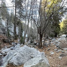

Truly amazing hike! Lots of great scenery and views. Lots of switchbacks as well. I'd say it's moderate-strenuous for beginners but definitely doable if you take your time and take breaks. Worth the view as well getting to the top of the saddle. Strongly recommend going early in the morning to get a parking spot. Round trip it was about 8 miles. Parking does require the adventure pass for which you can buy at REI or Big 5. I took this trail up to the saddle (the main center point where you can branch off to the bigger peaks like Baldy and Ontario) and came back down. If you go during winter, expect snow/ice on the trails so snow cleats / crampons are recommended with your hiking shoes. You will get hot from walking up a steady incline so no need to go all out on winter clothing. I got by with a 32oz hydro flask and 2 water bottles in my pack. And of course snacks for fuel. Dog friendly too!


What is great about this trail is it can be as long as you'd like or as short as you need it to be. Family Version 1mile into this trail gets you to the Chapman Trailhead, which is a great turnaround spot for little legs. The trail runs along the creek, boulders, and shade. It is not very technical and kids can manage on their own. Our littlest has been managing since she was three. There are plenty of little coves where kids can toss rocks, look for bugs, and explore. Took us about 2.5hours, 3 adults and 4 kids (ages 4 to 11) with lots of breaks for exploring. Bring repellant there were tons of bugs! We took the family dog on a leash. Yippee. Adult Version We completed Ontario Peak via Ice House Canyon with a 2am start time as a group of 10 adults. Head lamps were a must and it was great. We lost the trail once, but were able to find our way back. We only really hiked in the dark for 2 hours and there was strength in numbers for sure. The whole thing took us 8.5hours and we only started that early due to the day heat of June (100 degrees plus). We had reached the saddle by sunrise. We saw 1 child hiking that trail he looked to be around 10 years old. 0 After crossing the creek near cucamonga wilderness, there is NO shade. The switch backs are gruesome! Bring water, hats, snacks, and don't forget your forest permit (Big 5). Wonderful local hike.


This is by far my dog's FAVORITE trail. so... I am writing this review for my dog:) who is a Siberian husky and can't stand the heat. If you are looking for a professional report, not look here, I was there 3 times last weekend and I only made about 2 miles far from the parking lot (approx 4 miles total) I would say this place is cool, with nice view and it dose has some steep hills but kind easy. I usually go in the late afternoon, around 3pm so the trail is never over crowded. I guess all professional hikers go in the morning for some reason? I did took my senior friend there who, under my encouragement made it which wasn't seen possible at the beginning. As my trainer said, it is all in your head. My last time there the trail was icy, so I fell hard on the icy ground and couldn't get up without help. sucks. I thought my balance is outstanding. When cold enough..you see tons of snow aside the trail. Approx just 5 mins walk from the parking lot you can have tons of fresh snow for kids to play. I don't get why so many people go further to the bottom of ski lift and play with the snow aside the road...snow there are dirty. bty, I tasted the snow, it did tasted a little weird. My dog drank from the small river and he was fine. So please feel free to drink from the river:)
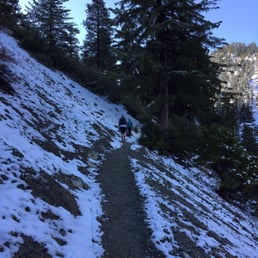

Hiked: Ice House Canyon Trail to Timber Mountain Distance: 9 miles Time: 3 hours to peak, 2 hours to parking lot Date hiked: Sat 5/9/2015 We wanted to do Cucamonga Peak but there was too much snow and we did not have the right gear to trek up there, so we hiked up Timber Mountain instead. Parking: Adventure pass is needed, $5. The trail does have it's own lot, and once it is full there is street parking. Trailhead: there are toilets at the trailhead. Busy trail with good signage. Easy to find the trail head to the right of the parking lot Trail: we weren't expecting so much snow 2 miles in, but I guess there's a reason the trail is called Ice House Canyon. I had hiking boots on, but 2 others in our group had on regular sneakers. Their feet were definitely soaked by the time we got to the peak. 3.6 miles to the Saddle, then another .9 miles to Timber's peak. Gorgeous hike, with beautiful views and lots of trees. I like this hike better than hiking up Mt. Baldy. Tips: keep an eye out on the weather. Weather varies along the trail, from cold, to warm, to windy, so wear layers! Lots of friendly hikers on this trail who are more than helpful with their own knowledge of trail life!


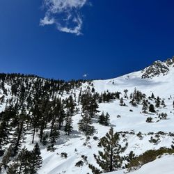
Day after Christmas, a hiking buddy of mine figured the recent rainfall over the weekend was good reason to visit Ice House Canyon. During the winter season, there is the added element of snow and icy roads. For some peace of mind, I brought a pair of crampons and gaiters. The hike started around 7:45am with a cool and crisp breeze. Best to keep cozy and layer up. First three or so miles were pretty similar to what you would expect during the summer, terrain-wise. The trail was fairly clean and clear with a few spots to climb up boulders or take a break near the river. One moment you pass through a cluster of trees surrounded by freshly fallen pinecones, and the next you are met with what seems strikingly like the same scree as the last. At a certain point though, the trail became icy and the air slightly chillier. Upon reaching the end of the saddle, there were a number of folks sipping from their thermos and playing with their pooch. After eating our packed lunch, we ventured further up towards Timber Mountain. It was here where patches of snow gradually became blankets as far as the eyes could see. With that said, crampons were unnecessary. The trail was no longer visible since we could not see the ground, so we kept heading up towards the trees till the sign "TIMBER MTN. ELEV. 8303" was within sight. We were greeted with a stunning view of snow-covered hills. There was also a little box of guestbooks to sign. We decided to take the Chapman trail back down. Whereas Ice House was more spread out, Chapman was more narrowly defined with more ups and downs. A few more areas looked like boulders worth a climb. Most of the manzanitas along the way were healthy and bushy with many of them bearing fruit. If you have the time, Chapman is easily the more scenic of the two and worth the extra mile and a half. In total, we hiked around 11 miles and enjoyed it immensely. read more


Great trail, great work out. This trail is not for beginners. Pack enough water! 2,700 ft elevation climb to saddle. Very steep so get ready for that lactic acid build up in the quads. Took me 3.5 hours to get up to saddle and 1.5 hours to get down. Make sure you fill out the free permit form in the brown box at the start of the trail (very important, in case something happens to you on the trail, ie, you get hurt or lost, etc). read more


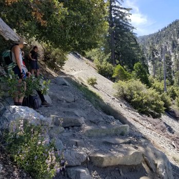
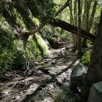


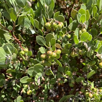


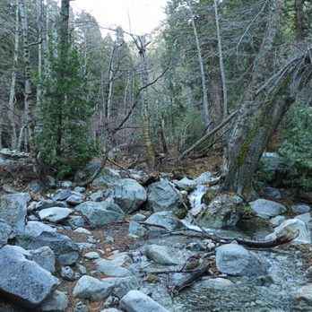
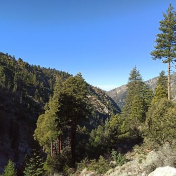
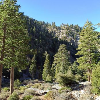
One of my favorite hikes ever, lots of shade and water. Tons to look at. Trees a stream old ruins of rock cabins it's a great place to hike for an hour or so the whole thing all day. Parking can get full on busy days. They will ticket if you don't have a pass. Bring lots of water and bring your trash out with you. The hike was very clean last time I went. read more

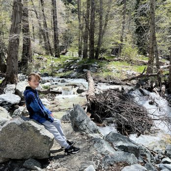

Ice House canyon trail is the main trail people start at when hiking up to Ontario or Cucamonga peak. The trail is just off the Baldy round & is pretty close to Mt. Baldy. The parking lot fills up pretty fast so try arriving before 7am, and don't forget your adventure pass for parking. A lot of this trail is shaded by the trees on the mountain, and depending on the time of year some of the creeks will have a good amount of water flowing throughout the trail. The trail does have a decent amount of elevation gain but it's not terrible hard for beginners to get through. You can get a good challenging hike here if you decided to go the 6 plus miles to some of the peaks, or you can wander around and just soak up the nature sites around you. read more


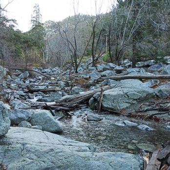
Rocks everywhere; this probably describes the majority of the trail to Icehouse Saddle. This was also one of the harder trails because it was mostly an uphill climb. We started at 8am and got back at 1pm; it was about a 7 mile round trip. Plenty of parking spots when we arrived. There were a few hikers that passed us on the way up but there were quite a lot of people on the way down. Expect to make multiple stops to the side to let others pass. Trail starts off next to a river that's flowing with water. Eventually, it'll become a gruesome uphill climb up the mountain for miles and the trails become narrow. A lot of experienced hikers seem to be using hiking poles but it's not necessary. There's also an ice patch along the way so pay attention and walk around it. You also want to make sure you have proper clothing. Once you hit the Icehouse Saddle... there was a huge temperature drop and it gets really cold and windy up there. read more







6 years ago
We usually come to Mt. Baldy for the snow, but this year, we decided to come for fall leaves and hiking. First off, we stopped at the visitor center for the parking pass. ($5 one day parking) Then, about 5 mins drive, you can reach to the parking lot! Limited parking space, we waited around 10 mins to get a spot! About hiking: 2.5 miles round trip to Ice house canyon, there's a beautiful stream there along the hiking trail, perfect for beginners and kids. Advanced hiking: additional 4 miles to Ice horse saddle, comfortable hiking shoes are strongly recommended, it's a bit steep and get prepared to walk over lots of rocks. Scenery is incredible! Some Tips: 1. They have a actual bathroom in the visitor center. It's clean! Or else, there is a public toilet next to the parking lot, close to the entrance of hiking trials. (You can't wash your hands there) 2. There is no WiFi in the mountains, so get yourself prepared for the route first! 3. Bottled water, snacks and a cap are needed! (We had a picnic there on the rock, it was so beautiful!) + Enough water and some food for advanced hiking, the hiking is real! 4. Time your hiking! Give yourself at least one hour beforehand to head back, it gets dark quickly. Mt Baldy is a place worth exploring! Spoil your eyes and enjoy the beauty of the nature, hikers! read more


5 years ago
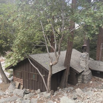
Great trail all the way up Mt Baldy Rd. Paved parking lot at the trailhead. Need an adventure pass to park here. Started hike at 6:30am I think you should start earlier in this summer heat. Trail is mostly shaded, lots of loose rocks and gravel so wear good hiking shoes or boots. Lots of people wearing hats with nets around there faces I think I need to invest as by the water there were so many flies and bugs and they fly right to you face, eyes, and ears it's a pain in the butt. This trail is very strenuous as it is all a gradual incline to the top. Only made it to the saddle as I did not come prepared with food and more drinks. read more




6 years ago
Review from 7/24/20 ~ Such an excellent hiking trail! We did the 5 mile trail and enjoyed it a lot. A couple of things to note if going out to this trail! 1. Parking is pretty limited and very full. We waited about 15 minutes for hikers to come off the trail and leave to take their spot. With that being said hikers tend to cycle in and out so if you wait you will get a spot. I see a lot of people talking about an "adventure pass" on here but when I went the pass was not needed. We did NOT have to pay for parking. We went to the visitors center to buy a pass but the center was closed. Found a ranger and talked to him and he said "don't worry about parking until the visitor center opens up" - Check if the visitors center is open before parking! 2. Bathrooms. There is always a question of "what If I need to use the bathroom?" There are 2 bathrooms in the parking lot. Neither of them have a hand wash station. Both of them are in extremely gross condition, especially if you have to sit to use them. But nonetheless, they are available to use! I would recommend eating lightly that day and drinking minimal fluids before the trail to avoid bathroom use. And bring hand sanitizer & toilet paper if needed. 3. The "walkway" of the trail is pretty tight and leaves minimal space for social distancing from others. While there aren't very many people around you during the hike, when you pass others there is minimal space so please bring a mask! I would say around 80% of people were masked on this hike, or had them under their chin and pulled them up when passing other people. Everyone was being very respectful of moving to the side to mass one another though. The further we got along on the trail, the less people there were Lastly, this trail is very rocky! So I would recommend high socks / leggings to prevent scrapes on the rocks. The trail is mostly inclined as well so you might want to double think hiking with young children. There were children on the trail, but they did not make it very far. This trail is definitely worth a hike, extremely pretty! read more


Cucamonga Peak at 8859ft offers amazing views and a great workout for many outdoor enthusiasts. Ice House Cayon Trail is about 12 miles roundtrip moderate to difficult trail. It's about a 7 to 8-hour hike including 30 minutes to 1-hour rest at the summit. With some planning, I left the trailhead about 7AM and arrived at the Cucamonga Peak with some parking available on the side of the street. You may need to park further down closer to the Visitor Center to get a Parking Pass. There are 2 restrooms at the trailhead that gets crowded so it's important to go early or before. Following the trail, you'll see streams, rocky trails, and many switchbacks as the trail become steep. Altitude will hit new hikers at around 8,000 ft so it can take a toll on your body if you're not athletic or practice hiking. The "half-way" point called the "Saddle" is located between Timber Mountain and Telegraph Peak and a favorite resting spot for trekkers. *Dogs are permitted to hike but must be on a leash. *Pack plenty of water (1.5+water), food, hiking poles, pills, first aid, sunblock, jacket, etc. *Use good hiking shoes that protect your ankles. I've must have offset my ankle on rocks more than a dozen times. read more


5 years ago
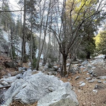
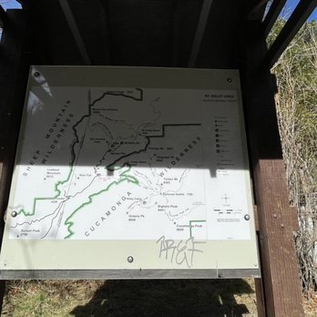
Truly amazing hike! Lots of great scenery and views. Lots of switchbacks as well. I'd say it's moderate-strenuous for beginners but definitely doable if you take your time and take breaks. Worth the view as well getting to the top of the saddle. Strongly recommend going early in the morning to get a parking spot. Round trip it was about 8 miles. Parking does require the adventure pass for which you can buy at REI or Big 5. I took this trail up to the saddle (the main center point where you can branch off to the bigger peaks like Baldy and Ontario) and came back down. If you go during winter, expect snow/ice on the trails so snow cleats / crampons are recommended with your hiking shoes. You will get hot from walking up a steady incline so no need to go all out on winter clothing. I got by with a 32oz hydro flask and 2 water bottles in my pack. And of course snacks for fuel. Dog friendly too! read more




7 years ago
What is great about this trail is it can be as long as you'd like or as short as you need it to be. Family Version 1mile into this trail gets you to the Chapman Trailhead, which is a great turnaround spot for little legs. The trail runs along the creek, boulders, and shade. It is not very technical and kids can manage on their own. Our littlest has been managing since she was three. There are plenty of little coves where kids can toss rocks, look for bugs, and explore. Took us about 2.5hours, 3 adults and 4 kids (ages 4 to 11) with lots of breaks for exploring. Bring repellant there were tons of bugs! We took the family dog on a leash. Yippee. Adult Version We completed Ontario Peak via Ice House Canyon with a 2am start time as a group of 10 adults. Head lamps were a must and it was great. We lost the trail once, but were able to find our way back. We only really hiked in the dark for 2 hours and there was strength in numbers for sure. The whole thing took us 8.5hours and we only started that early due to the day heat of June (100 degrees plus). We had reached the saddle by sunrise. We saw 1 child hiking that trail he looked to be around 10 years old. 0 After crossing the creek near cucamonga wilderness, there is NO shade. The switch backs are gruesome! Bring water, hats, snacks, and don't forget your forest permit (Big 5). Wonderful local hike. read more


This is by far my dog's FAVORITE trail. so... I am writing this review for my dog:) who is a Siberian husky and can't stand the heat. If you are looking for a professional report, not look here, I was there 3 times last weekend and I only made about 2 miles far from the parking lot (approx 4 miles total) I would say this place is cool, with nice view and it dose has some steep hills but kind easy. I usually go in the late afternoon, around 3pm so the trail is never over crowded. I guess all professional hikers go in the morning for some reason? I did took my senior friend there who, under my encouragement made it which wasn't seen possible at the beginning. As my trainer said, it is all in your head. My last time there the trail was icy, so I fell hard on the icy ground and couldn't get up without help. sucks. I thought my balance is outstanding. When cold enough..you see tons of snow aside the trail. Approx just 5 mins walk from the parking lot you can have tons of fresh snow for kids to play. I don't get why so many people go further to the bottom of ski lift and play with the snow aside the road...snow there are dirty. bty, I tasted the snow, it did tasted a little weird. My dog drank from the small river and he was fine. So please feel free to drink from the river:) read more


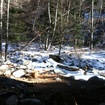

Hiked: Ice House Canyon Trail to Timber Mountain Distance: 9 miles Time: 3 hours to peak, 2 hours to parking lot Date hiked: Sat 5/9/2015 We wanted to do Cucamonga Peak but there was too much snow and we did not have the right gear to trek up there, so we hiked up Timber Mountain instead. Parking: Adventure pass is needed, $5. The trail does have it's own lot, and once it is full there is street parking. Trailhead: there are toilets at the trailhead. Busy trail with good signage. Easy to find the trail head to the right of the parking lot Trail: we weren't expecting so much snow 2 miles in, but I guess there's a reason the trail is called Ice House Canyon. I had hiking boots on, but 2 others in our group had on regular sneakers. Their feet were definitely soaked by the time we got to the peak. 3.6 miles to the Saddle, then another .9 miles to Timber's peak. Gorgeous hike, with beautiful views and lots of trees. I like this hike better than hiking up Mt. Baldy. Tips: keep an eye out on the weather. Weather varies along the trail, from cold, to warm, to windy, so wear layers! Lots of friendly hikers on this trail who are more than helpful with their own knowledge of trail life! read more
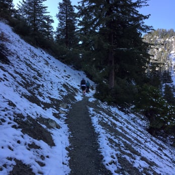


4 years ago
One of the most beautiful hikes I've ever been on! Tall pines and old succulents grace this beautiful tail. You can meander or get in a great workout. Loved seeing snow the higher we got! This trail is a very special place. read more


What an amazing trail. Beautiful Views all around. The trail is pretty clear once you start and weekends are always full with people to ask and follow if you don't know but not crowded were you cant enjoy the hike. This trail i would rate as a medium for hikers, not too easy but also not hard. There are so many trails in this area to enjoy. Parking here is a little hard, not too many spots and don't forget your parking pass. You can buy one in that area at the information center or i purchase mine at REI before hand. read more


6 years ago
Ice house saddle is a short 3.6 miles hike. Is a rocky elevated trail so the 3.6 miles become a 7 miles hike to me. When you hike in, you'll approach the river on the right side. This trail is indeed narrow with shade, do wear a mask and yield. When we get to the destination, we rested for a bit and decided to hike back longer way (timber mtn 0.9). This trail has limited of shade so protect yourself and apply sunblock! read more
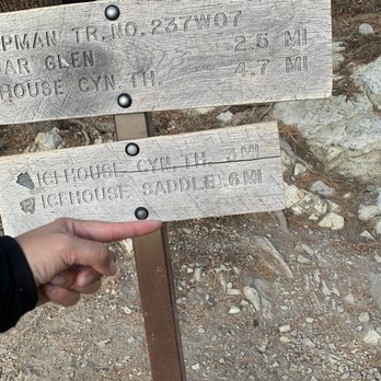


8 years ago
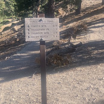
I normally hike trails in the Glendale/Pasadena area. But I want to come out this way more often as it's a great hike at ice house/mount baldy area. Parking does require adventure pass. Better off buying the annual pass versus a one day pass. Also, you will need to obtain a free wilderness permit which you can find at the start of the trailhead. We planned to hike cucamonga peak. But we hit a detour instead of going straight onto the trail for ice house. We kinda veered left and rock scrambled into chapman trail. Now chapman trail looks sketchy as it's a narrow trail with a nice angle slope down. So if you slip, you're sliding down for a bit. Lucky we all had hiking poles, and that assist making the hike much less scarier. I should of taken some pictures but didn't want to chance it with my camera at the time. By the time we got to the posted sign to ice house, we knew we made a wrong turn. But it was still fun if you're into that adventure. We continued on to the trail up to ice house canyon. Once you make it to ice house canyon, it's nice but crowded with other hikers. From ice house canyon, there are quite a few trails from the three T's, bighorn peak, ontario peak and cucamonga peak. Since the mishap to chapman trail we opted to knock out timber mountain and do cucamonga another time. This was the best part, once you leave ice house, the trail traffic thins out. We hardly saw anyone on the trail, so it was nice if you like that. Overall, great hike. It beats out any of the trails on the west side. As always, pack accordingly to the weather. Like if icy trails, take hiking poles and crampons. Hot days, bring plenty of water. In general, have hat, sunglasses, sun screen and light jacket. Plan ahead to make it most enjoyable hike ever read more
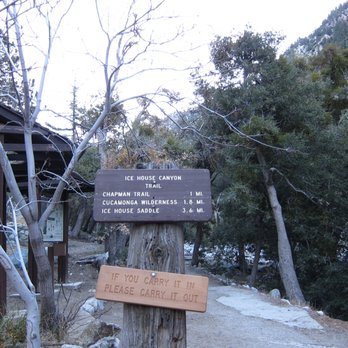


9 years ago
Liked the setting and well signed trail. Thankfully pretty perfect weather in mid November. Sorry to say parking lot fills quickly. Arriving at 7:30 on a Sunday there were say 44 spots filled and 3-4 open. Those coming later parked along a road say 1/3 mile from trailhead. Cool Summit. read more

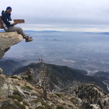

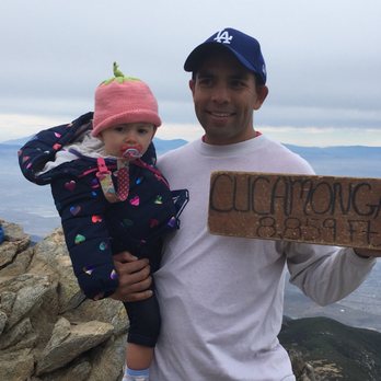


3 years ago


10 years ago
4 RESCUED, 1 MAN DEAD This past Saturday, me and The Crew headed up Ice House Canyon Trail for our annual grub fest held at a fellow crew members cabin. This year it was gumbo. While we head up to the cabin together, some splinter off and hike, typically to the Ice House Saddle, while others stay back and cook up the grub. Let me tell you, cooking on a wood burning stove for 50 people ain't easy, but somehow we manage every year. Anywhoo, the point of this update, is reinforce my hiking disclaimer. Although hiking is fun, it needs to be taken seriously. While cooking up a storm me and the other cooks heard helicopters. Helicopters in this area just means one thing, somebody got seriously wounded and can't make it out on their own. All we could do was hope and pray that our crew was ok, and whoever was injured will be ok as well. 12:30 rolled around and the crew was supposed to be back from their hike, with gumbo, cornbread, and a plethora of other fine eats ready to be consumed, our worry warts began to grow bigger and bigger. By now we have heard and seen four helicopters come and go from the area our crew members were hiking toward. We knew there were icy conditions, however, our crew leader was not going to go that far up the trail. Icy conditions are best seen from a distance. At last a small group of hikers that we knew from the hiking community came to our cabin, and the leader of the group came inside to make some calls. Unfortunately, two of his fellow hikers slipped on the slippery ice, sending them down the mountain upwards of a 1,000 feet. At the time of the incident, one had a few broken ribs, another a broken leg. I believe the girl who had the broken leg is a fellow Yelper's girlfriend. Four helicopter rescues in a matter of a couple of hours is not a good day on the trail. In addition, Search & Rescue pulled a dead adult male out of the canyon Saturday evening. Granted at least two of the four rescued by helicopters were well seasoned hikers, this just goes to show everyone, hiking is no joke, prepare for the worse, hope for the best, always hike with a group, let a friend or family member know where you are going and when you expect to be back, and above all, watch your step. Beautiful weather does not constitute perfect trail conditions, especially after a rain/snow storm. Due to the high level of danger in this area, all trails are closed at 7k feet until further notice. While there were four helicopter rescues we didn't not hear anything on the trail about rescue three and four. Although tragedy struck in this canyon, I'm still a fan of this area. Saturday's tragedies are slaps of reality. I know all too well how disappointing setting your sites on mounting that peak, or completing that loop, or climbing that boulder can be when conditions are not ideal. We got a gut, and although we tend to ignore, we all know, it knows best. DISCLAIMER: Hiking is not something that can be taken lightly. It can be life-threatening as you see and hear on the news, people die or get lost all time. Please, if you are going to hike, never go alone and prepare for the worst, hope for the best. Remember when going for a hike, no matter how short you think it may be, always be prepared. Carry at least two liters of water for every five miles (more if the weather is warm), protein bar, nuts, and electrolytes. Wear sturdy lug sole shoes and protective clothing. Some areas the weather can change quicker than a fireman can put on his gear. It is also very important, always always always let a family member or friend know where you are going and when you expect to be back. Lastly, have fun when you hike it up. read more


12 years ago
Mother nature scores again! You go girl! I recommend this hike for people who want to expand their hiking capability from local, under 1,000 feet elevation gain to more and better. Icehouse Canyon to Icehouse Saddle Trail is a 7 mile out and back trail located near Mt Baldy, California that offers the chance to see wildlife and is only recommended for very experienced outdoorspeople and is accessible from June until October. Or so says the National Geographic All Trails site: http://alltrails.com/trail/us/california/icehouse-canyon-to-icehouse-saddle-trail 7 miles out and back doesn't sound like a lot... but when you add 2500 ft + elevation gain, it gets a bit more strenuous. My hiking Yelping friends (Stephanie P, Ron W, Frank S and Niki S) have already provided the details of when, how, where, etc. They also give good advice on how to extend this hike to other peaks. What I want to build upon in the other reviews is that this is a BEAUTIFUL hike and a nice workout without being too crazy. You do need to follow good hiking guidelines but you'll increase your capabilities in a beautiful place. Here are some of my tips: - Download the info from the link in the link above and the link in the Yelp attributes - it was very helpful. - I do recommend poles for htis hike and normally I'm not a big fan of poles. - Take your time. Even though it's 'only 7 miles' if you're not used to the ele gain, you could feel unprepared if you go at a normal fast pace... just slow down. - Drink lots of water. Water enables your body to use oxygen which you'll need help with at this elevation gain. - Park by 8. Otherwise, you might not be able to park close by. - Bring a yummy lunch. Why not? Yelpers usually appreciate good food and you'll need it for fuel anyway. - Bring someone fun to hike with. Karen M and I had many a cackle, even when the nasty snake surprised us! - Be friendly on the trail. Stay safe, have fun and enjoy your hike! read more


If you're looking for a trail that is easer than the 10k Mt Baldy peak, ice house canyon trail is for you! There are so many trail options you can take, but I usually like going to the saddlehouse to the top of Timber Mtn (8303 elevation). This hike has a portion of strictly switchbacks, meaning a constant zigzag of uphill. The worst part is when you come downhill from that puts a strain on your feet and legs: so stretch and wear sturdy hiking shoes (WITH ANKLE SUPPORT). During the hike there are creeks you can stop by to rest, but it is truly relaxing. There is plenty of shade and you can dip your feet in and freshen up on the way back to the car. My tip would be to take plenty of snacks, water and wear thick socks. Also, starting the hike early in the morning is good too. read more

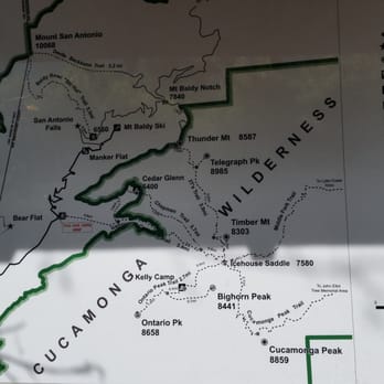


18 years ago
Whether you're someone who likes to stop and smell the roses or trek up trails with conviction, the Ice House Canyon Trail is an Angeles Forest gem less than an hour away from the city. What starts off as a fairly easy bucolic forest stream setting trail slowly meanders into a challenging mountain climb hike. For us first time visitors, our hike ended at the Ice House saddle, where just a few footsteps away past the rest stop, one can take in an amazing 100 degree view of the canyon below (we had to get back quickly due due to the setting sun) and enjoy the sounds of chipmunks, jays and a variety of insects that call the high elevation home. Be sure to stop occasionally and smell the variety of fallen pine cones, note the lichen and moss that grow upon the towering trees and striated rocks, and just take in the majestic silence we were fortunately afforded on a seemingly atypical uncrowded Sunday afternoon (I've read several reviews that mention a crowded path, but we literally did not see anyone for 30-60 minute stretches up past the first 3rd of the trail). I do not think I can remember a more blue sky than that we enjoyed while hiking on this trail locally near Los Angeles, so the sky itself is a reward while hiking Ice House Canyon. Early August weather was a perfect 76-82 degrees the whole way up, though we've noted this is an ideal rather than the norm on a location whose name was derived from an ice block business past. Bring sufficient water (3 liter camelbak was shared), an extra layer of clothing, at least a couple of energy bars (we got by barely with some almonds, a plum and a pack of energy gel, but we were famished on the return trip). I'd also recommend proper hiking/trail footwear, binoculars for wildlife watching, and hiking poles if you haven't trained for steady elevation gain hiking. The trail is well maintained, but there are several parts where steady footing is not always guaranteed (I watched one man slip, but was fortunately caught by friends). The trail was mostly left trash free, properly littered by the beauty of flowers rather than trash (we picked up three pieces of trash the whole trail), so kudos to the rangers and those who use this trail! read more


12 years ago
This is a 7.2 mile hike round trip if you take Ice House Canyon Trail only. There is an option to take Chapman Trail, and this will add 1.7 miles each way to get to Ice House Saddle, your destination. If you take Ice House Canyon Trail to the saddle, you will have a good, uphill workout with a steady incline most of the way. You will pass several cabins in the first 1/2 mile or so, and this part is pretty easy. There are many loose rocks on the path, so be mindful of where you step. Once you pass the last cabin, you will look ahead and the incline will get noticeably steeper. It's pretty much uphill from there. Although, to me, the incline was not that severe. But it does give you a good leg and butt workout and it is hard work (in my opinion, the Ben Overturff Trail is much more difficult). The path is mostly single file, and it has beautiful scenery all the way. If you don't want a difficult climb, then take Chapman Trail about 1 mile into the hike. It will add mileage and time, but it is a much gentler hike and has some different scenery. Or - take Ice House one way and Chapman Trail the other (that's what I did). Once you reach your destination, there is no additional view, per se. It is located in a heavily wooded setting and is very peaceful. The Saddle is the starting point of many other longer and more difficult hikes, such as the 3 T's. parking - lot located at the start of the trail, but it requires an adventure pass read more

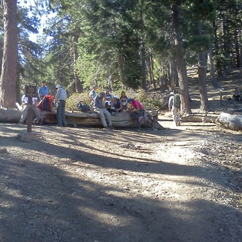


10 years ago
Found out about this hike when I was surfing instagram. Snow covered trails? around LA?? Say no more. Hiked it the next day with a couple buddies, and man, it did NOT disappoint. School work this past semester has prevented me from keeping in shape (sike, i'm just lazy), but this hike is definitely do-able. Some steep inclines, but just rest up a little bit and you'll be fine. Going up took about 3 hours, but we stopped a lot. Bring lots of agua and snacks if you're constantly hungry like me. I started the hike at around 8 AM, and the temperature was in the low 30's with no wind. The visitor center wasn't open at the time, so I just parked and hoped for the best LOL. I heard that it's the same price as getting a ticket from the guards anyways, but don't take my word on it. HEADS UP, be careful in the early going of the hike for icy paths on the trail (see picture below). I ate it pretty hard, on the way back. Definitely didn't have the right kicks for this hike. Overall, it was refreshing as hell to get out and kick it with nature a little bit and if you're in the OC or LA area, really recommend this hike. read more


15 years ago

"Damn, the incline though". Because of this hike, I realized how out of shape I am. I was dying, I almost had to resort to crawling. It took my friends and I about 6-7 hours to reach the destination and back. The weather was not in our favor, I remembered by 11 A.M., the weather was already 80 something degrees. So, do some researches on the weather before hiking. Before heading to the trail, stop by the office (an 1 mile from the trail) to purchase an adventure pass for 5 dollars if needed and a wilderness pass (free). CAUTION: While on the trail, my friends and I saw two bighorn rams. At first they looked really friendly until they started charging. The scary thing was that the rams were running on the trail. So be careful not to get headbutt. Also, remember to bring plenty of water, especially on a hot day. read more


Awesome hike!! Boy, was it crowded. The parking lot of 50+ spaces was full at 8:45a when I got there. But all well worth the trip. Sweet views. I was amazed to see so much water flowing in the river even in June. It must be incredible in the Spring. Gotta check out the ladybugs log about 3/4 mile into the hike. Must be thousands of them. I went from parking lot to Icehouse Saddle to Timber Mtn - about 9 miles round trip and about 4000' elevation gain. One hell of a workout. I want to go back and try the other peaks (Cucamonga, Ontario, and eventually Baldy) I must have seen 50 people on the trail, nearly all Koreans - not young, but older, senior citizen, Koreans. Wow - must be in good shape. PS. Saw a baby bear on the way back about 1/4m from the parking lot. Some dude was chasing after it with a camera so I wasn't too scared - thinking all I had to do was outrun him to ensure my safety read more


13 years ago
Wow what an extremely challenging hike! This trail itself is only about 3 or 4 miles to the end but it sure feels like it would be a lot more. When you first arrive, there's a small parking lot right next to the trail where you can only park if you have the forest ranger parking pass. My friend had already bought an annual pass, so we just used that, but I believe the visitor center that you pass by before you get to the trail sells them at certain hours as well. It was a bit overcast when we started the hike, which was really nice.. Until it started pouring like mad! The beginning of the hike is full of large rocks and small rocks that you have to step around, and there's a nice little creek that you'll see to your right that offers nice scenery. Although its not the most difficult part of the hike, this was my least favorite area of the trail because mosquitoes are EVERYWHERE. Especially during the summer months, these mosquitoes love hanging around the small creek and I was practically swatting them away the entire time. About 2 miles into the hike, the hike becomes extremely challenging in that- 1) there's an intense incline and 2) the trails are super narrow. At one point of the hike, I was so terrified that the loose soil from the rain would cause the rocks to my left to knock me off of the slope I was on. My friend and I heard rockslides throughout our whole trip, so we were especially cautious on this part of the trail. The views atop are absolutely breathtaking, and you really feel like you're tucked away deep within nature. You're surrounded by greenery in every direction and the large redwoods and fallen trees make for a very Yosemite-esque feel. I'm an avid hiker, and this is by far one of my favorites!! Whereas most other hikes are so developed to the point where it almost feels like its man-made, this particular hike really feels like you're in the wilderness. It's quiet and definitely a humbling experience when you're so deep in the mountains with such amazing views. Great hike that I would come back for- even despite the fact that my phone couldn't get any reception at all for 5 hours straight. read more
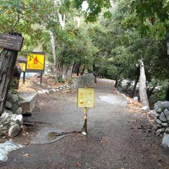

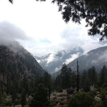


Shhhhh. Listen. Silence. Birds chirping. Wind lightly rustling the evergreen trees. This is nature. The drive up the mountain to ice canyon reminds me of the drive up to big bear. The road winds and turns through the mountain as you go further and further into the Angeles National forest. The scenery is utterly breathtaking, the tremendous amount of trees, the gigantic rocks and the striking cliffs all make this an enjoyable feast for the eyes. As you enter into the small mountain town, you feel as though you've driven into a movie set it all feels so surreal; like nothing you've seen down in the city. Once you've parked (purchase an adventure pass beforehand) and have made your way into the trail, that is when the fun begins. You are immediately immersed into the grand scale of the forest. The feeling that you are but a small part of this grand forest will begin to take of your thoughts. The hike itself is wonderful and truly magical. To think that only minutes ago I was surrounded by street lights, cars, people and now I'm in a peaceful and serene forest is mind boggling. The level of the hike from beginner, intermediate and professional I would say is somewhere between soft to mid intermediate level. For the most part the hike is a slow incline into the mountain and you climb it slowly and surely gazing at the creeks, streams and large trees that make up the forest. Be sure to bring a few things with you. First bring water. Lots of water because you will need it for obvious reasons. Second, bug repellent. I made the mistake of not bringing it and the nats attacked me most of the hike. Third, a snack or a small meal. And lastly good hiking boots or shoes. This is a hike where you will need some traction on your feet to make your way over the rocks, mud and streams. Out of all the hikes I have been on this is by far my most favorite and I will continue to come back here to conquer this mountain. Happy hiking!:) read more
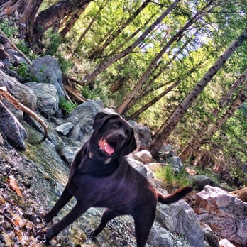


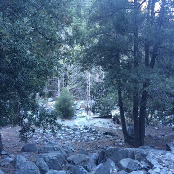


17 years ago
Nice hike, though a bit crowded. Get there early to snag a parking space, and remember to display your Adventure Pass. There were no mosquitoes in November, and the trail was mostly shaded along a nice, bubbly stream. Bring a jacket, lunch, snacks, and at least 1L of water, preferably more just in case. The trail is easy to follow and only some portions are steep, but nothing too threatening. Once at the saddle, the sweat evaporating off of you and the November wind may necessitate jackets. Enjoy your lunch and notice the many trail options before you (Cucamonga Peak, Baldy Notch, etc.). If you don't plan on going any further, instead of returning on the Ice House Canyon Trail, you should opt for the Chapman Trail, which, though it adds 1.7 miles to the overall trip, takes you through scenic territory with some nice views. Backtrack for about half a mile until you reach the sign indicating the Chapman Trail. The Chapman Trail starts off as a gravelly path and eventually winds down into the green. Eventually, you'll head down some switchbacks and arrive at the old trail again not far from the parking lot. Note: There have been reports of car break-ins at the parking lot. Be sure to stash your valuables in your trunk just in case. Also, DO NOT cut switchbacks. You may be tempted to shortcut the zigzagging trails to save some time, but that will only result in further degradation to the trails. Total distance traveled: ~8-9 miles. Time estimate: ~5 hours at an unrushed pace with solid breaks. Total Koreans encountered: ~100 (I'm not kidding!). read more


This hike is wonderful. The first part of the hike follows a creek for a while (It follows year round !). The trail is shaded most of this part. There are lots of cabins and old houses for the first couple of miles. This part of the hike makes me feel like I am a world away. It's shaded, damp, the water is raging, there are huge trees, steep canyon walls on either side. Wonderful. The trail keeps going to the saddle. It's beautiful up there, clean air, blue sky, great view! If you go to the saddle and back it's about 7.5 miles round trip. You can also go to one of the many peaks up there: Cucamonga Peak, the 3 T's, Ontario Peak... Unfortunately, this trail can get busy during the weekends. Most people aren't going all the way to the saddle, so at a certain point you can loose the crowds. Parking is a bitch - there is a large lot, but on busy weekends, its full! .. and watch out, you will get a ticket if you don't buy an adventure pass. This website has excellent information on this and other hikes: http://www.simpsoncity.com/hiking/icehouse.html read more


9 years ago
Absolutely wonderful trail & when you get to the saddle there's options for everyone. My goal was to hike to a peak but with having two torn ligaments and already doing the steep trail I only got 1 mile in on Cucamonga peak and decided until the snow melts it may be a tad too dangerous to push the knee any farther. It's not a difficult hike for someone experienced, like myself, but it's not something I'd recommend for a beginner unless they are in good shape. I didn't use poles (I have never used poles but should've since my knee is torn), but if you're a fan of hiking poles this is definitely a good hike for them. read more


12 years ago
Did I underestimate Ice House or what? Somehow I missed the part where this hike has an elevation of over 2,500 feet; I was expecting a relaxing hike and got a huge challenge instead. Be very aware of this and come prepared with a good night's sleep, plenty of water, and a snack or meal. My boyfriend and I brought more than enough water (2 gallons) but no food at all. We had hardly slept the night before as well. With half a mile left to go to reach the saddle, we decided to head back as we were way hungry and increasingly miserable! I beg you, be smarter (and fitter, hah) than us. My legs are so wrecked it hurts to even live. Nevertheless, the scenery itself was gorgeous and there was plenty to look at and admire. We ran into wildlife two times: two deer on our way out and a rattlesnake on our way back. Both times they were right on the trail so be careful and observant! Overall strenuous hike as an Ice House first-timer but so pretty that I will definitely come back. read more


Page 1 of 4
More info about Ice House Canyon Trail
Ask the Community - Ice House Canyon Trail
Review Highlights - Ice House Canyon Trail
You might also consider















Why does Yelp recommend reviews?
2 reviews that are not currently recommended
The reviews below are not factored into the business's overall star rating.

12 years ago

1 year ago
Ice House Canyon Trail - hiking - Updated May 2026
Best of Mount Baldy
People found Ice House Canyon Trail by searching for…
Fishing Spots in Mount Baldy, CA
Star Gazing in Mount Baldy, CA
Waterfall Hike in Mount Baldy, CA
River Swimming in Mount Baldy, CA
Things to Do in Mount Baldy, CA
Swimming Holes in Mount Baldy, CA
Scenic Drive in Mount Baldy, CA
Stairs Workout in Mount Baldy, CA
Secret Spots in Mount Baldy, CA
Rock Quarry in Mount Baldy, CA
Hiking Trails in Mount Baldy, CA
Campgrounds in Mount Baldy, CA
Redwood Forest in Mount Baldy, CA
Scenic Night View in Mount Baldy, CA
Cliff Jumping in Mount Baldy, CA
Picnic Areas in Mount Baldy, CA
Off Road Trails in Mount Baldy, CA
Sunset View in Mount Baldy, CA
Playgrounds in Mount Baldy, CA
Browse Nearby
BEST of Mount Baldy, California Restaurants near Ice House Canyon Trail
BEST of Mount Baldy, California Coffee near Ice House Canyon Trail
BEST of Mount Baldy, California Things to Do near Ice House Canyon Trail
BEST of Mount Baldy, California Breakfast near Ice House Canyon Trail
BEST of Mount Baldy, California Fishing near Ice House Canyon Trail
BEST of Mount Baldy, California Shopping near Ice House Canyon Trail
BEST of Mount Baldy, California Campgrounds near Ice House Canyon Trail
BEST of Mount Baldy, California Snow Tubing near Ice House Canyon Trail


