Daniel Ridge Falls Photos


More like Daniel Ridge Falls
Recommended Reviews - Daniel Ridge Falls
Start your review...



5 years ago
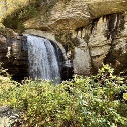
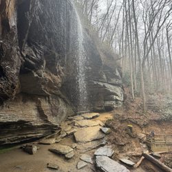
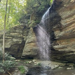
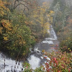
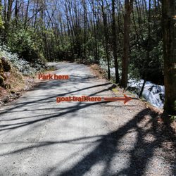
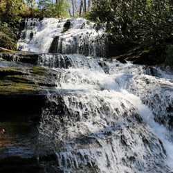
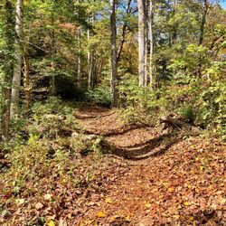
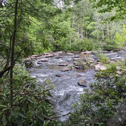
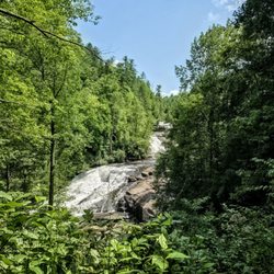
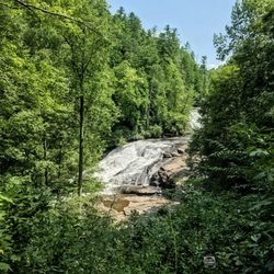
DANIEL RIDGE FALLS is also known as Tom's Spring Branch Falls and Jackson Falls. It is located in the Pisgah National Forest along the Daniel Ridge Loop Trail. This magical 150 foot waterfall is an easy family-friendly half mile hike from the parking area. The gravel road leading to the parking area was in very good condition on our April 11th, 2021 visit, but be forewarned this is a popular hiking AND camping destination, so the decent sized parking area fills up quickly on weekends. PRO TIP - The best overall picture of the falls is from the main trail and not from the side trail leading to the base. There is also a secondary trail once at the base of the falls that takes you about 12 feet higher. [ THE HIKE ] Walk toward the gate on the north end of the parking area. The entire trail to the falls is a wonderfully wide and well maintained forest service road. Approximately 325 feet past the gate you will encounter an iron bridge allowing you to cross Davidson River. It is here along the riverbanks we notice a half dozen hikers had set up camp for the night. About 145 feet past the bridge the trail will split. Follow the trail to the right, which is also marked with an arrow pointing towards the falls. Between the split and the falls is where you will have the majority of the elevation gain, but that being said, it is very minimal. Just before you reach the falls, you will see a small trail on the left leading upwards. Take this to reach the base of the falls, but for the best view of the falls, stay on the main trail. I love using ALLTRAILS for the topography maps which show elevation changes using sweeping lines. According to the map, the crest of the fall begins around 2920 feet and reaches the base around 2756 feet, where it still continues to drop an additional 15 feet to the main trail. This would make the Daniel Creek Falls approximately 179 feet tall, but only about 125 feet of it is visible from the trail. A drone video I saw on one website shows it in it's entirety and WOWZA, this is a very tall waterfall! The upper tiers are recessed back out of view, but it doesn't really matter because what IS visible is stunning enough. You can continue to hike the entire loop of this trail which will add 4 miles to your hike or simply walk the way you came back to the parking area making your total roundtrip hike1.1 miles. [ THINGS TO KNOW ] Total Hiking Distance: 1.1 miles Difficulty: Easy and family/pet friendly Creek Crossings: YES (1 bridge) Elevation Gain: 135 feet Waterfall Height: 150+ feet WATERFALL ATTRACTIVENESS - 8 out of 10 TRAIL ATTRACTIVENESS - 6.5 out of 10 Access to top of falls: NO Access to base of falls: YES Pool of water @ base of Falls: NO Sitting areas @ base: YES (limited) RESTROOMS: NO PARKING: YES (room for about a dozen car + more space along road) [ FINAL THOUGHTS ] Easy waterfall hike that could be coupled with several other nearby hikes in the area such as Moore Cove Falls, Looking Glass Falls, Caney Bottom Falls and Cove Creek Falls. This is a BEAUTIFUL section of the Pisgah National Forest where you will be just as pleased with all the trails as you will be with the waterfalls they lead you to find. No matter if you are a beginner or have been hiking for years, the waterfalls I mentioned here are sure to please! Bring your family, friends, pets and favorite snack and enjoy hours of gorgeous nature! 2021 / 48 read more

More info about Daniel Ridge Falls
National Forest 475 Rd
Brevard, NC 28716
Directions
Hours
Outdoor Amenities