Colby & Colby-Dalton Trail Photos




You might also consider


More like Colby & Colby-Dalton Trail
Recommended Reviews - Colby & Colby-Dalton Trail
Start your review...


Reviews With Photos


The trail starts at a cul de sac amongst a residential area. There isn't a parking lot but you can park on the side streets around the homes. The entrance is well marked with a sign that says Colby Trail. The hike itself isn't too hard. There are some steep parts and then it plateaus around some areas with some shade. Horses do travel the same path so just watch for horse poop. And I assume due to all the horse poop there were so many flies and bugs while hiking this trail. The view of the city is beautiful but with all the bugs I have to think whether to return. After your workout if you're looking for a treat this trail is pretty close to the famous donuts (The Donut Man) if that's incentive for a workout here haha


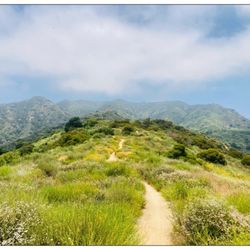
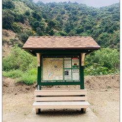
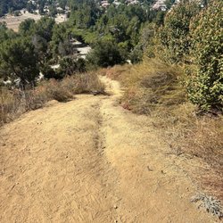
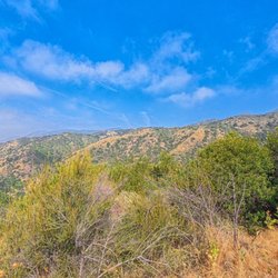
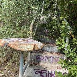
I would definitely call this little local trail a hidden gem...I had to go down quite a few "rabbit holes" in my searching for a quick local trail before I finally stumbled upon this treat of a hike! It's short, but I'd still call this hike moderate bc of the incline and the gravel that makes it so slippery! You seriously can't beat the views from the trail! You get almost a 360 view of DTLA to the right and the entire SGV in front and all the way over to the left! It's was just gorgeous for almost the entire length of the trail! And I'd say the trail is about 50% shaded - lots of nice oak trees, especially for the first 1/2 - 3/4 of the trail! It's quite short - I only did about 2 - 2.5 miles - I could've probably done a little more bc there are tons of trail offshoots - but I had already been out there for over an hour just goofing around with my camera mostly lol! In the short hike it's about a 500 foot elevation gain. And the trail is mostly soft dust covered in gravel and larger rocks - so I definitely consider it moderate. You'll gain almost all your elevation in the first half - so basically you go up all the way to the end, then back down on the way out. If you just simply follow the "colby" trail, you dead end at a fire road (with no view). But if you take the "Colby dalton" portion off to the side on your way back, you get extra trail with great views - and it's very well marked! There's even another extra little bit I stumbled upon that has a sigh with a QR code that gives you tons of cool info - I even learned that mango skins have the same chemical in them as poison ivy!!! I had on my trail shoes that have decent traction and I still slipped a little - but I didn't fall. I saw several people in just plain running shoes that fell several times coming down - and some kids too. So while it's not a super, hardcore trail, I'd still recommend decent trail shoes with traction and maybe even a pole for the downhill if you're prone to falling like me lol! The trail is lightly trafficked - I didn't see too many groups, even on a Sunday! Parking is on the street (free) and it's very heavily residential so please be aware and courteous. There are no bathrooms but there's some really nice seating at the trailhead under the large oaks! I wouldn't say this trail is handicap accessible- it's all gravel and dirt right from the start - even around the seating areas. Will definitely be revisiting this trail!


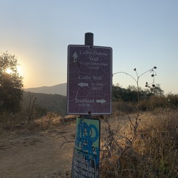
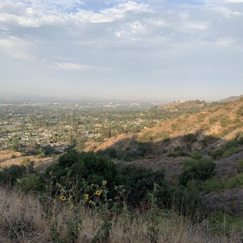
Let me start by saying this is a good hike, and I would rate it easy-moderate. I went for sunrise 6:00am. Had beautiful view of the sunrise, mountains and you can see Glendora from uphill. As it was Tuesday 6:00 am I was literally the only person on the hike! The hike is not too long, it's uphill for most of the part but not crazy uphill where your knees and heart give up. The vegetation is mix, some tall trees, shrubs, the small sunflowers and cacti. There are regular birds, but I saw a crow sized black and white bird with red Mohawk. It flew away before I could take a photo. The road is straight forward with no dangerous curves. Note: Due to time crunch I did not do the Dalton hike. Just did the Colby trail.


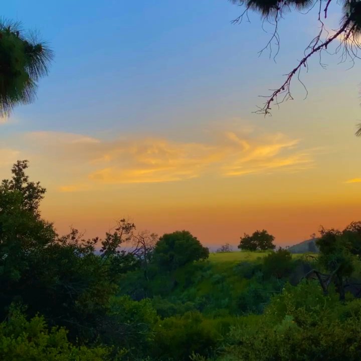
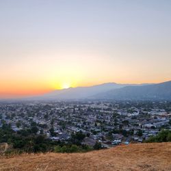
I use this trail quite often. It's short, yet steep a good quick workout I prefer to a treadmill or stairclimber. The incline is reasonably steep, and consistent most of the way up, but this would only be a moderate intensity rating as the trail is very well marked, free of any obstacles and there are plenty of places to rest. The views over the suburbs of Glendora are great, especially when the sun is setting(see pictures).


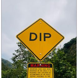
Was a bit scared to try this a while back on a dark moonless night after I read the sign that said beware of mountain lions :-/ Came this time just before sunset and felt fine lol. Short trail with lots of charred trees. Sad to see :-( Time to the top about 10-15min. Horse spotted along the way :-) Parking, residential cul da sac.


Colby Trail is a 2.5-mile loop trail near Glendora, California. It's considered a moderate to difficult challenging route, it took me 2.5 hrs (excluding taking breaks to take photos) roundtrip to complete. CT is a popular trail for birding, hiking, bikers and dog walkers. The trail's main base entrance is at N. Loraine ave in a posh cul-de-sac residential area. This trail is not for novice hikers! As an experience hiker myself, my heart rate went 130 bpm as I hiked those steep inclines. Furthermore, you'll find abundant wild flowers, trees and Mountain Lion growling or hissing at the bushes. The Colby Trail has very limited tree shades and very steady elevation gain incline. It is has two parts, a lower and upper trails which was divided by the main Glendora Mountain road. This trail has four very steep inclines to get to the Summit of CT. Summit has a peak of ~1,580 ft with mind-blowing views. Parking was super easy. Cell signal was spotty as you ascend the trail. Hikers and their dogs were friendly. Overall, I liked hiking Colby trail and recommend it. read more


1 year ago

2 years ago

5 years ago
The trail starts at a cul de sac amongst a residential area. There isn't a parking lot but you can park on the side streets around the homes. The entrance is well marked with a sign that says Colby Trail. The hike itself isn't too hard. There are some steep parts and then it plateaus around some areas with some shade. Horses do travel the same path so just watch for horse poop. And I assume due to all the horse poop there were so many flies and bugs while hiking this trail. The view of the city is beautiful but with all the bugs I have to think whether to return. After your workout if you're looking for a treat this trail is pretty close to the famous donuts (The Donut Man) if that's incentive for a workout here haha read more


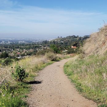


I would definitely call this little local trail a hidden gem...I had to go down quite a few "rabbit holes" in my searching for a quick local trail before I finally stumbled upon this treat of a hike! It's short, but I'd still call this hike moderate bc of the incline and the gravel that makes it so slippery! You seriously can't beat the views from the trail! You get almost a 360 view of DTLA to the right and the entire SGV in front and all the way over to the left! It's was just gorgeous for almost the entire length of the trail! And I'd say the trail is about 50% shaded - lots of nice oak trees, especially for the first 1/2 - 3/4 of the trail! It's quite short - I only did about 2 - 2.5 miles - I could've probably done a little more bc there are tons of trail offshoots - but I had already been out there for over an hour just goofing around with my camera mostly lol! In the short hike it's about a 500 foot elevation gain. And the trail is mostly soft dust covered in gravel and larger rocks - so I definitely consider it moderate. You'll gain almost all your elevation in the first half - so basically you go up all the way to the end, then back down on the way out. If you just simply follow the "colby" trail, you dead end at a fire road (with no view). But if you take the "Colby dalton" portion off to the side on your way back, you get extra trail with great views - and it's very well marked! There's even another extra little bit I stumbled upon that has a sigh with a QR code that gives you tons of cool info - I even learned that mango skins have the same chemical in them as poison ivy!!! I had on my trail shoes that have decent traction and I still slipped a little - but I didn't fall. I saw several people in just plain running shoes that fell several times coming down - and some kids too. So while it's not a super, hardcore trail, I'd still recommend decent trail shoes with traction and maybe even a pole for the downhill if you're prone to falling like me lol! The trail is lightly trafficked - I didn't see too many groups, even on a Sunday! Parking is on the street (free) and it's very heavily residential so please be aware and courteous. There are no bathrooms but there's some really nice seating at the trailhead under the large oaks! I wouldn't say this trail is handicap accessible- it's all gravel and dirt right from the start - even around the seating areas. Will definitely be revisiting this trail! read more


7 years ago

5 years ago
Let me start by saying this is a good hike, and I would rate it easy-moderate. I went for sunrise 6:00am. Had beautiful view of the sunrise, mountains and you can see Glendora from uphill. As it was Tuesday 6:00 am I was literally the only person on the hike! The hike is not too long, it's uphill for most of the part but not crazy uphill where your knees and heart give up. The vegetation is mix, some tall trees, shrubs, the small sunflowers and cacti. There are regular birds, but I saw a crow sized black and white bird with red Mohawk. It flew away before I could take a photo. The road is straight forward with no dangerous curves. Note: Due to time crunch I did not do the Dalton hike. Just did the Colby trail. read more





4 years ago

6 years ago
It was our first time here. It's a good hike, VERY steep but a great work out. Trail actually ends at Glendora Mountain Road - not a scenic bench read more


4 years ago

I use this trail quite often. It's short, yet steep a good quick workout I prefer to a treadmill or stairclimber. The incline is reasonably steep, and consistent most of the way up, but this would only be a moderate intensity rating as the trail is very well marked, free of any obstacles and there are plenty of places to rest. The views over the suburbs of Glendora are great, especially when the sun is setting(see pictures). read more


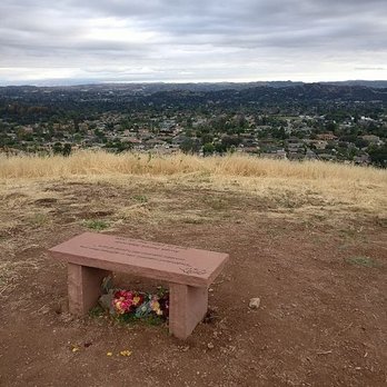


Was a bit scared to try this a while back on a dark moonless night after I read the sign that said beware of mountain lions :-/ Came this time just before sunset and felt fine lol. Short trail with lots of charred trees. Sad to see :-( Time to the top about 10-15min. Horse spotted along the way :-) Parking, residential cul da sac. read more


6 years ago

Fun/Cost: (2.5/5) The Colby Trail is short ~1.5 mile (roundtrip) hike that ends abruptly at Glendora Mountain Road. There were a couple good views of the valley below, but for the most part the trail wasn't too interesting. For a longer hike, we opted to finish via the Colby-Dalton trail that splits from the Colby trail after 0.66 miles, just 260 feet short of the end at Glendora Mountain Road. The Colby-Dalton trail leads you down a winding shaded path down to the Little Dalton Wash, where you can then take the path west to finish back at the starting point. This'll bump up your roundtrip distance to ~2.5 miles. During my pre-hike research of this trail, I found that many described the trail as moderate or strenuous -- I'd classify it more on the moderate side. Though there are a few short areas with a steep incline, these distances were extremely short and didn't really work up a sweat. We were done in 1.5 hours and that was at a pretty leisurely pace. Good thing there's no need for an Adventure Pass or any other sort of pass for this hike; it wouldn't have been worth the trouble. Location: (4/5) Getting and finding the trail is quite simple. It's very close to the 210 Fwy and you don't need to navigate any winding mountain roads. Once you arrive at the Sierra Madre and Loraine intersection, continue north on Loraine until you see the adorable trailhead labeled with a wood beam that says "Colby." You can park for free on the neighboring residential streets; I'd try to keep it quiet as this is generally a very peaceful area. Ambiance: (2.5/5) I last came yesterday, a Tuesday, around 9:45am and the trail was deserted other than 1 other hiker and 1 biker. The residential streets where we parked were also empty. I haven't been here on weekends, but I've heard that it's not super crowded. It's a bit more popular during the the brief blooming period of the thread-leaved brodiaea in May and June, but other than that the crowd usually consists of local hikers. Overall: (2.5/5) Unless you live a very close by or if you want to see the endangered thread-leaved brodiaea in May and June, I don't see any real reason to choose this trail. If you do come, just bring a bottle of water and maybe sunscreen. Serious hiking gear is definitely not needed; I wore my low top Merrells and my friend wore regular tennis shoes and we did fine. read more




7 years ago

8 years ago

13 years ago

13 years ago

More info about Colby & Colby-Dalton Trail
1018 Colby Trail Motorway
Glendora, CA 91741
Directions
Hours
Outdoor Amenities
Ask the Community - Colby & Colby-Dalton Trail
Review Highlights - Colby & Colby-Dalton Trail
You might also consider




















Colby & Colby-Dalton Trail - hiking - Updated May 2026
Best of Glendora
People found Colby & Colby-Dalton Trail by searching for…
Places to Take Pictures in Glendora, California
Hiking Trails in Glendora, California
Beautiful Views in Glendora, California
Watch Sunset in Glendora, California
Waterfall Hike in Glendora, California
Walking Trails in Glendora, California
Scenic View in Glendora, California
Scenic Drive in Glendora, California
Sunrise View in Glendora, California
Running Trails in Glendora, California
Off Road Trails in Glendora, California
Easy Hikes in Glendora, California
Night Hike in Glendora, California
Scenic Overlook in Glendora, California
Secret Spots in Glendora, California
Free Things to Do in Glendora, California
Dog Friendly Hiking Trails in Glendora, California
Night View in Glendora, California
Sunset View in Glendora, California
Bike Paths in Glendora, California
Trending Searches in Glendora, CA
Boat Rental near Colby & Colby-Dalton Trail
Botanical Gardens near Colby & Colby-Dalton Trail
Bounce House Rentals near Colby & Colby-Dalton Trail
Campgrounds near Colby & Colby-Dalton Trail
Cliff Jumping near Colby & Colby-Dalton Trail
Dog Friendly Things To Do near Colby & Colby-Dalton Trail
Flower Fields near Colby & Colby-Dalton Trail
Flower Shop near Colby & Colby-Dalton Trail
Hair near Colby & Colby-Dalton Trail
Lakes & Ponds near Colby & Colby-Dalton Trail
Movie Theatre near Colby & Colby-Dalton Trail
Nurseries & Gardening near Colby & Colby-Dalton Trail
Outdoor Activities near Colby & Colby-Dalton Trail
Outdoor Furniture Stores near Colby & Colby-Dalton Trail
Party Equipment Rentals near Colby & Colby-Dalton Trail
Pedicure near Colby & Colby-Dalton Trail
Pick Your Own Farms near Colby & Colby-Dalton Trail
Picnic Areas near Colby & Colby-Dalton Trail
Places To Walk Around near Colby & Colby-Dalton Trail
Rainy Day Activities near Colby & Colby-Dalton Trail
Rock Quarry near Colby & Colby-Dalton Trail
Running Trails near Colby & Colby-Dalton Trail
Scenic Drive near Colby & Colby-Dalton Trail
Secret Spots near Colby & Colby-Dalton Trail
Strawberry Picking near Colby & Colby-Dalton Trail
Sunrise View near Colby & Colby-Dalton Trail
Swimming Holes near Colby & Colby-Dalton Trail
Things To Do On A Rainy Day near Colby & Colby-Dalton Trail
Browse Articles
Browse Nearby
BEST of Glendora, California Coffee near Colby & Colby-Dalton Trail
BEST of Glendora, California Things to Do near Colby & Colby-Dalton Trail
BEST of Glendora, California Parks near Colby & Colby-Dalton Trail
BEST of Glendora, California Restaurants near Colby & Colby-Dalton Trail
BEST of Glendora, California Scenic View near Colby & Colby-Dalton Trail
BEST of Glendora, California Breakfast near Colby & Colby-Dalton Trail
BEST of Glendora, California Campgrounds near Colby & Colby-Dalton Trail
BEST of Glendora, California Hotels near Colby & Colby-Dalton Trail
Browse Brands
Related Searches in Glendora, CA
Best Fishing Locations and Guides in Glendora, California
Best Nature Trails for Hiking in Glendora, California
Best Places for Horseback Riding in Glendora, California
Best Waterfalls and Swimming Holes in Glendora, California
Check Out Off Road Trails in Glendora, California
Discover Dog Friendly Trails to Explore in Glendora, California
Discover Kid Friendly Hiking Trails in Glendora, California
Discover Scenic Hiking Trails in Glendora, California
Discover Scenic Mountain Bike Trails Near Glendora, California
Discover Scenic Waterfall Spots in Glendora, California
Discover Top Nature Parks to Visit in Glendora, California
Discover Walking Parks in Glendora, California Near You
Discover a Hiking Trail in Glendora, California
Discover the Best Night Hike Trails in Glendora, California
Discover the Best Running Track in Glendora, California
Dog-Friendly Hikes With Dogs in Glendora, California
Enjoy Camping Adventures Around Glendora, California
Enjoy Exciting Mountain Biking Adventures in Glendora, California
Enjoy Kayaking Adventures in Glendora, California
Enjoy Tent Camping Spots Around Glendora, California
Enjoy a Beautiful Waterfall Hike in Glendora, California
Enjoy a Peaceful Nature Walk in Glendora, California
Enjoy the Best Walking Path in Glendora, California
Enjoy the Best Walking Trails in Glendora, California
Exciting Cliff Jumping Spots in Glendora, California
Explore Beautiful Parks and Green Spaces in Glendora, California
Explore Easy Hikes Perfect for All in Glendora, California
Explore Fun Activities to Do in Glendora, California
Explore Popular Campgrounds Near Glendora, California
Explore the Best Beach Spots in Glendora, California
Explore the Best Trail Options in Glendora, California
Family Friendly Hiking With Kids in Glendora, California
Find Beautiful Views in Glendora, California
Find the Best Parks for Picnics in Glendora, California
Find the Best Scenic View Locations in Glendora, California
Great Places to Walk in Glendora, California
Hike the Popular Waterfall Trail in Glendora, California
Hiking Trails With Waterfalls in Glendora, California
Off Leash Dog Hiking Trails in Glendora, California
Plan a Scenic Drive Route Near Glendora, California
Popular Outdoor Activities to Try in Glendora, California
Popular Picnic Spots to Visit in Glendora, California
Safe River Swimming Areas in Glendora, California
Safe and Fun Parks for Kids in Glendora, California
Top Climbing Spots and Gyms in Glendora, California
Top Running Trails to Explore in Glendora, California
Top Swimming Lakes to Enjoy in Glendora, California
Top Swimming Spots and Pools in Glendora, California


