El Encanto Trail Hike Photos


You might also consider


More like El Encanto Trail Hike
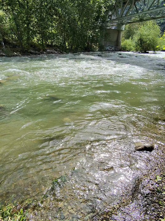
Recommended Reviews - El Encanto Trail Hike
Start your review...


Reviews With Photos


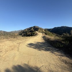
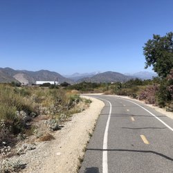
Beautiful easy wide spacious trail that's short and some cars coming out as you walk into it from the entrance. Lots of rocks above and up ahead, so don't go during any rainy or bad conditions and risk anything. They have a small lot. We didn't know it was closed on the weekends because we didn't see any signs, so just fyi!
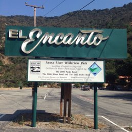

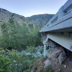
El Encanto Trail is located right before you head up to Crystal Lake on Highway 39. This fire trail road is located in between steep mountains, the serene sound of water flowing downstream from the riverbed & a wonderful equestrian center. If you look closely, there is a few white Buddha statues sitting on top of concrete platforms. It is an easy hike with mostly flat terrain throughout. Total round trip is less than three miles & close to an hour to complete. Unfortunately, there is no fishing in the riverbed. The parking lot is huge, very spacious which results to plenty of parking for everyone.
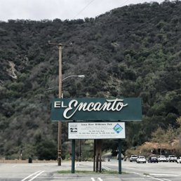

Easy hike - most of the trail is small rocks/dirt. Pretty flat terrain. The last 10 minutes of hike a lot of small rocks making it difficult for those who have a hard time balancing or vision. Little rope Hanging from the tree at the end of the hike, I'm assuming people like to swing into the river during warmer months but this area is marked on map as not for recreation. 10 minute drive north of Downtown Azusa. Only porter potty's available. There are trash bins to properly done any food to keep away from bears or wildlife. I would definitely recommend this trail for families with children. It was open today, Saturday so I don't know why it shows as closed on the Yelp page.
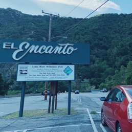

A really simple straight forward trail. It's around 2.5-2.8 miles out and back depending on how far you want to go. Large pathway and fairly flat. Went on a Saturday morning and only saw one other person. Pretty large parking in front and overall a nice walk. Wear bug spray, there flowing water which allows mosquitos to be in the area. read more


8 months ago

1 year ago
Really enjoyed this hike next to the river. Trail is mostly dirt and gravel but has great views of the river. It's an easy hike, sounds of the river can be heard. read more


3 years ago
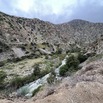
Beautiful easy wide spacious trail that's short and some cars coming out as you walk into it from the entrance. Lots of rocks above and up ahead, so don't go during any rainy or bad conditions and risk anything. They have a small lot. We didn't know it was closed on the weekends because we didn't see any signs, so just fyi! read more


2 years ago

9 years ago
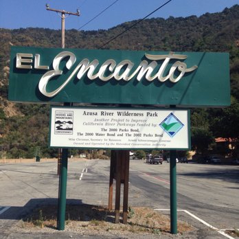
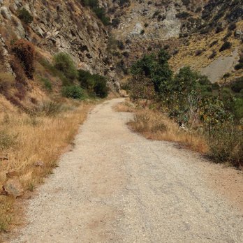
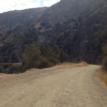
El Encanto Trail is located right before you head up to Crystal Lake on Highway 39. This fire trail road is located in between steep mountains, the serene sound of water flowing downstream from the riverbed & a wonderful equestrian center. If you look closely, there is a few white Buddha statues sitting on top of concrete platforms. It is an easy hike with mostly flat terrain throughout. Total round trip is less than three miles & close to an hour to complete. Unfortunately, there is no fishing in the riverbed. The parking lot is huge, very spacious which results to plenty of parking for everyone. read more





7 years ago
Easy hike - most of the trail is small rocks/dirt. Pretty flat terrain. The last 10 minutes of hike a lot of small rocks making it difficult for those who have a hard time balancing or vision. Little rope Hanging from the tree at the end of the hike, I'm assuming people like to swing into the river during warmer months but this area is marked on map as not for recreation. 10 minute drive north of Downtown Azusa. Only porter potty's available. There are trash bins to properly done any food to keep away from bears or wildlife. I would definitely recommend this trail for families with children. It was open today, Saturday so I don't know why it shows as closed on the Yelp page. read more


4 years ago
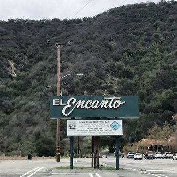
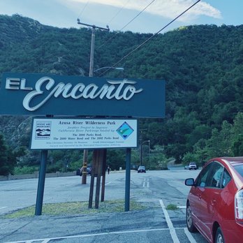
small hike, very pretty here is the entrance... yes I was singing the Encanto soundtrack the entire time read more
More info about El Encanto Trail Hike
100 Old San Gabriel Canyon Rd
Azusa, CA 91702
Directions
(626) 815-1019
Call Now
Hours
Outdoor Amenities
Ask the Community - El Encanto Trail Hike
You might also consider




















Why does Yelp recommend reviews?
1 review that is not currently recommended
The reviews below are not factored into the business's overall star rating.

1 month ago
El Encanto Trail Hike - hiking - Updated May 2026
Best of Azusa
People found El Encanto Trail Hike by searching for…
Hiking Trails in Azusa, California
Free Things to Do in Azusa, California
Walking Trails in Azusa, California
Beautiful Views in Azusa, California
Easy Hikes in Azusa, California
Fun Things to Do at Night in Azusa, California
Fishing Lake in Azusa, California
Stroller Friendly Hikes in Azusa, California
Hiking Trails Kid Friendly in Azusa, California
Lakes & Ponds in Azusa, California
Running Trails in Azusa, California
Rope Swing in Azusa, California
Places to Walk in Azusa, California
Waterfall in Azusa, California
Scenic View in Azusa, California
Places to Walk at Night in Azusa, California
Trending Searches in Azusa, CA
Boat Rental near El Encanto Trail Hike
Botanical Gardens near El Encanto Trail Hike
Bounce House Rentals near El Encanto Trail Hike
Campgrounds near El Encanto Trail Hike
Cliff Jumping near El Encanto Trail Hike
Dog Friendly Things To Do near El Encanto Trail Hike
Flower Fields near El Encanto Trail Hike
Flower Shop near El Encanto Trail Hike
Hair near El Encanto Trail Hike
Lakes & Ponds near El Encanto Trail Hike
Movie Theatre near El Encanto Trail Hike
Nurseries & Gardening near El Encanto Trail Hike
Outdoor Activities near El Encanto Trail Hike
Outdoor Furniture Stores near El Encanto Trail Hike
Party Equipment Rentals near El Encanto Trail Hike
Pedicure near El Encanto Trail Hike
Pick Your Own Farms near El Encanto Trail Hike
Picnic Areas near El Encanto Trail Hike
Places To Walk Around near El Encanto Trail Hike
Rainy Day Activities near El Encanto Trail Hike
Rock Quarry near El Encanto Trail Hike
Running Trails near El Encanto Trail Hike
Scenic Drive near El Encanto Trail Hike
Secret Spots near El Encanto Trail Hike
Strawberry Picking near El Encanto Trail Hike
Sunrise View near El Encanto Trail Hike
Swimming Holes near El Encanto Trail Hike
Things To Do On A Rainy Day near El Encanto Trail Hike
Browse Articles
Browse Nearby
BEST of Azusa, California Coffee near El Encanto Trail Hike
BEST of Azusa, California Things to Do near El Encanto Trail Hike
BEST of Azusa, California Restaurants near El Encanto Trail Hike
BEST of Azusa, California Parks near El Encanto Trail Hike
BEST of Azusa, California Walking Trails near El Encanto Trail Hike
BEST of Azusa, California Breakfast near El Encanto Trail Hike
BEST of Azusa, California Hotels near El Encanto Trail Hike
BEST of Azusa, California Campgrounds near El Encanto Trail Hike
Browse Brands
Related Searches in Azusa, CA
Best Fishing Locations and Guides in Azusa, California
Best Nature Trails for Hiking in Azusa, California
Best Places for Horseback Riding in Azusa, California
Check Out Off Road Trails in Azusa, California
Discover Dog Friendly Trails to Explore in Azusa, California
Discover Kid Friendly Hiking Trails in Azusa, California
Discover Scenic Hiking Trails in Azusa, California
Discover Scenic Mountain Bike Trails Near Azusa, California
Discover Scenic Waterfall Spots in Azusa, California
Discover Top Nature Parks to Visit in Azusa, California
Discover Walking Parks in Azusa, California Near You
Discover a Hiking Trail in Azusa, California
Discover the Best Night Hike Trails in Azusa, California
Discover the Best Running Track in Azusa, California
Dog-Friendly Hikes With Dogs in Azusa, California
Enjoy Camping Adventures Around Azusa, California
Enjoy Exciting Mountain Biking Adventures in Azusa, California
Enjoy Kayaking Adventures in Azusa, California
Enjoy Tent Camping Spots Around Azusa, California
Enjoy a Beautiful Waterfall Hike in Azusa, California
Enjoy a Peaceful Nature Walk in Azusa, California
Enjoy the Best Walking Path in Azusa, California
Enjoy the Best Walking Trails in Azusa, California
Exciting Cliff Jumping Spots in Azusa, California
Explore Beautiful Parks and Green Spaces in Azusa, California
Explore Easy Hikes Perfect for All in Azusa, California
Explore Fun Activities to Do in Azusa, California
Explore Popular Campgrounds Near Azusa, California
Explore the Best Beach Spots in Azusa, California
Explore the Best Trail Options in Azusa, California
Family Friendly Hiking With Kids in Azusa, California
Find Beautiful Views in Azusa, California
Find Parks and Recreation Activities in Azusa, California
Find the Best Parks for Picnics in Azusa, California
Find the Best Scenic View Locations in Azusa, California
Great Places to Walk in Azusa, California
Hike the Popular Waterfall Trail in Azusa, California
Hiking Trails With Waterfalls in Azusa, California
Off Leash Dog Hiking Trails in Azusa, California
Plan a Scenic Drive Route Near Azusa, California
Popular Outdoor Activities to Try in Azusa, California
Popular Picnic Spots to Visit in Azusa, California
Safe River Swimming Areas in Azusa, California
Safe and Fun Parks for Kids in Azusa, California
Top Climbing Spots and Gyms in Azusa, California
Top Running Trails to Explore in Azusa, California
Top Swimming Lakes to Enjoy in Azusa, California
Top Swimming Spots and Pools in Azusa, California
People who viewed El Encanto Trail Hike also viewed

Walnut Creek Park
70 reviews

West Fork Trail
31 reviews

Toyon Trail
1 review

Duarte Recreational Trail
36 reviews

Rock On a Cliff
17 reviews

San Gabriel Canyon Gateway Center
4 reviews

Marshall Canyon Regional Park
40 reviews

San Gabriel Canyon Hike
1 review

Smith Mountain Via Bear Creek Trail
9 reviews

Millard Canyon
141 reviews