Cancel

    Open app

    Search

    Bass Lake

    4.0 (58 reviews)

    Bass Lake Photos

    You might also consider

    Recommended Reviews - Bass Lake

    Your trust is our priority, so businesses can't pay to alter or remove their reviews. Learn more about reviews.
    Yelp app icon
    Browse more easily on the app
    Review Feed Illustration

    Reviews With Photos

    Carlos A.

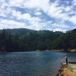
    Quite possibly my favorite place on the planet. You have a beautiful drive through Marin, a pristine lake and a waterfall that drops off into the ocean. Simply breathtaking. This is how you get there: http://www.bahiker.com... From the trailhead it's a good 35 minute hike to the lake and then another 30 to get to Alamere falls. The water is a bit chilly but not freezing. I love swimming in this lake. I feel...free. I am also in love with the rope swing. I have been on it about 4 times now and it always brings me back to a fictitious childhood by the lake I never had. It's a great place to go have a swim and picnic. From downtown SF it's about an hour's drive but worth every second. You'll occasionally see a nudist or two. As with most nudists it's not anyone you'd ever want to see naked, but c'est la vie, right? You owe it to yourself to visit Bass Lake.
    Jr P.

    Little heaven protected from the masses via a one hour trail walk. The water is warm and the lake is beautiful. It might be on of the last water landscape of the region that has not been took by the drought. It is a shame that the trail is forbidden to dogs...

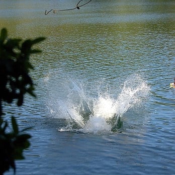
    Impending Belly Flop
    Jared W.

    This is an awesome spot to hike to. It's only a few miles from the trialhead, far enough that you feel like you've worked for it, short enough that I have seen people dragging a cooler full of 'beverages' with them. The lake is beautiful and there are a few clearings (not on the shore) to lay out some blankets and have a picnic. If you make your way through some brush there's an awesome rope swing and you can watch the occasional person with bad form do an awesome belly flop. As other reviews have noted, beware for clothing optional bathers, however on the more popular days that's not really a problem.

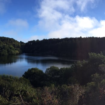
    Bass Lake
    Krista C.

    Absolutely lovely. The first time I went was when I first started dating my boyfriend. We had read about Alamere Falls in Pt. Reyes and decided to go for a hike. It was a beautiful day, warm and perfect. By the time we reached the lake we were ready to jump in. The rope swing was so much fun!!! We went back on Saturday and the rope swing seemed a bit more difficult- still didn't stop me. Check out the photos! http://www.flickr.com/photos/73056494@N00/

    Paulina F.

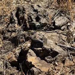
    I think we hiked about nine miles up and down these awesome trails with views of lush greens and the lake. On the way, we encountered deer, slugs and other insects, a lizard or whatever that smaller one is called, birds galore, rope swings, and friendly company. I snapped a few pictures you can check out, but you should go in person to do the place justice.

    beautiful cliffside trail (wear sunscreen!)
    K R.

    Once you get to the little clearing by Bass Lake (http://www.yelp.com/biz_photos/TcoYSVdyCpRyEB2Dtl_jAA?select=Sqx7grESx5vR9Xq2URhcjA) -- and you'll know because of the helpfully huge and obvious sign (http://www.yelp.com/biz_photos/TcoYSVdyCpRyEB2Dtl_jAA?select=iw0QO53inBTN1qfMvU1Nrg), if you're like me, you'll feel awfully dumb for wearing and carrying serious hiking gear when everyone else is wearing swimsuits and sundresses and unpacking beer and wine and cupcakes. So, you have been warned, Yelpers, and you're welcome. Rope Swing Info (http://www.yelp.com/biz_photos/TcoYSVdyCpRyEB2Dtl_jAA?select=ZjELJ7rCLT9kGssZFLpoDg): A note about the famous rope swing--the ranger comes every few days to cut down the rope swing and ruin everyone's fun, because apparently someone drowned a couple years ago (from getting knocked unconscious when he hit the water head-first) and people keep breaking feet and limbs (from slipping on the extremely steep and muddy take-off hill and/or knocking into the tree on their way out). So, take this warning seriously: you might not get to swing (http://www.yelp.com/biz_photos/TcoYSVdyCpRyEB2Dtl_jAA?select=kKu4l7udr9eQJDgzkJEv8w). If you're lucky, though, you might get to meet Frank, the Bass Lake institution with decades of rope-swinging experience under his belt/swim trunks, who keeps rehanging more ropes. This is the same guy who has, he describes, climbed to the almost-top of the tree, and dived "through the branches" to the water. Awesome. Hike Info: The hourish-long hike out is easy peazy and GORGEOUS. I mean unbelievably stunning. Most of it is in the sun, between flower- and foliage-covered hills and steep cliff-sides overlooking the water (http://www.yelp.com/biz_photos/TcoYSVdyCpRyEB2Dtl_jAA?select=AOqilymiJK4XHLWlcGqjvg), so wear sunscreen and bring a camera (http://www.yelp.com/biz_photos/TcoYSVdyCpRyEB2Dtl_jAA?select=bnzfDvY8YFwA-pL5sYmyKQ). It is about an hour-long hike, but I'll warn you that if you stop to admire the view every time you're sure it's the most beautiful one you've seen so far, it'll take you a good 30 minutes extra. Definitely wear a swimsuit (there's not a good place to change) and sunscreen and bring a towel and some munchies. You might want to wear light long pants as some of the path is a little overgrown and scratchy. FYI, dogs are not allowed but lots of people bring them. However, if the ranger sees you on the trail or passes through Bass Lake, she will make you hike ALL the way back to the parking lot with your dog and watch until you've driven away. So, it's risky.

    Sarah W.

    Amazing.. I can't wait to go back when its warmer to lay out and maybe swim. There is a cute spot at the back of the lake where people carve their names on trees.. my boyfriend and I had to do it of course.

    Ahhhh mazing

    See all

    13 hours ago

    Helpful 0
    Thanks 0
    Love this 0
    Oh no 0

    1 year ago

    Helpful 1
    Thanks 0
    Love this 0
    Oh no 0
    Photo of Jenn C.
    414
    1863
    1931

    5 years ago

    Helpful 3
    Thanks 0
    Love this 1
    Oh no 0

    3 years ago

    Helpful 0
    Thanks 1
    Love this 0
    Oh no 3
    Photo of Carlos A.
    1642
    2037
    2714

    19 years ago

    Helpful 9
    Thanks 0
    Love this 4
    Oh no 0
    Photo of Wolfe S.
    441
    116
    153

    9 years ago

    Helpful 12
    Thanks 0
    Love this 6
    Oh no 2

    14 years ago

    Helpful 16
    Thanks 0
    Love this 12
    Oh no 1
    Photo of Jr P.
    175
    90
    240

    11 years ago

    Helpful 4
    Thanks 0
    Love this 1
    Oh no 0

    18 years ago

    Helpful 3
    Thanks 0
    Love this 2
    Oh no 0

    19 years ago

    Helpful 1
    Thanks 0
    Love this 2
    Oh no 0

    11 years ago

    Helpful 1
    Thanks 0
    Love this 2
    Oh no 0
    Photo of Ace K.
    1022
    179
    3

    7 years ago

    Helpful 2
    Thanks 0
    Love this 1
    Oh no 0

    19 years ago

    Helpful 12
    Thanks 0
    Love this 6
    Oh no 0
    Photo of K R.
    1147
    374
    968

    15 years ago

    Helpful 8
    Thanks 0
    Love this 3
    Oh no 0
    Photo of Don T.
    4
    13
    0

    10 years ago

    Helpful 5
    Thanks 0
    Love this 1
    Oh no 0

    18 years ago

    Helpful 6
    Thanks 0
    Love this 6
    Oh no 0

    18 years ago

    Helpful 2
    Thanks 0
    Love this 2
    Oh no 0

    17 years ago

    Helpful 2
    Thanks 0
    Love this 7
    Oh no 0

    12 years ago

    Helpful 2
    Thanks 0
    Love this 3
    Oh no 0

    13 years ago

    Helpful 2
    Thanks 0
    Love this 4
    Oh no 0

    16 years ago

    Helpful 2
    Thanks 0
    Love this 2
    Oh no 0

    9 years ago

    Helpful 10
    Thanks 1
    Love this 10
    Oh no 0

    13 years ago

    Helpful 3
    Thanks 0
    Love this 0
    Oh no 0
    Photo of Natalie S.
    234
    68
    12

    18 years ago

    Helpful 1
    Thanks 0
    Love this 2
    Oh no 0

    16 years ago

    Helpful 0
    Thanks 0
    Love this 3
    Oh no 0

    19 years ago

    Helpful 0
    Thanks 0
    Love this 3
    Oh no 0

    14 years ago

    Helpful 1
    Thanks 0
    Love this 2
    Oh no 0

    8 years ago

    Helpful 1
    Thanks 0
    Love this 1
    Oh no 0

    17 years ago

    Helpful 1
    Thanks 0
    Love this 0
    Oh no 0

    17 years ago

    Helpful 4
    Thanks 0
    Love this 9
    Oh no 0
    Photo of Mike W.
    538
    32
    5

    19 years ago

    Helpful 9
    Thanks 0
    Love this 1
    Oh no 0

    12 years ago

    Helpful 12
    Thanks 0
    Love this 5
    Oh no 0
    Photo of N C.
    1
    13
    0

    10 years ago

    Helpful 7
    Thanks 0
    Love this 1
    Oh no 0
    Photo of Joe S.
    7
    12
    0

    18 years ago

    Helpful 2
    Thanks 0
    Love this 16
    Oh no 0

    10 years ago

    Helpful 8
    Thanks 0
    Love this 1
    Oh no 0

    10 years ago

    Helpful 8
    Thanks 0
    Love this 1
    Oh no 0

    19 years ago

    Helpful 3
    Thanks 0
    Love this 4
    Oh no 0

    16 years ago

    Helpful 2
    Thanks 0
    Love this 3
    Oh no 0
    Photo of Bob S.
    21
    66
    359

    15 years ago

    Helpful 1
    Thanks 0
    Love this 1
    Oh no 0
    Photo of Kira G.
    63
    202
    29

    17 years ago

    Helpful 1
    Thanks 0
    Love this 3
    Oh no 0

    Page 1 of 2

    Ask the Community - Bass Lake

    Can you camp here? And if so, do you need reservations? Where can I make the reservations if need be? Thank you

    You can camp, but not very close to the lake (it's still a hike). There are designated drive in campgrounds, and backpacking sites in Point Reyes. You need to reserve these months in advance through Reserve America.

    Can I bring my 11 lb dog as long as keep her on a leash?

    The park rules (and posted signs) out there state that no dogs are allowed on the trail, even on a leash. So if you take your dog, you will risk getting fined if any of the park rangers see you.

    Don’t See Your Question? Ask Away!

    Review Highlights - Bass Lake

    The rope swing is fun, and the lake offers a bunch of secluded water side hangout spots to post up for the day.

    Mentioned in 18 reviews

    Read more highlights

    You might also consider

    Verify this business for free

    People searched for Lakes 290 times last month within 15 miles of this business.

    Verify this business

    Alamere Falls - Point Reyes National Seashore - Honeysuckle  on the trail of Alamere Falls

    Alamere Falls - Point Reyes National Seashore

    4.6(565 reviews)
    1.1 mi

    Wow--absolutely spectacular, magical, and truly epic!…read more Alamere Falls is one of the most breathtaking hidden gems along the California coast, tucked inside Point Reyes National Seashore. What makes it so special is that it's a rare "tidefall," where the waterfall flows directly into the ocean--something you can only see in a couple of places in California, including McWay Falls. Watching the water cascade over the rugged shale cliffs onto the beach below is simply unforgettable. The surrounding landscape feels wild and untouched, adding to the sense of adventure. Upstream, the smaller cascades create a beautiful lead-up to the main falls, making the entire hike feel like a journey through nature's artwork. This spot is not just a destination--it's an experience. From the scenic hike to the dramatic ocean views, every moment feels rewarding. If you're looking for something unique, peaceful, and awe-inspiring, Alamere Falls absolutely delivers.

    People who have never been to Oregon will tell you that this is one of only two tidefalls (a…read morewaterfall that flows into the ocean) on the entire West Coast. People who believe AllTrails will tell you that this is one of only two tidefalls in California. (If you use Alltrails, you aren't allowed to hike with me, by the way.) Neither of these statements are anywhere close to true. As a matter of fact, there are at least two tidefalls on this one beach, and there are many more in areas that are not easily accessible to the public. Tidefalls are common along the coasts of Oregon, Washington, and Canada. There are several tall tidefalls in Cape Perpetua alone. That being said, Alamere Falls might be the biggest, prettiest publicly accessible tidefall in Northern California. I recently hiked Alamere Falls for the first time in nearly ten years, and I couldn't believe how much had seemed to change. First of all, the road to the Palomarin trail was hell in a compact vehicle. Even going like two miles per hour, I got a little motion sickness from the thousands of deep potholes. The road is so bad that it almost seems beyond repair. At this point, it's probably only suitable for high clearance vehicles, although I did not notice any signs warning of such. Secondly, I'm pretty sure I was the only sober person on the trail. The vibes were so, so weird. Consider packing your (legal) weapon of choice. Thirdly, I was certainly the only person to take the 'legal' trail down, although I gained some new perspective on this. While the trail that I took is ostensibly the trail recommended by NPS, one does have to wonder why it is so overgrown. It feels like, "Obviously, no one ever really hikes this trail," because it's nowhere near clear or well-trodden. Certain areas of the trail were so overgrown that it was impossible to see my feet, and difficult to find my footing. These areas were chalk full of poison oak, stinging nettle, poison hemlock, and a wide variety of (harmless) snakes. By contrast, much of the "social" trail was four feet wide, flat, and clear. Which made me wonder-- which trail is really safer? The cliffs at the end of the social trail are constantly crumbling. The risk of falling, breaking a leg, or at least spraining an ankle, seems high. But by contrast, the risk of spraining an ankle on the recommended trail seems high, too. And the stinging nettle hurt a lot, but only for a few hours. My personal recommendation is to take the recommended trail, but wear solid boots, long pants, and tall, colorful socks. Tuck your pants into your socks, or wear gaiters. Use permethrin or your tick repellant of choice. While the official Palomarin Trail may be very long and difficult, it's also worth the trouble. The ocean views and wildlife were unbelievable. I actually saw a mother deer nursing two spotted fawns in the middle of the trail. On the beach, I found agates, fossils, shells, giant bull kelp, snowy plovers, and lots of by-the-wind-sailors jellyfish in multiple stages of life and decomposition. The waterfall itself is pretty-- but make sure to check the tide!! I never do, and I almost always get stranded. The first time I ever hiked this trail, I actually had to climb up a cliff in terror and wait 3 hours for the tide to recede. But that doesn't need to happen to you if you remember to check the tide before you come out, while you still have service.

    Photos
    Alamere Falls - Point Reyes National Seashore - Top of the falls

    Top of the falls

    Alamere Falls - Point Reyes National Seashore
    Alamere Falls - Point Reyes National Seashore - Eucalyptus Grove at beginning of the trail

    See all

    Eucalyptus Grove at beginning of the trail

    Mount Tamalpais State Park

    Mount Tamalpais State Park

    4.8(435 reviews)
    9.4 mi

    Just past SF this park has so many different trail options perfect for all hiking levels. The…read moredownside is this place gets PACKED! My sister and I arrived before 8am at the Watershed parking lot and barely found a space. We did the trail that took us to the West Point Inn for the pancake breakfast and round trip was close to 5 miles so it was a great workout. There's gorgeous views and well! On the way back to the 101 however it's a mess. The road on the way down is crowded with parked cars, which makes driving through challenging. That's the only thing about this park, other than that I'd love to come back in spring when everything is green and vibrant!

    My first association of Mt Tam is from Cowgirl Creamery's best seller, Mt Tam Triple Cream with…read moreHeart cheese. Ever since then, I've wanted to hike this peak, today I have achieved my wish. Early June with mild coastal temp, 50s-60s. Started up Matt Davis Trail in the foggy forest, to Pantoll Campground, to West Point Inn where we can look down to the top of the fog layer, to the Fire Lookout building at the Peak. Then we came down reverse but split off to Steep Ravine and Dip Sea trail after the campground. I've also always wanted to climb that ladder. This hike provided views of the Pacific ocean on the West as well as views of Richmond-San Rafael Bridge on the East side. I thoroughly enjoyed the cool lush forest, but actually my favorite section was the single track along the slope of the open area after the Mt Tam State Park sign.

    Photos
    Mount Tamalpais State Park - Yummy time for critters

    Yummy time for critters

    Mount Tamalpais State Park
    Mount Tamalpais State Park

    See all

    Cataract Falls Trail - 1.10.26

    Cataract Falls Trail

    4.7(257 reviews)
    7.1 mi

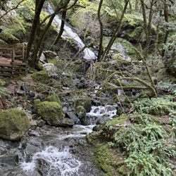
    I had forgotten just how gorgeous this hike is--the scenery is incredible the entire way. Be…read moreprepared for a steady climb through most of the route, with plenty of wooden stairs, gnarly roots, and rock steps, but the stunning views make every bit of effort worth it. There are many great spots to stop for photos, take a break, or enjoy a picnic--we did all three. Thanks to the recent rain, there was still plenty of water flowing, which made the trail even more beautiful. The picnic area at Laurel Dell is especially serene, with a babbling brook nearby. There's even an outhouse, which is always a welcome sight. I actually found climbing up much easier than descending as one has to really pay attention to their footing. We were happy seeing Alpine Lake again knowing we were close to end of hike.

    Went here with a friend and her dog and had such a great time. Such a beautiful, peaceful hike and…read moredefinitely one of my favorites on Mount Tam. The drive in was beautiful too, the views of Alpine Lake along the way made the whole trip feel extra special before we even got to the trail. Be prepared for a lot of stairs, so it can definitely get your legs working, but the waterfalls make it completely worth it. Hearing the water and being surrounded by all the greenery made the whole hike feel so calm and relaxing. The views throughout the hike are gorgeous, and it's such a nice escape if you're looking for something peaceful and scenic. Definitely recommend checking out Cataract Falls if you're up for a little workout with a really rewarding payoff. Definitely will be coming back :)

    Photos
    Cataract Falls Trail
    Cataract Falls Trail
    Cataract Falls Trail - So pretty and green

    See all

    So pretty and green

    Palomarin Trailhead

    Palomarin Trailhead

    4.6(62 reviews)
    1.4 mi

    We decided to go up to Alamere Falls this Saturday morning. Parking lot was not that full yet at…read more8am, maybe about 8-10 cars. There are lots of parking at this trail but by afternoon, good luck!! I would definitely come here super early to beat the crowd like we did! The road going here is very zigzag roads and some may get sick. Also, the road is very narrow and lots of loose gravel and lots of potholes so drive with caution. The trails are very well maintained. Lots of people traffic though. We got there early so there was barely anyone there but by the time we started going back, I stopped counting after a hundred people! Very popular trail as everyone wanted to go to Alamere Beach Waterfalls! We didn't go to the campgrounds as it was too far. Just going to Alamere Falls and back was already over eight miles! Alamere trails is another different review! I really enjoyed this trail as it goes along the coast and see the ocean views! Just beware there is a lot of poison oak! I saw a lot along the trail! It's part shade so wear a hat. Some parts of the trails goes up and down and lots of loose rocks so you can sleep. I would rate this trail moderate to hard as it's a long trail! Good workout!! I totally enjoyed this trail but recommend to come really early if you come on the weekend!! [31st R]

    Can I go back to last Thursday when I hiked this trail?! I couldn't have asked for better weather,…read moresunny, light breeze, mid-70s, and best of all, pretty empty! I'm not sure how anyone can find this place because there are no marked signs or paved roads to get to the parking lot or base of the trail. As a passenger, I was oblivious to driving directions. I must say that all the twists and turns left me a bit car-sick and thankfully that quickly passed. There are about 4 restroom stalls in the parking lot that stunk badly. Now onto the positive aspects of Palomarin. Many reviewers have mentioned that this trail to the falls is about 8 miles round-trip. I think I finished in about 4.5 hours with stops here and there at a leisurely pace. I bet the sunset would have been beautiful, but I left around 6:30pm. What I love about this hike is that there's a little of everything in terms of views and things to see. I saw the ocean, a lake, a fox, waterfalls, nature, and fresh air. I wonder if the waterfalls are always flowing, even a few years ago during the drought... A great pit-stop before coming to Palomarin is to stop in Stinson Beach for lunch or dinner. I'm glad lunch was eaten before the hike. Next time I'll bring snacks. Luckily I had brought lots of water. Still having Palomarin withdraws... #53/2018

    Photos
    Palomarin Trailhead - Monkey flower

    Monkey flower

    Palomarin Trailhead
    Palomarin Trailhead

    See all

    Petaluma Stand Up Paddle - One of our Newer Ohana stopped by on the way to a cocktail party

    Petaluma Stand Up Paddle

    4.7(30 reviews)
    21.2 mi

    We've been talking about trying out some kayaks on the Petaluma river for a while and we finally…read moredecided to do it. What a great experience! With six of us (including three kids and a dog), we needed two tandem and two single kayaks. The guys at Petaluma Paddle were great. On the phone, Drew helped me figure out what we needed - at the river, Chad was super helpful and got us going quickly. We were in our way. About 40 minutes later we made it to the turning basin where we docked and then walked into town for lunch. The timing was perfect, left at around noon as the tide took us up the river and on the way back the Petaluma wind was at our back. Glad we finally made it out, was great to see Petaluma from the river. Will definitely be back!!

    Yelp doesn't only help when you're hungry. It helps when you want to be active as well…read more Today we decided to try something new. Something we've never done before. We decided it was going to be Paddle Boarding. I called Petaluma Stand Up Paddle earlier in the week to get the low down. Jessica filled me in on how things operate. Today, I got the pleasure of meeting Jessica and Drew the owner. They got us all set up and have us a tutorial for us newbs. We rented our boards for $20/hr Or $65/day. They offer downwind paddles and other guided tours in their 2 other locations. Paddle Boarding seemed very novice. Anyone can do it. And you should do it especially if you're looking for a good core and upper body workout. You can paddle into Petaluma and have some lunch and paddle back. We did paddle twards town but never made it all the way. I think they said it was about a mile ? Along our paddle, we saw Blue Herons and Egrets hunting for their lunch. We watched as they caught and ate the fish. While we paddled, a parade of ducks joined us in the paddle. There were so many birds everywhere. We also saw jellyfish in the river. That was unexpected and neat to see. On the way back, the Smart train passed right in front of us. The passengers on the train waved as we waived back. We will be back and will hopefully bring others along with us. THANK YOU DREW AND JESS AT PETALUMA STAND UP PADDLE :-)

    Photos
    Petaluma Stand Up Paddle - What to wear 1st time on  a SUP @  PSUP?

    What to wear 1st time on a SUP @ PSUP?

    Petaluma Stand Up Paddle - Under the Smart train bridge heading into town

    Under the Smart train bridge heading into town

    Petaluma Stand Up Paddle - The board selection

    See all

    The board selection

    Cascade Falls - Poison oak

    Cascade Falls

    4.4(41 reviews)
    9.7 mi

    3/21/2026 On the way back from Cataract Falls Trail in Fairfax, CA, we decided to stop by the…read moreCascade Falls we visited last year with no water, all dried up. Since the Cataract Falls had water this time, we believed Cascade would too. It wasn't far from Cataract Falls, but if we drove from the East bay it would take more than an hour through 880 north 80 - 580 - Fairfax downtown. The hardest part of the trail is to find the parking space on the road to the trail. All along the street has no parking signs, we had to park almost a mile from the gate of the trail park. The hike is about 1.5 miles and uphill but not too hard. There are 2 trails to get to the Falls, on the way to the fall we used the right trail, on the way back, we used the left trail. The left trail is easier, wider than the right trail, both are on either side of the creek. This time, the water is there, very nice, although not many people there due to parking we guess. Anyhow, it's a quest that's successfully achieved for us. We had lunch at the top of the falls, all by ourselves which was nice. The next one will be Burney Falls. https://youtu.be/eHk-oivo32w

    Serenity now! Get ready for a great hike, a wonderful workout with such an incredible nature view…read moreof magnificent trees, rocks, water, ferns, birds, clean air, etc etc Cascade Fall trail is near Mill Valley, California. There are several paths from easily to moderately challenging route, it takes an average of 30 min to complete. This is absolutely my favorite trail for solitude, mindfulness. birding, hiking, and walking, Parking is a bit tough but if you can get there early, you can easily find a spot. The trail is open year-round and is beautiful to visit anytime. Dogs are welcome, but must be on a leash. Enjoy!

    Photos
    Cascade Falls
    Cascade Falls - Poison oak

    Poison oak

    Cascade Falls - Beautiful place

    See all

    Beautiful place

    Carson Falls - Parking area

    Carson Falls

    3.9(26 reviews)
    6.6 mi

    Carson Falls are epic! Carson Falls drops about 80 feet…read more along Carson Creek. In the winter after storms: totally amazing! The creek swells and the falls roar. You don't just see it, you feel it in your mind and heart! I love the power of water falls! In the summer, the water falls are quiet, delicate, still stunning. Your peaceful serenity moment with zero crowds makes your heart melt with smiles. Bring your lunch. Or a book. Or just simply enjoy the magic of living! It's about 3 miles round trip. 2 hours. Steady but happy climb, totally doable! The kind of "easy enough for any day of the week, rewarding enough to brag about hike. Chase this one right after a huge storm must be spectacular! Trust me. You'll see why Marin locals try to keep it quiet. Who's adding this to their hiking list?

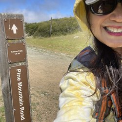
    This is a case where the journey is more important than the destination…read more Carson Falls is located in a remote part of Marin County. When I was into mountain biking, I read a book about the biking trails in Marin. On a scale of 1 to 5, 5 being the toughest, the Pine Mountain area is a 6! Pine Mountain Road is not only remote, it's rocky. If you get in trouble out here, you're REALLY in trouble. I'll stick to hiking, thankyouverymush. First stop: Carson Falls. I went in March, there had already been a few showers that year, so I wasn't worried about the lack of water. I was spectacularly underwhelmed. I think the falls are around 25 feet tall, and it wouldn't take much for the creek to run out of water. The rock where you can gaze at the falls while eating lunch is nice, and the immediate area is home to an endangered yellow-legged frog. Oh well, so much for this destination. The journey - the acreage surrounding the falls - truly is spectacular. Especially in Spring, when the grass is still green. Forests alternating with low manzanita. The last quarter mile before Carson Falls is deep redwoods. Views of canyons, ridgelines, the Meadow Club Golf Course, both Alpine and Kent Lakes, and Marin suburbia in the distance. You can even see Mt. Diablo and Mt. Tam in the same shot. I made it up to Pine Mountain, which requires bushwhacking to get to the actual summit, and found two mysterious rockwalls hidden among the manzanita. If camping was allowed here, there are plenty of nice backpacking spots, but this is an area for storage of Marin drinking water so camping is out. The Carson Falls and Pine Mountain area is really nice if you're looking for a different outdoors jaunt. It's not undiscovered by any means, but it does offer an experience that's different from most in Marin County - or the entire Bay Area, for that matter.

    Photos
    Carson Falls - Super windy on a sunny day

    Super windy on a sunny day

    Carson Falls - Trailhead

    Trailhead

    Carson Falls - Posting

    See all

    Posting

    Bass Lake - lakes - Updated May 2026

    Loading...
    Loading...
    Loading...