Cancel

    Open app

    Search

    Ashford Canyon Trail

    5.0 (1 review)

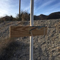
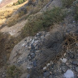
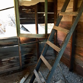
    Ashford Canyon Trail Photos

    You might also consider

    Recommended Reviews - Ashford Canyon Trail

    Your trust is our priority, so businesses can't pay to alter or remove their reviews. Learn more about reviews.
    Yelp app icon
    Browse more easily on the app
    Review Feed Illustration

    6 years ago

    Helpful 1
    Thanks 0
    Love this 1
    Oh no 0

    Verify this business for free

    Get access to customer & competitor insights.

    Verify this business

    Amargosa River Canyon

    Amargosa River Canyon

    5.0(4 reviews)
    27.5 mi

    Enjoyed going thru this river and canyon on a side by side! We camp at Dumont Dunes and this is…read morelocated in that vicinity. This river is an underground river but when it rains hard there's so much water on the trails it looks so cool! Such a great experience seeing this canyon! Totally recommend!

    I have been hiking in the area for over a decade and it's always been a very special…read moreplace--history, great geology, and a date shake--all are part of hiking here. The Amargosa Rover Canyon offers several trails in China Ranch and beyond. There are two ways to hike the canyon itself. The best way to enjoy most of the entire canyon is to spot cars. Leave one at China Ranch and drive the other to Tecopa, California and park where there's public parking behind the post office. From here, hike south following the trail. Mostly you'll hike on the railroad bed of the T&T Railroad (Tonopah and Tidewater) bed as it follows the Amargosa River through the canyon. At places, the trail leaves thew railroad bed and makes wide arcs on the east side of the trail. After 5 miles, you'll reach the turnoff for China Ranch and where the spur from the T&T was built to bring gypsum from the mines above the ranch from the Morrison Siding. Along the way through the canyon from Tecopa, you'll see areas with barbed wire. This is where horses and cattle were fenced in to keep them off the railroad tracks. You will see no track. The railroad stopped operating in 1940 and the rails were pulled up and used for World War II needs. About a mile and a half from the Ranch, there's a turnoff to the west (right) and this leads to a little waterfall on the river. Beyond this about 1/4 mile, there's another turnoff--again to the west--that leads to a slot canyon that is blocked by a huge chockstone. Both side trails have signs but they have faded a lot over the years. When you almost reach the 90º bend in the river, the trail goes up a hill and heads east (left) toward the ranch. Before going up the hill, take time to look at the wood left from when this was where the gypsum was loaded onto ore cars over 100 years ago. Follow the trail from here to China Ranch. On this last bit, you'll come to a building. My first photo of this building is from 2005. The building was called the Tuff Building and the sign that was there said it was first a bar and then an assay house. The building was supposed to have been repaired that years. 1w2 years later, another portion has fallen over including the concrete piece from the doorway with the 1903 construction date in the concrete. I'm sure when I hike here next year, the rest of the southerly wall will be down too! What a shame! There are several hikes. After this 6.5 mile hike, you'll want to have a date shake and perhaps some date cookies. You earned them. On another day(s), you can explore the other trails in China Ranch. After your shake, take the car you left at the ranch and ride back to Tecopa to get the one where you started your hike. This is the way to see almost the entire canyon.

    Photos
    Amargosa River Canyon
    Amargosa River Canyon
    Amargosa River Canyon

    See all

    Rainbow Basin Natural Area - Towering formation

    Rainbow Basin Natural Area

    4.6(10 reviews)
    63.8 mi

    Extremely beautiful area!! Similar to the painted hills in Oregon, this rural wonder is a must if…read moreyou're near Barstow. The road is a little ways off but there's helpful signage once you've typed in the location. The winding and rolling road has many spots to stop and get out of the car to look at the gorgeous rock formations. Peak sunset spot and view is right by the destroyed green piano and then the loop takes you back out to the main road. We came in December and we were all alone !! While it may not be as grand as the Grand Canyon the multi colored rocks and stacks are similarly beautiful here and the opportunity to get closer is even better. Practice leave no trace and be aware of your surroundings as the rocks can look quite precarious.

    A trip to Rainbow Basin will make you feel like you're on a different planet. It's a unique drive…read moreon a one-way unpaved road through some of the most striking geological formations I've ever seen. As other Yelpers have said, the photos don't do justice to the subtle variations in color that you'll see. Visiting in spring, lots of wildflowers and the Joshua trees were in bloom as well. Tips: Make sure your car is in good condition and take water. I made the drive in just a regular car with no 4-wheel drive and I was fine but check road conditions first. It's free! Don't forget to charge your phone and take your real camera.

    Photos
    Rainbow Basin Natural Area - Sunlit entrance

    Sunlit entrance

    Rainbow Basin Natural Area - Rocks at sunset

    Rocks at sunset

    Rainbow Basin Natural Area - Road

    See all

    Road

    Mojave Lava Tubes - View of the tube from on top

    Mojave Lava Tubes

    4.7(23 reviews)
    70.1 mi

    I can't believe I forgot to review this crazy adventure from a couple years ago…read more I have visited the lava tubes in Hawaii and when I found out we had one in the middle of the desert I knew I would have to come check it out. Post pandemic, my husband and I set out on a Saturday morning to find and explore these tubes. From Las Vegas it takes roughly 2.5 hours to get there. Driving the I15 freeway, take the Kelso Road exit and make a left turn. Drive on this road till you see Aiken Mine Road. Turn here and it will take you to the tubes. Be advised this is a dirt road not maintained so it can be a challenge for a regular vehicle. High clearance vehicles are preferred. Once you arrive and park, you will see the trail that takes you to a ladder that you will climb down to enter the tube. Be careful and watch your head as you descend into the lava tube. It is very easy to hit your head on the overhead rock hanging down. If you hit the tube at just the right time, light will filter through and it's very interesting and unique. Be careful with the dust down there, it is swirling all around from foot traffic. I advise wearing a mask like I did in order to not breathe in bad air. Although not as picturesque as the Hawaiian tubes, it was a fun little adventure to seek out. Remember to follow the principles and Leave No Trace.

    Very cool spot, off the beaten path... and when I say beaten, I mean it -- think bumpy, rocky…read more.. all the things besides smooth lol! This is about a 30 min drive off 15 and then once you turn off the main road, you'll take the unpaved road about 4.5 miles to the lava tubes where you'll then walk about .3 miles or so! Super easy and straightforward to find, worth it but take a look at my tips to understand what to prepare for to make it a great experience! 1. Make sure you have a vehicle that is higher up and can with stand a bumpy road -- it is no joke! 2. Climb all the way down into the lava tube, don't just look from above, otherwise it's not worth the trip. 3. Make sure you have some kind of light source because it's dark and you will bump your head or trip if you can't see. If you only have your phone, highly recommend videoing with the flash on, it is MUCH brighter than just the flashlight. 4. There is minimal to no service so just be prepared for that. 5. The 4.5 mile road to the lava tubes is one wide enough for cars going both ways most of the time, but there are times it's really a one lane road, so be aware of who is coming at you from afar and use the pull offs if needed. 6. Optimal lighting in the tube is between 10-2. Think peak sun time. This is slightly dependent on the season as it could fluctuate a bit, but ultimately that's the best time! Hopefully my review and tips help you have a great adventure at the lava tubes! Enjoy!

    Photos
    Mojave Lava Tubes
    Mojave Lava Tubes - Entrance with staircase

    Entrance with staircase

    Mojave Lava Tubes - Unpaved road

    See all

    Unpaved road

    Rainbow Basin Natural Area

    Rainbow Basin Natural Area

    4.7(3 reviews)
    58.0 mi

    I've a bit of the wanderlust running through me, and it's getting stronger with each day passing…read more To try and negate some of this growing restlessness, I thought perhaps reviewing one of my past adventures would help to calm the stormy seas inside of me before I go insane. I have a dirty past. Quite literally. I am one of very few chicks that dug dirt and rocks from a very tender age (mind the bad pun). And they continue to excite me even after a decade away from school. There's hardly anything more exciting than hiking to gods know where for some geologic/paleontologic mindjob. Was that TMI? Oops, my bad. But, please, don't go anywhere! Allow me to share one of my fondest geology trips with you. I loved my majour in college. What's not to love about a study that allows you to spend more than half of your collegiate time outdoors, rain or shine? I was never much one for classroom settings. Don't let the geeky exterior fool you. I'm the type to bring a laptop out into the wild unknown to play my video games. ^_- Whoever said you can't have it all? All that's missing is a wonderful companion to share it all with. My Spring Fieldtrip assignment was to map Rainbow Basin, outside of Barstow, California. I believe the area we had to map was about 3 square miles, up and down peaks and in and out of valleys. 9 glorious days did we spend out there. Rainbow Basin is a gorgeous stretch of land. If you haven't been there yet, promise me you will. If only for a day. The best part is during sunset in the main valley. There's a specific point in the valley where you crest a rise and just sit there, waiting for the magickal moment where the sun dips just low enough in the sky to light up the cliff face where there's a huge syncline composed of various oxidized layers (http://en.wikipedia.org/wiki/File:Rainbow_Basin.JPG). These layers, composed of various different minerals, oxidized over time to produce different shades of colours - red, purple, yellow, green, blue... The beauty is when the sun lights up these different layers to give you the most amazing display of coloured rock ever. Hence, the name of the basin itself. I'm thinking of a road trip back there this summer to view this phenomenom once more; only this time, I'll be bringing a camera to document my memories. Will you join me? Bring your sleeping bag, but forget the tent. We'll snuggle under the summer stars together.

    Beautiful place. Love the colors and formations. Geology is wonderful. Enjoyed the scenic drives as…read morethe valley walls get closer and closer as your car wanders through the basin. The road Is nicely graded that goes through a wash. Very epic, scenic panoramic views. Highly recommend spring, fall or winter times to visit as it can get hot!! We went in February, Not too far of a drive from Barstow or on the dirt road. We also hiked among the Mojave desert vegetation and enjoyed the Joshua trees. Think we got a glimpse of the lakebed with Goldstone. Great picture taking opportunities!

    Photos
    Rainbow Basin Natural Area
    Rainbow Basin Natural Area
    Rainbow Basin Natural Area

    See all

    Teutonia Peak - Athens out exploring

    Teutonia Peak

    4.5(4 reviews)
    74.1 mi

    I first hiked Teutonia Peak in 2004. It was a great hike then and still is but the landscape has…read morechanged so much. That's why I wanted to go back. During the summer, the Dome fire burned this area. What was once the largest concentration of Joshua trees in the world is now a sad hike along Joshuas that have been burned. It looked like some had some green at the top and may come back, but most won't. This three mile round trip hike starts along Cima Road. There is plenty of parking on both sides of the road. The first mile of the hike is on sand and gravel with the sand hard packed in a few places. There's a side trail that goes to some remnants of an old silver mine. The trail is clearly marked although some of the signs have faded in the desert sun. At about one mile out, the trail becomes totally different. It's here that the elevation gain of 700 feet begins. Much of the way up requires using rock steps and it becomes a workout. I seem to remember that the trail was a lot less steep almost 17 years ago, but maybe it's just me. At 1.5 miles out, you get a view of Cima Dome. It's a convex mound caused by movement of the tectonic plates in this area millions of years ago. This is where we decided to turn back as we had other things to see in the Mojave National Preserve. This is a good trail for families. It's not as beautiful as it was before the fire but the views and the rock outcrops make it a worthwhile hike!

    The hike is a fairly easy hike roughly 1.72 miles to the top. There is parking just outside the…read morestart of the trail and picnic tables at the Mojave Cross. The area is absolutely breathtaking the entire way full of wildlife and Joshua Trees and amazing cloud formations. The hike to the peak is worth it. The view is amazing!

    Photos
    Teutonia Peak - Interesting and precarious rock formations

    Interesting and precarious rock formations

    Teutonia Peak - Athens in the mancave

    Athens in the mancave

    Teutonia Peak

    See all

    Ashford Canyon Trail - hiking - Updated May 2026

    Loading...
    Loading...
    Loading...