Cancel

    Open app

    Search

    China Ranch Hiking Trail

    5.0 (1 review)

    China Ranch Hiking Trail Photos

    You might also consider

    More like China Ranch Hiking Trail

    Recommended Reviews - China Ranch Hiking Trail

    Your trust is our priority, so businesses can't pay to alter or remove their reviews. Learn more about reviews.
    Yelp app icon
    Browse more easily on the app
    Review Feed Illustration
    Photo of Rosabell M.
    114
    1466
    10882

    8 months ago

    Helpful 1
    Thanks 2
    Love this 2
    Oh no 0

    Verify this business for free

    Get access to customer & competitor insights.

    Verify this business

    Amargosa River Canyon

    Amargosa River Canyon

    5.0(4 reviews)
    3.2 km

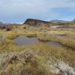
    Enjoyed going thru this river and canyon on a side by side! We camp at Dumont Dunes and this is…read morelocated in that vicinity. This river is an underground river but when it rains hard there's so much water on the trails it looks so cool! Such a great experience seeing this canyon! Totally recommend!

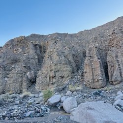
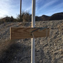
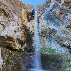
    I have been hiking in the area for over a decade and it's always been a very special…read moreplace--history, great geology, and a date shake--all are part of hiking here. The Amargosa Rover Canyon offers several trails in China Ranch and beyond. There are two ways to hike the canyon itself. The best way to enjoy most of the entire canyon is to spot cars. Leave one at China Ranch and drive the other to Tecopa, California and park where there's public parking behind the post office. From here, hike south following the trail. Mostly you'll hike on the railroad bed of the T&T Railroad (Tonopah and Tidewater) bed as it follows the Amargosa River through the canyon. At places, the trail leaves thew railroad bed and makes wide arcs on the east side of the trail. After 5 miles, you'll reach the turnoff for China Ranch and where the spur from the T&T was built to bring gypsum from the mines above the ranch from the Morrison Siding. Along the way through the canyon from Tecopa, you'll see areas with barbed wire. This is where horses and cattle were fenced in to keep them off the railroad tracks. You will see no track. The railroad stopped operating in 1940 and the rails were pulled up and used for World War II needs. About a mile and a half from the Ranch, there's a turnoff to the west (right) and this leads to a little waterfall on the river. Beyond this about 1/4 mile, there's another turnoff--again to the west--that leads to a slot canyon that is blocked by a huge chockstone. Both side trails have signs but they have faded a lot over the years. When you almost reach the 90º bend in the river, the trail goes up a hill and heads east (left) toward the ranch. Before going up the hill, take time to look at the wood left from when this was where the gypsum was loaded onto ore cars over 100 years ago. Follow the trail from here to China Ranch. On this last bit, you'll come to a building. My first photo of this building is from 2005. The building was called the Tuff Building and the sign that was there said it was first a bar and then an assay house. The building was supposed to have been repaired that years. 1w2 years later, another portion has fallen over including the concrete piece from the doorway with the 1903 construction date in the concrete. I'm sure when I hike here next year, the rest of the southerly wall will be down too! What a shame! There are several hikes. After this 6.5 mile hike, you'll want to have a date shake and perhaps some date cookies. You earned them. On another day(s), you can explore the other trails in China Ranch. After your shake, take the car you left at the ranch and ride back to Tecopa to get the one where you started your hike. This is the way to see almost the entire canyon.

    Photos
    Amargosa River Canyon
    Amargosa River Canyon
    Amargosa River Canyon

    See all

    Big Falls - 7.21.23

    Big Falls

    4.5(11 reviews)
    68.7 km

    I shared many photos during our hikes here but I realize I didn't leave a review…read more Big Falls is one of my favorite trails at Mt Charleston any time of year. I love the little bit of climbing we can do, the views we find, and as always, the people who come with us. I haven't visited this trail in so long, so I don't have fresh or new commentary. It's been over 8 years since I've been here. All the photos I see I shared here are with my old dog, who passed away, and maybe one day I'll return with my current dog.

    After wanting to do this hike for years, I finally got to go this morning with a friend leading the…read moreway. Since there isn't really an official trail to follow, I'm glad that I had someone who knew where to go. Even though it's June, there is still snow in parts of Mount Charleston due to the amount of rain that we had in the past few months. The snow is melting, so there was lots of water to see on this hike, which I loved. My friend, her dog, and I crossed quite a few areas with running water, so I was glad to have waterproof boots. It was also helpful to have hiking poles, as there were parts of the trek that they came in handy, notably when we encountered some snow to get to the falls. Big Falls itself did not disappoint; it's a beautiful sight! We had it to ourselves, too, which made this hike even better. We did see a couple of people on our way back to the parking area, but it's definitely not crowded like Mary Jane Falls or Cathedral Rock. Our hike was about 3.2 miles round-trip. Be advised that the amount of running water will depend on the weather and time of year; our timing was just right today.

    Photos
    Big Falls - June 7, 2023

    June 7, 2023

    Big Falls
    Big Falls

    See all

    Spring Mountain National Recreation Area - Evening primrose

    Spring Mountain National Recreation Area

    4.4(45 reviews)
    75.3 km

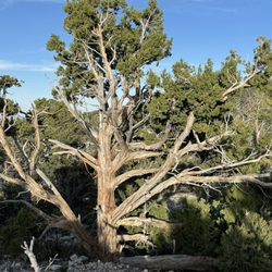
    Fun fact: Southern Nevada's Spring Mountain NRA has 7 different climate zones, a change in habitat…read morethat is similar to traveling from Mexico to the Canadian Arctic. SOURCE: Travel Nevada. There are also groves of Great Basin Bristlecone Pines--one of the oldest species on Earth that are only found in NV, CA, and UT--as well as at least 20 endemic species (that are found nowhere else on Earth). Home Means Nevada. :)

    Early May, 2024. (Arriving on a Sunday, leaving on Monday). We spent two days, including one night…read morecamping, in the Spring Mountains National Recreation Area (NRA) which includes Mount Charleston. Administered by the US Department of Agriculture's Forest Service, the entrance is just 17 miles from Hwy 95 on Rte 157 or 45 minutes (and a world away) from the hustle and bustle - and heat - of the Las Vegas strip. Sunday. We started at the Visitor Gateway, where there are helpful staff and maps to help you to plan your stay. In addition, there is a gift shop, clean restrooms, an amphitheater, picnic areas, and trailheads to the Pack Rat Route and the Escarpment Trails. Next on our itinerary were a pair of scenic drives. From the Visitors Gateway, we traveled a short distance on Rte 157, until intersecting with Rte 158, which took us up the windy mountain road. We passed the entrances to The Resort on Mount Charleston, various trailheads, picnic areas, and campgrounds. We stopped at the Desert View Overlook, walking the short interpretive trail and taking photos. We continued in Rte 158 until we intersected with Rte 156, which we took left to the Lee Canyon ski area, passing picnic areas, campgrounds, and trailheads along the way. We then turned around, and went back down the mountain. Upon again intersecting with Rte 157, we took it to its terminus at the Mount Charleston Lodge. Our final destination was our campsite at the Fletcher View Campground (reviewed separately). Monday. We returned to the Visitors Gateway, and did the two "more difficult" hikes that originated there -- the Pack Rat Route (only 0.4 mi) is short, paved, and very steep. If you do it as a loop, the trail is somewhat washed out towards the end. Pack Rat connected to the 2.4 mile Escarpment Trail, which takes you above the cliffs and to some wonderful mountain views. Both of these trails are for hiking only. No bikes or horses. Some things to note: *The Visitors Gateway provides a good map of the area which I've posted a Yelp (in Spanish). It shows trails (including hiking, cycling, equestrian, and interpretative), campgrounds, picnic areas, restrooms, etc. *The map also highlights the trails in the NRA, with ratings of easy to moderate to more difficult to most difficult. It also provides distances, but not elevation changes. *When we were there (May, 2024), at least 6 trails, including the popular Mary Jane Falls Trail, were closed due to storm damage.

    Photos
    Spring Mountain National Recreation Area - Look at this tree! Isn't it beautiful?

    Look at this tree! Isn't it beautiful?

    Spring Mountain National Recreation Area - Evening primrose ( growing in the tiny whole on the rocks)

    Evening primrose ( growing in the tiny whole on the rocks)

    Spring Mountain National Recreation Area - Sierra Juniper

    See all

    Sierra Juniper

    Cathedral Rock - August 2023

    Cathedral Rock

    4.8(72 reviews)
    73.8 km

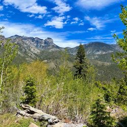
    We visited last saturday, which turned out to be a FREE entry day. This was a nationwide promotion…read morefor state parks. But not highly advertised. I think that this happens several times a year, every year. (Otherwise, it was $18 last year. This is the private area. Less people here. More people are at the free areas.) It was beautiful, the trees, the mountains, the scenery. Sunny, with it getting dark (chance of rain), at times, and some wind. At first, we went to a table that didn't have any shade. So we went a little further away. We went to Parking section H, which was not busy at all. Table number 71. Overlooking large white boulders. We saw chipmunks, a hawk high overhead, huge butterflies, and pesky horseflies. Also, a loud grasshopper making a mating call. (Section E was Reserved.) TIP: wipe off the tree sap with wet wipes! Good thing, my MIL brought a table cover to use. We had sandwiches, chips, cookies, bottled water, and sodas. (Some people were barbeque'ing. There are grills, but I suggest using foil, because they are black.) The blue dumpsters are in the parking lots. The dual bathroom, also located in the parking lots, is porta-potty style. There is a sign to "place the lid down". No trash bins inside. No soap to wash your hands. Good thing, I have hand sanitizer on my purse, always. (There is a purse hook inside, which is handy to use.) We went on a trail, which logged in 43 minutes of hiking, Past Discovery Trail, to the Fossil section, overlooking the mountains. Gorgeous. We brought the new pup along, and he didn't have any issues. He even jumped over a huge log on the ground! There was a random bench near the Bridge, which we noticed last year, too.

    Amazing views at the top! I went in June, and parking is fairly easy on weekday mornings. By 9 AM,…read moremost spots are full. There are bathrooms in the parking lot but like any park bathroom, they're pretty gross. I always bring my own wet wipes and toilet seat covers just in case. The elevation gain was pretty rough as a casual hiker, and there isn't much shade. There are a couple benches along the trail here and there. The most difficult part was the loose rocks/gravel that paved the trail, making it pretty difficult to get stable footing with every step. I'd recommend bringing hiking poles just in case. If I were to do it again, I'd probably start at around 7-7:30 am because it gets hot pretty quickly.

    Photos
    Cathedral Rock
    Cathedral Rock
    Cathedral Rock

    See all

    Mojave Lava Tubes - View of the tube from on top

    Mojave Lava Tubes

    4.7(23 reviews)
    80.2 km

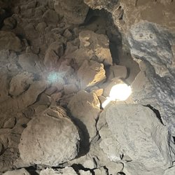
    I can't believe I forgot to review this crazy adventure from a couple years ago…read more I have visited the lava tubes in Hawaii and when I found out we had one in the middle of the desert I knew I would have to come check it out. Post pandemic, my husband and I set out on a Saturday morning to find and explore these tubes. From Las Vegas it takes roughly 2.5 hours to get there. Driving the I15 freeway, take the Kelso Road exit and make a left turn. Drive on this road till you see Aiken Mine Road. Turn here and it will take you to the tubes. Be advised this is a dirt road not maintained so it can be a challenge for a regular vehicle. High clearance vehicles are preferred. Once you arrive and park, you will see the trail that takes you to a ladder that you will climb down to enter the tube. Be careful and watch your head as you descend into the lava tube. It is very easy to hit your head on the overhead rock hanging down. If you hit the tube at just the right time, light will filter through and it's very interesting and unique. Be careful with the dust down there, it is swirling all around from foot traffic. I advise wearing a mask like I did in order to not breathe in bad air. Although not as picturesque as the Hawaiian tubes, it was a fun little adventure to seek out. Remember to follow the principles and Leave No Trace.

    Very cool spot, off the beaten path... and when I say beaten, I mean it -- think bumpy, rocky…read more.. all the things besides smooth lol! This is about a 30 min drive off 15 and then once you turn off the main road, you'll take the unpaved road about 4.5 miles to the lava tubes where you'll then walk about .3 miles or so! Super easy and straightforward to find, worth it but take a look at my tips to understand what to prepare for to make it a great experience! 1. Make sure you have a vehicle that is higher up and can with stand a bumpy road -- it is no joke! 2. Climb all the way down into the lava tube, don't just look from above, otherwise it's not worth the trip. 3. Make sure you have some kind of light source because it's dark and you will bump your head or trip if you can't see. If you only have your phone, highly recommend videoing with the flash on, it is MUCH brighter than just the flashlight. 4. There is minimal to no service so just be prepared for that. 5. The 4.5 mile road to the lava tubes is one wide enough for cars going both ways most of the time, but there are times it's really a one lane road, so be aware of who is coming at you from afar and use the pull offs if needed. 6. Optimal lighting in the tube is between 10-2. Think peak sun time. This is slightly dependent on the season as it could fluctuate a bit, but ultimately that's the best time! Hopefully my review and tips help you have a great adventure at the lava tubes! Enjoy!

    Photos
    Mojave Lava Tubes - Ladder that takes you to the tube

    Ladder that takes you to the tube

    Mojave Lava Tubes - Entrance to the tube, watch your head as you climb in.

    Entrance to the tube, watch your head as you climb in.

    Mojave Lava Tubes - More light filtering in

    See all

    More light filtering in

    China Ranch Hiking Trail - hiking - Updated August 2026

    Loading...
    Loading...
    Loading...