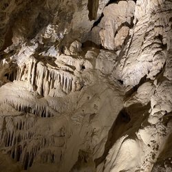
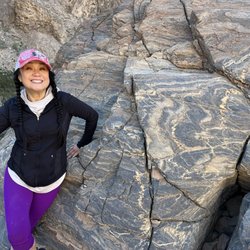
Amargosa Conservancy Photos


You might also consider
More like Amargosa Conservancy
Recommended Reviews - Amargosa Conservancy
Start your review...

12 years ago
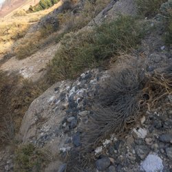
I want to thank the guy who works at the Crowbar, and works for the Conservancy, who told us about all of the hiking trails in Shoshone. We have been here so many times and never know about these trails. We hikes them all, and they are all so worth it. The trail that starts behind the Crowbar connects with two others and makes up for one GREAT hike that comes out across the road from the Shoshone Campground. The other trail starts beside Death Valley High School and goes way back into the Shoshone Badlands and comes out between the Shoshone Cemetery and the Dublin Gulch. Awesome hikes, and thanks to the Amargosa Conservancy! read more


More info about Amargosa Conservancy


Amargosa Conservancy - hiking - Updated July 2026
Best of Shoshone
People found Amargosa Conservancy by searching for…
Things to Do in Shoshone, California
Hiking Trails in Shoshone, California
Walking Trails in Shoshone, California
Tent Camping in Shoshone, California
Running Trails in Shoshone, California
Sunday Fun Things to Do in Shoshone, California
What to Do in Shoshone, California
Places to Visit in Shoshone, California
Attractions in Shoshone, California
Trails in Shoshone, California
Swimming Lakes in Shoshone, California
Off Road Trails in Shoshone, California
Browse Articles
Browse Nearby
Browse Brands
Related Searches in Shoshone, CA
Best Dog Hiking Trails Around Shoshone, California
Best Lookout Points to Visit in Shoshone, California
Best Nature Trails for Hiking in Shoshone, California
Best Sightseeing Experiences Available in Shoshone, California
Best Spots for Star Gazing in Shoshone, California
Best Waterfalls and Swimming Holes in Shoshone, California
Check Out Off Road Trails in Shoshone, California
Discover Dog Friendly Trails to Explore in Shoshone, California
Discover Popular Bike Trails in Shoshone, California
Discover Popular Photo Spots in Shoshone, California
Discover a Hiking Trail in Shoshone, California
Discover the Best Night Hike Trails in Shoshone, California
Discover the Best Running Track in Shoshone, California
Dog-Friendly Hikes With Dogs in Shoshone, California
Enjoy Camping Adventures Around Shoshone, California
Enjoy Off Leash Dog Hikes in Shoshone, California
Enjoy Scenic Night View Experiences in Shoshone, California
Enjoy Tent Camping Spots Around Shoshone, California
Enjoy the Best Walking Trails in Shoshone, California
Experience Stunning Sunset Views in Shoshone, California
Explore Easy Hikes Perfect for All in Shoshone, California
Explore Landmarks & Historical Buildings in Shoshone, California
Explore Popular Campgrounds Near Shoshone, California
Explore Popular RV Parks Around Shoshone, California
Explore Popular Scenic Overlook Points in Shoshone, California
Explore Popular Scenic Views Near Shoshone, California
Explore Popular View Points Around Shoshone, California
Explore Scenic Lakes to Visit in Shoshone, California
Explore the Best Swimming Holes Around Shoshone, California
Family Friendly Hiking With Kids in Shoshone, California
Find Beautiful Views in Shoshone, California
Find Exciting Tours to Take in Shoshone, California
Find Parks and Recreation Activities in Shoshone, California
Find Top-Rated Waterfalls in Shoshone, California Now
Find the Best Scenic View Locations in Shoshone, California
Hiking Trails With Waterfalls in Shoshone, California
Off Leash Dog Hiking Trails in Shoshone, California
Perfect Spots to Watch Sunset in Shoshone, California
Plan a Scenic Drive Route Near Shoshone, California
Popular Things to Do in Shoshone, California
Popular Things to See in Shoshone, California
Relax at Natural Hot Springs Near Shoshone, California
Safe River Swimming Areas in Shoshone, California
Top Hiking Trails to Explore in Shoshone, California
Top Running Trails to Explore in Shoshone, California
Top-Rated Camping Sites in Shoshone, California
Uncover the Best Secluded Spots Around Shoshone, California
People who viewed Amargosa Conservancy also viewed
Dublin Gulch
6 reviews
Amargosa Waterfall
1 review
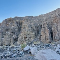
Shoshone Badlands Hiking Trail
4 reviews
Tecopa Hot Springs Campground & Pools
45 reviews
China Ranch Hiking Trail
1 review
Ashford Mills Ruins
2 reviews
Amargosa River Canyon
4 reviews
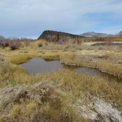
Shoshone Wetlands Hiking Trail
2 reviews
Sundance Ranch of Nevada
2 reviews
Ian Deutch Memorial Park
3 reviews