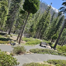
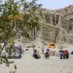
Rainbow Basin Natural Area Photos


You might also consider
More like Rainbow Basin Natural Area
Recommended Reviews - Rainbow Basin Natural Area
Start your review...

15 years ago
10 years ago
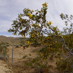
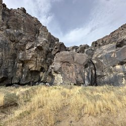
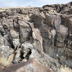
Beautiful place. Love the colors and formations. Geology is wonderful. Enjoyed the scenic drives as the valley walls get closer and closer as your car wanders through the basin. The road Is nicely graded that goes through a wash. Very epic, scenic panoramic views. Highly recommend spring, fall or winter times to visit as it can get hot!! We went in February, Not too far of a drive from Barstow or on the dirt road. We also hiked among the Mojave desert vegetation and enjoyed the Joshua trees. Think we got a glimpse of the lakebed with Goldstone. Great picture taking opportunities! read more


17 years ago
More info about Rainbow Basin Natural Area
Irwin Rd
Ridgecrest, CA 93555
Directions
Hours
Outdoor Amenities


Why does Yelp recommend reviews?
1 review that is not currently recommended
The reviews below are not factored into the business's overall star rating.
10 years ago
Rainbow Basin Natural Area - landmarks - Updated July 2026
Best of Ridgecrest
People found Rainbow Basin Natural Area by searching for…
Things to Do in Ridgecrest, CA
Watch Sunset in Ridgecrest, CA
Places to Take Pictures in Ridgecrest, CA
Hiking Trails in Ridgecrest, CA
Scenic Views in Ridgecrest, CA
Scenic Drive in Ridgecrest, CA
Tourist Attractions in Ridgecrest, CA
Tent Camping in Ridgecrest, CA
Public Services & Government in Ridgecrest, CA
Running Trails in Ridgecrest, CA
Historical Sites in Ridgecrest, CA
Walking Path in Ridgecrest, CA
Bird Sanctuary in Ridgecrest, CA
Trending Searches in Ridgecrest, CA
Hiking near Rainbow Basin Natural Area
Lakes near Rainbow Basin Natural Area
Landmarks & Historical Buildings near Rainbow Basin Natural Area
Parks near Rainbow Basin Natural Area
Public Shower near Rainbow Basin Natural Area
River Swimming near Rainbow Basin Natural Area
Sunset View near Rainbow Basin Natural Area
Swimming Holes near Rainbow Basin Natural Area
Swimming Lakes near Rainbow Basin Natural Area
Things To Do On A Rainy Day near Rainbow Basin Natural Area
Things To Do With Teenagers near Rainbow Basin Natural Area
Browse Articles
Browse Nearby
Browse Brands
Related Searches in Ridgecrest, CA
Best Dog Hiking Trails Around Ridgecrest, California
Best Fishing Locations and Guides in Ridgecrest, California
Best Fun Things to Do in Ridgecrest, California
Best Places for Horseback Riding in Ridgecrest, California
Best Spots for Star Gazing in Ridgecrest, California
Check Out Off Road Trails in Ridgecrest, California
Discover Charming Historic Homes in Ridgecrest, California
Discover Dog Friendly Beaches Near Ridgecrest, California
Discover Dog Friendly Trails to Explore in Ridgecrest, California
Discover Famous Monuments in Ridgecrest, California
Discover Historic Sites and Places in Ridgecrest, California
Discover Popular Photo Spots in Ridgecrest, California
Discover a Hiking Trail in Ridgecrest, California
Discover a Library Near You in Ridgecrest, California
Discover the Best Beaches in Ridgecrest, California
Discover the Best Night Hike Trails in Ridgecrest, California
Dog-Friendly Hikes With Dogs in Ridgecrest, California
Enjoy Arts & Entertainment in Ridgecrest, California
Enjoy Camping Adventures Around Ridgecrest, California
Enjoy Hiking Adventures in Ridgecrest, California
Enjoy Off Leash Dog Hikes in Ridgecrest, California
Enjoy Tent Camping Spots Around Ridgecrest, California
Enjoy the Best Walking Trails in Ridgecrest, California
Experience Stunning Sunset Views in Ridgecrest, California
Explore Beautiful Castles and Landmarks in Ridgecrest, California
Explore Beautiful Parks and Green Spaces in Ridgecrest, California
Explore Easy Hikes Perfect for All in Ridgecrest, California
Explore Family-Friendly Zoos and Wildlife in Ridgecrest, California
Explore Free Things to Do Around Ridgecrest, California
Explore Fun Activities to Do in Ridgecrest, California
Explore Fun Field Trips in Ridgecrest, California
Explore Popular Boat Charters Near Ridgecrest, California
Explore Popular Campgrounds Near Ridgecrest, California
Explore Popular RV Parks Around Ridgecrest, California
Explore Popular Scenic Views Near Ridgecrest, California
Explore Scenic Lakes to Visit in Ridgecrest, California
Explore Top Art Galleries Located in Ridgecrest, California
Explore Top Dog Parks in Ridgecrest, California Near You
Explore Venues & Event Spaces in Ridgecrest, California
Explore the Best Swimming Holes Around Ridgecrest, California
Family Friendly Hiking With Kids in Ridgecrest, California
Find Exciting Tours to Take in Ridgecrest, California
Find Fun Things to Do With Kids in Ridgecrest, California
Find Parks and Recreation Activities in Ridgecrest, California
Find Top Libraries to Visit in Ridgecrest, California


