Abrego Trailhead Photos


More like Abrego Trailhead
Recommended Reviews - Abrego Trailhead
Start your review...

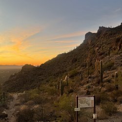
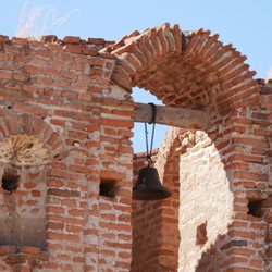
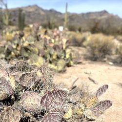
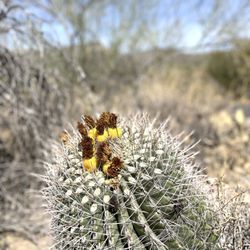
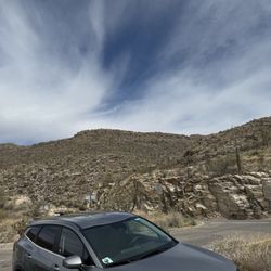
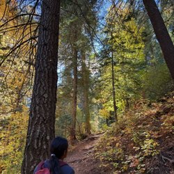
The Abrego Trailhead provides access to the Anza National Historic Trail. The trailhead is located in the Green Valley area immediately east of Abrego Drive approximately one mile south of Continental Road. It has a shade structure, 15 vehicle spaces including 2 that are accessible, and 4 horse rig parking spaces. Open sunrise to sunset. Dogs permitted on leash. Excellent picnicking area for large groups with electric outlets. One water spout but you need your own Sillcock key. read more


More info about Abrego Trailhead
2105 S Abrego Dr
Green Valley, AZ 85614
Directions
Visit Website
https://www.pima.gov
Hours
Outdoor Amenities


Abrego Trailhead - hiking - Updated July 2026
Best of Green Valley
People found Abrego Trailhead by searching for…
Things to Do in Green Valley, Arizona
Hiking Trails in Green Valley, Arizona
Sunset View in Green Valley, Arizona
Places to Take Pictures in Green Valley, Arizona
Swimming Lakes in Green Valley, Arizona
Walking Trails in Green Valley, Arizona
Running Trails in Green Valley, Arizona
Sunrise View in Green Valley, Arizona
Dog Friendly Hiking Trails in Green Valley, Arizona
Picnic Areas in Green Valley, Arizona
Attractions in Green Valley, Arizona
Scenic Overlook in Green Valley, Arizona
Fun Things to Do at Night in Green Valley, Arizona
What to Do in Green Valley, Arizona
To Do in Green Valley, Arizona
Swimming in Green Valley, Arizona
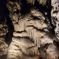
Caves in Green Valley, Arizona
Easy Hikes in Green Valley, Arizona
Scenic Restaurants in Green Valley, Arizona
Stuff to Do in Green Valley, Arizona
Sunset in Green Valley, Arizona
Skyline View in Green Valley, Arizona
Trending Searches in Green Valley, AZ
Boat Rental near Abrego Trailhead
Cliff Jumping near Abrego Trailhead
Day Trips near Abrego Trailhead
Dog Friendly Trails near Abrego Trailhead
Fireworks near Abrego Trailhead
Kayak Rental near Abrego Trailhead
Lakes & Ponds near Abrego Trailhead
Outdoor Activities near Abrego Trailhead
Places To Swim near Abrego Trailhead
Public Pools near Abrego Trailhead
Public Shower near Abrego Trailhead
River Swimming near Abrego Trailhead
Rock Quarry near Abrego Trailhead
Running Trails near Abrego Trailhead
Scenic Night View near Abrego Trailhead
Scenic Overlook near Abrego Trailhead
Secluded Spots near Abrego Trailhead
Soccer Store near Abrego Trailhead
Splash Pad near Abrego Trailhead
Sunrise View near Abrego Trailhead
Swimming Holes near Abrego Trailhead
Swimming Lakes near Abrego Trailhead
Swimming Pools near Abrego Trailhead
U Pick Farms near Abrego Trailhead
Watch Sunset near Abrego Trailhead
Browse Articles
Browse Nearby
BEST of Green Valley, Arizona Restaurants near Abrego Trailhead
BEST of Green Valley, Arizona Coffee near Abrego Trailhead
BEST of Green Valley, Arizona Things to Do near Abrego Trailhead
BEST of Green Valley, Arizona Parks near Abrego Trailhead
BEST of Green Valley, Arizona Lakes near Abrego Trailhead
BEST of Green Valley, Arizona Breakfast near Abrego Trailhead
Browse Brands
Related Searches in Green Valley, AZ
Best Fishing Locations and Guides in Green Valley, Arizona
Best Places for Horseback Riding in Green Valley, Arizona
Best Spots for Star Gazing in Green Valley, Arizona
Check Out Off Road Trails in Green Valley, Arizona
Discover Dog Friendly Trails to Explore in Green Valley, Arizona
Discover Scenic Mountain Bike Trails Near Green Valley, Arizona
Discover Scenic Waterfall Spots in Green Valley, Arizona
Discover a Hiking Trail in Green Valley, Arizona
Discover the Best Night Hike Trails in Green Valley, Arizona
Discover the Best Running Track in Green Valley, Arizona
Dog-Friendly Hikes With Dogs in Green Valley, Arizona
Enjoy Camping Adventures Around Green Valley, Arizona
Enjoy Exciting Mountain Biking Adventures in Green Valley, Arizona
Enjoy Kayaking Adventures in Green Valley, Arizona
Enjoy Tent Camping Spots Around Green Valley, Arizona
Enjoy a Beautiful Waterfall Hike in Green Valley, Arizona
Enjoy the Best Walking Path in Green Valley, Arizona
Enjoy the Best Walking Trails in Green Valley, Arizona
Explore Beautiful Parks and Green Spaces in Green Valley, Arizona
Explore Bike Rentals Throughout Green Valley, Arizona
Explore Easy Hikes Perfect for All in Green Valley, Arizona
Explore Fun Activities to Do in Green Valley, Arizona
Explore Nature Spots Around Green Valley, Arizona
Explore Popular Campgrounds Near Green Valley, Arizona
Explore Popular Scenic Overlook Points in Green Valley, Arizona
Explore Popular View Points Around Green Valley, Arizona
Explore Scenic Lakes to Visit in Green Valley, Arizona
Explore Secret Spots Worth Visiting in Green Valley, Arizona
Explore Top Dog Parks in Green Valley, Arizona Near You
Explore the Best Beach Spots in Green Valley, Arizona
Explore the Best Boating Spots in Green Valley, Arizona
Explore the Best Swimming Holes Around Green Valley, Arizona
Explore the Best Trail Options in Green Valley, Arizona
Family Friendly Hiking With Kids in Green Valley, Arizona
Find Cozy Camping Cabins in Green Valley, Arizona
Find the Best Parks for Picnics in Green Valley, Arizona
Find the Best Scenic View Locations in Green Valley, Arizona
Hiking Trails With Waterfalls in Green Valley, Arizona
Off Leash Dog Hiking Trails in Green Valley, Arizona
Plan a Scenic Drive Route Near Green Valley, Arizona
Popular Fishing Spots to Explore in Green Valley, Arizona
Popular Outdoor Activities to Try in Green Valley, Arizona
Popular Picnic Spots to Visit in Green Valley, Arizona
Popular Things to See in Green Valley, Arizona
Safe River Swimming Areas in Green Valley, Arizona
Safe and Fun Parks for Kids in Green Valley, Arizona
Top Climbing Spots and Gyms in Green Valley, Arizona
Top Running Trails to Explore in Green Valley, Arizona
People who viewed Abrego Trailhead also viewed
Madera Canyon Picnic Area
5 reviews
Mount Wrightson Picnic Area
5 reviews
Chimney Rock
1 review
Man in the Maze Trail Park
3 reviews
Quail Creek Veterans Municipal Park
6 reviews
Ivan's Spot Dog Park
1 review
Nine Trail Horse
4 reviews
Green Valley Recreation
4 reviews
Tucson Dragway
11 reviews
Green Valley Bike & Hike
1 review