Cancel

    Open app

    Search

    Wright Peak

    5.0 (2 reviews)

    Wright Peak Photos

    You might also consider

    Recommended Reviews - Wright Peak

    Your trust is our priority, so businesses can't pay to alter or remove their reviews. Learn more about reviews.
    Yelp app icon
    Browse more easily on the app
    Review Feed Illustration
    Photo of K G.
    1026
    606
    1689

    6 months ago

    Helpful 45
    Thanks 16
    Love this 47
    Oh no 0

    4 years ago

    Helpful 0
    Thanks 0
    Love this 0
    Oh no 0

    Verify this business for free

    People searched for Hiking 143 times last month within 15 miles of this business.

    Verify this business

    Linda Falls Preserve Hiking - At the bottom of falls are little water pools

    Linda Falls Preserve Hiking

    4.4(14 reviews)
    33.8 mi

    So happy to finally be able to cross this hike off my bucket list. It was certainly worth the wait…read more It's not a long hike, but there is a little bit of climbing on rocks, especially towards the end I suggest wearing good shoes with traction The scenery along the way to the falls is lovely and changes throughout the hike. Meadows, fir trees, boulders, and ponds! We made it to the Falls on the last day of April. I would think that during the summer they wouldn't be flowing as greatly as they were now. Sitting below the falls was majestic. We also did the hike at the fork of the road, which eventually ends due to all the brush on the trail, and it was lovely as well with a beautiful pond

    I always enjoy a hike to waterfall but it was quite disappointing that this fall was just a…read moretrickle. Though it's understandable because it is summer that the water flow is probably way better after some good rain. To get here, Google maps was help to get me to the parking lot. However, from the there i was quite confused reading others yelp or goggle reviews. Hopefully I can help those going. When driving up the hill from Napa, on the right you drive pass the Pacific Union College sign then pass by the city Angwin sign, immediately you will turn to your LEFT pass the baseball field into the gravel parking lot. From the baseball parking lot cross the street and walk along the bike path as you are walking against traffic flow. You will go back and pass the Pacific Union college sign and then you will see a bike path sign see pics. You walk on the pavement path for 6 min and then see the sign of Linda Fall preserve. See the map and the caution of the wild mushroom you should not eat. The path to the Falls is about 20 minutes in and 20 minutes out. You wil see your firstb Linda Falls sign. Then you will see a second Linda Falls sign. After the 2nd one be prepared for slippery dry dirt. You will want shoes with good grip. Soon you will be at Falls. Ther are lots of boulders to climb over to get close to the Falls. Its a small area and gets crowded. I suggest going before 11am. In my opinion age 6 and above it accurate. You will have to help kids the last 5- 10 minutes of the hike. Do not suggest infants and or in carriers. Im Glad I did this Falls hike while in Napa so I can write about and tell other people. It's a nice hike to get out with the family and friends, eat a snack or lunch at the Falls and head back. I recommend this hike just wish the beginning of the trail to get there had clear signs up.

    Photos
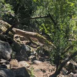
    Linda Falls Preserve Hiking - Fallen tree along the path. Not a huge deal but need to hike over or around it.

    Fallen tree along the path. Not a huge deal but need to hike over or around it.

    Linda Falls Preserve Hiking
    Linda Falls Preserve Hiking

    See all

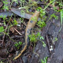
    Armstrong Redwoods State Natural Reserve - Banana slug

    Armstrong Redwoods State Natural Reserve

    4.7(412 reviews)
    32.9 mi

    SCW and I visited Armstrong Redwoods State Natural Park one day while staying nearby. I'd use…read morecaution when using a driving app to get here as we were led along a very narrow road through a local residential area with no room and switchbacks galore. Suffice it to say we saw a few locals along the way that seemed perplexed why we were driving very slowly through their neighborhood. I think that had to do with a bridge closure. Anyways... The return was not the same route thankfully. The park has for pay parking areas and what seemed to be free parking along the road to the park at your own risk. We found a spot in the paid lot ($10). Get a receipt, put it on your car's dashboard and off you go. There's a small welcome center and info at the entrance as well. The Redwoods are incredible here, some alive for 1400 plus years. You simply can't see the tops of the Redwoods from the ground. Truly incredible. The trails are well marked and it's highly discouraged to get off the trails as the environment is very ecologically sensitive. Unfortunately we saw some disregard for that. Stay on the trails people! You'll find placards noting interesting names and places along the way in addition to information about the flora and fauna. The history of the park and previous residents from indigenous peoples to the parks name sake are along the trail. It's an incredible park to visit and appreciate nature. The redwoods are incredible and certainly worth a visit.

    Wow! What can I say that will convince you to come visit the splendor at Armstrong? We walked…read more Hiked. And drove our vehicle up a tiny one lane hillside road to the top for a spectacular view of the whole area. It was beyond words! The park was immaculately clean. Everyone was kind and polite. The air was so fresh. I hope to return soon.

    Photos
    Armstrong Redwoods State Natural Reserve - Very cool mushroom

    Very cool mushroom

    Armstrong Redwoods State Natural Reserve - Redwood Rooter

    Redwood Rooter

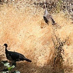
    Armstrong Redwoods State Natural Reserve - Wild turkeys in the park

    See all

    Wild turkeys in the park

    Willow Creek Road Trail - Keep your eye out for fungi!

    Willow Creek Road Trail

    4.7(3 reviews)
    40.0 mi

    Wide dirt path. It's like getting to eat dessert first! Great view when you start with a moderate…read moredownhill grade the whole way. No help for it, you have to eat your veggies some time! All uphill on the way back. Also, a fairly tick rich environment. We even came away with ticks in early January. Use of the area is by permit only. See photo below. However, I have a feeling most people using the area do not have permits. Contact: www.landpaths.org, (707)524-9381. Dogs are permitted on leash. My observation is that most people politely adhere to on leash protocols. I'd recommend first time visitors park at signage which indicates "no turn around beyond this point." The road does continue for another 1/4 mile but it's extremely narrow and really meant for the few residents who live down there. Better to park at the sign and walk that last 1/4 mile the first time to get the lay of the land. So how do you find this place? It's really just a stone's throw up the hill from the town of Occidental. It's easier to just put in these GPS coordinates: 38.422560, -122.996500. Want even more information? We found the AllTrails app really helpful.

    Pretty cool place for a little hike! Decent dirt road for a 6.8 there and back hike. Downhill there…read moreand uphill back. Filled with towering green trees, bright fungi, flowing creek, grassy hills and beautiful views!

    Photos
    Willow Creek Road Trail
    Willow Creek Road Trail
    Willow Creek Road Trail - Park near here and this is where it starts!

    See all

    Park near here and this is where it starts!

    Jenner Headlands Preserve

    Jenner Headlands Preserve

    4.9(13 reviews)
    40.9 mi

    We did Sea to Sky to Raptor Ridge Loop. What an amazing hike!…read moreWe did this one counterclockwise so we could get over the steep climbs at the beginning, and the second half of the hike felt much easier. We also took a few detours along the way, and each one was worth it. The first detour led us through dense trees. The second had us climbing up a large rock that opened up to gorgeous views of the surrounding hills and the ocean. The third was a short loop (Hawk Hill), which I'd definitely recommend! The views from the top are stunning and absolutely worth the extra steps. The real highlight of the day was spotting a BOBCAT in the wild. I've never seen one in person before and it made our day. It was foggy at the bottom, but the higher we climbed, the clearer it became. At one point we were actually above the cloud line, which was incredible. There's also a viewing scope at one of the overlooks, but we happened to reach it when the fog was at its thickest so we couldn't see much. It's definitely worth checking out if you visit on a clearer day. A few tips: wear sunscreen (I skipped it and got sunburned), bring plenty of water, and pack a hat and sunglasses because once you're above the fog, the sun gets surprisingly strong. There are also several picnic areas along the trail if you want to stop, take a break, or enjoy a snack. Parking is free. Overall, this is a moderate hike with a good amount of climbing, but the effort pays off. The trail was in great condition and wasn't crowded. Between the incredible views, the detours, and the unforgettable bobcat, this hike easily earns five stars!

    Another fabulous Sonoma Coast hike. One of our favorite day trips…read more Anytime is beautiful to visit this hiking destination but we love going in but May! It is the perfect time to soak in vibrant wildflowers and lush green landscapes. We love taking Plumette, our Schnoodle. She loves sniffaring here. ‍ Pups must be on Leash. Leave no trace.

    Photos
    Jenner Headlands Preserve
    Jenner Headlands Preserve
    Jenner Headlands Preserve

    See all

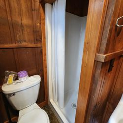
    Bothe-Napa Valley State Park - Manzanita cabin: toilet and shower

    Bothe-Napa Valley State Park

    4.0(179 reviews)
    32.3 mi

    We just spent one night at Bothe-Napa State Park, and it was the perfect first outing with our…read morerooftop tent! we loved it so peaceful. !! The campground is small but charming, nestled between Calistoga and Saint Helena -- a true hidden gem. We've driven by this park so many times on our way to Calistoga. Finally got to check it out and experience it. It's surrounded trees and the soothing sounds of a creek , offering a serene escape from the hustle and bustle of nearby towns. Trails and even a swimming pool that's open on the weekends. The park is well-maintained, with clean bathrooms and a great atmosphere. It was our first time using the rooftop tent, and this spot couldn't have been more ideal. We're already planning to come back and explore more of the park!

    Bothe-Napa is a California State park right outside of St. Helena ($10 day entry) with fern covered…read morehiking paths and a nice campground, with campsites, cabins and yurts to rent, but also, unfortunately with prolific amounts of poison oak everywhere. The hike though the redwoods (Redwood Trail and Richie Canyon) is well shaded and requires that you traverse a bubbling, active creek with wet stones to do the entire loop. The creek was still active in early summer, with small waterfalls and slippery stones in the creek bed. Fine for a regular hiker with great balance (and water shoes), but difficult for those with physical limitations or who can't afford a fall on slippery surfaces. It's a beautiful setting here, but with so much poison oak right off the path, and past experience with the rough side of poison oak, we opted to tread carefully. Come early in the day for a cooler hike, and try to stick to the trail so that you don't accidentally rub up on potential dangers, and leave this park with more than you'd intended.

    Photos
    Bothe-Napa Valley State Park - Spam for breakfast

    Spam for breakfast

    Bothe-Napa Valley State Park - Sisig!

    Sisig!

    Bothe-Napa Valley State Park

    See all

    Table Rock - Labyrinth along the way

    Table Rock

    4.5(15 reviews)
    24.0 mi

    Table Rock trail is located within Robert Louis Stevenson State Park. The road to get to the…read moretrailhead is directly north of Calistoga on Highway 29-about 20 minutes from the downtown. There are no facilities and parking can be hard to come by, as there are just two small lots. You're competing with other hikers who might be climbing up Mt St Helena. Mileage wise, the trail signs indicate 4.2 miles round trip. So, while the distance is short, the trail itself is moderate to challenging. There are sections both going in and out with an incline. While the inclines and declines aren't terribly steep, it's the loose rocks, downed trees and washed out trail sections that make it more challenging. I do wish I brought hiking poles to navigate the downhills and found myself tripping a few times, The scenery is quite unique with interesting rock formations along the way. The end of this trail, at Table Rock itself is spectacular, especially in winter when the valley below is green. The area did suffer from fires back in 2017 so there are a lot of burned trees and scrubby landscape. Interesting hike and worth checking out at least once. If you're up for more of a challenge, the trail continues to the Palisades trail and eventually connects down to the Oat Hill Mine trail in Calistoga. Good workout, scenic and not too crowded. Bring water and layers. It's exposed for much of the uphills and I was sweating but then cold and windy at the top. Minus 1 star for the challenging parking situation and washed out (but passable) sections.

    Fun little trail with a lot of scenic views, trees, and (currently) greenery. We went today, which…read morehappened to be cold, windy, cloudy, and even hailed a bit, and there were a few downed trees you needed to hop over. I loved the hike. Only saw 4 other people, a couple on their way out and a couple on their way in (when we were on our way out). It was quiet and peaceful. The parking lot adjacent to it was nearly full. There was another trail entrance across the road from this one that seemed more popular.

    Photos
    Table Rock - Views from Table Rock

    Views from Table Rock

    Table Rock - Table rock

    Table rock

    Table Rock

    See all

    Wright Peak - hiking - Updated August 2026

    Loading...
    Loading...
    Loading...