Cancel

    Open app

    Search

    Buckingham Peak Trail

    5.0 (1 review)

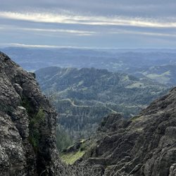
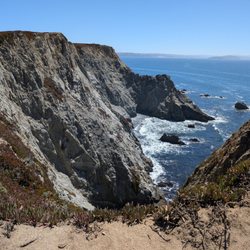
    Buckingham Peak Trail Photos

    You might also consider

    Recommended Reviews - Buckingham Peak Trail

    Your trust is our priority, so businesses can't pay to alter or remove their reviews. Learn more about reviews.
    Yelp app icon
    Browse more easily on the app
    Review Feed Illustration
    Photo of Scott H.
    140
    3974
    4369

    3 years ago

    Helpful 0
    Thanks 0
    Love this 0
    Oh no 0

    Verify this business for free

    People searched for Hiking 199 times last month within 15 miles of this business.

    Verify this business

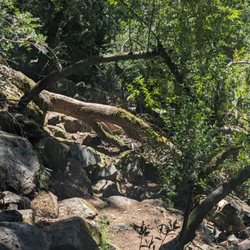
    Linda Falls Preserve Hiking - Fallen tree along the path. Not a huge deal but need to hike over or around it.

    Linda Falls Preserve Hiking

    4.5(12 reviews)
    34.8 mi

    So happy to finally be able to cross this hike off my bucket list. It was certainly worth the wait…read more It's not a long hike, but there is a little bit of climbing on rocks, especially towards the end I suggest wearing good shoes with traction The scenery along the way to the falls is lovely and changes throughout the hike. Meadows, fir trees, boulders, and ponds! We made it to the Falls on the last day of April. I would think that during the summer they wouldn't be flowing as greatly as they were now. Sitting below the falls was majestic. We also did the hike at the fork of the road, which eventually ends due to all the brush on the trail, and it was lovely as well with a beautiful pond

    No signs telling you where trail is so I'm here to tell you…read more Park across the street from Pacific Union College at the far left end ball park. Walk heading North from the parking lot towards the green sign that reads bike route. You will follow that trail all the way down to the trailhead about a 1/4 mile in from the road. Once you get to the trail head you have two trails to choose from: the Linda Falls Trail or the Saw Mill Ridge Trail. We opted for the Linda Falls trail which is a 1.6 miles round trip. You will walk down a rocky path , then through a forest of trees. The trail will start to go downhill then becomes steeper as you head toward the waterfall. Going do the steep hill is where the gravel is loose and slippery. Once you get to the falls you will need to climb around the boulders to get those winning photos your friends and family will love to see on social media media. My suggestion is that you wear good trail running shoes or running shoes with good grip to the gravel as the trail can be slippery from the loose gravel. Please do not wear sandals or slippahs. Please leave your tiny dogs home unless you want to carry them over the rocks when you get closer to the waterfall. Last tip- bring water and snack to enjoy when you get to the falls. Make sure you take your trash with you. If you still have energy to go to the next trail saw Mill Ridge then head back to the trailhead you first started at. We started to head down and made it half way down until my hubby said let's turn around. I think it was his way of saying "I'm really hungry and I need to eat soon before I get hanger." Haha We plan to go back again to finish the Saw Mill Ridge Hike. This trail does have two small creeks you need to cross over. Have fun, stay on the trail , and be safe. Enjoy the pics

    Photos
    Linda Falls Preserve Hiking
    Linda Falls Preserve Hiking
    Linda Falls Preserve Hiking - Linda falls

    See all

    Linda falls

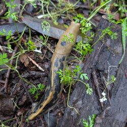
    Armstrong Redwoods State Natural Reserve - Banana slug

    Armstrong Redwoods State Natural Reserve

    4.7(408 reviews)
    33.8 mi

    Wow! What can I say that will convince you to come visit the splendor at Armstrong? We walked…read more Hiked. And drove our vehicle up a tiny one lane hillside road to the top for a spectacular view of the whole area. It was beyond words! The park was immaculately clean. Everyone was kind and polite. The air was so fresh. I hope to return soon.

    A state park with a good amount of redwood trees albeit mostly smaller/younger ones due to a good…read moreamount of logging done in this area to help build California in the 20th century. It is near the Russian River just outside of Guerneville. Redwood vibes similar to some parts of the Santa Cruz range or Marin Hills, but nothing that compares to the big redwoods in Northern California like near Humbolt Co or Crescent City, those are next level. There's a fee to park inside the park. Think it was about $10. It gets busy during the weekends and spaces can be super limited if you come after 11am. We were with a toddler, so we stayed on the main flat trails that go through redwood groves. It is very shady and well trafficked trails. There are a few loops you can join together, and the circumference may be a 2-3 mile hike. But you can do however long you want it to be. Now the trails that elevate into the hills are much more involved. It can elevate to a 1300 foot gain which is pretty strenuous. I haven't tried those yet but it is on my list to try. But even the easy trails that one day, was still beautiful and relaxing. To majestic red bark trees with healthy ferns all on the ground cover, fallen trees to climb on, large rocks to hop on was just a nice jaunt especially with young kids. We brought a light lunch and refreshments and were able to run into a small area with picnic benches. Perfect way to end a few hours steeped in nature, without having to be totally in the wild. Great intro for those that aren't too versed (yet) and to get them exposed to nature, ecosystems and wildlife. Connect with the world amongst which you live with but rarely see. Weekend mission accomplished!

    Photos
    Armstrong Redwoods State Natural Reserve - Very cool mushroom

    Very cool mushroom

    Armstrong Redwoods State Natural Reserve - Redwood Rooter

    Redwood Rooter

    Armstrong Redwoods State Natural Reserve - Wild turkeys in the park

    See all

    Wild turkeys in the park

    Willow Creek Road Trail - Keep your eye out for fungi!

    Willow Creek Road Trail

    4.7(3 reviews)
    40.9 mi

    Wide dirt path. It's like getting to eat dessert first! Great view when you start with a moderate…read moredownhill grade the whole way. No help for it, you have to eat your veggies some time! All uphill on the way back. Also, a fairly tick rich environment. We even came away with ticks in early January. Use of the area is by permit only. See photo below. However, I have a feeling most people using the area do not have permits. Contact: www.landpaths.org, (707)524-9381. Dogs are permitted on leash. My observation is that most people politely adhere to on leash protocols. I'd recommend first time visitors park at signage which indicates "no turn around beyond this point." The road does continue for another 1/4 mile but it's extremely narrow and really meant for the few residents who live down there. Better to park at the sign and walk that last 1/4 mile the first time to get the lay of the land. So how do you find this place? It's really just a stone's throw up the hill from the town of Occidental. It's easier to just put in these GPS coordinates: 38.422560, -122.996500. Want even more information? We found the AllTrails app really helpful.

    Pretty cool place for a little hike! Decent dirt road for a 6.8 there and back hike. Downhill there…read moreand uphill back. Filled with towering green trees, bright fungi, flowing creek, grassy hills and beautiful views!

    Photos
    Willow Creek Road Trail
    Willow Creek Road Trail
    Willow Creek Road Trail - Park near here and this is where it starts!

    See all

    Park near here and this is where it starts!

    Jenner Headlands Preserve

    Jenner Headlands Preserve

    4.9(12 reviews)
    41.8 mi

    Another fabulous Sonoma Coast hike. One of our favorite day trips…read more Anytime is beautiful to visit this hiking destination but we love going in but May! It is the perfect time to soak in vibrant wildflowers and lush green landscapes. We love taking Plumette, our Schnoodle. She loves sniffaring here. ‍ Pups must be on Leash. Leave no trace.

    Dog-friendly hiking?! Sign us up!…read more What an absolutely beautiful preserve! The parking lot was full on Sunday midday so we had to backtrack along the road to an auxiliary pullout parking area. Next time we'll drop off one human and the pups before moving the car as it was sketchy walking our pups on Rt 1. There's a nice Info Center at the trailhead, with signage and maps - both posted and printed copies to take. Bathrooms are just a short walk down the trail. There are various trail options, with I think up to 15 miles if you're up for the challenge. We planned to hike ~4 miles but the steep trail was in the direct sun and we all started feeling it. I don't think there's any water on the trail, so bring more than you think you need. We hiked ~1.5 miles up and our pups were getting a bit too warm so turned it around. Not mad about it as we enjoyed stunning ocean views on the way down/back. We all still enjoyed a workout and some peaceful time out in nature. Cows live on the preserve so expect to see cow pies/dung along the path. We didn't see any upclose, but there are warning signs at the trailhead advising you what to do. Despite the full parking lot, the trail wasn't crowded. We can't wait to return!

    Photos
    Jenner Headlands Preserve
    Jenner Headlands Preserve
    Jenner Headlands Preserve

    See all

    Table Rock - Labyrinth along the way

    Table Rock

    4.5(15 reviews)
    25.1 mi

    Table Rock trail is located within Robert Louis Stevenson State Park. The road to get to the…read moretrailhead is directly north of Calistoga on Highway 29-about 20 minutes from the downtown. There are no facilities and parking can be hard to come by, as there are just two small lots. You're competing with other hikers who might be climbing up Mt St Helena. Mileage wise, the trail signs indicate 4.2 miles round trip. So, while the distance is short, the trail itself is moderate to challenging. There are sections both going in and out with an incline. While the inclines and declines aren't terribly steep, it's the loose rocks, downed trees and washed out trail sections that make it more challenging. I do wish I brought hiking poles to navigate the downhills and found myself tripping a few times, The scenery is quite unique with interesting rock formations along the way. The end of this trail, at Table Rock itself is spectacular, especially in winter when the valley below is green. The area did suffer from fires back in 2017 so there are a lot of burned trees and scrubby landscape. Interesting hike and worth checking out at least once. If you're up for more of a challenge, the trail continues to the Palisades trail and eventually connects down to the Oat Hill Mine trail in Calistoga. Good workout, scenic and not too crowded. Bring water and layers. It's exposed for much of the uphills and I was sweating but then cold and windy at the top. Minus 1 star for the challenging parking situation and washed out (but passable) sections.

    Fun little trail with a lot of scenic views, trees, and (currently) greenery. We went today, which…read morehappened to be cold, windy, cloudy, and even hailed a bit, and there were a few downed trees you needed to hop over. I loved the hike. Only saw 4 other people, a couple on their way out and a couple on their way in (when we were on our way out). It was quiet and peaceful. The parking lot adjacent to it was nearly full. There was another trail entrance across the road from this one that seemed more popular.

    Photos
    Table Rock - Views from Table Rock

    Views from Table Rock

    Table Rock - Table rock

    Table rock

    Table Rock

    See all

    Buckingham Peak Trail - hiking - Updated May 2026

    Loading...
    Loading...
    Loading...