Cancel

    Open app

    Search

    Wild Utah Tours

    5.0 (2 reviews)

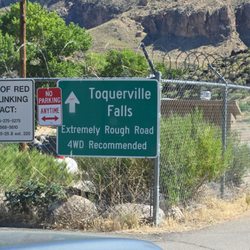
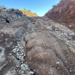
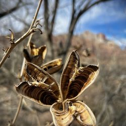
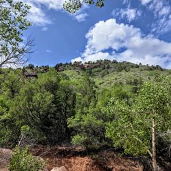
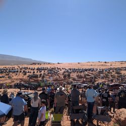
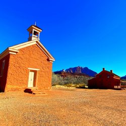
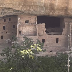
    Wild Utah Tours Hiking Photos

    You might also consider

    Recommended Reviews - Wild Utah Tours

    Your trust is our priority, so businesses can't pay to alter or remove their reviews. Learn more about reviews.
    Yelp app icon
    Browse more easily on the app
    Review Feed Illustration

    5 years ago

    Helpful 0
    Thanks 0
    Love this 0
    Oh no 0

    5 years ago

    Helpful 0
    Thanks 0
    Love this 0
    Oh no 0

    Ask the Community - Wild Utah Tours

    You might also consider

    Verify this business for free

    People searched for Hiking 373 times last month within 15 miles of this business.

    Verify this business

    Red Reef Trail

    Red Reef Trail

    4.9(11 reviews)
    7.6 mi

    You can use your national park pass to avoid the fee here. You just have to display it on your…read moredash. Maps took us like 2 miles north, then back track to the tunnel to get in. Not sure if that was the best way or not. The parking lot is not huge, and you can't park in the designated camping area spots. There are plenty of picnic tables, probably more than parking spaces. There are at least 20 tables there. There are a few trails to choose from. Very close the parking and campsites is a short 1/4 hike (or shorter) to the dinosaur prints. There is a hike in the other direction to the mini waterfall and pond. Probably about a mile or a little over a mile (1direction). We also found an old almost petrified bristlecone tree (that was neat). We got lucky with the weather for Dec, it was probably about 60 degrees and very nice. I saw that in the summer it can be over 110 so I am glad that we got the nice weather. The red /orange scenery is spectacular and representative of the area, like it is at zion, bryce, snow canyon, pioneer park, etc. We enjoyed a picnic lunch there, and we had a blue bird, a scrub jay, come join us and beg for food. Check out my photos.

    +++++++++++++++++++++++++++++ DO NOT FOLLOW THE YELP…read moreDIRECTIONAL MAP TO GET HERE! +++++++++++++++++++++++++++++++ To reach the Red Reef trailhead, take Exit 23 off Interstate 15 S and head east on Red Cliffs Campground Road. The trailhead is located at the campground, which is about 5 miles down the paved road. GPS Coordinates: 37.224794, -113.406300 It is $5 to park your car here in the parking lot, follow directions to the trail. It is a beautiful and easy hike - until the very end. it meanders along a path - then at the end you need to climb some pretty big rocks to see the payoff of the beautiful canyon. We loved this hike. (but were thrown off by the Yelp directions that sent us in an alternate direction.

    Photos
    Red Reef Trail
    Red Reef Trail
    Red Reef Trail

    See all

    Zion National Park - Don't feed the squirrels

    Zion National Park

    4.8(1.6k reviews)
    14.9 mi

    After Capitol Reef's stunning colored, sculpted mountains and Bryce Canyon's hoodoo amphitheater,…read moreZion offer s soaring mountains on each side of you, river, and many more non-hiker friendly trails besides the deadly Angel's Landing. It is an exceptionally well designed park with the free town and park shuttle system that centers at the Visitor Center and has many paved trails. - As you drive into Zion, you will go through the Zion-Mt Carmel tunnel - a 1.1 mile pitch black dark tunnel with no lighting, just a few windows of the stunning mountains as you drive through - The park and shuttles are free! Stay in Springdale for the closest location. The Best Western was very nice and Shuttle stop 4 - Favorite easy trails in my order of preference: -- Riverside Walk (2.2 miles, 57 ft elevation change, 1.5 hours) - paved path along the Virgin River in a Canyon -- Pa'rus Trail (1.7 or 3.5 miles, 50 ft elevation change, 1-2 hours) - start at park shuttle stop #3 (Canyon Junction-shuttle only stops going downhill - Not from the Visitor Center) for a 1.7 mile walk on a paved trail near the Human History museum, past the campgrounds and to the visitor center. If you start at the Visitor Center, then you will have to turnaround at Canyon Junction and it is 3.5 miles. - The Grotto Trail (1 miles, 35 ft, 0.5 hour) - dirt trail paralleling the road from Stop 6 (Grotto) to Stop 5 (Zion lodge) - saw and heard a wild turkey. - Weeping Rock Trail (0.4 miles, 98 ft, 0.5 hour) - short but steep paved trail ends at a rock alcove with dripping water - Lower Emerald Pool (2 miles, 150 ft, 1.5 hours) - paved trail to a small pool. It had been dry, so it was underwhelming but if it had rained more, it might have been better. If you are adventurous and like a good view and danger, then try to get a permit to hike Angel's Landing. Someone died the week before we arrived. In the park, there are 9 shuttle stops where you can get off to hike. The following stops have toilets (may be a pit toilet or flush toilet): stop 1 Visitor center - flush, 2 Zion Human History Museum - flush - but you have to walk a bit to get to the museum where the toilet are located outside, 5 Zion Lodge - flush -inside the lodge, 6 Grotto-pit?, 7 Weeping Rock-pit?, 9 Temple of Sinawava - pit.

    We arrived on Thursday May 14 around 11am. From past experience we decided to skip stopping at the…read moreVisitor Center for now (finding parking at this part of the day might involve circling the parking lot several times). So we drove out to the East side of the park via the Zion-Mount Carmel Highway and tunnel and took in the scenery, looked for bighorn sheep, and pulled over occasionally to get more photos and stretch. At this time they were still doing a one-way traffic control through the 1930's tunnel (to manage large vehicles passing through without incident). That ends June 7, 2026 and specific large vehicle sizes will have to take an alternative route - no tunnel for you! See their website for details and updates. We only waited about 7 minutes to pass to the East and only about 2 minutes to return on the West side. Just good timing on our departure - nothing you can control to shorten the wait. While on the East side of the tunnel we were fortunate to find a parking space in the limited areas so we could get out and walk the Canyon Overlook trail. It was easy walking but considered a moderate hike due to the drop-offs along the trail (handrails and plenty of space on the trail to feel safe going single file through a couple areas.) Most sections you can pass hikers coming back and have plenty of trail space. There were a couple of rock overhang, cave-like sections that provided a cool break from the sun. The trail end viewpoint overlooks the highway below and in the left bluff you can find one of the windows of the tunnel. Then we headed to the Visitor Center (around 2pm) and had no issues finding multiple parking spots were open. We sat at a picnic table on the Watchman side of the lots and enjoyed the sandwiches we brought for lunch. We did then go into the Visitor Center and it was crowded. A quick look around and I didn't find much new that I was interested in since we were there a couple years ago - until I saw an art book on Wildflowers of the West by Molly Hashimoto. Since I had bought her Trees of the West at Cedar Breaks Nat'l Monument a couple years ago I really wanted this new book. The checkout line was well organized and in 2 minutes I had paid for the book and was heading out to the informational side of the building where the crowd was not! We could have waited until after our final hike to go in, but I didn't want to be time constrained while on the trail just to and make it back before VC closed at 5pm. We boarded the shuttle before 3pm and made our way to Stop 9 - Temple of Sinawava where we undertook the Riverside Walk. Shuttle seemed to take about 20+ minutes to get up its route to reach this final stop. (Restrooms at the Temple stop were temporarily closed for renovation. Can't recall seeing notice of this prior to arriving at that stop). We'd been on the Riverside Walk during a previous visit and wanted to show our visiting relatives this easy, pleasant trail that takes you up to where those more adventuresome (and prepared with proper wading equipment) head into The Narrows. The main paved trail was busy but not too packed. We were still able to be alone on the path and experience the quiet forest and spot mule deer, lots of squirrels and see and hear little yellow goldfinches singing. On a previous trip we were more ambitious and exited the paved path to walk along the Virgin River on the dirt trail. I think we had to scramble up/down/over/around some boulders occasionally to stay along that river trail but there were a few cutovers to get back up on the easier paved main path if needed. We jumped back on the shuttle service in the 5:30 - 6pm timeframe and had time to stop at Zion Lodge (Stop 5). There were several turkeys strolling casually around the grounds looking amused (or annoyed, who can really read a turkey's face?) at the humans on their land. We used the restrooms, checked out the gift shop and then headed back over to catch the shuttle back to the VC. The park was already running extra shuttles at this hour of the day so no one would be stranded at any of the 9 stops along the Zion Canyon Scenic Drive. I think the next time I come to Zion it will be during the off-season when cars are allowed on the Scenic Drive - that will be a new experience.

    Photos
    Zion National Park - Very cool late February & early March dry flowers.

    Very cool late February & early March dry flowers.

    Zion National Park - Friend met on Kayenta Trail

    Friend met on Kayenta Trail

    Zion National Park - The squirrels here have no fear! The even strike a pose for you! LOL

    See all

    The squirrels here have no fear! The even strike a pose for you! LOL

    Kolob Canyons - On Taylor Creek Trail

    Kolob Canyons

    4.8(41 reviews)
    16.5 mi

    Kolob Canyons as part of Zion National Park is an underrated gem much less visited than The Narrows…read morein Zion. It's located about an hour north of the main park entrance, off the highway on the way to Cedar City. An admission fee is required to enter this area of the park. We arrived around 8:30am and there were only several cars in front of the visitor center. We checked in with our national park passes and started the 5-mile scenic drive up to the top of the mountain. There's are many pullouts along the road to take pictures and see the beautiful views. A circular parking lot is at the summit with vault restrooms and a nice view of the Kolob Canyons. The secret here is to hike the 0.5 mile trail with the trailhead at the parking lot. The hike has a little elevation, but a 76-year old in our party was able to hike all the way. The views at the end of the trail are phenomenal and worth the trip. We spent a lot of time here taking pictures and soaking up the sights. We could see far into the horizon, past the mountains into Arizona on a clear day. For me, visiting Kolob Canyons was my favorite and most memorable part of my Utah trip. The crowds here are nearly nonexistent, though parking at the top of the mountain can get full. If you're ever in the area, I highly recommend adding Kolob Canyons to your itinerary!

    Beautiful trails on this side of Zion. Nice easy access right off the 15 freeway. Not too crowded…read moreand pretty shady most of the way. There's lots to look at and climb. This could easily be an all day hike if you stop to explore the surroundings and climb the rocks around the trail. Very fun and beautiful!

    Photos
    Kolob Canyons - Ashdown Gorge

    Ashdown Gorge

    Kolob Canyons - On Taylor Creek Trail

    On Taylor Creek Trail

    Kolob Canyons - View on Kolob Canyon Rd. in Zion National Park

    See all

    View on Kolob Canyon Rd. in Zion National Park

    Utah State of - Grafton Ghost Town just outside Zion NP

    Utah State of

    4.8(5 reviews)
    7.1 mi

    Utah is one of the most majestic, awe-inspiring states and has been such an unexpected joy in my…read morelife - if you had told me 10 years ago that I'd be spending a significant part of my life in Utah I never would've believed you lol. Exploring Utah over the past 4-5 years has changed me - I have developed such a deep appreciation for the deserts and canyon lands that I used to vehemently dislike thanks to the Beehive State! Our 45th state is packed full of burnt orange cliffs and slot canyons, deep green rivers, towering multicolored mountains and hoodoos, unlimited arches and natural bridges, well preserved dinosaur footprints, and an insane amount of petroglyphs and pictographs dating back many thousands of years. I thoroughly enjoyed combing through my Utah photo collection from the past several years and I hope my pics will give you a sense of the vast land of adventure this state holds! When my son got out of the marines, he announced he was moving to Salt Lake City to go to college with his marine "brothers" - at the time I was absolutely devastated bc I thought he'd always live with me forever until the end of days (as I'm sure all mothers do LOL) - but he went off to make a life for himself with his newfound military bros (how dare he??!!!) His decision ended up being such a wonderful turn of events in all our lives - not only did it open up a whole new world of outdoor adventures and American history to explore, but it also brought so many wonderful people into our lives and given us a whole new branch of our family!! His military bros are the most fantastic people and their families have all become part of our family! The outdoor activities and wildlife are unparalleled- and the people are the kindest I've ever encountered. My son has utterly thrived in Utah and excelled at "The U" in his engineering major. This state will forever hold a special place in my heart! It's a hidden gem and I hope it stays that way - but I don't think it will bc apparently it's one of the fastest growing state in the US waaaa!! So I highly recommend visiting - but also please don't so it won't change LOL!!

    Just Go (#10) We've…read morevisited the Great State of Utah many times over the years. This is an updated review. We love Utah because they have some of the most beautiful National Parks, which I mentioned extensively in my original review. We even revisited Bryce Canyon during Covid year (2020)... it was a great place to social distance ¯\_(ツ)_/¯ Aside from these iconic national parks we also found some national monuments, landmarks and small towns to visit including Virgin Town. If passing by don't forget to stop at the Buffalo Trading Company and try their awesome buffalo burgers... and did you know that there is a real UP House located in the southwestern City of Herriman? You won't find Carl, Ellie and Russell here, though. This house isn't cartoon. Old Irontown (Cedar City) - located in the southern part of Utah Old Irontown is said to be the very first ghost town in Utah. What we found was an off-the-beaten trail that led to the historical part of Old Irontown and a charcoal kiln was one of the landmarks in the ghost town... no ghosts, just a bunch of fire ants! Yikes! Park City Historic Main Street - I was charmed by this popular historic mountain town. Lots of shops and restaurants, bars and breweries, entertainment, galleries, and nearby hotel and lodging. It was once a silver town and hosted the Winter Olympics in 2002. Reminded me of Virginia City in NV. Bonneville Salt Flats (Wendover) - this was cool! We drove here in 2020... can't practice anymore social distancing than being here at the Salt Flats. We drove a mile out from the west rest stop area and checked out this densely packed salt bed. I had no idea that Southern Utah was once a dinosaur stomping ground (no pun intended) and that inside the St George Dinosaur Discovery Site @ Johnson Farm is the original intact track surface. Thank you Great State of Utah... so much natural beauty! Review #1348 updated

    Photos
    Utah State of - Views around Capital Reef NP near Torrey Utah

    Views around Capital Reef NP near Torrey Utah

    Utah State of - Hiking the Hickman Natural Bridge trail in Capital Reef NP

    Hiking the Hickman Natural Bridge trail in Capital Reef NP

    Utah State of - Sunset at the top of Buffalo Point trail on Antelope Island - best sunsets I've ever seen!!

    See all

    Sunset at the top of Buffalo Point trail on Antelope Island - best sunsets I've ever seen!!

    Kanarra Falls - The river is the trail!!

    Kanarra Falls

    4.8(79 reviews)
    22.8 mi

    Tons of waterfalls + slot canyon hiking through a freezing river = one of the most epic trails I've…read moreever done! It's like a mini version of The Narrows in Zion. The Kanarra Falls trail is quite an adventure - it's a water hike with some dramatic scenery and intense rock scrambling depending on how far in you go. If you only go to the ladder, I'd say it's a moderate trail. But if you go all the way to the last falls, it's more strenuous. I hiked it in late spring and the water was a balmy 38°F! I did some research and planned ahead to wear thick neoprene socks - But even with my thermal socks, the water was so cold my lower legs were numb for about 60-70% of the trail which made this moderate/strenuous hike even more challenging! So I highly recommend the socks if you're hiking outside of the late summer season bc that water is COLD! And you'll be walking in water depths anywhere from your ankles up to your mid-shins for about 75-80% of the trail. Getting to the first large falls by the ladder isn't terribly difficult and you'll still see several smaller falls along the way. The first part is along a well maintained dirt trail with a few small water crossings before you have to get down into the riverbed. So for those wanting to stop at the top of the ladder, it's still a fantastic and much less strenuous hike. But there are about 3-4 gorgeous falls and slot canyons past that leading up to the last falls that I really would've regretted not seeing. The rock scrambling can get quite difficult- especially for a short person (I'm 5'2"). At one point I had to hoist myself up over some very tall boulders using just my arms and had to do a bit of a chimney crawl up another boulder and a narrow slot wall so be prepared and know your abilities bc I struggled to get back down LOL! I used one of my poles for most of the hike bc the riverbed is very rocky and slippery. I also wore an old pair of my fave Salomon waterproof(ish) hiking shoes with really solid tread - definitely helped. I imagine in the hot weather you'd be fine in some sort of water shoe with no socks but not in winter/spring. Reservations for this hike are required year-round as they limit the number permitted daily to preserve the environment here since this is such a popular trail. It was easy to reserve my spot online and I recommend doing it as far in advance as possible bc spots go fast - especially in the summer. There's plenty of paved parking at the trailhead with nice bathrooms. There are also more bathrooms along the trail right before the first water crossing. It's easy to find - google maps takes you right to the parking area. AllTrails says the trail is 3.6 miles with 656 feet elevation gain but I did just over 5 miles total with 1100+ feet elevation gain by going past the ladder at the first falls - totally worth it - Definitely in my top 5 trails of all time!

    This is an amazing slot canyon hike and is very popular so requires a permit. The permit is only…read more$15 but they only sell 200 a day so some planning is required to visit this location. Not a long trail, only about 4 miles round-trip with very little elevation gain, but Very beautiful mountains and rocks and the slot Canyon is just fantastic!! If you're in the area or passing by, I highly recommend checking it out, an amazing small piece of the Utah's vast scenery...

    Photos
    Kanarra Falls - Got my souvenir - I always get a sticker for my water bottle when I finish a big trail lol!

    Got my souvenir - I always get a sticker for my water bottle when I finish a big trail lol!

    Kanarra Falls - Parking lot at the trailhead

    Parking lot at the trailhead

    Kanarra Falls - Bathrooms on the trail right before the first water crossing - last chance for toilets!

    See all

    Bathrooms on the trail right before the first water crossing - last chance for toilets!

    Wild Utah Tours - hiking - Updated May 2026

    Loading...
    Loading...
    Loading...