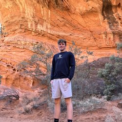
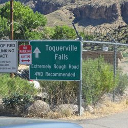
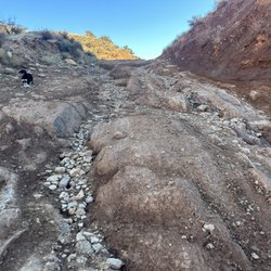
Kolob Canyons Photos


More like Kolob Canyons
Recommended Reviews - Kolob Canyons
Start your review...

Reviews With Photos

When visiting Zion National Park this is a must-see area on your trip. It is not in the main Park but up along hwy 15 in the back part of Zion. There is a 5 mile scenic loop and 3 main hiking trails at Timber Creek, Lee Pass, and Taylor Creek. The hiking is probably on the medium level scale, but the scenic drive allows numerous pull-outs and amazing photography. Stop at the visitor section and get a map! Also, it is very windy up there. You do not need a shuttle here, so you are free to roam, and this area us far less crowded than Zion's main scenic loop. Plan on doing both places during your stay. Beautiful country.

Located not far from I15, this canyon probably doesn't get as much attention as Zion (but is part of Zion National Park). It is smaller than Zion, but it does have some very long trails for hiking. The drive up is very nice and has several spots to stop and hike from (or just take in the view). If you like hiking and have all day, this is a good place.

Visiting Zion? Kolob Canyons is a must stop. At a minimum, take the 5-mile scenic road along Kolob Canyons Road to view the magestic crimson canyons and breathtaking scenic view points. Here are the trails: Timber Creek Overlook Trail at the end of the Kolob Canyons Road/Kolob Canyons Viewpoint. Distance: 1.0 miles (round trip). This was a great little hike and the view of the Kolob Canyons, the Kolob Terrace, and the Pine Valley Mountains at the end of the trail were incredible. We sat on large rock to soak in the canyons and breathe in the fresh crisp air. Taylor Creek Trail off of Kolob Canyons Road. Look for the small parking lot on the left side. Distance: 5.0 miles (round trip) La Verkin Creek Trail at the Lee Pass Trailhead on the Kolob Canyons Road. Distance: 14.0 miles (round trip) Happy trails to you!!

Beautiful scenic drive - we didn't hike here - we just enjoyed the drive and the pull outs. Less crowded than Zion canyon where the shuttles run but the hiking here is tougher than some offered in Zion canyon. $35 entrance fee for the five mile drive - we have a National Parks pass so we didn't pay.

The Taylor Creek trail not to be missed, views of majestic cliffs, a creek, historic cabins, nice shade about half way in when the canyon narrows, and at the Double Arch Alcove there is a large amphitheater with lush vegetation growing in the dripping overhang. This is also the place to avoid crowds, on July 4th there were not that many visitors and we had the amphitheater to ourselves for a full 20 minutes making for a great lunch spot. When we went in July the creek was very low flow and we did not get our boots wet at all, probably due to the drought. The hike is not very shaded for the first half and is hot in the summer so bring lots of water. Hiking poles are also helpful when rock hopping over the creek.


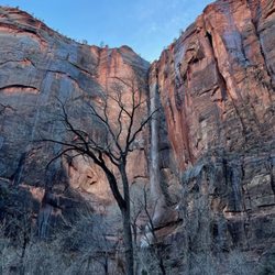
Kolob Canyons Viewpoint and Timber Creek Overlook Trail Kolob Canyons Viewpoint at Zion National Park is where you'll be able to view the 2,000 foot tall walls of the Kolob Canyon from a mile away. These canyons are extremely colorful. From tan to red and even orange which is a color palette that is one of the reasons why we love Utah so much. Directly across from you, you'll be staring at Shuntavi Butte. You can park next to the Kolob Canyons Viewpoint as well as hike the Timber Creek Overlook Trail. We did both. This part of the park has less visitors. We were the only ones on the trail. It still had snow and some parts of the path were icy. It is a very easy trail to do and it is only 1 mile round-trip.


Far less promoted, well-known, or visited than the "main" part of Zion National Park, this area is well worth exploring - without having to take a shuttle or deal with crowds. The entrance is very close to I-15 and is basically just a 5-mile scenic drive and back - with several places to take photos or to stop and hike. The most popular trail is at the end of the road. It's only a mile total to an overlook. Most other trails elsewhere are longer. If coming from Zion or Cedar Breaks there is also a scenic mostly unpaved road between Zion and Kolob Canyons with Kolob reservoir in the middle that allows access to trails and parts of the national park few tourists probably even know about, let alone visit. Worth doing if you have time and are a little adventurous.

Kolob Canyons as part of Zion National Park is an underrated gem much less visited than The Narrows in Zion. It's located about an hour north of the main park entrance, off the highway on the way to Cedar City. An admission fee is required to enter this area of the park. We arrived around 8:30am and there were only several cars in front of the visitor center. We checked in with our national park passes and started the 5-mile scenic drive up to the top of the mountain. There's are many pullouts along the road to take pictures and see the beautiful views. A circular parking lot is at the summit with vault restrooms and a nice view of the Kolob Canyons. The secret here is to hike the 0.5 mile trail with the trailhead at the parking lot. The hike has a little elevation, but a 76-year old in our party was able to hike all the way. The views at the end of the trail are phenomenal and worth the trip. We spent a lot of time here taking pictures and soaking up the sights. We could see far into the horizon, past the mountains into Arizona on a clear day. For me, visiting Kolob Canyons was my favorite and most memorable part of my Utah trip. The crowds here are nearly nonexistent, though parking at the top of the mountain can get full. If you're ever in the area, I highly recommend adding Kolob Canyons to your itinerary! read more


Beautiful trails on this side of Zion. Nice easy access right off the 15 freeway. Not too crowded and pretty shady most of the way. There's lots to look at and climb. This could easily be an all day hike if you stop to explore the surroundings and climb the rocks around the trail. Very fun and beautiful! read more
 - Hiking Near Me - New Harmony, Utah")
This area, and specifically the Ashdown Gorge trail and the Kolb reservoir are great side trips away from the crowded Zion park. Even better is that it's cooler up in this area compared to the rest of Southern Utah (big plus during the hot summer months). Ashdown Gorge trail - https://maps.app.goo.gl/CnuyR8k8FQfczHzm6 This is a less traveled trail but still epic in many ways. You will be getting wet on this one, how much depends on how much water is moving down the river. This isn't the best trail for people with mobility issues. There's a lot of walking on rocks and over the a river many times. It's also a nice trail in the summer as there's shade before/after high noon. The Kolob reservoir is a good side trip with the drive up there that makes for some great pictures. There is a camp host if you want to reserve an empty space for the day and swim. It's more of a kayak experience than a swimming one. *The best tips can be found at the Kolob Canyons gift shop. read more


6 months ago
When visiting Zion National Park this is a must-see area on your trip. It is not in the main Park but up along hwy 15 in the back part of Zion. There is a 5 mile scenic loop and 3 main hiking trails at Timber Creek, Lee Pass, and Taylor Creek. The hiking is probably on the medium level scale, but the scenic drive allows numerous pull-outs and amazing photography. Stop at the visitor section and get a map! Also, it is very windy up there. You do not need a shuttle here, so you are free to roam, and this area us far less crowded than Zion's main scenic loop. Plan on doing both places during your stay. Beautiful country. read more


Located not far from I15, this canyon probably doesn't get as much attention as Zion (but is part of Zion National Park). It is smaller than Zion, but it does have some very long trails for hiking. The drive up is very nice and has several spots to stop and hike from (or just take in the view). If you like hiking and have all day, this is a good place. read more


2 years ago
6 years ago
Visiting Zion? Kolob Canyons is a must stop. At a minimum, take the 5-mile scenic road along Kolob Canyons Road to view the magestic crimson canyons and breathtaking scenic view points. Here are the trails: Timber Creek Overlook Trail at the end of the Kolob Canyons Road/Kolob Canyons Viewpoint. Distance: 1.0 miles (round trip). This was a great little hike and the view of the Kolob Canyons, the Kolob Terrace, and the Pine Valley Mountains at the end of the trail were incredible. We sat on large rock to soak in the canyons and breathe in the fresh crisp air. Taylor Creek Trail off of Kolob Canyons Road. Look for the small parking lot on the left side. Distance: 5.0 miles (round trip) La Verkin Creek Trail at the Lee Pass Trailhead on the Kolob Canyons Road. Distance: 14.0 miles (round trip) Happy trails to you!! read more


 - Hiking Near Me - New Harmony, Utah")
2 years ago
Beautiful scenic drive - we didn't hike here - we just enjoyed the drive and the pull outs. Less crowded than Zion canyon where the shuttles run but the hiking here is tougher than some offered in Zion canyon. $35 entrance fee for the five mile drive - we have a National Parks pass so we didn't pay. read more


The Taylor Creek trail not to be missed, views of majestic cliffs, a creek, historic cabins, nice shade about half way in when the canyon narrows, and at the Double Arch Alcove there is a large amphitheater with lush vegetation growing in the dripping overhang. This is also the place to avoid crowds, on July 4th there were not that many visitors and we had the amphitheater to ourselves for a full 20 minutes making for a great lunch spot. When we went in July the creek was very low flow and we did not get our boots wet at all, probably due to the drought. The hike is not very shaded for the first half and is hot in the summer so bring lots of water. Hiking poles are also helpful when rock hopping over the creek. read more


4 years ago
This was on the way back to St George after a day up the mountain, Cedar Breaks The facility was a bit small. Bathroom was an outdoor portal potty. The sight and some hiking trails were fun. read more


6 years ago
On a Saturday morning in October, we drove here to look at part of Zion. The visitor center was closed. It is 5 mile drive with lots of stops to hike. Every stop has beautiful views. Although some people wasn't wearing their masks when hiking. read more


6 years ago
Kolob Canyons Viewpoint and Timber Creek Overlook Trail Kolob Canyons Viewpoint at Zion National Park is where you'll be able to view the 2,000 foot tall walls of the Kolob Canyon from a mile away. These canyons are extremely colorful. From tan to red and even orange which is a color palette that is one of the reasons why we love Utah so much. Directly across from you, you'll be staring at Shuntavi Butte. You can park next to the Kolob Canyons Viewpoint as well as hike the Timber Creek Overlook Trail. We did both. This part of the park has less visitors. We were the only ones on the trail. It still had snow and some parts of the path were icy. It is a very easy trail to do and it is only 1 mile round-trip. read more


9 years ago
Beautiful part of Zion National Park with stunning views and serene calm. We hiked to a lookout over the landscape and greeted people of all ages which was rad. Not a lot of shade here so make sure you bring a gallon of water per person per day and wear a hat and sunscreen! read more


Far less promoted, well-known, or visited than the "main" part of Zion National Park, this area is well worth exploring - without having to take a shuttle or deal with crowds. The entrance is very close to I-15 and is basically just a 5-mile scenic drive and back - with several places to take photos or to stop and hike. The most popular trail is at the end of the road. It's only a mile total to an overlook. Most other trails elsewhere are longer. If coming from Zion or Cedar Breaks there is also a scenic mostly unpaved road between Zion and Kolob Canyons with Kolob reservoir in the middle that allows access to trails and parts of the national park few tourists probably even know about, let alone visit. Worth doing if you have time and are a little adventurous. read more


6 years ago
Even though this area of the Zion National Park is not as popular as the main area near Springdale, it is still as equally as gorgeous. Since services were limited we took the 5 mile scenic drive and admired the views from the various pullouts and trailheads. The road ends at the Timber Creek Overlook with beautiful views of the towering buttes and red cliffs. read more


Took my 5 year old daughter on this amazing and spectacular drive through a part of Zion National Park known as Kolob Canyons and it did not disappoint! Beautiful rock formations along the drive, lots of pull offs for photos and short and long hikes available. A great way to spend the day! read more


This spot is amazing! Beautiful and less crowded. There's so much wild life around so travel with caution to avoid putting them in danger. We saw Elk, and deer. Depending on what time of the year you come but October was nice. Weather is good and not too hot or cold. The water reservoir is up there and makes for many great pictures. I'd recommend coming up here to get away from everything. Mother Nature is so awesome. read more


6 years ago
The astounding landscapes and canyons will totally catch your eyes , the scenery drive experience is beyond your imaginations. read more


The less traveled area of Zion National Park, I would be surprised if someone who isn't familiar with the area would even know about kolob canyon. The best part about it, way less visitors and traffice through here than Zion's main entrance. This entrance is located off I-15, just North of St. George, right before Cedar City. There are only a few trails in Kolob Canyon, I've done Kolob Arch, which was a 14.5 mile RT hike that takes you to the second longest arch in the world (it used to be the first). This was a great hike, parts of it run along the La Verkin Creek and there is tons of wildlife and wildflowers. The scenic drive is a considerably shorter than the main park, but the scenery is well worth with. The brilliant red sandstone makes for a perfect Instagram pic, no filter required. It's worth a trip if you are seeking a hiking trails that are less traveled. read more


11 years ago
We got a wonderful tip at our speaking engagement in Cedar City to make the stop here on our way back to Vegas. We are so grateful we did. Our journey didn't have time for sightseeing, so it was just by chance we pulled off here thinking we'd no see much in just the brief time we had. What a wonderful side trip this was. Just think of all the people speeding by this temple of grandeur not knowing what's just a couple of minutes away. The other Yelpers' pictures are wonderful but of course only suggest the incredible beauty of this very accessible place. read more


9 years ago
The Kolob Canyons were pretty amazing! My friends and I were staying in Cedar City so the drive in was very short. On our first night in town, we drove the five miles around the park, stopping to take pictures. The next day, we hiked to the Double Arch Alcove. It was about five miles and was moderate. Along the way, we saw many rock formations, animals, and historical sites. The hike passes a creek many times as you wind your way through the canyon. read more


5 years ago
12 years ago
We often wanna go inside because you can see the "fingers" from the highway but always say we'll go inside later when we come back from our travel. But this time the fingers were covered with snow so we made a u turn and it was the best u turn we ever did!! The visitors area is very clean restroom is clean we have an annual pass to Zion so we we're happy that we didn't have to pay coz it's part of Zion but less traveled. The kolob canyon was a winter wonderland! The place is a 5 mile scenic drive we stopped at every turn outs and lookouts eventhough it was 30-20 degrees outside with the windchill and were not dressed for the weather!! We got beautiful pictures, we we're so happy that we turned around and went to the canyons. We'll definitely come back in Spring or fall to do the 12-15 mile hike to reach Kolob Arch!! read more


10 years ago
10 years ago
First time here. First snow of the season. It was great. I would have loved to hike one of the trails but it was a little cold and I was not fully equipt. Can't wait to return when it is a little warmer. read more


10 years ago
This place is a hidden gem! I have driven by on the interstate a dozen times and never saw it. It is hidden from view until you drive up into the canyon and around the corner. What an awesome place to visit. I didn't see any campgrounds but they're are some trails to hike and an awesome overlook. This is a must see place if you are in the area. read more


11 years ago
Beautiful views at 10,300'. Good roads easily accessible. Very enjoyable. Staff was friendly & accommodating. read more

10 years ago
Kolob canyon are the hidden gems of Zion. Situated in the northwestern portion of the park, it has its own visitor center and entrance about an hours drive from the main areas of the park. It might be a bit of a hike but it's well worth it! The Lees pass trail to the Kolob arch is my favorite place in Zion. It's a 14 mile "strenuous" (although it's mostly just long, and only strenuous on the last mile of the hike back but completely achievable if you have the stamina to do a 14 mile hike) through the canyon following a creek then a river. The views as spectacular and the foot path is easy to follow. I only wish we were brave enough to camp outside Ina primitive area without a fire bc the campsites, especially #6 and 9 along the way we're amazing (right up on the river). The arch itself is nice but if you've been to The Arches then it's not too special but you go up here to get away from the crowds and enjoy all the beauty in this park! read more


9 years ago
9 years ago
Page 1 of 2
More info about Kolob Canyons
Ask the Community - Kolob Canyons
How much time for this place?
Depends on what all you want to do. For me, I drove all the way to the end basically and hiked the short Timber Creek Overlook Trail (about 1.5 miles) - I was here less than 2 hours. But there other trails and activities.
Review Highlights - Kolob Canyons


Kolob Canyons - hiking - Updated June 2026
Best of New Harmony
People found Kolob Canyons by searching for…
Campgrounds in New Harmony, Utah
Hiking Trails With Waterfalls in New Harmony, Utah
Attractions in New Harmony, Utah
Scenic Drive in New Harmony, Utah
Secret Spots in New Harmony, Utah
Photo Spots in New Harmony, Utah
Sunset View in New Harmony, Utah
River Swimming in New Harmony, Utah
Things to Do in New Harmony, Utah
Scenic Overlook in New Harmony, Utah
Dog Friendly Hiking Trails in New Harmony, Utah
Visitor Centers in New Harmony, Utah
Off Road Trails in New Harmony, Utah
Canyoneering in New Harmony, Utah
Dog Friendly Parks in New Harmony, Utah
Waterfalls in New Harmony, Utah
Scenic View in New Harmony, Utah
Hiking With Kids in New Harmony, Utah
Parks for Kids in New Harmony, Utah
Lookout Points in New Harmony, Utah
Sightseeing in New Harmony, Utah
Browse Articles
Browse Nearby
Browse Brands
Related Searches in New Harmony, UT
Best Fishing Locations and Guides in New Harmony, Utah
Best Places for Horseback Riding in New Harmony, Utah
Enjoy Exciting Mountain Biking Adventures in New Harmony, Utah
Explore Beautiful Parks and Green Spaces in New Harmony, Utah
Explore Bike Rentals Throughout New Harmony, Utah
Explore Popular Campgrounds Near New Harmony, Utah
Hiking Trails With Waterfalls in New Harmony, Utah
Plan a Scenic Drive Route Near New Harmony, Utah
Trending Searches in New Harmony, UT
Boat Rental near Kolob Canyons
Cliff Jumping near Kolob Canyons
Fishing Spots near Kolob Canyons
Places To Swim near Kolob Canyons
Public Shower near Kolob Canyons
Scenic Overlook near Kolob Canyons
Sunrise View near Kolob Canyons
Swimming Holes near Kolob Canyons
Swimming Lakes near Kolob Canyons
Watch Sunset near Kolob Canyons