WILD GUYde Adventures Photos


More like WILD GUYde Adventures
Recommended Reviews - WILD GUYde Adventures
Start your review...

Reviews With Photos

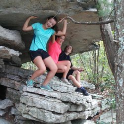
I took my three kids (4, 7, & 10) on a guided caving tour with WILD GUYde a few weeks ago. I hadn't been caving since college - a long time ago! Lester was great. Clearly very experienced and knowledgeable. He was also incredibly patient with three small excited children asking all sorts of questions - which was very much appreciated. I will admit I was regretting my decision to be an adventurous mom when we started sliding down into a small hole under a tree but once I reminded myself that we were with an expert guide that all went away. My kids on the other hand didn't want to leave the cave. We will be back to continue our adventure for sure!

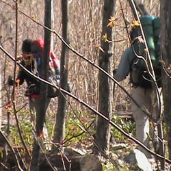
I really could not have been happier with our time spent with the Wild Guyde himself! Another climbing guide in the area who I had initially reached out to that didn't have availability connected me with Lester. First off, he is SUPER friendly and very accommodating. Planning was so easy ! The half day climbing trip was a a surprise for my husband. Neither of us had climbed outdoors prior to this trip, only in a indoor rock climbing gym. Lester put us both at ease and taught us everything we needed to repel 80' safely and climb back up in George Washington National Forest. He had all the gear we needed. He was an excellent coach throughout the entire adventure and really held safety paramount. He taught us great technique that will help in future climbing trips. Lester really is a true gem of a guide and a really awesome person. He was so knowledgeable and gave us tons of outdoorsy facts that are definitely going to be great in trivia someday. We are truly looking forward to scheduling another trip with him! He also gave me an awesome patch to add to my growing collection on my backpack!

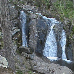
Lester (the owner) is just what you call "good people"! We did the half day canoe trip while we were visiting the Shenandoah National Park. We originally scheduled for Monday afternoon, however, the weather was proving to be nasty so we collectively decided it was best to wait until Tuesday morning. Lester was so communicative and accommodating for something that was completely out of his control. Tuesday, we followed Lester's perfect directions over the Blue Ridge and met him in an area of the river that was calm and beautiful. He taught us 3 main strokes (Sweep, Rudder, Bow Stroke) and one additional advanced stroke called the J-Stroke. Within 20 minutes we were in the water practicing and doing well! He took us through a beautiful stretch of water about 3 miles long with 3 really cool rapid like areas. The water was perfect, we had so much fun, and we learned so much too! Lester was an amazing and patient teacher and was so friendly. We thoroughly enjoyed getting to know more about him and his story! He likewise had a lot of interest in learning about us and our family. It was like we were talking with an old friend and we had never met him before! The canoe trip turned out to be the highlight of our trip! We are already looking to book with him again in the next year or so and take our kiddos this time! We think they would like canoeing under Lester's direction just as much as we did! I highly recommended this company. We were so pleased with the value of what we got and the knowledge and fun Lester shared with us! Also - we asked for a few ideas on local hikes and Lester gave us two great ones. We only had time to do one (Dark Hollow Falls) but we loved it!!!

It was really fun! Scary at times... but fun. I would highly recommend this if you're looking for an outdoor adventure with a little more thrill added. It was our first time climbing outdoors. I would say leaning back at the edge of a cliff prior to rappelling down definitely made me rethink whether I value my life a bit, but Lester was great at encouraging and making us feel comfortable enough to give it a go. There's always a danger factor when doing these activities, but he was a really helpful guide and went through all the safety procedures with us, to make us feel safe, so it was a good experience and I'm glad we did it.

6 months ago


7 months ago
2 years ago
I took my three kids (4, 7, & 10) on a guided caving tour with WILD GUYde a few weeks ago. I hadn't been caving since college - a long time ago! Lester was great. Clearly very experienced and knowledgeable. He was also incredibly patient with three small excited children asking all sorts of questions - which was very much appreciated. I will admit I was regretting my decision to be an adventurous mom when we started sliding down into a small hole under a tree but once I reminded myself that we were with an expert guide that all went away. My kids on the other hand didn't want to leave the cave. We will be back to continue our adventure for sure! read more
8 years ago
I really could not have been happier with our time spent with the Wild Guyde himself! Another climbing guide in the area who I had initially reached out to that didn't have availability connected me with Lester. First off, he is SUPER friendly and very accommodating. Planning was so easy ! The half day climbing trip was a a surprise for my husband. Neither of us had climbed outdoors prior to this trip, only in a indoor rock climbing gym. Lester put us both at ease and taught us everything we needed to repel 80' safely and climb back up in George Washington National Forest. He had all the gear we needed. He was an excellent coach throughout the entire adventure and really held safety paramount. He taught us great technique that will help in future climbing trips. Lester really is a true gem of a guide and a really awesome person. He was so knowledgeable and gave us tons of outdoorsy facts that are definitely going to be great in trivia someday. We are truly looking forward to scheduling another trip with him! He also gave me an awesome patch to add to my growing collection on my backpack! read more


Business owner information
Lester Z.
High praise for our patch to earn a spot on your awesome backpack!…
5 years ago
Lester (the owner) is just what you call "good people"! We did the half day canoe trip while we were visiting the Shenandoah National Park. We originally scheduled for Monday afternoon, however, the weather was proving to be nasty so we collectively decided it was best to wait until Tuesday morning. Lester was so communicative and accommodating for something that was completely out of his control. Tuesday, we followed Lester's perfect directions over the Blue Ridge and met him in an area of the river that was calm and beautiful. He taught us 3 main strokes (Sweep, Rudder, Bow Stroke) and one additional advanced stroke called the J-Stroke. Within 20 minutes we were in the water practicing and doing well! He took us through a beautiful stretch of water about 3 miles long with 3 really cool rapid like areas. The water was perfect, we had so much fun, and we learned so much too! Lester was an amazing and patient teacher and was so friendly. We thoroughly enjoyed getting to know more about him and his story! He likewise had a lot of interest in learning about us and our family. It was like we were talking with an old friend and we had never met him before! The canoe trip turned out to be the highlight of our trip! We are already looking to book with him again in the next year or so and take our kiddos this time! We think they would like canoeing under Lester's direction just as much as we did! I highly recommended this company. We were so pleased with the value of what we got and the knowledge and fun Lester shared with us! Also - we asked for a few ideas on local hikes and Lester gave us two great ones. We only had time to do one (Dark Hollow Falls) but we loved it!!! read more


Business owner information
Lester Z.
Applause to you both for coming all the way from Texas for a "couples…
3 years ago
5 years ago
Business owner information
Lester Z.
Thanks for trying something new. If you get back to this area, we…
3 years ago
2 years ago
6 years ago
It was really fun! Scary at times... but fun. I would highly recommend this if you're looking for an outdoor adventure with a little more thrill added. It was our first time climbing outdoors. I would say leaning back at the edge of a cliff prior to rappelling down definitely made me rethink whether I value my life a bit, but Lester was great at encouraging and making us feel comfortable enough to give it a go. There's always a danger factor when doing these activities, but he was a really helpful guide and went through all the safety procedures with us, to make us feel safe, so it was a good experience and I'm glad we did it. read more

Business owner information
Lester Z.
Proud of you guys for jumping into something new -- beginners are…
2 years ago
6 years ago
Business owner information
Lester Z.
Adam, it was delightful to host you all on your VA/WV adventure trip!…
3 years ago
7 years ago
Was absolutely the highlight of my kids spring break!! I coordinated with Lester before we left Michigan, and we met up with and were guided on a fun several hour afternoon cave adventure by Ethan, who was incredibly accommodating and helpful. My sons (7 and 9 years old) loved it - and my normal shy quiet 7 year old talked non-stop as he explored, climbed, observed, and learned below. The adventure was well-paced to my family's interests and ability level. I would recommend it to anyone visiting the area. read more


Business owner information
Lester Z.
I love hearing about non-stop talking kids! Ethan enjoyed meeting…
8 years ago
Business owner information
Lester Z.
I love to see families sharing meaningful times together -- this is…
3 years ago
8 years ago
Business owner information
Lester Z.
I was SO impressed with you guys, and the way you stayed positive in…
9 years ago
Business owner information
Lester Z.
I enjoy taking anybody adventuring, but there is a special joy when…
6 years ago
Business owner information
Lester Z.
Great to mix fun, challenge, and natural beauty into an event for…
7 years ago
Business owner information
Lester Z.
Glad you enjoyed your day on REAL rock! We have other places to…
5 years ago
7 years ago
Business owner information
Lester Z.
Great to see families planning intentional and meaningful experiences…
8 years ago
Business owner information
Lester Z.
Our goals for every trip are FUN and LEARNING, so if those happened…
9 years ago
Business owner information
Lester Z.
Thanks for your kind words! My two goals for every trip are "funnin'…
8 years ago
Business owner information
Lester Z.
Love to hear about folks "facing the fear!" Courage is not the…
8 years ago
Business owner information
Lester Z.
"Challenged and educated" sounds like we nailed it -- great trip…
8 years ago
10 years ago
Business owner information
Lester Z.
Thanks again for calling us into your troop trip. We work with over…
12 years ago
Business owner information
Lester Z.
Great time with you and your buddies. I try to include FUN and…
More info about WILD GUYde Adventures
1047 Stuart St
Harrisonburg, VA 22802
Directions
(540) 433-1637
Call Now
Visit Website
http://www.wildguyde.com
Hours
Outdoor Amenities
From the Business
Ask the Community - WILD GUYde Adventures
Review Highlights - WILD GUYde Adventures


Why does Yelp recommend reviews?
70 reviews that are not currently recommended
The reviews below are not factored into the business's overall star rating.
4 years ago
4 years ago
1 year ago
7 years ago
3 years ago
5 years ago
9 years ago
6 years ago
12 years ago
3 years ago
5 years ago
6 years ago
9 years ago
2 years ago
7 years ago
7 years ago
3 years ago
5 years ago
10 months ago
5 years ago
WILD GUYde Adventures - hiking - Updated June 2026
Best of Harrisonburg
People found WILD GUYde Adventures by searching for…
Things to Do in Harrisonburg, Virginia
Parks in Harrisonburg, Virginia
Hiking Trails With Waterfalls in Harrisonburg, Virginia
Scenic View in Harrisonburg, Virginia
Fun Things to Do at Night in Harrisonburg, Virginia
Lookout Points in Harrisonburg, Virginia
Secret Spots in Harrisonburg, Virginia
Outdoor Gear in Harrisonburg, Virginia
Climbing in Harrisonburg, Virginia
Caves in Harrisonburg, Virginia
Things to Do on a Rainy Day in Harrisonburg, Virginia
View Points in Harrisonburg, Virginia
Scenic Overlook in Harrisonburg, Virginia
Tubing in Harrisonburg, Virginia
Kayaking in Harrisonburg, Virginia
White Water Rafting in Harrisonburg, Virginia
Playgrounds in Harrisonburg, Virginia
Gyms in Harrisonburg, Virginia
Photo Spots in Harrisonburg, Virginia
Kayak Rental in Harrisonburg, Virginia
Adventure in Harrisonburg, Virginia
Night Hike in Harrisonburg, Virginia
Trending Searches in Harrisonburg, VA
Blueberry Picking near WILD GUYde Adventures
Boat Rental near WILD GUYde Adventures
Cliff Jumping near WILD GUYde Adventures
Day Trips near WILD GUYde Adventures
Dog Friendly Trails near WILD GUYde Adventures
Fishing Spots near WILD GUYde Adventures
Kayak Rental near WILD GUYde Adventures
Off Road Trails near WILD GUYde Adventures
Outdoor Activities near WILD GUYde Adventures
Peach Picking near WILD GUYde Adventures
Public Shower near WILD GUYde Adventures
River Swimming near WILD GUYde Adventures
River Tubing near WILD GUYde Adventures
Rock Quarry near WILD GUYde Adventures
Scenic Night View near WILD GUYde Adventures
Scenic Overlook near WILD GUYde Adventures
Secluded Spots near WILD GUYde Adventures
Splash Pad near WILD GUYde Adventures
Strawberry Picking near WILD GUYde Adventures
Sunrise View near WILD GUYde Adventures
Swimming Holes near WILD GUYde Adventures
Swimming Lakes near WILD GUYde Adventures
U Pick Farms near WILD GUYde Adventures
Watch Sunset near WILD GUYde Adventures
Browse Articles
Browse Nearby
BEST of Harrisonburg, Virginia Coffee near WILD GUYde Adventures
BEST of Harrisonburg, Virginia Things to Do near WILD GUYde Adventures
BEST of Harrisonburg, Virginia Restaurants near WILD GUYde Adventures
BEST of Harrisonburg, Virginia Parks near WILD GUYde Adventures
BEST of Harrisonburg, Virginia Breakfast near WILD GUYde Adventures
BEST of Harrisonburg, Virginia Museums near WILD GUYde Adventures
BEST of Harrisonburg, Virginia Campgrounds near WILD GUYde Adventures
Browse Brands
Related Searches in Harrisonburg, VA
Affordable Kayak Rental Services in Harrisonburg, Virginia
Best Fishing Locations and Guides in Harrisonburg, Virginia
Best Fun Things to Do in Harrisonburg, Virginia
Best Gym With Sauna Amenities in Harrisonburg, Virginia
Best Places for Horseback Riding in Harrisonburg, Virginia
Best Rock Climbing Gyms to Try in Harrisonburg, Virginia
Best Spinning Classes Offered in Harrisonburg, Virginia
Browse Yoga Classes and Schedules in Harrisonburg, Virginia
Check Out Off Road Trails in Harrisonburg, Virginia
Discover Boot Camps Options in Harrisonburg, Virginia
Discover Dog Friendly Trails to Explore in Harrisonburg, Virginia
Discover Great Fitness Classes Available in Harrisonburg, Virginia
Discover Rock Climbing Walls in Harrisonburg, Virginia
Discover Scenic Mountain Bike Trails Near Harrisonburg, Virginia
Discover Top Yoga Options and Studios in Harrisonburg, Virginia
Discover Walking Parks in Harrisonburg, Virginia Near You
Discover a Hiking Trail in Harrisonburg, Virginia
Discover the Best Night Hike Trails in Harrisonburg, Virginia
Dog-Friendly Hikes With Dogs in Harrisonburg, Virginia
Effective Strength Training Near Harrisonburg, Virginia
Enjoy Camping Adventures Around Harrisonburg, Virginia
Enjoy Exciting Mountain Biking Adventures in Harrisonburg, Virginia
Enjoy Kayaking Adventures in Harrisonburg, Virginia
Enjoy River Tubing Adventures in Harrisonburg, Virginia
Enjoy Tent Camping Spots Around Harrisonburg, Virginia
Enjoy the Best Bouldering Experiences in Harrisonburg, Virginia
Enjoy the Best Family Activities in Harrisonburg, Virginia
Enjoy the Best Tubing Experiences in Harrisonburg, Virginia
Enjoy the Best Walking Trails in Harrisonburg, Virginia
Exciting Laser Tag Games and Venues in Harrisonburg, Virginia
Experience Thrilling White Water Rafting in Harrisonburg, Virginia
Explore Beautiful Parks and Green Spaces in Harrisonburg, Virginia
Explore Bike Rentals Throughout Harrisonburg, Virginia
Explore Easy Hikes Perfect for All in Harrisonburg, Virginia
Explore Exciting Jump Parks in Harrisonburg, Virginia
Explore Fitness Centers and Gyms in Harrisonburg, Virginia
Explore Fun Activities to Do in Harrisonburg, Virginia
Explore Gyms With Pool Access in Harrisonburg, Virginia
Explore Martial Arts Options in Harrisonburg, Virginia
Explore Popular Campgrounds Near Harrisonburg, Virginia
Explore Popular Scenic Overlook Points in Harrisonburg, Virginia
Explore Scenic Lakes to Visit in Harrisonburg, Virginia
Explore Summer Camps for All Ages in Harrisonburg, Virginia
Explore Top Dog Parks in Harrisonburg, Virginia Near You
Explore Top Water Parks in Harrisonburg, Virginia Today
Explore Top Womens Gym Options in Harrisonburg, Virginia Today
Explore Top-Rated Mma Gyms in Harrisonburg, Virginia Near You
Explore Zumba Classes Near Harrisonburg, Virginia
Explore the Best Barre Classes Available in Harrisonburg, Virginia
People who viewed WILD GUYde Adventures also viewed
Doyles River Falls Trail
3 reviews
Shenandoah River Adventures
21 reviews
Patricia Ann Byrom Forest Preserve Park
2 reviews
Dark Hollow Falls Trail
21 reviews
Mountaintop Ranch
3 reviews
Escapism Escape Rooms
15 reviews
Massanutten Mountain Bike Park
6 reviews
Reddish Knob
3 reviews
Westover Park
3 reviews
Woodstone Meadows Stables
13 reviews