Walker Sisters Place Photos


You might also consider
More like Walker Sisters Place
Recommended Reviews - Walker Sisters Place
Start your review...

7 months ago


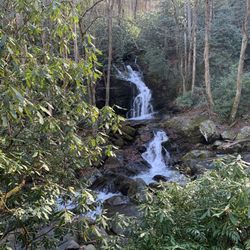
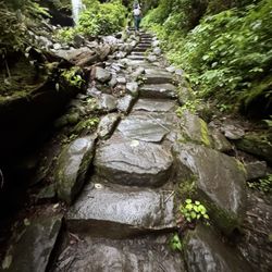
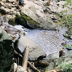
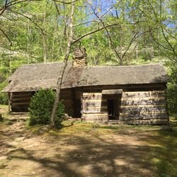
This is a very remote property located along the Little Brier Gap Trail, about 1.5 miles from the Little Greenbrier School. It is only accessible by foot. The site contains a house, corn crib or barn and springhouse built in the mid-1800s. The buildings are the last remnants of the Little Greenbrier Community and were occupied by the Walker Sisters until the 1960s. Although the hike to the property is fairly easy, this spot does not attract as many visitors as others in the park and as a pleasant result you can find more solitude and tranquility here than other places you may visit. It is hard to imagine what life must have been like for the women who lived here. A tour of the interior of the house will leave those of us used to creature comforts thankful for all we take for granted. The grounds provide ample spots for taking a break, stretching out and relaxing. There are no restrooms, water stations or amenities of any kind available here. The hike to the Walker Sisters Place for the most part follows an old road and is easy to navigate. Just before the turn to the property, a narrow footbridge allows you to cross the stream. The sounds of running water, scurrying critters and the leaves rustling in the wind can make you forget that just a few miles away there is a park road teeming with traffic and other visitors. We hiked after lunch and it made for a perfect afternoon. We met a few people on the trail as we hiked in, but there were only three or four other people at the house when we arrived. This is a great family hike. We managed well with a 3 and 5 year old, although some piggy back rides were needed on the return trip. read more

More info about Walker Sisters Place


Walker Sisters Place - hiking - Updated June 2026
Best of TN
People found Walker Sisters Place by searching for…
Hiking Trails in Tn, Tennessee
Dinosaur Park in Tn, Tennessee
Waterfall Hike in Tn, Tennessee
Scenic Overlook in Tn, Tennessee
Running Trails in Tn, Tennessee
Swimming Lakes in Tn, Tennessee
Free Campgrounds in Tn, Tennessee
Walking Trails in Tn, Tennessee
Places to Take Pictures in Tn, Tennessee
Browse Nearby
BEST of TN, Tennessee Coffee near Walker Sisters Place
BEST of TN, Tennessee Restaurants near Walker Sisters Place
BEST of TN, Tennessee Things to Do near Walker Sisters Place
BEST of TN, Tennessee Lakes near Walker Sisters Place
BEST of TN, Tennessee Breakfast near Walker Sisters Place
BEST of TN, Tennessee Taxis near Walker Sisters Place
BEST of TN, Tennessee Campgrounds near Walker Sisters Place
BEST of TN, Tennessee Horseback Riding near Walker Sisters Place