Look Rock Tower Photos


You might also consider

More like Look Rock Tower
Recommended Reviews - Look Rock Tower
Start your review...







3 years ago


3 years ago
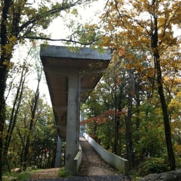
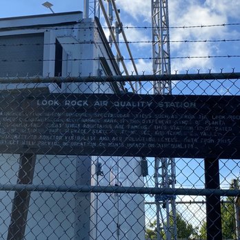
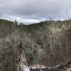
Reviewing the tower and campground all in one, since there is no way to differentiate them. Quick glance: Look Rock Tower Pros: beautiful view, accessible to most people. Cons: parking pass is needed and not nearby to purchase, poison ivy abundant. Look Rock Campground Pros: close to Look Rock Tower, quiet and secluded, dump station, sites with electric and water, clean public bathroom, near enough to major tourist hits. Cons: no security/enforcement, poison ivy absolutely everywhere so parts of campsite are unusable, small parking pads on campsites, popular motorcycle highway nearby so loud engine reverberations frequently heard. More details and elaborations: Look Rock Tower: gorgeous views, even on a slightly cloudy day. The walk up is paved through the woods with a very clear, defined path. It is a steep hill, so wear comfortable shoes, but it is doable for most people including young children and ADA accessible. At the top of the paved walk is the tower with a ramp all the way to the top, and a small viewing platform. It was not crowded when we got there. WARNING: you need a day parking pass to park in the lot at the bottom of the hill. These CANNOT be purchased anywhere nearby (Townsend is the closest, nearly 45 minute drive) The woods itself is swollen with poison ivy, so tall socks are a must and warning signs to not stray off the pavement are posted. All around this took an hour, including parking, walking and photographing. Look Rock Campground: is located nearby (about a mile from the Look Rock Tower parking lot) and is very calm, secluded campground. There are public toilets and sinks, and while they were rustic, the facilities were very clean and stocked with toilet paper the entire time we stayed. There was no soap though, so bring your own. The campground is very strict about bear-proofing your campsite and a waiver is signed stating you understand and will obey or forfeit your site. Our site was very small, had to park the 25 foot tow trailer and immediately detach the truck so we could park it next to the RV in the side-by-side spot. The table was behind the RV so we didn't use it since it was surrounded by poison ivy. We had full water and electric hookup at our site, and many of the sites offered this amenity but not all. Some of the tent spots had roadside parking and a pad located deeper in the woods, so it might provide nice shade and privacy but again, poison ivy was everywhere so I imagine it'd be hard not to get it at a tent site. There was a spot called "the amphitheater" but I can't imagine when it was last used; it looked like ruins with cement posts in the ground completely overrun with poison ivy and other plant life. If it hadn't been marked on the map I'd have never noticed to look at it. The volunteer camp hosts were pleasant, we had minimum interactions with them except to issue concerns about a neighbor who wasn't abiding by the quiet hours posted (their RV engine was broken and sounded like a broken fan belt running 24 hours a day. They would leave it running all day and night and left the campground for days at a time) the camp hosts worked to help the situation as best they could. The road to get to the campground has many places to pull over and view the Smokey Mountains, we got some amazing photos. It seems to be about 45 minutes to an hour from all major hotspots like Gatlinburg, Townsend, Maryville and Pigeon Forge so we were able to take day trips into each town and see the sites. It's also about 1.5 hours from Clingman's Dome and 50 minutes to 1.5 hours from other massive trailheads, so this campground may be a hiker's delight (if you're not allergic to poison ivy that is). This campground is also near some major curvy roads, which made it a popular destination for motorcyclists who's engines can be heard all day roaring in the mountains' echoes. read more

2 years ago
7 years ago
7 years ago
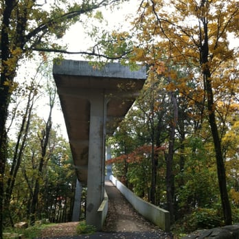
Worth the drive and the time. So glad we did this. Spectacular views, not many people, steep hike to the tower, but worth it. Looking for something to do other than spending money on go carts, zip lining, etc. take the drive and enjoy! read more



14 years ago
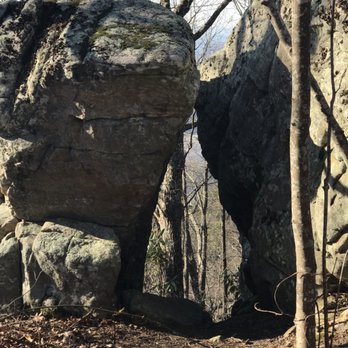
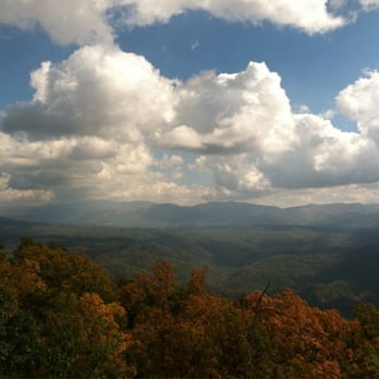
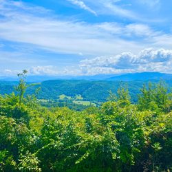
Beautiful, doesn't even begin to describe the view from here. It rivals Clingman's Dome, and is even better in my book, because it's a low traffic area. We stayed at the campgrounds, so hiked over, it's about a 2 mile trek. But I believe there's parking at the picnic area that provides a shorter jaunt. Also, check out the huge stones beneath the tower, while you're there. How'd they get there?! read more



11 years ago
More info about Look Rock Tower
Foothills Pkwy
Maryville, TN 37803
Directions
Hours
Outdoor Amenities
Ask the Community - Look Rock Tower


















Look Rock Tower - hiking - Updated May 2026
Best of Maryville
People found Look Rock Tower by searching for…
Things to Do in Maryville, Tennessee
Campgrounds in Maryville, Tennessee
Scenic View in Maryville, Tennessee
Scenic Overlook in Maryville, Tennessee
Hiking Trails in Maryville, Tennessee
Picnic Areas in Maryville, Tennessee
Beautiful Views in Maryville, Tennessee
Walking Trails in Maryville, Tennessee
Photo Spots in Maryville, Tennessee
Off Road Trails in Maryville, Tennessee
Waterfall in Maryville, Tennessee
Running Trails in Maryville, Tennessee
Lookout Points in Maryville, Tennessee
Day Trips in Maryville, Tennessee
Easy Hikes in Maryville, Tennessee
Camping Sites in Maryville, Tennessee
Night Hike in Maryville, Tennessee
Free Campgrounds in Maryville, Tennessee
Secluded Spots in Maryville, Tennessee
View Points in Maryville, Tennessee
Picnic Tables in Maryville, Tennessee
Trending Searches in Maryville, TN
Bird Sanctuary near Look Rock Tower
Boat Rental near Look Rock Tower
Botanical Gardens near Look Rock Tower
Bounce House Rentals near Look Rock Tower
Campgrounds near Look Rock Tower
Cliff Jumping near Look Rock Tower
Flower Fields near Look Rock Tower
Flower Shop near Look Rock Tower
Garage Sales near Look Rock Tower
Lookout Points near Look Rock Tower
Nurseries & Gardening near Look Rock Tower
Outdoor Activities near Look Rock Tower
Outdoor Furniture Stores near Look Rock Tower
Party Equipment Rentals near Look Rock Tower
Pick Your Own Farms near Look Rock Tower
Picnic Areas near Look Rock Tower
Rainy Day Activities near Look Rock Tower
Rock Quarry near Look Rock Tower
Running Trails near Look Rock Tower
Scenic Drive near Look Rock Tower
Secret Spots near Look Rock Tower
Strawberry Picking near Look Rock Tower
Sunrise View near Look Rock Tower
Swimming Holes near Look Rock Tower
Table And Chair Rentals near Look Rock Tower
Browse Articles
Browse Nearby
Browse Brands
Related Searches in Maryville, TN
Affordable Kayak Rental Services in Maryville, Tennessee
Best Fishing Locations and Guides in Maryville, Tennessee
Best Places for Horseback Riding in Maryville, Tennessee
Best Waterfalls and Swimming Holes in Maryville, Tennessee
Check Out Off Road Trails in Maryville, Tennessee
Discover Dog Friendly Trails to Explore in Maryville, Tennessee
Discover Kid Friendly Hiking Trails in Maryville, Tennessee
Discover Scenic Mountain Bike Trails Near Maryville, Tennessee
Discover Scenic Waterfall Spots in Maryville, Tennessee
Discover Walking Parks in Maryville, Tennessee Near You
Discover a Hiking Trail in Maryville, Tennessee
Discover the Best Night Hike Trails in Maryville, Tennessee
Dog-Friendly Hikes With Dogs in Maryville, Tennessee
Enjoy Camping Adventures Around Maryville, Tennessee
Enjoy Exciting Mountain Biking Adventures in Maryville, Tennessee
Enjoy Kayaking Adventures in Maryville, Tennessee
Enjoy River Tubing Adventures in Maryville, Tennessee
Enjoy Tent Camping Spots Around Maryville, Tennessee
Enjoy a Beautiful Waterfall Hike in Maryville, Tennessee
Enjoy the Best Tubing Experiences in Maryville, Tennessee
Enjoy the Best Walking Trails in Maryville, Tennessee
Exciting Cliff Jumping Spots in Maryville, Tennessee
Experience Thrilling White Water Rafting in Maryville, Tennessee
Explore Beautiful Parks and Green Spaces in Maryville, Tennessee
Explore Easy Hikes Perfect for All in Maryville, Tennessee
Explore Fun Activities to Do in Maryville, Tennessee
Explore Popular Campgrounds Near Maryville, Tennessee
Explore Top Dog Parks in Maryville, Tennessee Near You
Explore the Best Boating Spots in Maryville, Tennessee
Explore the Best Swimming Holes Around Maryville, Tennessee
Find Beautiful Views in Maryville, Tennessee
Find Cozy Camping Cabins in Maryville, Tennessee
Find Popular Ziplining Spots Around Maryville, Tennessee
Find the Best Parks for Picnics in Maryville, Tennessee
Find the Best Playgrounds to Visit in Maryville, Tennessee
Find the Best Scenic View Locations in Maryville, Tennessee
Hiking Trails With Waterfalls in Maryville, Tennessee
Plan a Scenic Drive Route Near Maryville, Tennessee
Popular Fishing Spots to Explore in Maryville, Tennessee
Popular Outdoor Activities to Try in Maryville, Tennessee
Safe River Swimming Areas in Maryville, Tennessee
Safe and Fun Parks for Kids in Maryville, Tennessee
Top Climbing Spots and Gyms in Maryville, Tennessee
Top Paddleboarding Activities in Maryville, Tennessee
Top Playgrounds for Kids to Enjoy in Maryville, Tennessee
Top Running Trails to Explore in Maryville, Tennessee
Top Swimming Lakes to Enjoy in Maryville, Tennessee
Top Swimming Spots and Pools in Maryville, Tennessee


