Spruce Flats Falls Photos


You might also consider


More like Spruce Flats Falls
Recommended Reviews - Spruce Flats Falls
Start your review...



7 months ago
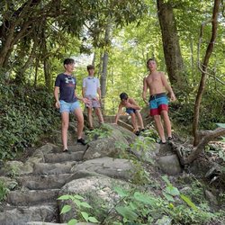
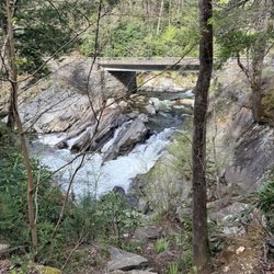
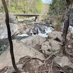
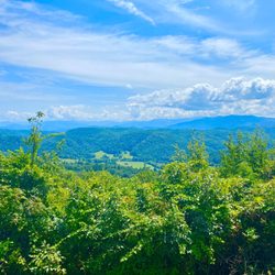
Beautiful short hike that is around 2 miles total roundtrip in Townsend near the Smoky Mountains. A lot of uphill climbing, but worth it for the waterfall. When we were here this trail was still quite crowded and parking was limited/hard to find so be mindful of that. Otherwise, it's a beautiful site to see. read more

6 years ago
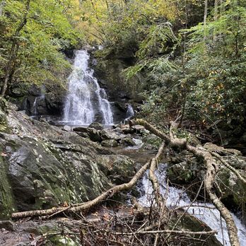
Looking for short, less populated, but still fabulous waterfall hike while visiting Gatlinburg or the Great Smoky Mountains? This is it!!! SPRUCE FLATS FALLS is a very short hike that begins at the Great Smoky Mountains Institute @ Tremont. The waterfall trail begins at the exact same point as the Lumber Ridge Trailhead, but the Lumber Ridge Trail goes left while the Spruce Flats trail goes right. The trail is easy to follow for the most part due to the Institute providing additional signs along the way to help guide you. Various hiking websites have differing difficult ratings as well as differing distances to the falls. My personal hiking experience would rate this as mildly moderate and the distance, according to our tracking systems was around .8 miles to the falls for a grand total of about 1.6 miles round trip. ~ MILDLY MODERATE HIKE The distance is easy, and while there are some steep uphill and downhill sections, my heartrate was never elevated to the point of heavy breathing. Experienced hikers would likely rate this trail on the harder side of an easy scale, primarily because of the difficulty of the terrain. It is heavily laced with exposed tree roots and/or embedded with jagged stones making it important to watch your step and balance. ~ OUR EXPERIENCE Our primary reason for visiting the Smokies was to hike Mount LeConte, which we successfully did the day prior to hiking here to Spruce Flats Falls. LeConte is a beast of a hike with an elevation gain of just under 2,900 feet over 5.5 miles. Comparatively, Spruce Flats Falls trail was a delight, but our legs were still extremely sore from our LeConte hike! The pain made our this hike less joyful, but each painful step was well rewarded with a gorgeous waterfall. Our group included myself, an experienced hiker, a grandmother (64), two single moms (29 & 31), their two kids: Adorable 3 year old Jojo and 10 year old Zeke + my yelp daughter Jess (30). My wife was still sore from the LeConte hike and opted to stay back in Gatlinburg. *** LET ME JUST TAKE A MOMENT TO SAY HOW INCREDIBLE MOTHERS ARE!!! Little 3-year-old Jojo's mom carried her probably more then 1/3rd of the hike, particularly over some of the tougher terrains and didn't break a friggin' sweat!!! I carried her tiny 30 pound body up one of the steeper parts of the trail for about 5 minutes and thought I was gonna die! Jojo's 64 year old grandmother who does not hike at all handled the trail like a champion, even leading the way on occasion. Truthfully I was worried by some of the hiking reports for this trail saying it may be difficult for children, seniors and inexperienced hikers, but our group had all of those and it was not a problem. PLUS it had been raining most of the morning (wetting the trail) and continued with a light dewy drizzle most of our hike. ~ FINAL THOUGHTS Yep, my group included three generations of women on a rainy, misty Saturday and we all had a great time! The falls are beautiful! One of the more beautiful ones I've seen in the area, but hard to see in full from the base. This is definitely a waterfall where the pictures are best if you have a drone that can capture it's full grandeur. My difficulty scale: 0 = no effort required 1-3 = easy 4-6 = moderate 7-9 = difficult 10 = extremely difficult WATERFALL ATTRACTIVENESS: 8 out of 10 OVERALL DIFFICULTY: 4 out of 10 (mostly because of terrain) OUR TRACKING DISTANCE: 1.6 miles round trip from parking area across from the Institute @ Tremont. 2020 / 68 read more



3 years ago

3 years ago

6 years ago