Umbrella Falls Trail Photos


More like Umbrella Falls Trail
Recommended Reviews - Umbrella Falls Trail
Start your review...

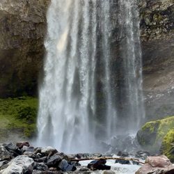
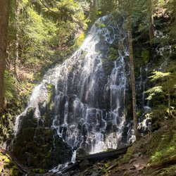
If your thing is almost no effort for huge reward, consider checking out Umbrella Falls. Right now you can park at Meadows and you'll see the trail sign. A narrow, (worn out) paved, and very short trail will take you right down to the falls in a minute. The setting is gorgeous and the falls are stunning. From the top when you see the little stream it's hard to believe that small amount of water can make such a beautiful and wide display. You can also add Umbrella into other hikes should you crave more of an adventure...adding in Sahalie Falls makes a great trip. But almost anyone can take the short trip down to Umbrella right now...highly recommend. read more


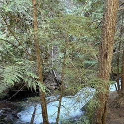
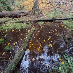
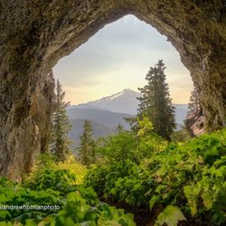
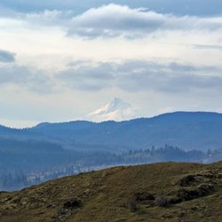
Hiking around a ski bowl in the off season is definitely cool. Something kinda creepy about those chair lifts just sitting there above the abundant foliage and creeks. This hike also has some amazing waterfalls. I took the "Umbrella Falls, Sahalie Falls and Timberline Trail Loop" as it is described in AllTrails. It's a 10.7 mile loop with a good combination of easy, tree covered strolling and uphill pushes that are strenuous but not hard. I started at Hood Meadows, at the Umbrella Falls trailhead, but you can start many places. I recommend either downloading g or printing a map - there are many cross trails and it would be easy to take an unintentional detour. I went counterclockwise, so Umbrella Falls was literally the first thing I saw. Steps from the parking area. So beautiful, just picture ready. A couple miles along I came to Sahalie Falls. The scramble down to the base was super sketchy, so be careful! It's truly one of the prettiest waterfalls in the Mt. Hood Forest. Remember I said be careful? Ya, I took a hard fall at a small creek crossing. Don't be like me, test that footing and log before you put your weight on it. I fell sideways into the creek, then several more times trying to get out of it. I'm pretty bruised but okay - it's a reminder how the simplest thing can still be dangerous. Nature don't care about you, so be cautious out there. I know I'll be a lot more wary of where I place my feet. It was a warm day and nothing was broken, so I dried out and carried on. Hey, can I just say - my phone was in a Unicorn Beetle Supcase and it survived the ordeal without a scratch. Sexy and functional, I'll never put my phone in any other case (I'm a former Otterbox user. Go Unicorn Beetle or bust!) This hike is one of those you can only do when the snow is gone, and right now the weather is perfect. Enjoy! read more


Moderate loop trail at 3.9 miles. Expect to climb about 900 ft. When you find the trail head you are going to want to go straight and follow the loop in a counter clockwise direction. The trail is smooth at first with many wildflowers and Doug first to view bit will begin to climb about 20 min in. The climb can be a bit strenuous at times if you have a lot of gear. Expect dust to kick up in certain sections. You will also pass by some really beautiful small creeks as you near the waterfall. At some point you'll reach the juncture. Head towards umbrella falls which is about a 10 min hike. Great place to eat lunch and enjoy photos with family and friends. You can finish the loop back at the junction. On the way there is Sahalie falls but it is extremely precipitous going down! With good gear you can get down and enjoy the punch bowl below for swimming. A fun hike but expect some strenuous parts. read more


6 years ago
More info about Umbrella Falls Trail
Umbrella Falls Trl
Mt Hood, OR 97041
Directions
Hours
Outdoor Amenities