Tamanawas Falls Photos


More like Tamanawas Falls
Recommended Reviews - Tamanawas Falls
Start your review...


Reviews With Photos


We were in the area and wanted to do a little hike. We found the Tamanawas falls hike and was described as an easy to moderate hike. The first mile was an easy dirt path with a modest elevation climb. When you turn away from the highway and cross the creek the trail turns a little rocky. The next mile and a half of the trail is intermittent mud and a lot of areas quite rocky. When you're about 300 yards or so from the waterfalls you'll encounter a rock slide that is one long boulder hop with some areas -that are quite treacherous. Once you get past the mudslide it's a short walk to the payoff. The waterfall is very stunning. We sat and gathered ourselves close to the base and enjoyed the beautiful scenery. The hike back seemed a lot shorter because we knew what we were encountering. The hike was described as a 4 mile hike we clocked it closer to 5 miles. Not a big deal but if you can get past the Boulder scramble the payoff is worth it. We definitely will do this hike again if in the area. There is a 5 dollar parking fee or the America the beautiful park pass we leave on the dash. There is a kiosk for the five dollar option at the trail head.
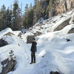

Awww I love that you can leave a yelp review for this trail. FYI though if you're looking for trail conditions, All Trails is an excellent resource. People update it often. I've hiked this trail twice now and I love it. I did it once in the fall and recently in the winter. It's an out and back that won't take you too long. Right now you for sure need spikes. There's a ton of snow and it's slippery, but it's so beautiful. The waterfall is so worth the hike! I loved it in the fall too. There were so many cool mushrooms. Parking at the trailhead can be a little crowded since it's popular. You need a pass or you can pay at the trailhead.


This is where you start the hike to Tamanawas Falls. Signs at the start of the trail (at this pin) showing distances don't agree/match with signs along the trail even though they show the same route. You must pay $5 per vehicle which can be paid at the cash drop pay station onsite, then you keep the stub in your car on the dash - a national park pass waives this fee. You'll start the trail by crossing a one person wide narrow bridge and following the highway north for a while. Once at the falls, you'll feel lots of water spray and it will be loud. You can walk behind the falls if you don't mind risking slick rocks.


Easy peasy 3.5 mile out and back to one of the most beautiful waterfalls in Oregon. Plentiful parking at the trail head if you get there before 08:00 or so. NW Forest or America the Beautiful pass required. Need a break from this crazy world? Nature has got you! Resplendent foliage, blue water rushing over rocks and swirling in clear pools, and as if that wasn't reward enough for simply being in this place, a breathtaking waterfall at the top of the trail. Modest gain along a soft path, with a bit of a rock scramble toward the top. It's short and you've got nowhere else to go and all day to get there, so take the paths along the way down to the water. Linger, contemplate, relax.


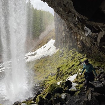
Tamanawas Falls is a "moderate" 3.4 mile hike in Mt Hood National Forest. I put moderate in quotations because if this is moderate I do not want to hike a difficult trail. In a few areas I felt like one wrong step and I was going to fall to my death, the heights definitely got to me. Once we got to the rocks, we couldn't figure out where the trail went. Luckily a party was on their way down and mentioned there was a rock slide recently so up we went. The waterfall was beautiful, you have to climb on rocks to get really good views of it. I do recommend Tamanawas Falls if you are in the area.


Great 2-mile hike along the stream leading to a very pretty waterfall. The first section is easy and no part is more than moderate in difficulty. This is a trail I will happily hike whenever I'm in the area.


I found this specific falls through Yelp while I was looking for waterfalls to visit while in Oregon. Surprisingly, this was the first one to pop-up on my search. I knew this was definitely something I had to see, as the photos looked amazing! I didn't realize that this fall was actually further away than the rest of the falls we wanted to see. It's okay though; the trek was worth it. When we started the hike, we realized we had to pay for parking, which was about $5 (if I can remember correctly). We filled out a form and dropped it off in a box. The hike itself was pretty easy, with the exception of the rocky area right before you see the falls. We went on a pretty sunny day, but I could only imagine how hiking through this rocky area could've been difficult, as it probably would get slippery. Once we got to the falls, we were in love! It was such a gorgeous sight to see and worth the 45-minute hike to see this. One of the hikers that we had run into in passing said that we had to walk all the way to the back of the falls to get the best experience. Well, we did just that! He was absolutely correct. If you decide to do this, be very careful as the rocks to get to the back of the falls could be extremely slippery. You could seriously get injured if you don't take precaution. Also, be cautious of the rocks above your head. I was walking alongside the edge and didn't realize there was a rock above me as I was hunched over. When I stood up, I hit the edge of the rock. Luckily, I was fine, but it could've been worse! If you're in Oregon and are looking for awesome sites to see, check this place out! It'll be worth your time!


To give you some context of my review for this hike: I am a 5'3'' semi-athletic female (meaning I didn't play NCAA and I'm not an Olympian, but I can hold my own when it comes to hiking and recreational sports - just to give you an idea, because sometimes Yelpers will be like "THIS WAS SOOOO EASYYY" but it's because they're a freaking marathoner or something lol) It's a 3.3 mi trail, I would say moderate hike (not impossible, but definitely not flat, decently steep at some points) Conditions: Saturday in late May, no rain, temperature low 70s, I'm wearing Nike free runs that have zero traction because I just moved to Portland and have no good hiking shoes (but it's okay, it can be done!) This is an out & back trail (not a loop), it's about If you're coming from Portland it's about a 2 hour drive to the trailhead, type "Tamanawas Falls Trailhead" into your google maps and it will lead you straight to the beginning. Parking is pretty easy along the side of the hill's highway (lots of good space), with a $5 parking fee (honor system, you write your license plate and time you're going to be there on a little pass and put it on your mirror, and drop the envelope into a box). The hike takes about 45 mins to get to the waterfall if you're going at a medium pace, with no small children. It wasn't annoyingly crowded on this day but there were enough people along the path. LOTS of cute dogs and little children doing it. The journey: The first part is like a light stroll on a small incline, and then about halfway it starts getting kind of steep. There's a few bridges you cross that give you awesome views of the raging river. There's a part that can get slippery (assuming you're doing this in the spring/summer and there's no snow) where there's crumbled large/small rocks on the path and you have to be kind of careful where you're stepping (especially if you're wearing terrible Nikes like me...) The hike is beautiful, I don't think there's anything like it in California (I now know why people who move to Oregon love it here...). There's plenty of trees, the air feels so fresh, and I love the sound of the river coming from the waterfall. It's not a boring hike at all, and it's so gorgeous the whole way. If I remember, there might be one fork in the road and I took the left on the way up. Once you get to the waterfall, it's totally worth it. There's not a ton of signage along the path telling you how much further you have to go,but it's pretty easy to follow. Basically, you should be able to follow the river on your left to go up to the waterfall. There's a point where you've been going up hill for a really long time and you might feel like giving up, BUT DON'T. THE WATERFALL IS LITERALLY RIGHT THERE AND IT'S TOTALLY WORTH. Once you get to the actual waterfall, there's a bunch of rocks you have to navigate to get up close to it/ under it. These rocks can get slippery when they're wet from the mist, so be careful. But the view is amazing and the waterfall is RAGING. It's pretty huge and you are able to get pretty close to it if you want. If you sit at the base of the waterfall, there's a few places to sit if you want to snack/ watch the waterfall and feel the cold mist on your face. Going down, it only took about 35-40 mins. The thing I appreciate about this hike is that there's some parts that aren't challenging, and then there's periods where you're definitely getting a heavy cardio/ glut work out. Highly recommend, definitely taking my friends here again!
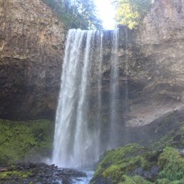

EXCELLENT. My friend took me out here and it was her first time too. We snagged a parking spot and began our hike. It was a moderate level, not too much elevation, lots of rocks, and diverse landscape. And the best part: a waterfall at the end! Absolutely beautiful. Would recommend. Saw a lot of groups and families with kids here, even dogs. The trees are soothing and rejuvenating, and it was a great way to spend the morning. 4 miles took us about 2 hours, including time spent at the waterfall.


Came here on a whim, thanks to an article on Outdoor Project, and holy moly, was not disappointed by how beautiful this place is! The hike itself is ideylic and picturesque, snow covering the ground, and sun shining through the trees. This was a super easy hike to do , there and back, with moderate elevation. It was a perfect place to let our dog off leash as well, as he tends to stay on the trails, its easy for him to walk straight and not veer off too much. One of the coolest things about this hike is that you can follow the river/ creek all the way up back to the the falls. The waterfall had beautiful frozen ice pillars all around it, as well as ice carvings by the base that were beyond anything I had ever seen before. I was able to climb behind the waterfall, and see the ice pillars in person. They were a beautiful blue color, and very very slippery. I don't really recommend going behind the waterfall if you are a little skiddish, because if you slip you could fall right into the freezing water, and you have to slide down ice a bit to get there. Definitely worth it!! SOoo ooo good


I've been going on a lot of hikes this summer, and I've started to really like it. Tamanawas was the most recent hike I've done, and it is by far my favorite hike. Every second of the hike is beautiful, there isn't a single part where it's not. The entire hike is nestled through the woods, and you'll pass by a lot of mini waterfalls on your way. When the hike first starts, there's two really dramatic hills, but then the rest of it is pretty easy going. There's one section where it's very rocky and steep right before you get to the falls, so make sure you're prepared for that. We had to take a few breaks on the way there because I got tired, but it was a lot easier on the way back. It took us about 3 hours to complete the whole hike, and that included hanging out at the falls for about half an hour. We did this hike around 4pm, and honestly, considering I usually go hiking early in the morning, I preferred this one later in the day. We only saw about four other groups of people on the way, and we also found a geo cache by accident (!!). I'm definitely gonna be doing this hike again in the fall. It's amazing.


My Favorite Waterfall on the east side of Mt. Hood. It takes about 90 minutes to get there from Portland, 30 minutes from Hood River. Park off Highway 35 near milepost 72 (just north of the Sherwood Campground). NW Forest Parking Pass required. It's a moderate (sometimes hot) hike, just shy of 4 miles roundtrip. About a half-mile traverse parallel to the highway and then turn up Cold Spring Creek and follow all the way up to the falls (about 1.5 miles). Beautiful creek hike, through a monster rock slide and then a giant waterfall that you can (carefully) walk behind. There's a small island in the middle of the creek, just below the falls that you can sit on. It's just at the edge of the spray zone. You can watch the swirls of mist. It's Very Cool! Bring water and good shoes, especially if you're going to climb up behind. If you get up early, you can have lunch at the falls and dinner in Hood River or even back in Portland.


This is such a cool waterfall! It's really high up, and the hike there is pretty fun and quite pretty. The hike there is constantly next to water, and the hike isn't too difficult. There's some slopes up and down, but it's never too steep. Near the waterfall, I felt the mist spraying, and we actually climbed up to behind the waterfall. It was really fun and really pretty! The water is pretty cold, and we saw some dogs splashing in the water too. Really nice place to visit, and I'd definitely recommend it!


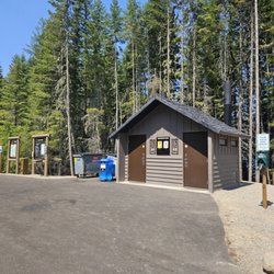
This review is for Tamanawas Falls Trail which was a ~3.4 miles round trip that took ~2 hours to complete. This was a short and easy hike towards another stunning waterfall in the Mt Hood, Oregon. Trail was mostly a narrow dirt path that becomes a little more rocky with a steady incline in the second half of the trail. Most of the trail was next to a running creek. Furthermore, there were a bit of flies in the last 0.25 miles to the waterfall. Limited parking area at the trailhead. Restroom available at the parking lot. Short video of the hike for those interested! https://youtu.be/vRrwqvR6rJo read more


5 months ago
What a beautiful hike! I'd say it's pretty family-friendly overall. There is some uphill hiking and two short sections that are a little questionable to get up and over, but we were able to do it with a 9-month-old strapped to one parent, a 3-year-old strapped to the other, a 12-year-old, a 14-year-old, and two grandparents. We loved that most of the trail is shaded by trees, though enough sun still comes through that sunscreen is recommended. Definitely bring water. One of the coolest parts is that you can go up behind the waterfall, but be prepared to climb rocks to get there--it's not an easy walk-up-and-around situation. The hike is about 3.5-3.6 miles. There were a decent number of people there, but it never felt overwhelmingly crowded. Amenities include restrooms, picnic tables, an information kiosk, and dogs are allowed on leash. A $5 day pass, Northwest Forest Pass, or Interagency Pass is required from May 15 to October 1. read more


1 year ago
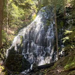
Tamanawas Falls is one of my favorite waterfalls I've seen in Oregon. I've hiked it twice now-- once this past summer with my cousin, and more recently, last week. The hike is about three and a half miles round trip, with about 600 feet in elevation gain. Some light scrambling is necessary to get up close to the waterfall. There is a decent sized parking area at the trail head. Parking is $5 or free with a valid recreation pass. The waterfall itself is a hundred foot tall curtain. While it's only about one third the size, the shape reminds me of Vernal Fall in Yosemite. The basalt underneath the waterfall is very pretty and interesting to examine. There were lots of yellow trees (in October) including maple and Tamarack. I've read that you can go behind this waterfall, but I did not, since I'm a chicken, and like to play it safe around water. The hike was a little harder than it sounds, but still definitely doable within a couple of hours. There are a few campgrounds nearby, including Sherwood, Pollalie, and Nottingham. read more

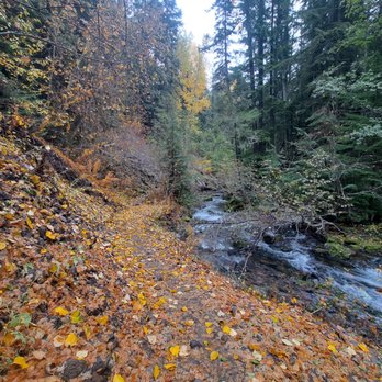


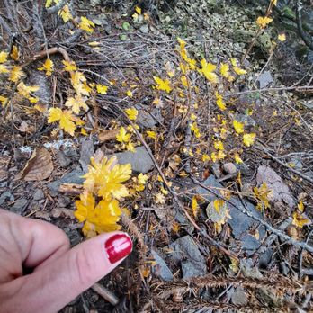


We were in the area and wanted to do a little hike. We found the Tamanawas falls hike and was described as an easy to moderate hike. The first mile was an easy dirt path with a modest elevation climb. When you turn away from the highway and cross the creek the trail turns a little rocky. The next mile and a half of the trail is intermittent mud and a lot of areas quite rocky. When you're about 300 yards or so from the waterfalls you'll encounter a rock slide that is one long boulder hop with some areas -that are quite treacherous. Once you get past the mudslide it's a short walk to the payoff. The waterfall is very stunning. We sat and gathered ourselves close to the base and enjoyed the beautiful scenery. The hike back seemed a lot shorter because we knew what we were encountering. The hike was described as a 4 mile hike we clocked it closer to 5 miles. Not a big deal but if you can get past the Boulder scramble the payoff is worth it. We definitely will do this hike again if in the area. There is a 5 dollar parking fee or the America the beautiful park pass we leave on the dash. There is a kiosk for the five dollar option at the trail head. read more


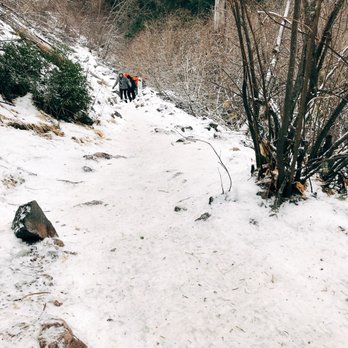
Awww I love that you can leave a yelp review for this trail. FYI though if you're looking for trail conditions, All Trails is an excellent resource. People update it often. I've hiked this trail twice now and I love it. I did it once in the fall and recently in the winter. It's an out and back that won't take you too long. Right now you for sure need spikes. There's a ton of snow and it's slippery, but it's so beautiful. The waterfall is so worth the hike! I loved it in the fall too. There were so many cool mushrooms. Parking at the trailhead can be a little crowded since it's popular. You need a pass or you can pay at the trailhead. read more


2 years ago
This is where you start the hike to Tamanawas Falls. Signs at the start of the trail (at this pin) showing distances don't agree/match with signs along the trail even though they show the same route. You must pay $5 per vehicle which can be paid at the cash drop pay station onsite, then you keep the stub in your car on the dash - a national park pass waives this fee. You'll start the trail by crossing a one person wide narrow bridge and following the highway north for a while. Once at the falls, you'll feel lots of water spray and it will be loud. You can walk behind the falls if you don't mind risking slick rocks. read more


10 months ago

Easy peasy 3.5 mile out and back to one of the most beautiful waterfalls in Oregon. Plentiful parking at the trail head if you get there before 08:00 or so. NW Forest or America the Beautiful pass required. Need a break from this crazy world? Nature has got you! Resplendent foliage, blue water rushing over rocks and swirling in clear pools, and as if that wasn't reward enough for simply being in this place, a breathtaking waterfall at the top of the trail. Modest gain along a soft path, with a bit of a rock scramble toward the top. It's short and you've got nowhere else to go and all day to get there, so take the paths along the way down to the water. Linger, contemplate, relax. read more


1 year ago

5 years ago
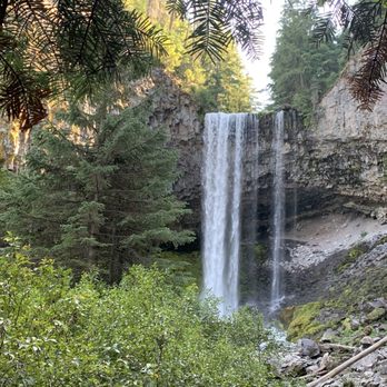
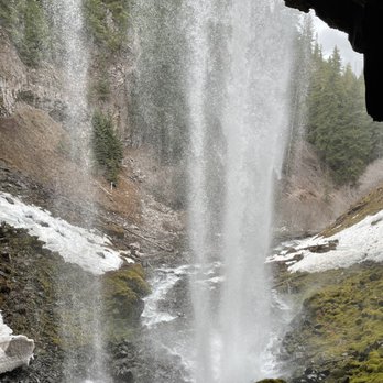
Tamanawas Falls is a "moderate" 3.4 mile hike in Mt Hood National Forest. I put moderate in quotations because if this is moderate I do not want to hike a difficult trail. In a few areas I felt like one wrong step and I was going to fall to my death, the heights definitely got to me. Once we got to the rocks, we couldn't figure out where the trail went. Luckily a party was on their way down and mentioned there was a rock slide recently so up we went. The waterfall was beautiful, you have to climb on rocks to get really good views of it. I do recommend Tamanawas Falls if you are in the area. read more






8 years ago
I found this specific falls through Yelp while I was looking for waterfalls to visit while in Oregon. Surprisingly, this was the first one to pop-up on my search. I knew this was definitely something I had to see, as the photos looked amazing! I didn't realize that this fall was actually further away than the rest of the falls we wanted to see. It's okay though; the trek was worth it. When we started the hike, we realized we had to pay for parking, which was about $5 (if I can remember correctly). We filled out a form and dropped it off in a box. The hike itself was pretty easy, with the exception of the rocky area right before you see the falls. We went on a pretty sunny day, but I could only imagine how hiking through this rocky area could've been difficult, as it probably would get slippery. Once we got to the falls, we were in love! It was such a gorgeous sight to see and worth the 45-minute hike to see this. One of the hikers that we had run into in passing said that we had to walk all the way to the back of the falls to get the best experience. Well, we did just that! He was absolutely correct. If you decide to do this, be very careful as the rocks to get to the back of the falls could be extremely slippery. You could seriously get injured if you don't take precaution. Also, be cautious of the rocks above your head. I was walking alongside the edge and didn't realize there was a rock above me as I was hunched over. When I stood up, I hit the edge of the rock. Luckily, I was fine, but it could've been worse! If you're in Oregon and are looking for awesome sites to see, check this place out! It'll be worth your time! read more


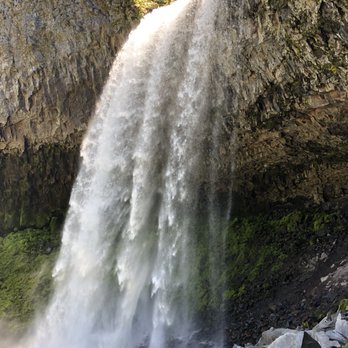


To give you some context of my review for this hike: I am a 5'3'' semi-athletic female (meaning I didn't play NCAA and I'm not an Olympian, but I can hold my own when it comes to hiking and recreational sports - just to give you an idea, because sometimes Yelpers will be like "THIS WAS SOOOO EASYYY" but it's because they're a freaking marathoner or something lol) It's a 3.3 mi trail, I would say moderate hike (not impossible, but definitely not flat, decently steep at some points) Conditions: Saturday in late May, no rain, temperature low 70s, I'm wearing Nike free runs that have zero traction because I just moved to Portland and have no good hiking shoes (but it's okay, it can be done!) This is an out & back trail (not a loop), it's about If you're coming from Portland it's about a 2 hour drive to the trailhead, type "Tamanawas Falls Trailhead" into your google maps and it will lead you straight to the beginning. Parking is pretty easy along the side of the hill's highway (lots of good space), with a $5 parking fee (honor system, you write your license plate and time you're going to be there on a little pass and put it on your mirror, and drop the envelope into a box). The hike takes about 45 mins to get to the waterfall if you're going at a medium pace, with no small children. It wasn't annoyingly crowded on this day but there were enough people along the path. LOTS of cute dogs and little children doing it. The journey: The first part is like a light stroll on a small incline, and then about halfway it starts getting kind of steep. There's a few bridges you cross that give you awesome views of the raging river. There's a part that can get slippery (assuming you're doing this in the spring/summer and there's no snow) where there's crumbled large/small rocks on the path and you have to be kind of careful where you're stepping (especially if you're wearing terrible Nikes like me...) The hike is beautiful, I don't think there's anything like it in California (I now know why people who move to Oregon love it here...). There's plenty of trees, the air feels so fresh, and I love the sound of the river coming from the waterfall. It's not a boring hike at all, and it's so gorgeous the whole way. If I remember, there might be one fork in the road and I took the left on the way up. Once you get to the waterfall, it's totally worth it. There's not a ton of signage along the path telling you how much further you have to go,but it's pretty easy to follow. Basically, you should be able to follow the river on your left to go up to the waterfall. There's a point where you've been going up hill for a really long time and you might feel like giving up, BUT DON'T. THE WATERFALL IS LITERALLY RIGHT THERE AND IT'S TOTALLY WORTH. Once you get to the actual waterfall, there's a bunch of rocks you have to navigate to get up close to it/ under it. These rocks can get slippery when they're wet from the mist, so be careful. But the view is amazing and the waterfall is RAGING. It's pretty huge and you are able to get pretty close to it if you want. If you sit at the base of the waterfall, there's a few places to sit if you want to snack/ watch the waterfall and feel the cold mist on your face. Going down, it only took about 35-40 mins. The thing I appreciate about this hike is that there's some parts that aren't challenging, and then there's periods where you're definitely getting a heavy cardio/ glut work out. Highly recommend, definitely taking my friends here again! read more


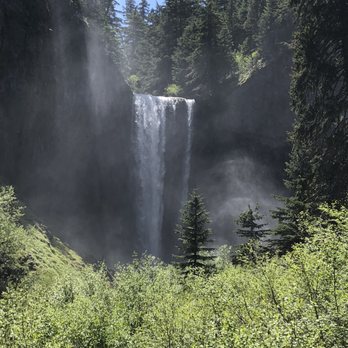


EXCELLENT. My friend took me out here and it was her first time too. We snagged a parking spot and began our hike. It was a moderate level, not too much elevation, lots of rocks, and diverse landscape. And the best part: a waterfall at the end! Absolutely beautiful. Would recommend. Saw a lot of groups and families with kids here, even dogs. The trees are soothing and rejuvenating, and it was a great way to spend the morning. 4 miles took us about 2 hours, including time spent at the waterfall. read more
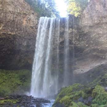

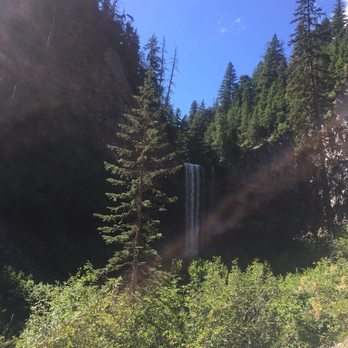

Came here on a whim, thanks to an article on Outdoor Project, and holy moly, was not disappointed by how beautiful this place is! The hike itself is ideylic and picturesque, snow covering the ground, and sun shining through the trees. This was a super easy hike to do , there and back, with moderate elevation. It was a perfect place to let our dog off leash as well, as he tends to stay on the trails, its easy for him to walk straight and not veer off too much. One of the coolest things about this hike is that you can follow the river/ creek all the way up back to the the falls. The waterfall had beautiful frozen ice pillars all around it, as well as ice carvings by the base that were beyond anything I had ever seen before. I was able to climb behind the waterfall, and see the ice pillars in person. They were a beautiful blue color, and very very slippery. I don't really recommend going behind the waterfall if you are a little skiddish, because if you slip you could fall right into the freezing water, and you have to slide down ice a bit to get there. Definitely worth it!! SOoo ooo good read more


8 years ago
I've been going on a lot of hikes this summer, and I've started to really like it. Tamanawas was the most recent hike I've done, and it is by far my favorite hike. Every second of the hike is beautiful, there isn't a single part where it's not. The entire hike is nestled through the woods, and you'll pass by a lot of mini waterfalls on your way. When the hike first starts, there's two really dramatic hills, but then the rest of it is pretty easy going. There's one section where it's very rocky and steep right before you get to the falls, so make sure you're prepared for that. We had to take a few breaks on the way there because I got tired, but it was a lot easier on the way back. It took us about 3 hours to complete the whole hike, and that included hanging out at the falls for about half an hour. We did this hike around 4pm, and honestly, considering I usually go hiking early in the morning, I preferred this one later in the day. We only saw about four other groups of people on the way, and we also found a geo cache by accident (!!). I'm definitely gonna be doing this hike again in the fall. It's amazing. read more

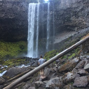


My Favorite Waterfall on the east side of Mt. Hood. It takes about 90 minutes to get there from Portland, 30 minutes from Hood River. Park off Highway 35 near milepost 72 (just north of the Sherwood Campground). NW Forest Parking Pass required. It's a moderate (sometimes hot) hike, just shy of 4 miles roundtrip. About a half-mile traverse parallel to the highway and then turn up Cold Spring Creek and follow all the way up to the falls (about 1.5 miles). Beautiful creek hike, through a monster rock slide and then a giant waterfall that you can (carefully) walk behind. There's a small island in the middle of the creek, just below the falls that you can sit on. It's just at the edge of the spray zone. You can watch the swirls of mist. It's Very Cool! Bring water and good shoes, especially if you're going to climb up behind. If you get up early, you can have lunch at the falls and dinner in Hood River or even back in Portland. read more


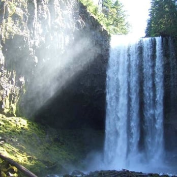


This is such a cool waterfall! It's really high up, and the hike there is pretty fun and quite pretty. The hike there is constantly next to water, and the hike isn't too difficult. There's some slopes up and down, but it's never too steep. Near the waterfall, I felt the mist spraying, and we actually climbed up to behind the waterfall. It was really fun and really pretty! The water is pretty cold, and we saw some dogs splashing in the water too. Really nice place to visit, and I'd definitely recommend it! read more


12 years ago
Beautiful! Misty at the top so if you're not going in the dead of summer make sure to have a few layers. Easy hike overall until the last if you want to get behind the fall that part gets a little rocky. Lots to look at and enjoy. It was SO beautiful read more


6 years ago

12 years ago
I hike this year round, and its a blast. It is the most fun in the summer of course, but if you are in great physical shape, winter isn't bad. The waterfall is beyond gorgeous, and the hike in general, has easy access. read more


8 years ago
Awesome. Arrived around 0830 during July and it was pretty chilly. There were just a few cars parked out front. Best to start out early. The two mile hike took us around an hour. I was winded in several sections but noting major. Once we came upon the fall, it was all worth it. Very beautiful and great photo opportunities. Be sure to take your shoes off and chill your feet in the ice water before heading back. read more


8 years ago
Beautiful hike with well groomed trail, lots of breath taking sites and enough challenge to consider it moderate. read more


9 years ago
My review is based on a non-experienced hikers experience with kids ranging from 7-13. This 2 mile hike to the waterfall is very scenic. Took us a little over 2 hours to get to it. Most of the time you walk next the river, which I find very soothing to hear. There are a few difficult areas when you reach a massive rockslide. You just have to take your time going through. Once you get to the waterfall you have an option to keep going, and eventually you will end up behind it. I did not go to the back of the waterfall since it starts getting slippery and I was having difficulty (and a little anxiety) about going through the steep rocks. Others in my party were able to get behind it and they said it was dry once you get behind it. Just make sure you take water and take your time. read more


3 years ago


11 years ago

7 years ago

11 years ago
Loved it! Just went to snow shoe there yesterday! It was easy to moderate with a great view at the end! We also had an 11 year old with us, she did great! Highly recommend it. read more


Went mid Oct. It is an Excellent hike!!! Approx 4 miles round trip. A lot of up and down hills, a few cool bridges to cross, land slide has covered a large portion of the trail so you get to enjoy some incredibly fun rock scaling to get past a few points. Once you get to the waterfall you can hike behind it but youve got to navigate the rocks! A lot of people had dogs on the hike but if you want to get behind the falls, leave the pup at home because the rocks you have to scale to get there are not dog friendly! What a great hike! Highly recommend! P.s. wear flexible clothing! There are a lot of spots you have to stretch your legs to get over and around rocks- i wore khakis assuming it would be a light hike and they split down the middle while i was crossing a big gap between rocks! :) at least I had a nice breeze the rest of the hike haha read more


6 years ago
Absolutely beautiful winter hike. Relatively easy/moderate 4.0 mile out and back trail. It took about two hours, with our group ages ranging from 27-52. I have torn ligaments in my knee and had no issues navigating. There is a small parking area right off the road, by the trail head. If going in the winter, make sure your vehicle is AWD. It can get stuck pulling in/out of the parking area, especially if there's fresh snow. The trail is extremely narrow at points, so recommend timing your hike when there are fewer crowds. We went early in the morning (around 8am, December 26th, 2020). There were only two other groups on the trail on our way out, more coming as we were headed back. There are some steep points, which can be difficult when covered in ice/snow. That being said, although we had crampons with us, we didn't feel they were necessary to wear. The view of the falls does not disappoint. Made for a gorgeous backdrop of a surprise proposal. read more


8 years ago
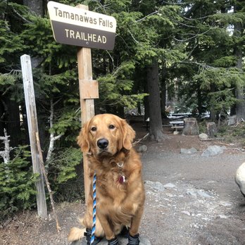
My boyfriend and I took our dog hiking today! I've read a lot of reviews saying the hike was moderate, but it was actually very easy! Approximately 4 mile hike round trip, only took us 2.5 hours! The views were amazing! I love how the trail follows the creek! We will definitely be coming back! read more


9 years ago
dangerous. exciting. cold. thrilling. beautiful. awe inspiring. certainly one of the best hikes i've ever been on. my first icy winter hike and though i slipped and fell and felt the pain days later it was worth it !!!! bring a friend never go alone and wear those shoes with chains and snowboarding attire. read more

8 years ago

7 years ago
9 years ago