Trail Canyon Trail Photos


You might also consider


More like Trail Canyon Trail
Recommended Reviews - Trail Canyon Trail
Start your review...


Reviews With Photos

Fewer people than MaryJane Falls. More of a challenge than MJF. Views comparable to MJF at the end. So do the math according to your preference if you're going to remain at the lower elevations. The first quarter of this trail is a real drag. There's a loose deep-gravel path that makes climbing more difficult than it need be as you begin the ascent. Passing a water tank reservoir at the onset, your heart will not at first be filled with rugged outdoor inspiration and desire. You can discover some of that rugged outdoorsy-ness should you need to relieve yourself behind a tree, as often the parking lot facilities are locked closed, lacking TP, or overrun with trash and turds. Upkeep is sporadic. Part of the reason for that is that the area becomes super crowded at some times during the week/year more than others. This can also make the trail crowded, another sometimes-unappealing aspect. It's not always the best option for getting away from it all, i.e., getting away from people. But how does one review and rank a trail, as opposed to a business? My metric is how eager I am to return to a trail after I've done it a dozen times already. Interest in TCT is low. It's a necessary evil for those looking to connect to the North Loop Trail a few miles above. Still, it's not the worst evil, as you'll be able to enjoy ample foliage in the fall, and lush green in the spring and summer. There's a lot to be said for that alone. The trail itself is clean and clear, so positive marks for that, and it's a solid challenge in that you'll gain some 1,600 feet in 2 miles, topping off at about 9,300ft. If that's all you're looking for, then you'll be satisfied. It's a hard effort that's at least twice as challenging as MaryJaneFalls on the other side of the parking lot, but it's a trail with a boring send-off and dull switchbacks the remainder of the way. There's not much variety of terrain and scenery. If you return to the parking lot during sunset, you might catch some vibrant colors in the opposite facing cliff faces. Anyway, at the end/intersection with North Loop, you're rewarded with some stunning views if you continue to the right and go to the rocktop overlook. Many of my best MtCharleston photos have been taken here. Thus, in the end, TCT is A-Ok, not bad not great, but you'll need to use it to get to Mt Charleston's more stunning trail options above. Keep going, hikers, there's more to discover!

Tip to those considering this trail: take into consideration the fitness level of your sidekick before taking them on this hike; It is basically uphill for 2 miles. Uphill, not level. I believe the sign said MOST DIFFICULT. If your sidekick has never been hiking, do not take that person on this hike. On the day that we went on the Trail Canyon Trail, we saw many people that should have hiked an easier trail. Also, there were people without water and people in jeans. Now for a public service announcement: do not hike in jeans. Ladies, if your legs are ultra bumpy and you are trying to hide it in jeans, just be real and get some yoga pants and tie a light jacket or sweater around your waist. Wearing jeans will probably cause a medical condition due to the excessive heat and rubbing going on in the special areas. All hikers should dress to accommodate sweating because all will sweat. My experience on this trail was pleasant and I appreciated that a good portion of the trail has shade. There is no water available, so bring your own! It is cooler than Las Vegas, but you might still be at risk for heat stroke if you fail to hydrate properly. Once at the top of the 2 mile hike, you have the option of continuing on to the peak, which is an addition 6 miles. I opted out on this trip; I had a date with Leticia's down the road and did not want to be late. Bathroom tip: if you have to potty, a nice clean spot is the visitor's center a few miles down the road. For those that are not used to going potty in a trail bathroom ( where flies are in abundance ), I strongly recommend the visitor's center bathroom... Enjoy!

EXCESSIVE HEAT WARNING! 11 DEGREES ABOVE THE AVERAGE TEMPS!! I CAN BAKE COOKIES ON THE HOOD OF MY CAR!!! When the U.S. National Weather Service maps for our area consistently turn red, you know the heat has arrived. Ugh, welcome to the Las Vegas summer, and it's not even officially summer yet. What to do when you want to get your outdoors fix, but you risk melting in the meantime? Head to Mt. Charleston, my friends. Last weekend, the b/f and I tried out a new trail (to us). After reading Angela T.'s review for Trail Canyon, we knew we had to try it because it offered us what sounded like a killer cardio workout, and that's what we got. We found the trail quite easily because there are signs leading you to it. Just drive past the new Visitors Centre about 1.5 miles or so, past Mary Jane Falls, and you will see the parking lot for Trail Canyon--again there are SIGNS so you can't get lost. Put on your sunscreen, grab your hydration and a snack or two, and a light jacket and get ready to climb. We started around 5:30am and it was 59 glorious degrees - we were actually cold at the start. The trail is well-marked and groomed so you can't lose your way-just keep heading up this natural StairMaster. Just know that it's basically a straight climb for 1.5 miles before you get to some switchbacks and it evens out. This fact is based on what Yelp Hiker Extraordinaire Norm K. told me afterwards because, guess what? We got so tired from climbing and our hearts were beating out of our chests from the altitude that Mel and I turned around just before the switchbacks. According to my Garmin, we climbed 1.3 miles before we headed back. This is a popular trail as we had company most of the time. Obviously you can go at your own pace and stop for a breath, a drink, a snack, and/or a picture along the way. The jackets didn't stay on long, either, and it was warming up by the time we got back to our cars. We'll definitely be coming back a lot this summer and making this trail one of our regular destinations. Next time we're doing all 2 miles to the official turn-around, too--maybe we'll see you there. P.S. We ran into Angela T on the way down as she was heading up to hike the North Peak--that girl is a beast! She and Norm K. are our hiking gurus--thanks for all the tips!


Came here to escape the heat. And while it was 15-20 degrees cooler than the city, you'll feel just as hot once you start that incline and aren't shaded! This one is a great workout. I was annoyed at how many "breathers" I had to take for such a short trip, but will return for the workout. If you're in fantastic shape, my post might be laughable. Great views once you reach the junction with north loop. Went 0.5 miles further to the cave springs. Sat on a rock to enjoy the little trickle and some snacks, smelled poop, and realized a camper had pooped, put toilet paper on top of it, and placed a rock that didn't completely cover it on it. (You can tell ppl like to camp here). At least bury your freaking poop so visitors don't have to gag when they rest on a nice large rock only to smell your napkin covered feces chillen' next to them. Sry, I digress. The descent was kind of annoying as I felt like I was constantly trying not to slip. Either way, I'll be back! Oh, and not a whole lot of tagging and litter (except for poop) like some of the more popular hikes (Mary Jane Falls) so that was nice!


Trail Canyon Trail - Spring Mountain National Recreation Area I do not recommend this hike if you struggle with Cathedral Rock or even Mary Jane Falls. I also don't recommend this hike if you do not have the will power to keep going. This hike is all uphill and a very steep uphill. This hike will test your quads, calves, glutes, and mental toughness. I've done this hike numerous times. And every time, I'm questioning why I'm even doing it. The thing that keeps me going is the view, the fact that I've done it before, because I'm not a quitter, and the meal that awaits when we're done. According to my GPS, the hike up is about 1.6 miles, which means that the total hike is a little over 3 miles. This hike usually takes us a little over an hour to reach the top. The trail is well-marked and don't be surprised if you see deer during your hike. The hike back down is no picnic either, especially if you have knee problems. Overall, I love this hike. It's one of my favorites out here. It's a good workout, great cardio, and the view is awesome. Just a note...when hiking back down, you will get at least one hiker that's going to ask you "how much longer to the top?" Quote me on this. I'm asked all the time. 2017 Hike Review #2 / 2017 Yelp Review #30


This is a great trail to get acclimatized to the elevation. It's short, only two miles, but you climb about 1500 feet. I've used this trail several different ways, coming down from Mt. Charleston peak, from the north loop, it's taken me to the bottom (or start) of this trailhead. Most recently I used it to start the hike, and it connects to north loop, instead of continuing on, we went down Fletcher Canyon. This is how I usually start out the season to get used to the elevation. The two mile warm up is great, and then you get to scramble down Fletcher Canyon.


This is a nice short 2 mile trail that connects to the North Loop Trail. I hiked this in the fresh snow and the trail was easy to follow. In the summer, you should be in the shade most of the way. In the 2 miles you climb an elevation gain of 1,530 feet as you reach a saddle at the North Loop Trail junction. http://www.yelp.com/biz_photos/trail-canyon-trail-las-vegas?select=LrvNL6WYeiC2pllYa_YtYw#gN7nIomxvQvcn57WC-v8rw To continue towards Mt Charleston Peak, head west, to the left on the North Loop Trail. To the east you will find the Raintree, Mummy Spring and the Fletcher Peak Trail. By taking this Trail Canyon Trail to summit Mt Charleston, you will save a round trip of 3.6 miles than if you took the North Loop Trail all the way to the peak. Plus, I found the North Loop Trail harder to follow in the snow on the way to the Raintree. http://www.yelp.com/user_local_photos?select=6sXBs3DxbmknbsfVOFru6A&userid=RoGuDu1egfAvVgb4WmZwUw To get to the Trail Canyon trailhead take US 95 to Route 157 towards Kyle Canyon. Off Route 157, 2.1 miles past the Visitors Center, at a hairpin turn, go straight onto Echo Road towards the Mary Jane Falls sign. In about a half of a mile you will reach the Trail Canyon trailhead, just past the Mary Jane Falls trailhead. http://www.yelp.com/biz_photos/trail-canyon-trail-las-vegas?select=LrvNL6WYeiC2pllYa_YtYw#LrvNL6WYeiC2pllYa_YtYw


The views at the overlook are just wonderful and breathtaking. The trail up is well maintained, and pretty steadily inclined, so pace yourself and take as many micro-breaks as you need. I took my dog and paused for him to catch his breath a few times, so it took just under 2 hours to get to the top. I was more focused on enjoying the trip than racing to the top. We saw a few deer on our way up which was cool. And we encountered an awful lot of horse poop, so watch your step lol. Once you get to the clearing at the top where a few other trails shoot off, you walk towards the right and just over the hill you will see the sweeping view of the canyon. I waited a few minutes for a large group of hikers to leave and then I had the entire place to myself for about 15 minutes. I was very careful and walked out over the rocks a bit to get a better view, but PLEASE be careful because one false step and you will have a long fall below you. I loved how quiet and peaceful this hike was, would totally do it again. read more


Can you say Challenge? Yes! A great hike to burn some calories? Yes! A great workout? Yes! Is it worth it? Absolutely! Up in the mountains early Sunday morning and hubby chose this toughie trail to fulfill our bi-weekly hiking day. I had forgotten that we took this trail years ago when we hiked to the Mt. Charleston peak! Easy trail to locate, right off of Kyle Canyon Rd and plenty of signage to guide you to the parking area. Plenty of parking but always remember to lock your car! There are facilities at the base of the trail for both men and women. We were on the trail by 8:30am and it was absolutely gorgeous outside. Plenty of shade coverage heading up. Lots of ponderosa pines, aspen groves, desert wildflowers, butterflies and chipmunks to see. Let me be very honest with you. This trail gains elevation of 1500 feet within the first two miles. Be prepared with lots of water and snacks. You will need some breaks along the way as you will be working hard on your ascent up. This trail actually connects to the North Loop which takes you right up to the summit. This is a beautiful, but difficult climb. A fantastic cardio workout and your thighs, glutes and calves will thank you for working them nice and hard. Plenty of photo opportunities along the way too! Once we reached the top, we decided to climb a little further up to Cave Spring. There were volunteers working on the trail so we were careful to not disturb their work. We stopped at the base of the spring and had lunch early as it took us about two hours from the bottom to the top! Cave Spring was a tiny spring but still had water flowing out of it. There is also a small cave where we could smell that someone had probably stayed the night as the smell of wood was prominent. A quick note, when you reach the saddle of this hike there are a couple routes you can take. One is to keep heading north for six more miles to the summit. Another is to head towards the Raintree and Fletcher Canyon. Right about the time we finished lunch, the clouds filled in and we had a beautiful summer rain keeping us cool on the hike down. You just can't beat the smells of the forrest during a rainstorm. Plenty of thunder and a couple of lightening flashes but nothing to be scared of. Total mileage round trip was 5.2 miles. This trail is recommended for people that love a challenge and it is a plus to be in good physical shape for this hike. I would not recommend for families with kids under five. Do yourself a favor and continue up this trail to the summit! It does not disappoint and you will feel an overwhelming feeling of accomplishment! I know I did! read more



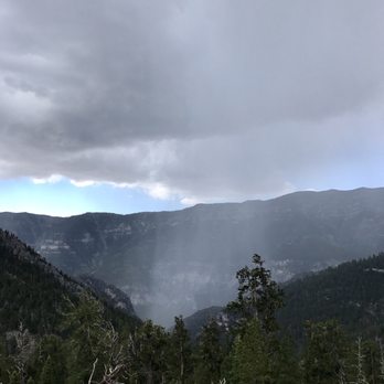
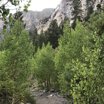

Fewer people than MaryJane Falls. More of a challenge than MJF. Views comparable to MJF at the end. So do the math according to your preference if you're going to remain at the lower elevations. The first quarter of this trail is a real drag. There's a loose deep-gravel path that makes climbing more difficult than it need be as you begin the ascent. Passing a water tank reservoir at the onset, your heart will not at first be filled with rugged outdoor inspiration and desire. You can discover some of that rugged outdoorsy-ness should you need to relieve yourself behind a tree, as often the parking lot facilities are locked closed, lacking TP, or overrun with trash and turds. Upkeep is sporadic. Part of the reason for that is that the area becomes super crowded at some times during the week/year more than others. This can also make the trail crowded, another sometimes-unappealing aspect. It's not always the best option for getting away from it all, i.e., getting away from people. But how does one review and rank a trail, as opposed to a business? My metric is how eager I am to return to a trail after I've done it a dozen times already. Interest in TCT is low. It's a necessary evil for those looking to connect to the North Loop Trail a few miles above. Still, it's not the worst evil, as you'll be able to enjoy ample foliage in the fall, and lush green in the spring and summer. There's a lot to be said for that alone. The trail itself is clean and clear, so positive marks for that, and it's a solid challenge in that you'll gain some 1,600 feet in 2 miles, topping off at about 9,300ft. If that's all you're looking for, then you'll be satisfied. It's a hard effort that's at least twice as challenging as MaryJaneFalls on the other side of the parking lot, but it's a trail with a boring send-off and dull switchbacks the remainder of the way. There's not much variety of terrain and scenery. If you return to the parking lot during sunset, you might catch some vibrant colors in the opposite facing cliff faces. Anyway, at the end/intersection with North Loop, you're rewarded with some stunning views if you continue to the right and go to the rocktop overlook. Many of my best MtCharleston photos have been taken here. Thus, in the end, TCT is A-Ok, not bad not great, but you'll need to use it to get to Mt Charleston's more stunning trail options above. Keep going, hikers, there's more to discover! read more


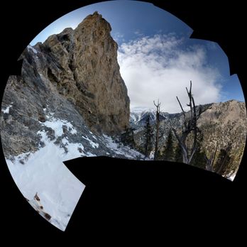

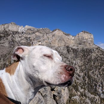


Tip to those considering this trail: take into consideration the fitness level of your sidekick before taking them on this hike; It is basically uphill for 2 miles. Uphill, not level. I believe the sign said MOST DIFFICULT. If your sidekick has never been hiking, do not take that person on this hike. On the day that we went on the Trail Canyon Trail, we saw many people that should have hiked an easier trail. Also, there were people without water and people in jeans. Now for a public service announcement: do not hike in jeans. Ladies, if your legs are ultra bumpy and you are trying to hide it in jeans, just be real and get some yoga pants and tie a light jacket or sweater around your waist. Wearing jeans will probably cause a medical condition due to the excessive heat and rubbing going on in the special areas. All hikers should dress to accommodate sweating because all will sweat. My experience on this trail was pleasant and I appreciated that a good portion of the trail has shade. There is no water available, so bring your own! It is cooler than Las Vegas, but you might still be at risk for heat stroke if you fail to hydrate properly. Once at the top of the 2 mile hike, you have the option of continuing on to the peak, which is an addition 6 miles. I opted out on this trip; I had a date with Leticia's down the road and did not want to be late. Bathroom tip: if you have to potty, a nice clean spot is the visitor's center a few miles down the road. For those that are not used to going potty in a trail bathroom ( where flies are in abundance ), I strongly recommend the visitor's center bathroom... Enjoy! read more


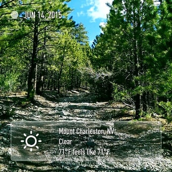
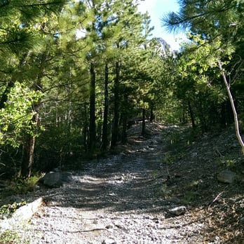
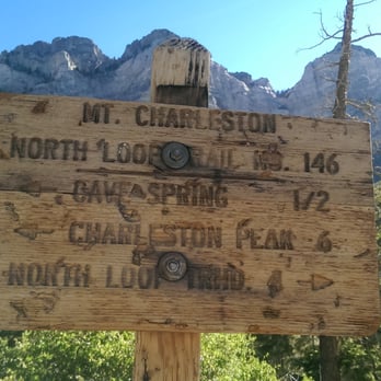
EXCESSIVE HEAT WARNING! 11 DEGREES ABOVE THE AVERAGE TEMPS!! I CAN BAKE COOKIES ON THE HOOD OF MY CAR!!! When the U.S. National Weather Service maps for our area consistently turn red, you know the heat has arrived. Ugh, welcome to the Las Vegas summer, and it's not even officially summer yet. What to do when you want to get your outdoors fix, but you risk melting in the meantime? Head to Mt. Charleston, my friends. Last weekend, the b/f and I tried out a new trail (to us). After reading Angela T.'s review for Trail Canyon, we knew we had to try it because it offered us what sounded like a killer cardio workout, and that's what we got. We found the trail quite easily because there are signs leading you to it. Just drive past the new Visitors Centre about 1.5 miles or so, past Mary Jane Falls, and you will see the parking lot for Trail Canyon--again there are SIGNS so you can't get lost. Put on your sunscreen, grab your hydration and a snack or two, and a light jacket and get ready to climb. We started around 5:30am and it was 59 glorious degrees - we were actually cold at the start. The trail is well-marked and groomed so you can't lose your way-just keep heading up this natural StairMaster. Just know that it's basically a straight climb for 1.5 miles before you get to some switchbacks and it evens out. This fact is based on what Yelp Hiker Extraordinaire Norm K. told me afterwards because, guess what? We got so tired from climbing and our hearts were beating out of our chests from the altitude that Mel and I turned around just before the switchbacks. According to my Garmin, we climbed 1.3 miles before we headed back. This is a popular trail as we had company most of the time. Obviously you can go at your own pace and stop for a breath, a drink, a snack, and/or a picture along the way. The jackets didn't stay on long, either, and it was warming up by the time we got back to our cars. We'll definitely be coming back a lot this summer and making this trail one of our regular destinations. Next time we're doing all 2 miles to the official turn-around, too--maybe we'll see you there. P.S. We ran into Angela T on the way down as she was heading up to hike the North Peak--that girl is a beast! She and Norm K. are our hiking gurus--thanks for all the tips! read more






10 years ago
Came here to escape the heat. And while it was 15-20 degrees cooler than the city, you'll feel just as hot once you start that incline and aren't shaded! This one is a great workout. I was annoyed at how many "breathers" I had to take for such a short trip, but will return for the workout. If you're in fantastic shape, my post might be laughable. Great views once you reach the junction with north loop. Went 0.5 miles further to the cave springs. Sat on a rock to enjoy the little trickle and some snacks, smelled poop, and realized a camper had pooped, put toilet paper on top of it, and placed a rock that didn't completely cover it on it. (You can tell ppl like to camp here). At least bury your freaking poop so visitors don't have to gag when they rest on a nice large rock only to smell your napkin covered feces chillen' next to them. Sry, I digress. The descent was kind of annoying as I felt like I was constantly trying not to slip. Either way, I'll be back! Oh, and not a whole lot of tagging and litter (except for poop) like some of the more popular hikes (Mary Jane Falls) so that was nice! read more


Trail Canyon Trail - Spring Mountain National Recreation Area I do not recommend this hike if you struggle with Cathedral Rock or even Mary Jane Falls. I also don't recommend this hike if you do not have the will power to keep going. This hike is all uphill and a very steep uphill. This hike will test your quads, calves, glutes, and mental toughness. I've done this hike numerous times. And every time, I'm questioning why I'm even doing it. The thing that keeps me going is the view, the fact that I've done it before, because I'm not a quitter, and the meal that awaits when we're done. According to my GPS, the hike up is about 1.6 miles, which means that the total hike is a little over 3 miles. This hike usually takes us a little over an hour to reach the top. The trail is well-marked and don't be surprised if you see deer during your hike. The hike back down is no picnic either, especially if you have knee problems. Overall, I love this hike. It's one of my favorites out here. It's a good workout, great cardio, and the view is awesome. Just a note...when hiking back down, you will get at least one hiker that's going to ask you "how much longer to the top?" Quote me on this. I'm asked all the time. 2017 Hike Review #2 / 2017 Yelp Review #30 read more


This is a great trail to get acclimatized to the elevation. It's short, only two miles, but you climb about 1500 feet. I've used this trail several different ways, coming down from Mt. Charleston peak, from the north loop, it's taken me to the bottom (or start) of this trailhead. Most recently I used it to start the hike, and it connects to north loop, instead of continuing on, we went down Fletcher Canyon. This is how I usually start out the season to get used to the elevation. The two mile warm up is great, and then you get to scramble down Fletcher Canyon. read more


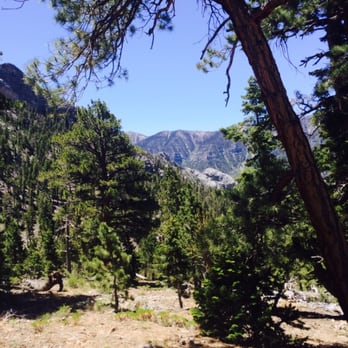


This is a nice short 2 mile trail that connects to the North Loop Trail. I hiked this in the fresh snow and the trail was easy to follow. In the summer, you should be in the shade most of the way. In the 2 miles you climb an elevation gain of 1,530 feet as you reach a saddle at the North Loop Trail junction. http://www.yelp.com/biz_photos/trail-canyon-trail-las-vegas?select=LrvNL6WYeiC2pllYa_YtYw#gN7nIomxvQvcn57WC-v8rw To continue towards Mt Charleston Peak, head west, to the left on the North Loop Trail. To the east you will find the Raintree, Mummy Spring and the Fletcher Peak Trail. By taking this Trail Canyon Trail to summit Mt Charleston, you will save a round trip of 3.6 miles than if you took the North Loop Trail all the way to the peak. Plus, I found the North Loop Trail harder to follow in the snow on the way to the Raintree. http://www.yelp.com/user_local_photos?select=6sXBs3DxbmknbsfVOFru6A&userid=RoGuDu1egfAvVgb4WmZwUw To get to the Trail Canyon trailhead take US 95 to Route 157 towards Kyle Canyon. Off Route 157, 2.1 miles past the Visitors Center, at a hairpin turn, go straight onto Echo Road towards the Mary Jane Falls sign. In about a half of a mile you will reach the Trail Canyon trailhead, just past the Mary Jane Falls trailhead. http://www.yelp.com/biz_photos/trail-canyon-trail-las-vegas?select=LrvNL6WYeiC2pllYa_YtYw#LrvNL6WYeiC2pllYa_YtYw read more


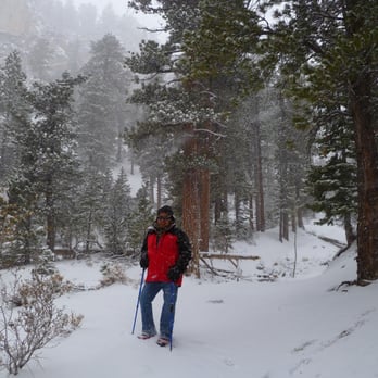


I loved the hike. We did it in the snow which is quite a bit harder. Kicked my butt. Gold strike hot springs is still my favorite right now. But this was a HIKE!!!!its uphill the whole way. Beautiful scenary. If you are just starting this lifestyle start on a different hike. This will kick your butt. read more



More info about Trail Canyon Trail
Ask the Community - Trail Canyon Trail
Review Highlights - Trail Canyon Trail
You might also consider



















Why does Yelp recommend reviews?
1 review that is not currently recommended
The reviews below are not factored into the business's overall star rating.

7 months ago
Trail Canyon Trail - hiking - Updated May 2026
Best of Las Vegas
People found Trail Canyon Trail by searching for…
Natural Hot Springs in Las Vegas, NV
Things to Do With Kids in Las Vegas, NV
Places to Take Pictures in Las Vegas, NV
Lookout Points in Las Vegas, NV
Swimming Holes in Las Vegas, NV
Visitor Centers in Las Vegas, NV
Hiking Trails With Waterfalls in Las Vegas, NV
Off Road Trails in Las Vegas, NV
Hiking Groups in Las Vegas, NV
Romantic Views in Las Vegas, NV
Trending Searches in Las Vegas, NV
Boat Rental near Trail Canyon Trail
Botanical Gardens near Trail Canyon Trail
Bounce House Rentals near Trail Canyon Trail
Campgrounds near Trail Canyon Trail
Cliff Jumping near Trail Canyon Trail
Dog Friendly Things To Do near Trail Canyon Trail
Flower Fields near Trail Canyon Trail
Flower Shop near Trail Canyon Trail
Garage Sales near Trail Canyon Trail
Nurseries & Gardening near Trail Canyon Trail
Outdoor Activities near Trail Canyon Trail
Outdoor Furniture Stores near Trail Canyon Trail
Party Equipment Rentals near Trail Canyon Trail
Pedicure near Trail Canyon Trail
Pick Your Own Farms near Trail Canyon Trail
Picnic Areas near Trail Canyon Trail
Places To Walk Around near Trail Canyon Trail
Rainy Day Activities near Trail Canyon Trail
Rock Quarry near Trail Canyon Trail
Running Trails near Trail Canyon Trail
Scenic Drive near Trail Canyon Trail
Secret Spots near Trail Canyon Trail
Strawberry Picking near Trail Canyon Trail
Sunrise View near Trail Canyon Trail
Swimming Holes near Trail Canyon Trail
Table And Chair Rentals near Trail Canyon Trail
Browse Articles
Browse Nearby
BEST of Las Vegas, Nevada Restaurants near Trail Canyon Trail
BEST of Las Vegas, Nevada Things to Do near Trail Canyon Trail
BEST of Las Vegas, Nevada Coffee near Trail Canyon Trail
BEST of Las Vegas, Nevada Picnic Areas near Trail Canyon Trail
BEST of Las Vegas, Nevada Campgrounds near Trail Canyon Trail
BEST of Las Vegas, Nevada Breakfast near Trail Canyon Trail
BEST of Las Vegas, Nevada Shopping near Trail Canyon Trail
Browse Brands
Related Searches in Las Vegas, NV
Affordable Kayak Rental Services in Las Vegas, Nevada
Best Fishing Locations and Guides in Las Vegas, Nevada
Best Nature Trails for Hiking in Las Vegas, Nevada
Best Places for Horseback Riding in Las Vegas, Nevada
Check Out Off Road Trails in Las Vegas, Nevada
Discover Dog Friendly Trails to Explore in Las Vegas, Nevada
Discover Scenic Mountain Bike Trails Near Las Vegas, Nevada
Discover Top Nature Parks to Visit in Las Vegas, Nevada
Discover Walking Parks in Las Vegas, Nevada Near You
Discover a Hiking Trail in Las Vegas, Nevada
Discover the Best Night Hike Trails in Las Vegas, Nevada
Discover the Best Running Track in Las Vegas, Nevada
Dog-Friendly Hikes With Dogs in Las Vegas, Nevada
Enjoy Camping Adventures Around Las Vegas, Nevada
Enjoy Exciting Mountain Biking Adventures in Las Vegas, Nevada
Enjoy Kayaking Adventures in Las Vegas, Nevada
Enjoy Tent Camping Spots Around Las Vegas, Nevada
Enjoy a Beautiful Waterfall Hike in Las Vegas, Nevada
Enjoy the Best Walking Path in Las Vegas, Nevada
Enjoy the Best Walking Trails in Las Vegas, Nevada
Exciting Cliff Jumping Spots in Las Vegas, Nevada
Explore Beautiful Parks and Green Spaces in Las Vegas, Nevada
Explore Easy Hikes Perfect for All in Las Vegas, Nevada
Explore Fun Activities to Do in Las Vegas, Nevada
Explore Popular Campgrounds Near Las Vegas, Nevada
Explore the Best Beach Spots in Las Vegas, Nevada
Explore the Best Swimming Holes Around Las Vegas, Nevada
Explore the Best Trail Options in Las Vegas, Nevada
Family Friendly Hiking With Kids in Las Vegas, Nevada
Find Beautiful Views in Las Vegas, Nevada
Find Popular Ziplining Spots Around Las Vegas, Nevada
Find the Best Parks for Picnics in Las Vegas, Nevada
Find the Best Scenic View Locations in Las Vegas, Nevada
Great Places to Walk in Las Vegas, Nevada
Hiking Trails With Waterfalls in Las Vegas, Nevada
Off Leash Dog Hiking Trails in Las Vegas, Nevada
Plan a Scenic Drive Route Near Las Vegas, Nevada
Popular Fishing Spots to Explore in Las Vegas, Nevada
Popular Outdoor Activities to Try in Las Vegas, Nevada
Popular Picnic Spots to Visit in Las Vegas, Nevada
Safe River Swimming Areas in Las Vegas, Nevada
Safe and Fun Parks for Kids in Las Vegas, Nevada
Top Climbing Spots and Gyms in Las Vegas, Nevada
Top Paddleboarding Activities in Las Vegas, Nevada
Top Running Trails to Explore in Las Vegas, Nevada
Top Swimming Lakes to Enjoy in Las Vegas, Nevada
Top Swimming Spots and Pools in Las Vegas, Nevada
Top Things to Do With Kids in Las Vegas, Nevada


