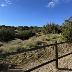
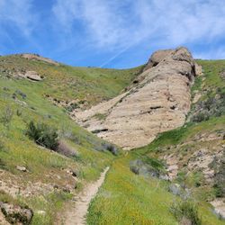
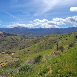
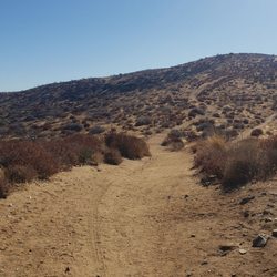
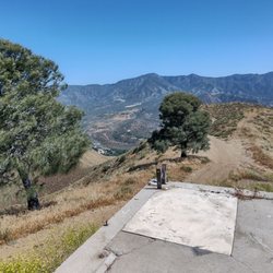
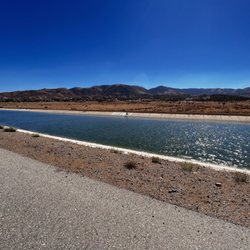
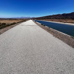
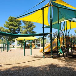
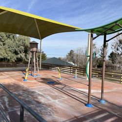
Top 'O The AV Photos


You might also consider
More like Top 'O The AV
Recommended Reviews - Top 'O The AV
Start your review...

7 years ago
More info about Top 'O The AV
35900 Tierra Subida Ave
Palmdale, CA 93551
Directions
Hours
Outdoor Amenities
You might also consider


Top 'O The AV - hiking - Updated July 2026
Best of Palmdale
People found Top 'O The AV by searching for…
Walking Trails in Palmdale, CA
Running Trails in Palmdale, CA
Free Things to Do in Palmdale, CA
Things to Do With Kids in Palmdale, CA
Places to Take Pictures in Palmdale, CA
Park & Forests in Palmdale, CA
Things to Do at Night in Palmdale, CA
Swimming Lakes in Palmdale, CA
Off Road Trails in Palmdale, CA
Beautiful Views in Palmdale, CA
Hiking With Kids in Palmdale, CA
Places to Visit in Palmdale, CA
Waterfalls and Swimming Holes in Palmdale, CA
Trending Searches in Palmdale, CA
Blueberry Picking near Top 'O The AV
Cliff Jumping near Top 'O The AV
Cruising Spots near Top 'O The AV
Dog Friendly Things To Do near Top 'O The AV
Jet Ski Rental near Top 'O The AV
Kayak Rental near Top 'O The AV
Kids Activities Indoor near Top 'O The AV
Off Road Trails near Top 'O The AV
Outdoor Activities near Top 'O The AV
Peach Picking near Top 'O The AV
Places To Walk Around near Top 'O The AV
Public Shower near Top 'O The AV
River Swimming near Top 'O The AV
Rock Quarry near Top 'O The AV
Scenic Night View near Top 'O The AV
Scenic Overlook near Top 'O The AV
State Parks near Top 'O The AV
Swimming Holes near Top 'O The AV
Swimming Lakes near Top 'O The AV
Things To Do On A Rainy Day near Top 'O The AV
Watch Sunset near Top 'O The AV
Browse Articles
Browse Nearby
Browse Brands
Related Searches in Palmdale, CA
Best Dog Hiking Trails Around Palmdale, California
Best Fishing Locations and Guides in Palmdale, California
Best Nature Trails for Hiking in Palmdale, California
Best Places for Horseback Riding in Palmdale, California
Best Sightseeing Experiences Available in Palmdale, California
Check Out Off Road Trails in Palmdale, California
Discover Dog Friendly Trails to Explore in Palmdale, California
Discover Easy Hiking Trails Near Palmdale, California
Discover Kid Friendly Hiking Trails in Palmdale, California
Discover Popular Bike Trails in Palmdale, California
Discover Scenic Mountain Bike Trails Near Palmdale, California
Discover Walking Parks in Palmdale, California Near You
Discover a Hiking Trail in Palmdale, California
Discover the Best Night Hike Trails in Palmdale, California
Discover the Best Running Track in Palmdale, California
Dog-Friendly Hikes With Dogs in Palmdale, California
Enjoy Camping Adventures Around Palmdale, California
Enjoy Kayaking Adventures in Palmdale, California
Enjoy Off Leash Dog Hikes in Palmdale, California
Enjoy Scenic Places to Walk in Palmdale, California
Enjoy Tent Camping Spots Around Palmdale, California
Enjoy a Beautiful Waterfall Hike in Palmdale, California
Enjoy the Best Walking Path in Palmdale, California
Enjoy the Best Walking Trails in Palmdale, California
Explore Beautiful Parks and Green Spaces in Palmdale, California
Explore Easy Hikes Perfect for All in Palmdale, California
Explore Fun Activities to Do in Palmdale, California
Explore Picnic Parks Near Palmdale, California
Explore Popular Campgrounds Near Palmdale, California
Explore Top Dog Parks in Palmdale, California Near You
Family Friendly Hiking With Kids in Palmdale, California
Find Parks and Recreation Activities in Palmdale, California
Find Top Dog Friendly Parks to Visit in Palmdale, California
Find Top-Rated Waterfalls in Palmdale, California Now
Find the Best Parks for Picnics in Palmdale, California
Hiking Trails With Waterfalls in Palmdale, California
Off Leash Dog Hiking Trails in Palmdale, California
Popular Outdoor Activities to Try in Palmdale, California
Popular Picnic Spots to Visit in Palmdale, California
Popular Waterfall Hiking Trails in Palmdale, California
Safe River Swimming Areas in Palmdale, California
Safe and Fun Parks for Kids in Palmdale, California
Top Hiking Trails to Explore in Palmdale, California
Top Playgrounds for Kids to Enjoy in Palmdale, California
Top Running Trails to Explore in Palmdale, California
Top Swimming Lakes to Enjoy in Palmdale, California
Top-Rated Camping Sites in Palmdale, California