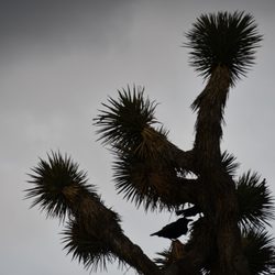
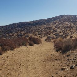
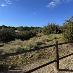
Saddleback Butte State Park Photos


You might also consider


More like Saddleback Butte State Park
Recommended Reviews - Saddleback Butte State Park
Start your review...


Reviews With Photos
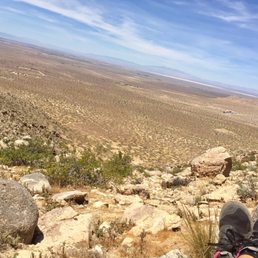

It's AloT Harder than it Looks! 2 miles Up about 1000ft elevation gain; Hiking in sand uphill is quite difficult even for those whom are fit. Spectacular views of the High Desert & surrounding mountains. We hiked to the ToP of the Butte to view a SunseT that had a sky painted with brushstrokes of ruby red and flames of orange. After SunseT it soon became pItch black & even tho we've hiked this trail many times we got a bit disoriented and had difficulty finding the trail cos it's not clearly marked at all points and the rocks look very much alike in the dark LoL. Our headlamps, All Trails app and Compass got us back on track. DO IT, buT make sure you are prepared :)


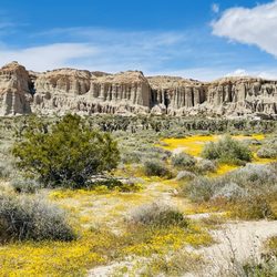
Went to Saddleback Butte SP on Fri 3/28/14. They have a really good wildflower season right now! Parking is $6 per vehicle or $5 with a senior citizen. Self-Registration so you need Exact Change, no credit cards, Cash or maybe Check Only. Visitor Center wasn't open when we went. Call for hours. We did the Nature Trail which is pretty boring, I guess only good for people in wheelchairs since it's mostly paved and flat. Skip it. Little Butte is nice and pretty easy to do. You'll see the wildflowers along the trail down low. If you continue to Saddleback Butte it gets really steep and seems to go on Forever, but eventually you'll climb some rocks and get to the Top! There's a small container with notebooks where you can write your name down to saw you were there and made it. There are 2 Survey Markers near the top too. Worth it for views and exercise. Total hike is only 3 miles total round trip. Bring food & water because there is none there & No shade on the trail.


Saddleback Butte is a great place to hike, find some solitude, and learn more about the Mojave dessert. There's a lovely nature trail with a well-written guide available in the ranger station. There are also longer trails to take if you feel up to it and it's not too hot. If you visit in spring, summer or fall, don't forget to take plenty of water and sunscreen. There were plenty of wildlife around during my latest visit including ground squirrels, birds, and lizards. Day use is $6; camping is also available. Check out more details here: http://www.parks.ca.gov/?page_id=618.
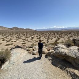
The highlight is the lookout from the visitor station. The shorter paved trail close by is likely sufficient for most people. There's not much else different from going to the buttes and the non-paved trails are tough because of their condition; really soft sand for most of it. We did the trail to the smaller butte, down to the trail intersection, over to the campground, and back up to the main parking via the gravel road - 3.6 miles. $6 day use fee for a car paid via cash that is placed in a provided envelope as you enter.


Way, way out at the far reaches of Los Angeles County are some eerily fascinating wildlife reserves and parks. Visible from many miles away, Saddleback Butte rises out of the desert floor like a specter; many don't realize this formation is also a state park where one can go hiking, camping or just stroll around in the profound silence of the high desert. Before you go, be sure to check out the official website for important information regarding facilities, conditions and possible closures. This is not a place to go unprepared. If the wind isn't tearing your hair off, you're roasting alive in the heat or merely turning a festive red color in the low humidity. That is to say: The camping is semi-primitive, the landscape bleak and the hiking can end up an exercise in misery and heat syncope. Bring water, people. Hike early. There's a cute little nature trail that circles around the ranger station, which apparently contains some exhibits. I wouldn't know, since it has never been open one single time I've gone. Nearby are some wooden ramadas with picnic tables, which provide a bit of shade and some protection from the wind. You can drive to the actual campground from here, or enter via 170th street (around the corner.) I always tell people to make this one stop on a tour of the Antelope Valley, because there are some other interesting places nearby - the Indian Museum, some empty gas stations and motels that are used exclusively for film sets, as well as some of the aforementioned county wildlife reserves. Just up the hill is a Joshua tree forest so thick and green it rivals anything I ever saw at the national park of the same name. Or, if you're the gritty outdoors type, go ahead and camp there. You just have to love stark vistas and a pronounced feeling of ennui. Here is some of the information from the site. You really *have* to be prepared before you go: "Saddleback Butte, elevation 3,651 feet, is a granite mountaintop that towers some thousand feet above the broad alluvial bottom land of the Antelope Valley about fifteen miles east of Lancaster, on the western edge of the Mojave Desert. The state park surrounding Saddleback Butte was created in 1960 to protect the butte (one of many similar land features in the Antelope Valley) and examples of native Joshua Tree woodlands and other plants and animals that were once common throughout this high desert area. The best time to visit is in the springtime (February through May) when wildflowers are apt to put on a beautiful display of color. Autumn (October and November) is pleasant as well, although temperatures may vary widely and change rather suddenly. Summer temperatures average 95° F and occasionally range as high as 115° F, but evenings are peaceful with warm breezes and clear skies. Average minimum temperature during the winter is 33 ° F (frost and sub-freezing temperatures are common, with occasional snow). Hiking The Little Butte Trail is about 2.5 miles to the peak and can be picked up from below the day-use area, or take the 2-mile Saddleback Butte Peak Trail from the trailhead parking area in the campground. The trails begin on a mild slope through moderately loose sand among creosote bushes and Joshua trees to the base of the butte where they merge. It then becomes a challenging climb up sand and rock, but the finale is worth every step. At the top, enjoy a breathtaking 360° view over the Antelope Valley and east across the Mojave desert. For a nice moderate 3-mile loop, go up one trail to where they merge, come back down on the other, then return on the park's gravel road to the trailhead where you started. See the "Equestrian" section for additional trail information. Day-use fee applies. The short self-guided Dic Dowen Nature Trail is located at the Visitor Center in the day-use area, with information on the natural history of the park and area. Day-Use Facilities Day-use facilities within the park include 27 picnic sites with tables and barbecue grills, each with ramadas for protection from the sun and wind. Water and pit toilets are located near the picnic area. Visit the park office and visitor center, located at the entrance to the day-use area, featuring displays and hands-on exhibits about the natural and cultural history and geology of the area. Campground Facilities The family campground is first-come, first-served and offers 50 units with tables, stoves, fire rings, and shade ramadas. Potable water spigots and full restrooms with a flush toilet and sink are located throughout the campground (no showers). Eight people maximum per campsite. There is a 30-foot max for campers/RVs. Use of the RV dump station is free for paid campers, or a $6 fee for non-campers. The dump station is currently closed for repairs."


If you are a fan of hiking, camping or just getting away from it all for a little while, Saddleback Butte State Park is a wonderful place to visit. And if you love Spring and wildflowers as much as I do, now is the perfect time to go! My husband and I went there today. First we checked out the quaint visitor center. Then we did the short and easy nature trail loop. Then we tackled the hike that takes you up to Saddleback Butte peak. I felt like a kid on a field trip (and who doesn't love that feeling). The wildflowers were blooming like crazy, the Joshua Trees were cool like they always are, and the views and rock formations were pretty special as well. The hike is not the farthest, but the last section is an incline that will have you asking yourself, "Do I really need to see what's at the top?" This is really a very special place. I'm glad that we made the trip out there, and you will be too.


Saddleback Butte State Park is a small tract of land on the corners of two major routes in this area. It's great for short stays, day hiking... but I think someone would go mad if they had to stay here more than a few days since recreation here is limited. There are a few trails, one goes up the side of the butte for a great view of the valley. One is a loop to one camping area to the next, and down the access road back. In the springs the blooming wildflowers were amazing in this park, and abundant. We stayed two nights- two WINDY as hell nights. Most of the campsites have ramada structures, but they did very little to fend off the intense winds swooping the valley. Most of the campsites come with a pit and a bbq grill and two picnic tables. However, on the lower part of the campgrounds where we stayed half of the grounds were closed off. Some of the camps open did not come with a pit, and this time of the year when we woke up to 34f cold- they are necessary. There's plenty of room for tents and camping on the lot, too. However there is a 8 person capacity and only one car capacity ($6 for each extra). The campsites are a tad pricey, too at $20 a night. However it is a State Park and I understand the costs to run these places and inadequate funds to provide that maintenance. There's two parts to this campground, too. You can enter from one end and drive the 3/4 mile to the other end. Campgrounds are first come, first serve. For those looking for things to do, definitely check out the near-by Antelope Valley Indian Museum (free for Saddleback Butte campers). The building is amazing, as are the artifacts and even a really short and fun hike up the hills behind it. There's a near-by wildflower reserve, a poppy reserve not too far away, and for people into movies the church from Kill Bill is about 3 miles away. Not far from the campsites are also movie sets used in House of 1,000 Corpses, Devils' Rejects, and many more movies. I enjoyed our stay and may be back.


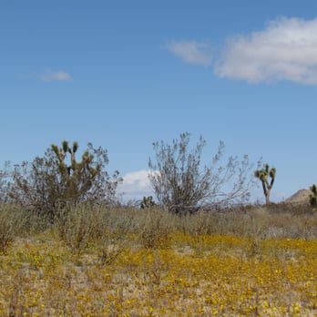
I stumbled upon Saddleback Butte park while driving toward the poppies. I was pleasantly surprised by the blanket of yellow flowers and I love Joshua trees.


This a pretty small state park so I imagine the only reason you would come here is to pitch a tent or just to get close and take pics of joshua trees without driving all the way out to Joshua Tree! When i was driving through (there's a dirt road that takes you all the way way through the park) I thought I had the whole place to myself. It wasn't until I was leaving that I saw one other car, and this was on a sunny weekend! So I guess it's great for solitude.


Great clean restroom; picnic table with shades; nice and quiet. Nice hike to the peak, only takes you around 1.5 hours to get up and you'll see the beautiful dessert. The hike is so sandy, it's like walking on the beach. Worth coming here once. Beware of mountain lions after sunset! Parking is $6 for day time and fyi you have to put cash in the envelope and into the box. So bring exact change.


The summit and view are just excellent!! The rest of the trail was better than I expected and the sand that people complain about is mostly compacted, so it's not hard to walk through. I'm sure in the summer when it's 100° it's a much different hike than the one I took today at 55°, but it's not a difficult hike. The summit on the right side of the saddle is closed off for Rehabilitation, so you really can't do the full traverse of the entire ridge line and bag both summits (unless you break the rules and don't get caught). There's very little parking at the visitor center, so best just to park on the road and walk in unless you're going to reserve a picnic table or a camping site. The visitor center doesn't open until 9 AM and the gate is closed, so if you get there before then just head down the road and enter through the campground and there's plenty of parking on the dirt roads and you can still easily get to all your destinations. read more



3 years ago
Great customer service, wonderful, very nice horses. Very good scenery and trails the horses are very nice and clean. read more


3 years ago
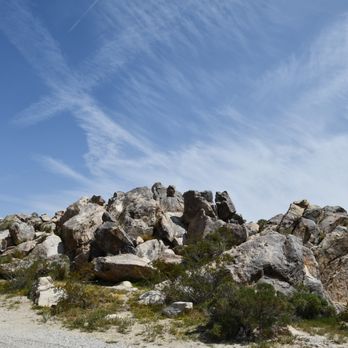
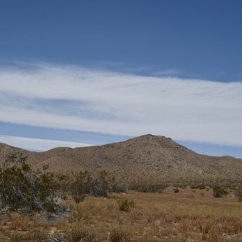
This was a nice spot to stop on my trip from San Bernardino to Lancaster...Entered on the North side, stopped at the bathrooms and then drove through to the other side...Lots of beautiful flowers because of all the rain we have had. . stopped at the visitors center to do the short trail behind..Beautiful view and some very interesting rocks. Wouldn't go out of my way , but well worth the stop read more





7 years ago
It's AloT Harder than it Looks! 2 miles Up about 1000ft elevation gain; Hiking in sand uphill is quite difficult even for those whom are fit. Spectacular views of the High Desert & surrounding mountains. We hiked to the ToP of the Butte to view a SunseT that had a sky painted with brushstrokes of ruby red and flames of orange. After SunseT it soon became pItch black & even tho we've hiked this trail many times we got a bit disoriented and had difficulty finding the trail cos it's not clearly marked at all points and the rocks look very much alike in the dark LoL. Our headlamps, All Trails app and Compass got us back on track. DO IT, buT make sure you are prepared :) read more
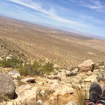
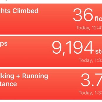


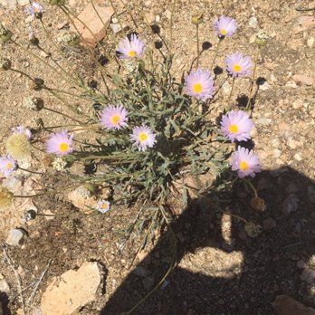


Went to Saddleback Butte SP on Fri 3/28/14. They have a really good wildflower season right now! Parking is $6 per vehicle or $5 with a senior citizen. Self-Registration so you need Exact Change, no credit cards, Cash or maybe Check Only. Visitor Center wasn't open when we went. Call for hours. We did the Nature Trail which is pretty boring, I guess only good for people in wheelchairs since it's mostly paved and flat. Skip it. Little Butte is nice and pretty easy to do. You'll see the wildflowers along the trail down low. If you continue to Saddleback Butte it gets really steep and seems to go on Forever, but eventually you'll climb some rocks and get to the Top! There's a small container with notebooks where you can write your name down to saw you were there and made it. There are 2 Survey Markers near the top too. Worth it for views and exercise. Total hike is only 3 miles total round trip. Bring food & water because there is none there & No shade on the trail. read more


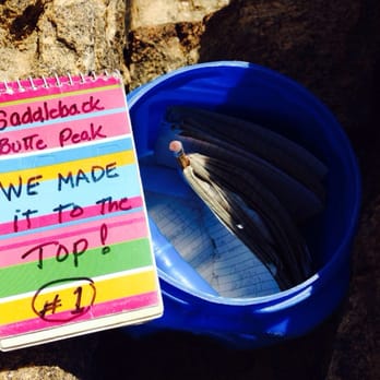


Saddleback Butte is a great place to hike, find some solitude, and learn more about the Mojave dessert. There's a lovely nature trail with a well-written guide available in the ranger station. There are also longer trails to take if you feel up to it and it's not too hot. If you visit in spring, summer or fall, don't forget to take plenty of water and sunscreen. There were plenty of wildlife around during my latest visit including ground squirrels, birds, and lizards. Day use is $6; camping is also available. Check out more details here: http://www.parks.ca.gov/?page_id=618. read more


4 years ago

6 years ago
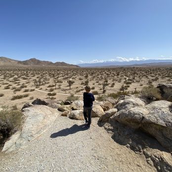
The highlight is the lookout from the visitor station. The shorter paved trail close by is likely sufficient for most people. There's not much else different from going to the buttes and the non-paved trails are tough because of their condition; really soft sand for most of it. We did the trail to the smaller butte, down to the trail intersection, over to the campground, and back up to the main parking via the gravel road - 3.6 miles. $6 day use fee for a car paid via cash that is placed in a provided envelope as you enter. read more


4 years ago

15 years ago
Way, way out at the far reaches of Los Angeles County are some eerily fascinating wildlife reserves and parks. Visible from many miles away, Saddleback Butte rises out of the desert floor like a specter; many don't realize this formation is also a state park where one can go hiking, camping or just stroll around in the profound silence of the high desert. Before you go, be sure to check out the official website for important information regarding facilities, conditions and possible closures. This is not a place to go unprepared. If the wind isn't tearing your hair off, you're roasting alive in the heat or merely turning a festive red color in the low humidity. That is to say: The camping is semi-primitive, the landscape bleak and the hiking can end up an exercise in misery and heat syncope. Bring water, people. Hike early. There's a cute little nature trail that circles around the ranger station, which apparently contains some exhibits. I wouldn't know, since it has never been open one single time I've gone. Nearby are some wooden ramadas with picnic tables, which provide a bit of shade and some protection from the wind. You can drive to the actual campground from here, or enter via 170th street (around the corner.) I always tell people to make this one stop on a tour of the Antelope Valley, because there are some other interesting places nearby - the Indian Museum, some empty gas stations and motels that are used exclusively for film sets, as well as some of the aforementioned county wildlife reserves. Just up the hill is a Joshua tree forest so thick and green it rivals anything I ever saw at the national park of the same name. Or, if you're the gritty outdoors type, go ahead and camp there. You just have to love stark vistas and a pronounced feeling of ennui. Here is some of the information from the site. You really *have* to be prepared before you go: "Saddleback Butte, elevation 3,651 feet, is a granite mountaintop that towers some thousand feet above the broad alluvial bottom land of the Antelope Valley about fifteen miles east of Lancaster, on the western edge of the Mojave Desert. The state park surrounding Saddleback Butte was created in 1960 to protect the butte (one of many similar land features in the Antelope Valley) and examples of native Joshua Tree woodlands and other plants and animals that were once common throughout this high desert area. The best time to visit is in the springtime (February through May) when wildflowers are apt to put on a beautiful display of color. Autumn (October and November) is pleasant as well, although temperatures may vary widely and change rather suddenly. Summer temperatures average 95° F and occasionally range as high as 115° F, but evenings are peaceful with warm breezes and clear skies. Average minimum temperature during the winter is 33 ° F (frost and sub-freezing temperatures are common, with occasional snow). Hiking The Little Butte Trail is about 2.5 miles to the peak and can be picked up from below the day-use area, or take the 2-mile Saddleback Butte Peak Trail from the trailhead parking area in the campground. The trails begin on a mild slope through moderately loose sand among creosote bushes and Joshua trees to the base of the butte where they merge. It then becomes a challenging climb up sand and rock, but the finale is worth every step. At the top, enjoy a breathtaking 360° view over the Antelope Valley and east across the Mojave desert. For a nice moderate 3-mile loop, go up one trail to where they merge, come back down on the other, then return on the park's gravel road to the trailhead where you started. See the "Equestrian" section for additional trail information. Day-use fee applies. The short self-guided Dic Dowen Nature Trail is located at the Visitor Center in the day-use area, with information on the natural history of the park and area. Day-Use Facilities Day-use facilities within the park include 27 picnic sites with tables and barbecue grills, each with ramadas for protection from the sun and wind. Water and pit toilets are located near the picnic area. Visit the park office and visitor center, located at the entrance to the day-use area, featuring displays and hands-on exhibits about the natural and cultural history and geology of the area. Campground Facilities The family campground is first-come, first-served and offers 50 units with tables, stoves, fire rings, and shade ramadas. Potable water spigots and full restrooms with a flush toilet and sink are located throughout the campground (no showers). Eight people maximum per campsite. There is a 30-foot max for campers/RVs. Use of the RV dump station is free for paid campers, or a $6 fee for non-campers. The dump station is currently closed for repairs." read more

3 years ago

13 years ago
If you are a fan of hiking, camping or just getting away from it all for a little while, Saddleback Butte State Park is a wonderful place to visit. And if you love Spring and wildflowers as much as I do, now is the perfect time to go! My husband and I went there today. First we checked out the quaint visitor center. Then we did the short and easy nature trail loop. Then we tackled the hike that takes you up to Saddleback Butte peak. I felt like a kid on a field trip (and who doesn't love that feeling). The wildflowers were blooming like crazy, the Joshua Trees were cool like they always are, and the views and rock formations were pretty special as well. The hike is not the farthest, but the last section is an incline that will have you asking yourself, "Do I really need to see what's at the top?" This is really a very special place. I'm glad that we made the trip out there, and you will be too. read more


13 years ago
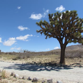
Saddleback Butte State Park is a small tract of land on the corners of two major routes in this area. It's great for short stays, day hiking... but I think someone would go mad if they had to stay here more than a few days since recreation here is limited. There are a few trails, one goes up the side of the butte for a great view of the valley. One is a loop to one camping area to the next, and down the access road back. In the springs the blooming wildflowers were amazing in this park, and abundant. We stayed two nights- two WINDY as hell nights. Most of the campsites have ramada structures, but they did very little to fend off the intense winds swooping the valley. Most of the campsites come with a pit and a bbq grill and two picnic tables. However, on the lower part of the campgrounds where we stayed half of the grounds were closed off. Some of the camps open did not come with a pit, and this time of the year when we woke up to 34f cold- they are necessary. There's plenty of room for tents and camping on the lot, too. However there is a 8 person capacity and only one car capacity ($6 for each extra). The campsites are a tad pricey, too at $20 a night. However it is a State Park and I understand the costs to run these places and inadequate funds to provide that maintenance. There's two parts to this campground, too. You can enter from one end and drive the 3/4 mile to the other end. Campgrounds are first come, first serve. For those looking for things to do, definitely check out the near-by Antelope Valley Indian Museum (free for Saddleback Butte campers). The building is amazing, as are the artifacts and even a really short and fun hike up the hills behind it. There's a near-by wildflower reserve, a poppy reserve not too far away, and for people into movies the church from Kill Bill is about 3 miles away. Not far from the campsites are also movie sets used in House of 1,000 Corpses, Devils' Rejects, and many more movies. I enjoyed our stay and may be back. read more




8 years ago
I stumbled upon Saddleback Butte park while driving toward the poppies. I was pleasantly surprised by the blanket of yellow flowers and I love Joshua trees. read more


11 years ago
This a pretty small state park so I imagine the only reason you would come here is to pitch a tent or just to get close and take pics of joshua trees without driving all the way out to Joshua Tree! When i was driving through (there's a dirt road that takes you all the way way through the park) I thought I had the whole place to myself. It wasn't until I was leaving that I saw one other car, and this was on a sunny weekend! So I guess it's great for solitude. read more


8 years ago
Great clean restroom; picnic table with shades; nice and quiet. Nice hike to the peak, only takes you around 1.5 hours to get up and you'll see the beautiful dessert. The hike is so sandy, it's like walking on the beach. Worth coming here once. Beware of mountain lions after sunset! Parking is $6 for day time and fyi you have to put cash in the envelope and into the box. So bring exact change. read more


4 years ago

6 years ago

11 years ago
5 years ago
11 years ago
I went on... May /// 2014 November /// 2014 August /// 2015 There is a guaranteed star-filled night. The Habitat: * First come first serve, however we never had a problem with finding a campsite. * $20 (cash) for a campsite with a max 8 people. The most tents we've had is 4 and we still had a little bit of wiggle room. * As mentioned before, the night sky is gorgeous. There are plenty of shooting stars to go around. * Ground is rough. Make sure to have sturdy tent stakes and a good hammer. * This place is freezing at night and scorching by the late morning. (It is the desert) * There are a few up-to-date clean restroom stalls (sinks & toilets). No showers. * Each campsite comes with both a standard size shade ramada and picnic table. * Great for groups or couples * Joshua Trees galore! Overall, this low-key campsite is a great way to get away from the city without completely leaving civilization. read more


4 years ago


6 years ago

12 years ago
Felt like I was in an episode of the Walking Dead...haha Pristine ramadas with grilles picnic tables at every location. However, didn't see a single soul on a Sunday afternoon. Restrooms were spotless and no one appeared to be at the visitor center. Your $3 admission at the AV Indian Museum pays for your entrance here. Very peaceful just quite eerie with all campgrounds barely used and empty. Perhaps that's a good thing ;) read more


11 years ago
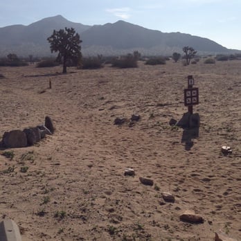
Use to be really nice place to camp back when they had a host to take care of the place. They say there is 50 spots to camp there but only 1/4 of the spots are open for camping. A lot of the wind/sun covers are falling over and are yellow taped off. read more



9 years ago
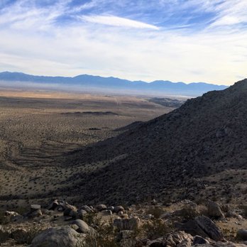
Park is clean. Camp Host is friendly and helpful as well as very hardworking. He even let me give his very well groomed dog a treat for giving me a his paw/ high five. The views are beautiful over the entire valley: 360 degrees at the peak. Much of the trail is very soft dirt so bring shoes you can use to step into the dirt. Bit of a workout on your knees. There's sturdier ground towards the top. Seems like it is super windy at the peak every time I come here. Trekking poles are helpful for the descent down over the rocks at the top; especially if the light is going. Very enjoyable every time I have visited over the years. It's nice to park ($6 for permit isn't bad if you carpool) and walk up to see the view). You can warm yourself after using the grills at the campground by making a soup or hot drink. There are faucets and bathrooms available and you camp by paying the ($20?) fee. Small state park that is worth the time for the view! read more



12 years ago

12 years ago

12 years ago
8 years ago
9 years ago
More info about Saddleback Butte State Park
17150 E Ave J
Lancaster, CA 93535
Directions
(661) 727-9899
Call Now
Hours
Outdoor Amenities
Other Amenities
Ask the Community - Saddleback Butte State Park
Review Highlights - Saddleback Butte State Park
You might also consider















Why does Yelp recommend reviews?
1 review that is not currently recommended
The reviews below are not factored into the business's overall star rating.

12 years ago
Saddleback Butte State Park - hiking - Updated October 2026
Best of Lancaster
People found Saddleback Butte State Park by searching for…
Rv Dump Station in Lancaster, CA
National Parks in Lancaster, CA
Hiking Trails in Lancaster, CA
Public Running Track in Lancaster, CA
Places to Take Pictures in Lancaster, CA
Waterfall Hike in Lancaster, CA
Off Road Trails in Lancaster, CA
Public Shower in Lancaster, CA
Camping Sites in Lancaster, CA
Free Campgrounds in Lancaster, CA
Dog Friendly Hiking Trails in Lancaster, CA
Park With BBQ Pits in Lancaster, CA
Secluded Spots in Lancaster, CA
Trending Searches in Lancaster, CA
Apple Orchards near Saddleback Butte State Park
Apple Picking near Saddleback Butte State Park
Archery near Saddleback Butte State Park
Barbershop near Saddleback Butte State Park
Baseball Fields near Saddleback Butte State Park
Beautiful Views near Saddleback Butte State Park
Bird Sanctuary near Saddleback Butte State Park
Blow Dry Bar near Saddleback Butte State Park
Campgrounds near Saddleback Butte State Park
Cliff Jumping near Saddleback Butte State Park
Corn Maze near Saddleback Butte State Park
Dog Friendly Things To Do near Saddleback Butte State Park
Dog Parks near Saddleback Butte State Park
Eyelash Extensions near Saddleback Butte State Park
Halloween Events near Saddleback Butte State Park
Haunted Houses near Saddleback Butte State Park
Hiking Trails near Saddleback Butte State Park
Kids Birthday Party near Saddleback Butte State Park
Lakes near Saddleback Butte State Park
Long Term Rv Parking near Saddleback Butte State Park
Lookout Points near Saddleback Butte State Park
Makeup Artists near Saddleback Butte State Park
Meteor Shower near Saddleback Butte State Park
Off Road Trails near Saddleback Butte State Park
Photo Spots near Saddleback Butte State Park
Picnic Areas near Saddleback Butte State Park
Places To Take Pictures near Saddleback Butte State Park
Places To Walk Around near Saddleback Butte State Park
Playgrounds near Saddleback Butte State Park
Private Schools near Saddleback Butte State Park
Public Running Track near Saddleback Butte State Park
Public Shower near Saddleback Butte State Park
Pumpkin Patches near Saddleback Butte State Park
Rock Quarry near Saddleback Butte State Park
Scenic Night View near Saddleback Butte State Park
Scenic Overlook near Saddleback Butte State Park
State Parks near Saddleback Butte State Park
Sunrise View near Saddleback Butte State Park
Swimming Holes near Saddleback Butte State Park
Volleyball Courts near Saddleback Butte State Park
Browse Nearby
Browse Brands
Related Cost Guides
Related Searches in Lancaster, CA
Affordable Long Term RV Parking in Lancaster, California
Best Dog Hiking Trails Around Lancaster, California
Best Fishing Locations and Guides in Lancaster, California
Best Off Leash Dog Parks in Lancaster, California
Best Parks for Parties and Events in Lancaster, California
Best Places for Horseback Riding in Lancaster, California
Best Water Parks for Kids in Lancaster, California
Best Waterfalls and Swimming Holes in Lancaster, California
Browse Tent Camping Sites in Lancaster, California
Browse Top Hotels in Lancaster, California for Your Stay
Check Out Great Playgrounds in Lancaster, California
Check Out Off Road Trails in Lancaster, California
Discover Baseball Fields Around Lancaster, California
Discover Dog Friendly Beaches Near Lancaster, California
Discover Dog Friendly Trails to Explore in Lancaster, California
Discover Easy Hiking Trails Near Lancaster, California
Discover Free Campgrounds in Lancaster, California Area
Discover Kid Friendly Hiking Trails in Lancaster, California
Discover Lakes & Ponds to Explore in Lancaster, California
Discover Popular Bike Trails in Lancaster, California
Discover Popular Photo Spots in Lancaster, California
Discover Scenic Beach Camping Sites in Lancaster, California
Discover Scenic Mountain Bike Trails Near Lancaster, California
Discover Soccer Fields in Lancaster, California Near You
Discover Top Nature Parks to Visit in Lancaster, California
Discover Top State Parks to Visit in Lancaster, California
Discover a Hiking Trail in Lancaster, California
Discover the Best Beaches in Lancaster, California
Discover the Best Kids Park Spots in Lancaster, California
Discover the Best Night Hike Trails in Lancaster, California
Enjoy Camping Adventures Around Lancaster, California
Enjoy Hiking Adventures in Lancaster, California
Enjoy Kayaking Adventures in Lancaster, California
Enjoy Off Leash Dog Hikes in Lancaster, California
Enjoy Scenic Places to Walk in Lancaster, California
Enjoy Tent Camping Spots Around Lancaster, California
Enjoy a Beautiful Waterfall Hike in Lancaster, California
Enjoy the Best Picnic Spots and Ideas in Lancaster, California
Enjoy the Best Walking Path in Lancaster, California
Enjoy the Best Walking Trails in Lancaster, California
Explore Beautiful Parks and Green Spaces in Lancaster, California
Explore Car Camping Spots and Gear in Lancaster, California
Explore Easy Hikes Perfect for All in Lancaster, California
Explore Family-Friendly Zoos and Wildlife in Lancaster, California
Explore Free Picnic Areas Around Lancaster, California
Explore Fun Activities to Do in Lancaster, California
Explore Mobile Home Parks in Lancaster, California Now


