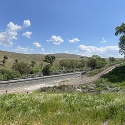
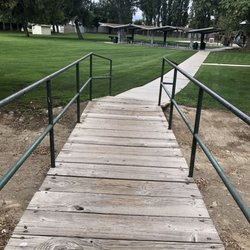
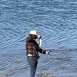
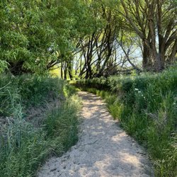
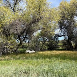
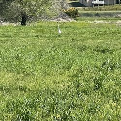
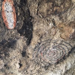
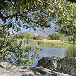
Tehachapi Mountain Park Photos


You might also consider
More like Tehachapi Mountain Park
Recommended Reviews - Tehachapi Mountain Park
Start your review...

Reviews With Photos

Almost 3 miles straight up, 3 miles down. 1600 calories. Fresh Air. Not as hot as Bakersfield. Clean park, so many big, beautiful, green trees! 2 deer sightings on Water Canyon. Everyone that we did encounter on the trails were friendly but the mountain was not crowded or busy by any means. This may not be the case for the camping down below but we were just there for a day hike. Bring lots of water, snacks, sunscreen, bug spray and good hiking shoes/boots. Once you get past the fire road and head straight up, it is no joke. Super steep. Coming down was actually harder than going up! A great day. This was a place well deserving of respect.

Had my daughter's wedding here on the plateau above the mess hall and the reception inside the mess hall. We had a beautiful cathedral in nature and a prefect rustic dream wedding. The caretaker Stuart was fantastic, helping whenever we called on him. This place is perfect for almost any family gathering.

Need an escape from the unhealthy air in Bakersfield? Don't want to travel to far from Bako either? Tehachapi Mountain Park is the perfect answer!! It is only about a 1 hour drive from Bakersfield!! We came here to get some good exercise and this park did not disappoint! Got us a great workout plus more! Hiked the Tehachapi Mountain trail. It is approximately 2.5 miles from the beginning of the trail to the peak. The last .88 miles is very very steep! An awesome cardiovascular workout! The walk down is challenging as well. Make sure to tread carefully lest you fall. Love the clean fresh air! Beautiful Mother Nature! Cannot tell you more about Tehachapi Mountain Park because all we did was hike plus take pics. Enjoy and Do Not Litter!!

We came up here for the day to roast hot dogs and make s'mores. The grounds are well kept and it seems that each campsite has a water spicket for fresh water. There is a fire pit, bbq and a picnic bench on each site too. But, we went to use the rest room and it was absolutely disguising. The toilet had old splattered s*** on it and looked like it hadn't been cleaned in a year or so. I mean I know that's something minimal but it's a big deal especially when the bathroom doesn't have running water. Other then that the sites seem clean I just wish the sites had their own trash can on it.
")
NO way..... My first review as an elite and a FTR??????? This is going to be a good day, oh and on another note... I found 5 bucks on the ground this morning, another reason its going to be a good day :) Anyways...Growing up in Tehachapi this was one of my favorite spots so tranquil and serene, this place is just beautiful! I thought about it this morning when I was wishing I could relax instead of work... as my body is aching after my 17 hour day yesterday thank you St. Patty :) I miss this quaint little place, its really a nice town for natural & scenic beauty but its infested with drugs and crime :( Huge campground Cabins and a rec center open parts of the year Great for conventions (furries, cults, & hippies) Lots of hiking trails http://www.yelp.com/biz_photos/VMPouOE9MfbauHjDXCfc5Q?select=NaisbZEm-YZo7j7KuwU2hQ Amazing views "The Cliffs" are worth the hike http://www.yelp.com/biz_photos/VMPouOE9MfbauHjDXCfc5Q?select=hgm3plKA8rIGhSUnA0kFWA Star gazing here is a must $14 a night to camp VERY VERY steep cliffs with narrow roads Nice to visit....but you would have to pay me to live there again! I Heart Mountain Park!!!

So, the yelp reviews helped me to decide to go here. We'd like to say that ya'll some liars. This is a pretty calf clenching climb the entire way. The last .88 miles is marked and is significant steeper than the first 1.67 miles. Though you can guarantee a good workout the entire time. We did the full hike to the top and back to our car in 2 and 1/2 hrs. Consider that we made stops, took pictures, and hung out a the tip for a while. I don't recommend this for kids under 6, Especially if they don't like the outdoors. I recommend taking snacks and water. I wore shorts, but had to put my sweatshirt on and off depending on the temperature. We started the hike at 10:21am. Weather was great! Though we'd definitely do this again, we'll like try different trails. We live in Bakersfield.


Camped at site 57 and 59 at end of May 2020. Loved this campground. Good for primitive camping. Clusters of campsites are placed spaciously throughout the site. Water access is easy to get to and good water pressure and vault toilets are clean. Camp hosts are super nice and kind. Downfall is it's first come first serve but it's kinda like a hidden gem so you may get lucky if you're getting their on a Friday night. No electricity. Sufficient room for at least 1-2 vehicles.

I had been to Tehachapi Mtn park several times but never took thee hike. This was amazing !!!! Awesome views, fresh air, great workout. The hike is easy up untill you run out of road. Then its a .88 mile hike to the very steep top. Keep going till you reach the top, even if its passed the private property. "Everybody goes passed the private property sign" Just please be respectful and don't litter nor vandalize anything. Have fun !!!!


Another amazing night spent at Mountain Park. Took about 9 kids for my sons party. Awesome place for the kids to play and explore. Roasting hot dogs and eating s'mores, what more could you want on a beautiful Tehachapi night? Highly recommend if you have never been here. read more


If you're looking for a park in the middle of nowhere, but still just outside town, where you can camp or visit on a day trip, this is your place. Granted you have to be in Tehachapi, or know where Tehachapi is, or be wanderIng around southeastern California, or have a sweet GPS. Given all the above transpiring, if you find yourself in the lucky position of needing to do a summer XC run with your sophomore weak-of-heart running daughter, just don't tell her about the steep uphill. You do get to run back down afterward anyway. Should you be able to trick your kids into the run or perhaps a hike, magnificent views await at the overlooks partway and all the way up. We're talking Twitter-background-wallpaper-quality shots (not that I would know). Should I wind up randomly or intentionally in T-town, I'll take another hike, provided I can talk the daughter into it ("no honey this isn't the one you remember, it's an easy hike":). read more


6 years ago
Almost 3 miles straight up, 3 miles down. 1600 calories. Fresh Air. Not as hot as Bakersfield. Clean park, so many big, beautiful, green trees! 2 deer sightings on Water Canyon. Everyone that we did encounter on the trails were friendly but the mountain was not crowded or busy by any means. This may not be the case for the camping down below but we were just there for a day hike. Bring lots of water, snacks, sunscreen, bug spray and good hiking shoes/boots. Once you get past the fire road and head straight up, it is no joke. Super steep. Coming down was actually harder than going up! A great day. This was a place well deserving of respect. read more

8 years ago
Had my daughter's wedding here on the plateau above the mess hall and the reception inside the mess hall. We had a beautiful cathedral in nature and a prefect rustic dream wedding. The caretaker Stuart was fantastic, helping whenever we called on him. This place is perfect for almost any family gathering. read more


6 years ago
9 years ago
Need an escape from the unhealthy air in Bakersfield? Don't want to travel to far from Bako either? Tehachapi Mountain Park is the perfect answer!! It is only about a 1 hour drive from Bakersfield!! We came here to get some good exercise and this park did not disappoint! Got us a great workout plus more! Hiked the Tehachapi Mountain trail. It is approximately 2.5 miles from the beginning of the trail to the peak. The last .88 miles is very very steep! An awesome cardiovascular workout! The walk down is challenging as well. Make sure to tread carefully lest you fall. Love the clean fresh air! Beautiful Mother Nature! Cannot tell you more about Tehachapi Mountain Park because all we did was hike plus take pics. Enjoy and Do Not Litter!! read more


7 years ago
We came up here for the day to roast hot dogs and make s'mores. The grounds are well kept and it seems that each campsite has a water spicket for fresh water. There is a fire pit, bbq and a picnic bench on each site too. But, we went to use the rest room and it was absolutely disguising. The toilet had old splattered s*** on it and looked like it hadn't been cleaned in a year or so. I mean I know that's something minimal but it's a big deal especially when the bathroom doesn't have running water. Other then that the sites seem clean I just wish the sites had their own trash can on it. read more


15 years ago
NO way..... My first review as an elite and a FTR??????? This is going to be a good day, oh and on another note... I found 5 bucks on the ground this morning, another reason its going to be a good day :) Anyways...Growing up in Tehachapi this was one of my favorite spots so tranquil and serene, this place is just beautiful! I thought about it this morning when I was wishing I could relax instead of work... as my body is aching after my 17 hour day yesterday thank you St. Patty :) I miss this quaint little place, its really a nice town for natural & scenic beauty but its infested with drugs and crime :( Huge campground Cabins and a rec center open parts of the year Great for conventions (furries, cults, & hippies) Lots of hiking trails http://www.yelp.com/biz_photos/VMPouOE9MfbauHjDXCfc5Q?select=NaisbZEm-YZo7j7KuwU2hQ Amazing views "The Cliffs" are worth the hike http://www.yelp.com/biz_photos/VMPouOE9MfbauHjDXCfc5Q?select=hgm3plKA8rIGhSUnA0kFWA Star gazing here is a must $14 a night to camp VERY VERY steep cliffs with narrow roads Nice to visit....but you would have to pay me to live there again! I Heart Mountain Park!!! read more
 - Hiking Near Me - Tehachapi, California")


11 years ago
So, the yelp reviews helped me to decide to go here. We'd like to say that ya'll some liars. This is a pretty calf clenching climb the entire way. The last .88 miles is marked and is significant steeper than the first 1.67 miles. Though you can guarantee a good workout the entire time. We did the full hike to the top and back to our car in 2 and 1/2 hrs. Consider that we made stops, took pictures, and hung out a the tip for a while. I don't recommend this for kids under 6, Especially if they don't like the outdoors. I recommend taking snacks and water. I wore shorts, but had to put my sweatshirt on and off depending on the temperature. We started the hike at 10:21am. Weather was great! Though we'd definitely do this again, we'll like try different trails. We live in Bakersfield. read more

8 years ago
Me and my girlfriend found this area when we were looking to go hike with our gerberian shepsky pup we went in December and there was snow everywhere our little guy loved it. Can't wait to go up there in the spring and summer and camp! read more


6 years ago
Camped at site 57 and 59 at end of May 2020. Loved this campground. Good for primitive camping. Clusters of campsites are placed spaciously throughout the site. Water access is easy to get to and good water pressure and vault toilets are clean. Camp hosts are super nice and kind. Downfall is it's first come first serve but it's kinda like a hidden gem so you may get lucky if you're getting their on a Friday night. No electricity. Sufficient room for at least 1-2 vehicles. read more


I had been to Tehachapi Mtn park several times but never took thee hike. This was amazing !!!! Awesome views, fresh air, great workout. The hike is easy up untill you run out of road. Then its a .88 mile hike to the very steep top. Keep going till you reach the top, even if its passed the private property. "Everybody goes passed the private property sign" Just please be respectful and don't litter nor vandalize anything. Have fun !!!! read more


 - Hiking Near Me - Tehachapi, California")


7 years ago
14 years ago
16 years ago
Tehachapi Mountain Park is maintained by Kern County Parks and Recreation. Beautiful location, wonderful Hikes, Plenty of snow during winter. Read the County Web site for further instructions regarding camping, snow play and the like. read more


13 years ago
I actually went to visit my best friend that cares for my 140 pound son (Stafforshire Terrier) Tehacapi City...especially up in the moutains is a Beautiful, almost resort like community. It is common to see many Deer, skunks and their babies. It's very quiet and peaceful....I Love It! read more


10 years ago
Love this place. As a local, it is great to have a close-by place to camp. Beautiful tall trees, nice trails, and cool temperatures. The bathrooms were clean and we saw a fox crossing through our campsite. Fun time. read more


8 years ago
11 years ago
9 years ago
More info about Tehachapi Mountain Park
17350 Water Canyon Rd
Tehachapi, CA 93561
Directions
Visit Website
https://www.co.kern.ca.us
Hours
Outdoor Amenities
Other Amenities
Ask the Community - Tehachapi Mountain Park
Review Highlights - Tehachapi Mountain Park
You might also consider


Why does Yelp recommend reviews?
4 reviews that are not currently recommended
The reviews below are not factored into the business's overall star rating.
8 years ago
8 years ago
5 years ago
11 years ago
Tehachapi Mountain Park - hiking - Updated June 2026
Best of Tehachapi
People found Tehachapi Mountain Park by searching for…
Snow Play in Tehachapi, California
Things to Do in Tehachapi, California
Snow Park in Tehachapi, California
Hiking Trails in Tehachapi, California
Star Gazing in Tehachapi, California
Fun Things to Do With Kids in Tehachapi, California
Scenic Drive in Tehachapi, California
Places to Take Pictures in Tehachapi, California
Secret Spots in Tehachapi, California
Off Road Trails in Tehachapi, California
Camping Sites in Tehachapi, California
Wedding Venues in Tehachapi, California
Natural Hot Springs in Tehachapi, California
Running Trails in Tehachapi, California
Scenic Overlook in Tehachapi, California
Scenic View in Tehachapi, California
Trails in Tehachapi, California
Lookout Points in Tehachapi, California
Waterfalls in Tehachapi, California
Creeks in Tehachapi, California
Picnic Areas BBQ Pits in Tehachapi, California
Reception Halls in Tehachapi, California
Trending Searches in Tehachapi, CA
Beaches near Tehachapi Mountain Park
Black Owned Nail Salons near Tehachapi Mountain Park
Day Trips near Tehachapi Mountain Park
Fishing Spots near Tehachapi Mountain Park
Fruit Picking near Tehachapi Mountain Park
Lakes near Tehachapi Mountain Park
Lakes & Ponds near Tehachapi Mountain Park
Long Term Rv Parking near Tehachapi Mountain Park
Off Road Trails near Tehachapi Mountain Park
Pick Your Own Farms near Tehachapi Mountain Park
Playgrounds near Tehachapi Mountain Park
Public Pools near Tehachapi Mountain Park
Public Shower near Tehachapi Mountain Park
River Swimming near Tehachapi Mountain Park
River Tubing near Tehachapi Mountain Park
Rock Quarry near Tehachapi Mountain Park
Rv Campgrounds near Tehachapi Mountain Park
Scenic Drive near Tehachapi Mountain Park
Splash Pad near Tehachapi Mountain Park
Strawberry Picking near Tehachapi Mountain Park
Swimming Holes near Tehachapi Mountain Park
Swimming Lakes near Tehachapi Mountain Park
Swimming Pools near Tehachapi Mountain Park
Browse Articles
Browse Nearby
BEST of Tehachapi, California Restaurants near Tehachapi Mountain Park
BEST of Tehachapi, California Coffee near Tehachapi Mountain Park
BEST of Tehachapi, California Things to Do near Tehachapi Mountain Park
BEST of Tehachapi, California Breakfast near Tehachapi Mountain Park
BEST of Tehachapi, California Wineries near Tehachapi Mountain Park
BEST of Tehachapi, California Campgrounds near Tehachapi Mountain Park
BEST of Tehachapi, California Thrift Stores near Tehachapi Mountain Park
Browse Brands
Related Cost Guides
Related Searches in Tehachapi, CA
Affordable Long Term RV Parking in Tehachapi, California
Affordable RV Rental Options in Tehachapi, California
Best Fishing Locations and Guides in Tehachapi, California
Best Fun Things to Do in Tehachapi, California
Best Places for Horseback Riding in Tehachapi, California
Best RV Dump Stations Available in Tehachapi, California
Best Sledding Spots and Fun in Tehachapi, California
Best Spots for Star Gazing in Tehachapi, California
Best Water Parks for Kids in Tehachapi, California
Browse Top Hotels in Tehachapi, California for Your Stay
Browse Vacation Rentals to Book in Tehachapi, California
Check Out Great Playgrounds in Tehachapi, California
Check Out Off Road Trails in Tehachapi, California
Discover Baseball Fields Around Tehachapi, California
Discover Beautiful Garden Spots in Tehachapi, California
Discover Dog Friendly Trails to Explore in Tehachapi, California
Discover Free Campgrounds in Tehachapi, California Area
Discover Lakes & Ponds to Explore in Tehachapi, California
Discover Scenic Beach Camping Sites in Tehachapi, California
Discover Scenic Mountain Bike Trails Near Tehachapi, California
Discover Top Nature Parks to Visit in Tehachapi, California
Discover a Hiking Trail in Tehachapi, California
Discover the Best Beaches in Tehachapi, California
Discover the Best Night Hike Trails in Tehachapi, California
Dog-Friendly Hikes With Dogs in Tehachapi, California
Enjoy Camping Adventures Around Tehachapi, California
Enjoy Exciting Mountain Biking Adventures in Tehachapi, California
Enjoy Hiking Adventures in Tehachapi, California
Enjoy River Tubing Adventures in Tehachapi, California
Enjoy Tent Camping Spots Around Tehachapi, California
Enjoy a Relaxing Bed & Breakfast Experience in Tehachapi, California
Enjoy the Best Picnic Spots and Ideas in Tehachapi, California
Explore Beautiful Botanical Gardens in Tehachapi, California
Explore Beautiful Parks and Green Spaces in Tehachapi, California
Explore Bike Rentals Throughout Tehachapi, California
Explore Easy Hikes Perfect for All in Tehachapi, California
Explore Family-Friendly Zoos and Wildlife in Tehachapi, California
Explore Free Picnic Areas Around Tehachapi, California
Explore Free Things to Do Around Tehachapi, California
Explore Fun Activities to Do in Tehachapi, California
Explore Hotels & Travel Options in Tehachapi, California
Explore Mobile Home Parks in Tehachapi, California Now
Explore Parks With Pull Up Bars in Tehachapi, California
Explore Popular Campgrounds Near Tehachapi, California
Explore Popular Picnic Areas Around Tehachapi, California
Explore Popular RV Parks Around Tehachapi, California
Explore Popular Recreation Centers Around Tehachapi, California
Explore Popular Scenic Views Near Tehachapi, California
Explore Scenic Lakes to Visit in Tehachapi, California
Explore Secret Spots Worth Visiting in Tehachapi, California
People who viewed Tehachapi Mountain Park also viewed
Brite Lake Campground
29 reviews
Philip Marx Central Park
11 reviews
Brite Valley Aquatic Recreation Area
3 reviews
Horse Thief Park
5 reviews
Pioneer Park
2 reviews
4 Island Lake
5 reviews
Tomo-Kahni State Historic Park
1 review
Indian Hill Ranch RV Park
7 reviews
Tejon Ranch Conservancy
2 reviews
Mountain Valley RV Park
62 reviews