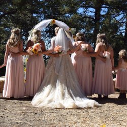
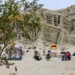
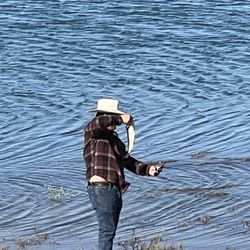
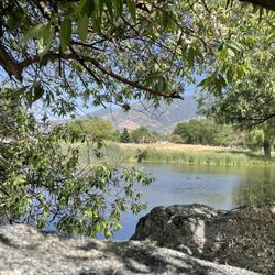
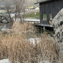
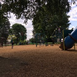
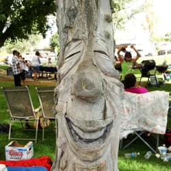
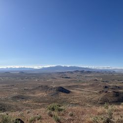
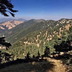
Golden Hills Nature Park Hiking Photos


You might also consider
More like Golden Hills Nature Park
Recommended Reviews - Golden Hills Nature Park
Start your review...

2 months ago


I have not yet been able to walk the trails at the nature park. The Tehachapi News says, "There are almost five miles of fire access roads and non-motorized multiuser recreational trail for walkers, hikers, equestrians and cyclist". I posted pictures awhile back at the entrance. As soon as the world gets back to normal and I am no longer isolating due to the Corona Virus, I plan on visiting the nature park. I will post some new info and photos at that time. read more


More info about Golden Hills Nature Park
22360 Woodford-Tehachapi Rd
Tehachapi, CA 93561
Directions
Hours
Outdoor Amenities
You might also consider


Golden Hills Nature Park - hiking - Updated May 2026
Best of Tehachapi
People found Golden Hills Nature Park by searching for…
Hiking Trails in Tehachapi, California
Parks in Tehachapi, California
Things to Do in Tehachapi, California
Natural Hot Springs in Tehachapi, California
Off Road Trails in Tehachapi, California
Walking Trails in Tehachapi, California
Running Trails in Tehachapi, California
Scenic Views in Tehachapi, California
Fun Things to Do at Night in Tehachapi, California
Places to Visit in Tehachapi, California
Beautiful Views in Tehachapi, California
Trail in Tehachapi, California
Dog Friendly Trails in Tehachapi, California
Secluded Spots in Tehachapi, California
Nature Parks in Tehachapi, California
Waterfalls in Tehachapi, California
Places to Walk Around in Tehachapi, California
Park & Forests in Tehachapi, California
Sunday Fun Things to Do in Tehachapi, California
Things to See in Tehachapi, California
Places to Take Pictures in Tehachapi, California
Nature in Tehachapi, California
Trending Searches in Tehachapi, CA
Botanical Gardens near Golden Hills Nature Park
Bounce House Rentals near Golden Hills Nature Park
Campgrounds near Golden Hills Nature Park
Flower Shop near Golden Hills Nature Park
Hair near Golden Hills Nature Park
Lakes & Ponds near Golden Hills Nature Park
Nurseries & Gardening near Golden Hills Nature Park
Parks near Golden Hills Nature Park
Party Equipment Rentals near Golden Hills Nature Park
Pedicure near Golden Hills Nature Park
Pick Your Own Farms near Golden Hills Nature Park
Picnic Areas near Golden Hills Nature Park
Places To Take Pictures near Golden Hills Nature Park
Rock Quarry near Golden Hills Nature Park
Running Trails near Golden Hills Nature Park
Rv Rental near Golden Hills Nature Park
Scenic Drive near Golden Hills Nature Park
Secret Spots near Golden Hills Nature Park
Strawberry Picking near Golden Hills Nature Park
Swimming Holes near Golden Hills Nature Park
Browse Articles
Browse Nearby
BEST of Tehachapi, California Parks near Golden Hills Nature Park
BEST of Tehachapi, California Coffee near Golden Hills Nature Park
BEST of Tehachapi, California Restaurants near Golden Hills Nature Park
BEST of Tehachapi, California Things to Do near Golden Hills Nature Park
BEST of Tehachapi, California Scenic View near Golden Hills Nature Park
BEST of Tehachapi, California Breakfast near Golden Hills Nature Park
BEST of Tehachapi, California Caves near Golden Hills Nature Park
BEST of Tehachapi, California Campgrounds near Golden Hills Nature Park
BEST of Tehachapi, California Hotels near Golden Hills Nature Park
Browse Brands
Related Searches in Tehachapi, CA
Best Fishing Locations and Guides in Tehachapi, California
Best Fun Things to Do in Tehachapi, California
Best Places for Horseback Riding in Tehachapi, California
Best Sledding Spots and Fun in Tehachapi, California
Best Spots for Star Gazing in Tehachapi, California
Check Out Off Road Trails in Tehachapi, California
Discover Dog Friendly Trails to Explore in Tehachapi, California
Discover Lakes & Ponds to Explore in Tehachapi, California
Discover Scenic Mountain Bike Trails Near Tehachapi, California
Discover a Hiking Trail in Tehachapi, California
Discover the Best Night Hike Trails in Tehachapi, California
Dog-Friendly Hikes With Dogs in Tehachapi, California
Enjoy Camping Adventures Around Tehachapi, California
Enjoy Exciting Mountain Biking Adventures in Tehachapi, California
Enjoy River Tubing Adventures in Tehachapi, California
Enjoy Tent Camping Spots Around Tehachapi, California
Explore Beautiful Parks and Green Spaces in Tehachapi, California
Explore Bike Rentals Throughout Tehachapi, California
Explore Easy Hikes Perfect for All in Tehachapi, California
Explore Free Things to Do Around Tehachapi, California
Explore Fun Activities to Do in Tehachapi, California
Explore Popular Campgrounds Near Tehachapi, California
Explore Popular RV Parks Around Tehachapi, California
Explore Scenic Lakes to Visit in Tehachapi, California
Explore Secret Spots Worth Visiting in Tehachapi, California
Explore Top Dog Parks in Tehachapi, California Near You
Explore Top Water Parks in Tehachapi, California Today
Explore the Best Boating Spots in Tehachapi, California
Explore the Best Swimming Holes Around Tehachapi, California
Family Friendly Hiking With Kids in Tehachapi, California
Find Fun Things to Do With Kids in Tehachapi, California
Find the Best Playgrounds to Visit in Tehachapi, California
Find the Best Scenic View Locations in Tehachapi, California
Hiking Trails With Waterfalls in Tehachapi, California
Must-See Tourist Attractions Around Tehachapi, California
Off Leash Dog Hiking Trails in Tehachapi, California
Popular Fishing Spots to Explore in Tehachapi, California
Popular Kids Activities in Tehachapi, California
Popular Outdoor Activities to Try in Tehachapi, California
Popular Places to Take Pictures in Tehachapi, California
Popular Things to Do in Tehachapi, California
Relax at Natural Hot Springs Near Tehachapi, California
Safe River Swimming Areas in Tehachapi, California
Safe and Fun Parks for Kids in Tehachapi, California
Top Paddleboarding Activities in Tehachapi, California
Top Playgrounds for Kids to Enjoy in Tehachapi, California
Top Running Trails to Explore in Tehachapi, California
Top Swimming Lakes to Enjoy in Tehachapi, California